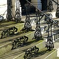
Category:Railings in Leeds
Jump to navigation
Jump to search
Media in category "Railings in Leeds"
The following 57 files are in this category, out of 57 total.
-
12A, Clarendon Road.jpg 2,122 × 2,830; 1.11 MB
-
9 And 10, Blenheim Square.jpg 2,312 × 3,083; 1.35 MB
-
Aire and ironwork (2100821153).jpg 1,920 × 2,560; 2.97 MB
-
Aire River Bridge Whitehall Road.JPG 6,000 × 4,000; 3 MB
-
Armley Mills (34945465122).jpg 6,000 × 4,000; 15.6 MB
-
Armley Road - Wellington Road - geograph.org.uk - 1987291.jpg 640 × 480; 67 KB
-
Baltic Car Repairs, Canal Road, Leeds - geograph.org.uk - 4920884.jpg 1,024 × 768; 254 KB
-
Blocked footpath, Leeds - geograph.org.uk - 4829951.jpg 1,024 × 768; 318 KB
-
Boundary Wall And Railings To Leeds General Infirmary With Gate Piers And Gates.jpg 4,608 × 3,456; 4.49 MB
-
The spire of Bramley St Margaret - geograph.org.uk - 276158.jpg 480 × 640; 146 KB
-
Bridge over the motorway east of Belle Isle - geograph.org.uk - 4280722.jpg 1,600 × 1,200; 528 KB
-
Burley Branch Library. - geograph.org.uk - 482533.jpg 640 × 426; 259 KB
-
Casti(ro)ng shadows (1) - geograph.org.uk - 5627854.jpg 1,280 × 1,280; 555 KB
-
Casti(ro)ng shadows (2) - geograph.org.uk - 5627983.jpg 1,280 × 1,280; 489 KB
-
Central Viaduct, Leeds - geograph.org.uk - 4891544.jpg 1,280 × 960; 809 KB
-
Central Viaduct, Leeds - geograph.org.uk - 4891601.jpg 1,280 × 851; 546 KB
-
Churchyard Wall With Railings And Gate Piers To South And Steps To North.jpg 3,252 × 4,336; 3.25 MB
-
Deli-Licious - Selby Road - geograph.org.uk - 1869852.jpg 609 × 640; 72 KB
-
East Garforth railway station (8th November 2014) 003.JPG 4,608 × 3,456; 6.42 MB
-
East Garforth railway station (8th November 2014) 004.JPG 4,608 × 3,456; 6.36 MB
-
End of the Transpennine Trail diversion - geograph.org.uk - 5674171.jpg 1,024 × 768; 161 KB
-
Footpath to Vesper Lane - geograph.org.uk - 832365.jpg 640 × 480; 99 KB
-
Gate Piers And Garden Wall To Number 36.jpg 3,456 × 4,608; 2.74 MB
-
Gate Piers And Wall To Adult Education Centre.jpg 3,129 × 4,173; 1.81 MB
-
Hyde Park Corner (4466607434).jpg 2,268 × 1,768; 3.4 MB
-
Kingston Terrace (1).jpg 3,803 × 2,852; 2.53 MB
-
Kingston Terrace (2).jpg 3,915 × 2,937; 3.11 MB
-
Kirkstall Forge. Leeds (33712625054).jpg 1,280 × 853; 802 KB
-
Kirkstall Forge. Leeds (34169481110).jpg 1,280 × 853; 569 KB
-
Kirkstall Forge. Leeds (34394099932).jpg 1,280 × 853; 577 KB
-
Kirkstall Forge. Leeds (34394100302).jpg 1,280 × 853; 620 KB
-
Kirkstall Forge. Leeds (34394134342).jpg 1,280 × 853; 542 KB
-
Kirkstall Forge. Leeds (34514287316).jpg 1,280 × 853; 548 KB
-
Leeds MillHillChapel WestDoor.jpg 958 × 1,280; 836 KB
-
Leeds RailwayStation TypeG.jpg 914 × 1,280; 599 KB
-
Sinai Synagogue Roundhay LS8 2AN.jpg 1,783 × 1,337; 500 KB
-
Monk Bridge, Leeds - geograph.org.uk - 4481641.jpg 1,024 × 768; 157 KB
-
Monk Bridge, Whitehall Road, Leeds - geograph.org.uk - 4891611.jpg 1,280 × 851; 728 KB
-
Monk Bridge, Whitehall Road, Leeds - geograph.org.uk - 4926435.jpg 1,280 × 720; 566 KB
-
New path at Abbey House Museum - geograph.org.uk - 1322865.jpg 450 × 600; 67 KB
-
New sign to Kirkstall Forge station - geograph.org.uk - 6559972.jpg 1,024 × 768; 287 KB
-
Number 80 And Attached Wall.jpg 4,177 × 3,133; 3.45 MB
-
Numbers 11 And 12 And Attached Railings.jpg 2,275 × 3,412; 1.32 MB
-
Numbers 11, 12 And 13 And Attached Railings.jpg 4,608 × 3,456; 4.01 MB
-
Numbers 13 And 14 And Attached Railings (2).jpg 3,234 × 2,425; 1.8 MB
-
Numbers 13 And 14 And Attached Railings.jpg 1,817 × 2,725; 1.25 MB
-
Numbers 7 And 8 And Attached Railings.jpg 2,715 × 3,619; 2.06 MB
-
Park Spring Rise, Swinnow, Leeds (43252202821).jpg 4,160 × 3,120; 4.1 MB
-
Raynville Road, Bramley, Leeds (35947524741).jpg 3,840 × 2,160; 4.32 MB
-
River Aire (34474217293).jpg 5,099 × 2,658; 4.57 MB
-
School railings, Argie Road - geograph.org.uk - 6915869.jpg 1,024 × 768; 137 KB
-
Stream - Grove Lane - geograph.org.uk - 783487.jpg 563 × 640; 114 KB
-
The Gateway Offices - Duke Street - geograph.org.uk - 537464.jpg 640 × 455; 48 KB


