Category:Rainow
Jump to navigation
Jump to search
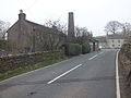
English: Rainow is a small village and civil parish in the unitary authority of Cheshire East, located, mostly, on the eastern side of the River Dean valley next to the B5470 road, between Macclesfield and Kettleshulme in the ceremonial county of Cheshire, England. It straddles the eastern side of the Peak District border of Derbyshire and Cheshire, surrounded by arable farmland. The village name comes from the Old English Hraefn Hoe, meaning Ravens' Hill, and is a former coal mining village. It has a total population of just over 2,500.
Main Wikipedia article: Rainow.

village and civil parish in Cheshire East, England  | |||||
| Upload media | |||||
| Instance of | |||||
|---|---|---|---|---|---|
| Location | Cheshire East, Cheshire, North West England, England | ||||
| official website | |||||
 | |||||
Subcategories
This category has the following 6 subcategories, out of 6 total.
H
- Holy Trinity Church, Rainow (4 F)
J
- Jenkin Chapel (26 F)
R
- Rainow War Memorial (1 F)
S
- Shining Tor (58 F)
W
- Walker Barn (4 F)
Media in category "Rainow"
The following 200 files are in this category, out of 444 total.
(previous page) (next page)-
 A frosty morning near Bollington - geograph.org.uk - 3180302.jpg 640 × 480; 166 KB
-
 A view of Kettleshulme from Bakestonedale Road - geograph.org.uk - 2493829.jpg 3,648 × 2,736; 5.27 MB
-
 A537 and Brink Farm - geograph.org.uk - 2858530.jpg 5,184 × 3,456; 2.73 MB
-
 Above Gulshaw Hollow - geograph.org.uk - 169403.jpg 640 × 480; 131 KB
-
 Above Lima Clough - geograph.org.uk - 5060692.jpg 3,456 × 2,304; 4.49 MB
-
 Across Gulshaw Hollow - geograph.org.uk - 2389807.jpg 2,972 × 1,947; 2.81 MB
-
 Across the valley from Gausie Brow - geograph.org.uk - 3022165.jpg 3,872 × 2,592; 4.14 MB
-
 All that remains.... - geograph.org.uk - 4027045.jpg 4,320 × 3,240; 4.56 MB
-
 Along Hedge Row, Berristall Dale - geograph.org.uk - 2824383.jpg 4,000 × 2,667; 3.66 MB
-
 Along the ridge approaching Oldgate Nick - geograph.org.uk - 3511745.jpg 4,000 × 2,248; 4.98 MB
-
 An old packhorse trail^ - geograph.org.uk - 2852564.jpg 5,184 × 3,456; 4.99 MB
-
 Andrew's Edge - geograph.org.uk - 3709024.jpg 3,872 × 2,592; 1.5 MB
-
 Approaching Brink Farm - geograph.org.uk - 3496633.jpg 2,048 × 1,536; 560 KB
-
 Approaching Burton Springs Farm - geograph.org.uk - 5778372.jpg 1,514 × 1,136; 851 KB
-
 B5470 at Four Lane Ends Farm - geograph.org.uk - 2571969.jpg 640 × 480; 58 KB
-
 B5470 at Robin Hood Inn - geograph.org.uk - 2571963.jpg 640 × 480; 61 KB
-
 B5470 Macclesfield Road - geograph.org.uk - 5778079.jpg 2,272 × 1,704; 1,022 KB
-
 B5470 near Calrofold Lane - geograph.org.uk - 2569579.jpg 640 × 480; 113 KB
-
 Bakestonedale Road - geograph.org.uk - 3342921.jpg 1,600 × 1,064; 381 KB
-
 Bakestonesdale Road, with Brink Farm and Brink Brow - geograph.org.uk - 3231428.jpg 4,000 × 3,000; 2.23 MB
-
 Bank Lane - geograph.org.uk - 1802058.jpg 480 × 640; 119 KB
-
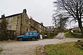
 Barn at Hedgerow Farm, Rainow.JPG 1,800 × 1,350; 489 KB
-
 Barn on Bull Hill Lane - geograph.org.uk - 4108587.jpg 3,648 × 2,736; 4.01 MB
-
 Beauty and the beast - geograph.org.uk - 5778192.jpg 2,272 × 1,704; 1.63 MB
-
 Berristal Road - geograph.org.uk - 4105175.jpg 3,648 × 2,736; 3.94 MB
-
 Berristall Farm from Berristall Road - geograph.org.uk - 2804104.jpg 4,000 × 3,000; 3.44 MB
-
 Berristall Road, Rainow - geograph.org.uk - 2804108.jpg 4,000 × 3,000; 2.64 MB
-
 Big Low - geograph.org.uk - 4107281.jpg 3,648 × 2,736; 3.67 MB
-
 Billinge Head Farm - geograph.org.uk - 4107270.jpg 3,648 × 2,736; 3.8 MB
-
 Billinge Hill gorse - geograph.org.uk - 2856024.jpg 2,272 × 1,704; 1.6 MB
-
 Black Brook - geograph.org.uk - 5778180.jpg 2,234 × 1,675; 1.48 MB
-
 Black Brook meandering - geograph.org.uk - 2823772.jpg 4,000 × 2,667; 5.05 MB
-
 Black Brook meandering - geograph.org.uk - 3022190.jpg 3,872 × 2,592; 6.23 MB
-
 Black Sponds - geograph.org.uk - 3799073.jpg 3,888 × 1,978; 1.15 MB
-
 Blackbrook Farm - geograph.org.uk - 5778435.jpg 2,196 × 1,647; 808 KB
-
 Blackbrook fields, Rainow - geograph.org.uk - 2805097.jpg 3,072 × 2,048; 2.26 MB
-
 Blaze Hill - geograph.org.uk - 3798989.jpg 3,761 × 2,405; 1.46 MB
-
 Blaze Hill - geograph.org.uk - 4107284.jpg 3,648 × 2,736; 4 MB
-
 Blaze Hill fields (2) - geograph.org.uk - 2851259.jpg 5,184 × 3,456; 4.11 MB
-
 Blaze Hill fields - geograph.org.uk - 2851233.jpg 5,184 × 3,456; 3.19 MB
-
 Blaze Hill, Bollington - geograph.org.uk - 1276569.jpg 640 × 480; 76 KB
-
 Blue Boar Farm Cottages - geograph.org.uk - 4130765.jpg 3,500 × 2,624; 3.02 MB
-
 Bollington - geograph.org.uk - 3798988.jpg 3,888 × 2,295; 1.05 MB
-
 Bowl barrow at Ox Close.jpg 4,000 × 3,000; 4.47 MB
-
 Bridge over Todd Brook - geograph.org.uk - 5778378.jpg 2,272 × 1,704; 1.36 MB
-
 Brink Brow - geograph.org.uk - 3799076.jpg 3,888 × 2,592; 2.28 MB
-
 Brink Farm - geograph.org.uk - 3490065.jpg 2,048 × 1,536; 632 KB
-
 Broad Moss Ridge - geograph.org.uk - 1802064.jpg 480 × 640; 79 KB
-
 Broken Wall at Cats Tor - geograph.org.uk - 3727711.jpg 4,000 × 3,000; 1.93 MB
-
 Brookhouse Farm near Kerridge End - geograph.org.uk - 3530940.jpg 1,600 × 1,200; 439 KB
-
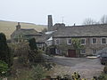
 Brown House, Rainow.JPG 1,800 × 1,350; 602 KB
-
 Burton Springs Farm and lake - geograph.org.uk - 5778388.jpg 1,514 × 1,136; 575 KB
-
 Cats Tor - geograph.org.uk - 2588848.jpg 640 × 426; 59 KB
-
 Cats Tor - geograph.org.uk - 3004109.jpg 640 × 480; 66 KB
-
 Cats Tor - geograph.org.uk - 3840021.jpg 4,286 × 2,806; 2.6 MB
-
 Cats Tor - geograph.org.uk - 4071125.jpg 2,560 × 1,920; 3.75 MB
-
 Cats Tor summit - geograph.org.uk - 5724595.jpg 1,500 × 1,000; 1.36 MB
-
 Cattle grid along the Gritstone Trail - geograph.org.uk - 5514365.jpg 640 × 427; 103 KB
-
 Charles Head Farm (geograph 2817872).jpg 3,872 × 2,592; 5.33 MB
-
 Church Lane, Terraced cottages - geograph.org.uk - 4108542.jpg 3,648 × 2,736; 3.72 MB
-
 Clapper bridge over Black Brook - geograph.org.uk - 2824320.jpg 4,000 × 2,667; 5.3 MB
-
 Clapper bridges in Cheshire - geograph.org.uk - 2824281.jpg 4,000 × 2,667; 4.18 MB
-
 Common Barn - geograph.org.uk - 4105245.jpg 3,648 × 2,736; 3.71 MB
-
 Common Barn, farmhouse tea-room - geograph.org.uk - 4105216.jpg 3,648 × 2,736; 3.94 MB
-

-
 Cool spot for a picnic - geograph.org.uk - 4973341.jpg 3,072 × 1,728; 3.97 MB
-
 Cottage near bottom of Pedley Hill - geograph.org.uk - 4108554.jpg 3,648 × 2,736; 3.73 MB
-
 Cottages and phone box - geograph.org.uk - 4105322.jpg 3,648 × 2,736; 3.9 MB
-
 Cottages at Blue Boar Farm - geograph.org.uk - 4105330.jpg 3,648 × 2,736; 3.88 MB
-
 Cottages on Berristall Road - geograph.org.uk - 4105178.jpg 3,648 × 2,736; 3.8 MB
-
 Cottages on Blaze Hill - geograph.org.uk - 2851263.jpg 5,184 × 3,456; 3.4 MB
-
 Cottages on Oakenbank Lane - geograph.org.uk - 4107300.jpg 3,648 × 2,736; 4.05 MB
-
 Cottages on Oakenbank Lane - geograph.org.uk - 4107303.jpg 3,648 × 2,736; 3.69 MB
-
 Cottages, Rainow - geograph.org.uk - 169994.jpg 640 × 480; 143 KB
-
 Crags on Cat's Tor - geograph.org.uk - 696104.jpg 640 × 426; 79 KB
-
 Cutlers ^ Hazel Trees Farm above Rainow - geograph.org.uk - 5217514.jpg 5,184 × 2,920; 4.06 MB
-
 Dangerous bridge - geograph.org.uk - 5778327.jpg 2,272 × 1,704; 1.38 MB
-
 Dean Valley towards Rainow - geograph.org.uk - 2805027.jpg 4,000 × 3,000; 2.7 MB
-
 Disused barn at Lamaload Reservoir - geograph.org.uk - 1399832.jpg 640 × 480; 88 KB
-

-
 Disused Mill - geograph.org.uk - 2691604.jpg 640 × 480; 105 KB
-
 Down the fields into Harrop Vale - geograph.org.uk - 5060739.jpg 3,456 × 2,304; 5.31 MB
-
 Dry stone wall - geograph.org.uk - 4027306.jpg 4,320 × 3,240; 4.79 MB
-
 Dry stone wall on Andrew's Edge - geograph.org.uk - 3706868.jpg 3,872 × 2,592; 1.83 MB
-
 Drystone walls on Cheshire moorland - geograph.org.uk - 4967235.jpg 800 × 600; 104 KB
-
 East side of the Kerridge Ridge - geograph.org.uk - 358167.jpg 640 × 426; 112 KB
-
 Electric gate, Valeroyal Farm - geograph.org.uk - 4105159.jpg 3,648 × 2,736; 3.99 MB
-
 Embridge Causeway - geograph.org.uk - 2967342.jpg 640 × 480; 72 KB
-
 Errwood footpath - geograph.org.uk - 4473267.jpg 3,648 × 2,736; 4.47 MB
-
 Farm at Redmoor - geograph.org.uk - 1399685.jpg 640 × 480; 76 KB
-
 Farm Buildings at Walker Barn - geograph.org.uk - 2389796.jpg 2,914 × 1,951; 3.14 MB
-
 Farm on Bull Hill Lane - geograph.org.uk - 3490077.jpg 2,048 × 1,536; 557 KB
-
 Farm track at Calrofold - geograph.org.uk - 3530921.jpg 1,600 × 1,200; 304 KB
-
 Farm track crossing the B5470 Macclesfield Road - geograph.org.uk - 5778229.jpg 2,272 × 1,704; 1.05 MB
-
 Farm track near Billinge Farm - geograph.org.uk - 3180322.jpg 640 × 480; 123 KB
-
 Farm track with a view - geograph.org.uk - 5778239.jpg 2,272 × 1,704; 1.02 MB
-
 Farm track with surprising sign - geograph.org.uk - 5778368.jpg 2,272 × 1,704; 1.23 MB
-
 Farmhouse Calrofold Lane - geograph.org.uk - 2328900.jpg 1,600 × 1,200; 564 KB
-

-
 Farmland on the Gritstone Trail - geograph.org.uk - 258303.jpg 640 × 454; 120 KB
-
 Flaged Path to Shining Tor - geograph.org.uk - 3004118.jpg 640 × 480; 68 KB
-
 Folly, Tower Hill - geograph.org.uk - 169429.jpg 640 × 480; 110 KB
-
 Folly, Tower Hill - geograph.org.uk - 169436.jpg 480 × 640; 153 KB
-
 Footbridge over Harrop Brook in Berristall dale - geograph.org.uk - 2483092.jpg 3,072 × 2,304; 4.31 MB
-
 Footbridge, Beristall Dale - geograph.org.uk - 3496615.jpg 2,048 × 1,536; 522 KB
-
 Footpath at Summer Close - geograph.org.uk - 1802069.jpg 480 × 640; 116 KB
-
 Footpath crossing Black Brook - geograph.org.uk - 5778175.jpg 2,167 × 1,625; 1.5 MB
-
 Footpath down to Black Brook - geograph.org.uk - 5778170.jpg 2,272 × 1,704; 1.66 MB
-
 Footpath down to Todd Brook - geograph.org.uk - 5778268.jpg 2,272 × 1,704; 1.32 MB
-
 Footpath junction north of Kerridge End - geograph.org.uk - 3490088.jpg 2,048 × 1,536; 522 KB
-
 Footpath near Charles Head Farm - geograph.org.uk - 2250425.jpg 640 × 480; 179 KB
-
 Footpath near Further Harrop Farm - geograph.org.uk - 2250414.jpg 640 × 480; 153 KB
-
 Footpath near Withinlow Farm - geograph.org.uk - 2250411.jpg 640 × 480; 160 KB
-
 Footpath off Oakenbank Lane - geograph.org.uk - 4107307.jpg 3,648 × 2,736; 4.05 MB
-
 Footpath on Billinge Hill - geograph.org.uk - 2168035.jpg 640 × 480; 166 KB
-
 Footpath on Kerridge Hill - geograph.org.uk - 2167803.jpg 640 × 480; 136 KB
-

-
 Footpath over Saddle Cote - geograph.org.uk - 5778399.jpg 2,256 × 1,692; 982 KB
-
 Footpath post, Ewrin Lane - geograph.org.uk - 4105317.jpg 3,648 × 2,736; 3.4 MB
-
 Footpath sign on Gritstone Trail - geograph.org.uk - 4105169.jpg 3,648 × 2,736; 3.75 MB
-
 Footpath sign on Shining Tor - geograph.org.uk - 697149.jpg 426 × 640; 96 KB
-
 Footpath to Andrew's Edge - geograph.org.uk - 3706822.jpg 3,872 × 2,592; 4.5 MB
-
 Footpath to Kerridge Hill - geograph.org.uk - 4967219.jpg 600 × 800; 104 KB
-

-
 Footpath to Rainow - geograph.org.uk - 2321349.jpg 1,989 × 1,338; 401 KB
-
 Footpath to Summer Close - geograph.org.uk - 5778259.jpg 2,272 × 1,704; 1.12 MB
-
 Footpath towards Shining Tor - geograph.org.uk - 1401777.jpg 640 × 480; 129 KB
-
 Ford across Black Brook - geograph.org.uk - 3022178.jpg 3,872 × 2,592; 6.41 MB
-
 Former Hooleyhey Farm above Lamaload Reservoir - geograph.org.uk - 5217254.jpg 5,184 × 2,920; 4.85 MB
-
 Former Setter Dog pub, Walker Barn - geograph.org.uk - 4423780.jpg 1,800 × 1,350; 488 KB
-
 Four Lane Ends Farm - geograph.org.uk - 4107263.jpg 3,648 × 2,736; 3.75 MB
-
 Free Range Eggs and honesty box - geograph.org.uk - 3180315.jpg 615 × 464; 161 KB
-
 From Cat's Tor in direction of Shining Tor - geograph.org.uk - 3511750.jpg 4,000 × 2,248; 5.89 MB
-
 From Cats Tor - geograph.org.uk - 1401841.jpg 640 × 480; 119 KB
-
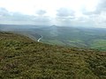
 From Shining Tor - geograph.org.uk - 1401822.jpg 640 × 480; 115 KB
-
 From Shining Tor to Shutlingshoe - geograph.org.uk - 251091.jpg 640 × 480; 82 KB
-
 Frosty fields towards Kerridge End - geograph.org.uk - 2711281.jpg 1,704 × 2,272; 1.27 MB
-
 Further Harrop Farm - geograph.org.uk - 3022186.jpg 3,872 × 2,592; 4.31 MB
-
 Gateway with benchmark, Smithy Brow, Bollington - geograph.org.uk - 3496590.jpg 2,048 × 1,536; 577 KB
-
 Gathering in the flock at Saltersford - geograph.org.uk - 2967255.jpg 640 × 480; 106 KB
-
 Gausie Brow - geograph.org.uk - 3799001.jpg 3,823 × 2,242; 994 KB
-
 Gin Clough Cottage.jpg 795 × 609; 155 KB
-
 Gin Clough Farm, Rainow - geograph.org.uk - 1478822.jpg 640 × 480; 70 KB
-
 Gin Clough Mill, Rainow 1862.JPG 3,264 × 2,448; 1.87 MB
-
 Gin Clough Mill, Rainow 1867.JPG 3,264 × 2,448; 1.84 MB
-
 Gin Clough Mill, Rainow 1869.JPG 3,264 × 2,448; 1.89 MB
-
 Gin Clough Mill.jpg 1,280 × 960; 306 KB
-
 Ginclough barrow.jpg 1,280 × 960; 290 KB
-
 Gnarled old hawthorns by the footpath - geograph.org.uk - 5778428.jpg 2,272 × 1,704; 1.2 MB
-
 Grazing land on Wimberry Moss - geograph.org.uk - 1478851.jpg 640 × 480; 65 KB
-
 Green Booth - geograph.org.uk - 5778347.jpg 2,272 × 1,704; 1.01 MB
-
 Green Stack - geograph.org.uk - 2441732.jpg 3,648 × 2,736; 5.47 MB
-
 Green Stack - geograph.org.uk - 3799017.jpg 3,888 × 2,160; 1.31 MB
-
 Gritstone trail at Brookhouse - geograph.org.uk - 3531045.jpg 1,600 × 1,200; 245 KB
-
 Gritstone Trail descending Brink hill - geograph.org.uk - 258306.jpg 640 × 453; 147 KB
-
 Gritstone Trail marker and dry stone wall - geograph.org.uk - 258296.jpg 640 × 433; 151 KB
-
 Gritstone Trail near Savio House - geograph.org.uk - 2167809.jpg 640 × 480; 173 KB
-
 Gulshaw Hollow - geograph.org.uk - 4105157.jpg 3,648 × 2,736; 3.9 MB
-
 Gulshaw Hollow from the Gritstone Trail - geograph.org.uk - 3531092.jpg 1,600 × 1,200; 256 KB
-
 Harrop Brook confluence - geograph.org.uk - 2823809.jpg 4,000 × 2,667; 5.59 MB
-
 Harrop House farm - geograph.org.uk - 3799004.jpg 3,888 × 1,744; 890 KB
-
 Harrop in the Parish of Rainow - geograph.org.uk - 2805080.jpg 3,072 × 2,048; 3.74 MB
-
 Hayles Clough - geograph.org.uk - 5060646.jpg 2,306 × 1,841; 3.44 MB
-
 Heading for Cats Tor - geograph.org.uk - 3476191.jpg 2,048 × 1,536; 600 KB
-
 Heading For Oldgate Nick - geograph.org.uk - 4071132.jpg 2,560 × 1,920; 2.59 MB
-

-

-
 Hedge Row - geograph.org.uk - 804299.jpg 640 × 427; 116 KB
-
 Hedge Row, Berristall Dale - geograph.org.uk - 2824331.jpg 4,000 × 2,667; 3.76 MB
-
 High stile - geograph.org.uk - 5778342.jpg 2,212 × 1,659; 1,023 KB
-
 Higherlane Farm - geograph.org.uk - 4105180.jpg 3,648 × 2,736; 3.94 MB
-

-
 Hordern Farm - geograph.org.uk - 4105164.jpg 3,648 × 2,736; 3.61 MB
-
 Hordern Farm from A537 - geograph.org.uk - 2858829.jpg 5,184 × 3,456; 2.98 MB
-
 Horses munching below Brink Brow - geograph.org.uk - 2817883.jpg 3,872 × 2,592; 4.24 MB
-
 House on Bull Hill Lane, Rainow - geograph.org.uk - 4108577.jpg 3,648 × 2,736; 3.71 MB
-
 Houses at Hayles Clough, Rainow - geograph.org.uk - 4108526.jpg 3,648 × 2,736; 3.77 MB
-
 Houses off Mill Lane - geograph.org.uk - 2475095.jpg 1,600 × 1,200; 462 KB
-
 Howlersknowl - geograph.org.uk - 3799015.jpg 3,888 × 2,412; 952 KB
-
 Howlersknowll Farm - geograph.org.uk - 6426382.jpg 800 × 533; 190 KB
-
 Ice on the path to Shining Tor - geograph.org.uk - 3793575.jpg 1,600 × 1,105; 517 KB
-
 Ingersley Clough Waterfall - geograph.org.uk - 44589.jpg 480 × 640; 184 KB
-
 Ingersley Vale Mill Chimney - geograph.org.uk - 4195696.jpg 800 × 1,000; 823 KB
-
 Inside Jenkin Chapel - geograph.org.uk - 5778365.jpg 2,272 × 1,704; 840 KB
-

-
 Jenkin Chapel - geograph.org.uk - 4071148.jpg 2,459 × 1,382; 1.6 MB
-
 Jenkin Chapel - geograph.org.uk - 4130874.jpg 3,500 × 2,624; 3.4 MB
-
 Jenkin Chapel - tower - geograph.org.uk - 5974245.jpg 810 × 1,080; 118 KB
-
 Jenkin Chapel, Saltersford - geograph.org.uk - 5051363.jpg 1,500 × 1,125; 1.4 MB
-
 Jenkin Chapel, Saltersford - geograph.org.uk - 6346416.jpg 1,600 × 1,064; 486 KB
-
 Jenkin Chapel, Saltersford - geograph.org.uk - 6460995.jpg 1,024 × 677; 121 KB
-
 Jenkin Chapel, Saltersford. - geograph.org.uk - 5217243.jpg 5,184 × 2,920; 5.77 MB
-
 Junction of Bull Hill Lane and Buxton New Road - geograph.org.uk - 2321330.jpg 2,022 × 1,283; 464 KB
-
 Lamaload Dam - geograph.org.uk - 5391438.jpg 4,352 × 2,904; 1.86 MB
-
 Lamaload Reservoir - geograph.org.uk - 1401762.jpg 640 × 480; 156 KB
-
 Lamaload Reservoir - geograph.org.uk - 2791031.jpg 1,024 × 768; 323 KB
-

-
 Lamaload Water Treatment Works, Rainow - geograph.org.uk - 2805012.jpg 4,000 × 3,000; 2.72 MB
-
 Lamaload.jpg 640 × 480; 76 KB
-
 Late afternoon sunshine over a snowy Rainow - geograph.org.uk - 5217568.jpg 5,184 × 2,920; 5.53 MB


_-_geograph.org.uk_-_2851259.jpg)


.jpg)


