Category:Raster maps of the quarters of Cagliari
Jump to navigation
Jump to search
Media in category "Raster maps of the quarters of Cagliari"
The following 18 files are in this category, out of 18 total.
-
 BonariaCA.png 708 × 604; 229 KB
-
 CastelloCagliariMappa.png 708 × 604; 226 KB
-
 FonsardaCagliariMappa.png 708 × 604; 227 KB
-
 Is MirrionisCagliariMappa.png 708 × 604; 227 KB
-
 La PalmaCA.png 708 × 604; 226 KB
-
 La VegaCagliariMappa.png 708 × 604; 226 KB
-
 MarinaCagliariMappa.png 708 × 604; 227 KB
-
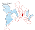
 Monte UrpinuCA.png 708 × 604; 228 KB
-
 Mulinu BecciuCA.png 708 × 604; 225 KB
-
 PoettoCA.png 708 × 604; 229 KB
-
 Quartiere del SoleCA.png 708 × 604; 226 KB
-
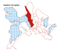
 Quartieri di Cagliari.png 705 × 909; 306 KB
-
 San BenedettoCagliariMappa.png 708 × 604; 227 KB
-
 Sant'AvendraceCA.png 708 × 604; 230 KB
-
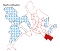 Sant'EliaCA.png 708 × 604; 226 KB
-
 StampaceCagliariMappa.png 708 × 604; 229 KB
-
 Tuvixeddu-TuvumannuCagliariMappa.png 708 × 604; 227 KB
-
 VillanovaCagliariMappa.png 708 × 604; 227 KB


