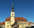
Category:Rathaus Weißenberg
Jump to navigation
Jump to search
| Object location | | View all coordinates using: OpenStreetMap |
|---|
.jpg) | |||||
| Upload media | |||||
| Instance of | |||||
|---|---|---|---|---|---|
| Location | Weißenberg, Bautzen District, Saxony, Germany | ||||
| Street address |
| ||||
| Heritage designation | |||||
| Inception |
| ||||
 | |||||
Media in category "Rathaus Weißenberg"
The following 25 files are in this category, out of 25 total.
-
 Rathaus weissenberg1.JPG 2,448 × 3,264; 1.76 MB
-
 Rathaus weissenberg2.JPG 3,264 × 2,448; 1.81 MB
-
 Rathaus weissenberg3.JPG 2,448 × 3,264; 1.69 MB
-
 Rathaus Weißenberg - Mai 2014 (01).jpg 3,026 × 2,487; 3.64 MB
-
 Rathaus Weißenberg - Mai 2014 (02).jpg 2,369 × 3,291; 3.61 MB
-
 Rathaus Weißenberg.jpg 1,221 × 1,600; 295 KB
-
 Weißenberg, das Rathaus.jpg 2,424 × 3,638; 1.59 MB
-
 Weißenberg - August-Bebel-Platz+1Rathaus 01 ies.jpg 5,616 × 3,744; 18.72 MB
-
 Weißenberg - August-Bebel-Platz+1Rathaus 02 ies.jpg 5,616 × 3,744; 10.74 MB
-
 Weißenberg - August-Bebel-Platz1Rathaus 01 ies.jpg 5,616 × 3,744; 20.2 MB
-
 Weißenberg - August-Bebel-Platz1Rathaus 02 ies.jpg 5,616 × 3,744; 11.99 MB
-
 Weißenberg - August-Bebel-Platz1Rathaus 03 ies.jpg 3,744 × 5,616; 10.91 MB
-
 Weißenberg - August-Bebel-Platz1Rathaus 04 ies.jpg 5,616 × 3,744; 15.23 MB
-
 Weißenberg - August-Bebel-Platz1Rathaus 05 ies.jpg 5,616 × 3,744; 16.59 MB
-
 Weißenberg - August-Bebel-Platz1Rathaus 06 ies.jpg 5,616 × 3,744; 16.66 MB
-
 Weißenberg - August-Bebel-Platz1Rathaus 07 ies.jpg 5,616 × 3,744; 12.71 MB
-
 Weißenberg, August-Bebel-Platz mit Rathaus.jpg 4,127 × 2,304; 1.01 MB
-
 Weißenberg, Rathaus am August-Bebel-Platz 1.jpg 4,000 × 3,000; 2.51 MB
-
 Weißenberg, Rathaus Stadt Sachsen (3).jpg 5,120 × 2,448; 1.39 MB
-
 Weißenberg, Rathaus.jpg 2,590 × 1,491; 150 KB
-
 Weißenberg, Rathausturm am August-Bebel-Platz 1.jpg 3,000 × 4,000; 1.72 MB
-
 Weißenberg-Rathaus-1.jpg 3,648 × 2,736; 2.99 MB
-
 Weißenberg-Rathaus-2.jpg 3,712 × 3,102; 2.2 MB
-
 Weißenberg-Rathaus-3.jpg 3,248 × 2,165; 1.62 MB
-
 Wóspork – radnica.jpg 4,500 × 3,000; 7.5 MB


.jpg)


.jpg)


