Category:Ratinger Straße (Düsseldorf)
Jump to navigation
Jump to search
| Object location | | View all coordinates using: OpenStreetMap |
|---|
street in Düsseldorf, Germany  | |||||
| Upload media | |||||
| Instance of | |||||
|---|---|---|---|---|---|
| Location | Düsseldorf, Düsseldorf Government Region, North Rhine-Westphalia, Germany | ||||
| Inception |
| ||||
 | |||||
Subcategories
This category has the following 15 subcategories, out of 15 total.
0
- Kreuzherrenkirche (Düsseldorf) (24 F)
1
- Ratinger Hof (4 F)
- Zur Uel (6 F)
- Zum Goldenen Einhorn (8 F)
2
- Henkel-Saal (4 F)
- Brauerei im Füchschen (10 F)
4
5
R
Media in category "Ratinger Straße (Düsseldorf)"
The following 54 files are in this category, out of 54 total.
-
 Düsseldorf - Ratinger Mauer - Henkel-Saal 03 ies.jpg 5,616 × 3,744; 15.67 MB
-

-

-
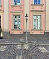
 Gaslaterne Alt-Düsseldorf, Ratinger Straße, Düsseldorf-Altstadt.jpg 2,861 × 3,790; 6.03 MB
-
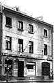
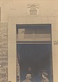
 Düsseldorf, Ratingerstr. 15, Erwin Quedenfeldt, 1909.jpg 1,882 × 2,487; 1.2 MB
-
-
 Altstadt in Düsseldorf - panoramio.jpg 4,608 × 3,456; 5.72 MB
-

-
 Karnevalsband aus Amriswil in Düsseldorf, Februar 2024.jpg 5,472 × 3,648; 2.29 MB
-

-
 Düsseldorf, Ratinger Straße 23 (2017).jpg 3,420 × 4,689; 9.13 MB
-
 Stolperstein Düsseldorf 1 Altstadt Ratinger Straße 23 Willi Schneider 2018-08-20.jpg 4,288 × 3,216; 3.28 MB
-
 Stolperstein Düsseldorf 1 Altstadt Ratinger Straße 23 Willi Schneider.jpg 4,288 × 3,216; 7.01 MB
-
 Stolperstein Düsseldorf Altstadt Ratinger Straße 23 Willi Schneider.jpg 1,864 × 2,091; 1.43 MB
-

-
 Altstadt in Düsseldorf - panoramio (1).jpg 4,608 × 3,456; 6.45 MB
-
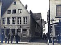
 Duesseldorf-Altstadt Fuechschen.jpg 808 × 1,077; 177 KB
-
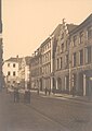
 Düsseldorf, Ratingerstraße Häuser Nr. 30, 32.jpg 1,021 × 1,350; 1,002 KB
-
 Mühlengasse, Düsseldorf-Altstadt, im November 2022.jpg 2,729 × 3,324; 5.06 MB
-
 Ratinger Straße, Blick in Mühlengässchen, Düsseldorf, 1909.jpg 2,671 × 1,976; 2.19 MB
-
 Düsseldorf, Häuser der Ratingerstr., Erwin Quedenfeldt, 1909.jpg 2,571 × 1,862; 1.13 MB
-
 Eckhaus Mühlengasse 10, Ratinger Straße (Düsseldorf-Altstadt).jpg 2,628 × 2,966; 4.19 MB
-

-
 Mühlensignet am Haus Ratinger Straße 42 "Zur Windmühle", Düsseldorf, 1909.jpg 1,929 × 2,730; 1.71 MB
-
 Retematäng, Düsseldorf, Februar 2024.jpg 5,000 × 3,331; 1.8 MB
-
 Haus Ratinger Straße 44 (Düsseldorf).jpg 1,708 × 2,360; 2.2 MB
-
 Düsseldorf - Ratinger Straße+Heinrich-Heine-Allee 01 ies.jpg 5,616 × 3,744; 15.86 MB
-
 Ratinger Straße 45 Düsseldorf, um 1920.jpg 498 × 754; 220 KB
-
 Haus Ratinger Straße 46 (Düsseldorf).jpg 1,280 × 2,416; 1.67 MB
-
 Düsseldorf - Ratinger Straße+Hofgartenrampe + Parkhaus Ratinger Tor 01 ies.jpg 5,616 × 3,744; 17.1 MB
-
 Düsseldorf - Ratinger Straße+Hofgartenrampe + Parkhaus Ratinger Tor 02 ies.jpg 5,616 × 3,744; 16.27 MB
-
 5697644.Erwin Quedenfeldt.jpg 1,981 × 2,788; 827 KB
-
 5697647.Erwin Quedenfeldt.jpg 2,758 × 2,049; 1.04 MB
-
 5697650.Erwin Quedenfeldt.jpg 2,762 × 1,946; 1.06 MB
-
 5722618.Erwin Quedenfeldt.jpg 1,978 × 2,789; 1.13 MB
-
 5722633.Erwin Quedenfeldt.jpg 1,963 × 2,779; 974 KB
-
 5723069.Erwin Quedenfeldt.jpg 1,968 × 2,687; 1.45 MB
-

-
 DemoVersGNRWstoppen 26062021 3.jpg 3,264 × 2,448; 2.73 MB
-
 Düsseldorf - Ratinger Straße + Kreuzherrenkirche (Parkhaus Ratinger Tor) 01 ies.jpg 5,616 × 3,744; 16.29 MB
-

-
 Düsseldorf 17.JPG 2,124 × 1,480; 641 KB
-
 Düsseldorf Sep 2019 22 12 27 607000.jpeg 4,032 × 3,024; 4.06 MB
-
 Düsseldorf Sep 2019 22 12 34 934000.jpeg 4,032 × 3,024; 4.94 MB
-
 Düsseldorf, ehemaliges Landgericht, Rückseite während des Umbaus, 2012 (1).jpg 2,027 × 1,497; 2.4 MB
-
 Düsseldorf, ehemaliges Landgericht, Rückseite während des Umbaus, 2012 (2).jpg 2,022 × 1,450; 2.33 MB
-
 Düsseldorf, Ratinger Straße, Sicht vom Ratinger Tor aus, Erwin Quedenfeldt, 1909.jpg 1,954 × 2,685; 1.22 MB
-
 Mühlenplatz (heute Grabbeplatz), Franz Bernhard Custodis, um 1800.JPG 1,408 × 1,491; 433 KB
-
 Ratinger Straße Düsseldorf, um 1920.jpg 3,249 × 2,268; 1.94 MB
-
 VersG NRW stoppen 26062021 Polizeimacht.jpg 2,844 × 1,600; 1.34 MB
-

-

-
 Wilhelm Schreuer, Das alte Ratinger Tor (Düsseldorf).jpg 1,854 × 1,541; 2.47 MB
-
 Wolfgang Rolshoven (2018).jpg 2,200 × 1,480; 1.05 MB

,_Nr._6_%22Zum_Schwarzen_Horn%22_(Mitte),_Nr._8_mit_Volutengiebel_und_Pilastergliederung_(rechts)_im_Jahr_1910.jpg)
,_Nr._6_%22Zum_Schwarzen_Horn%22_(Mitte),_Nr._8_mit_Volutengiebel_und_Pilastergliederung_(rechts).jpg)


,_1922,_Abb._50b_D%C3%BCsseldorf,_ehemaliges_Haus_Ratinger_Stra%C3%9Fe_16_erbaut_1707.jpg)
.jpg)


,_1922,_Abb._33_Ratinger_Strasse_26_Erbaut_1633_(Anker).jpg)
.jpg)


.jpg)
.jpg)


.jpg)


.jpg)


_01_ies.jpg)
_01_ies.jpg)


.jpg)
.jpg)

,_Franz_Bernhard_Custodis,_um_1800.JPG)


,_D%C3%BCsseldorf,_die_ersten_Russen_auf_der_Ratingerstrasse.jpg)
,_D%C3%BCsseldorf,_Naploeons_Armee_in_der_Ratinger_Stra%C3%9Fe.jpg)
.jpg)
.jpg)