Category:Ratlinghope
Jump to navigation
Jump to search
English: Ratlinghope is a village and civil parish in Shropshire, England. It is situated four miles west from Church Stretton and twelve miles south from Shrewsbury.
village in the United Kingdom  | |||||
| Upload media | |||||
| Instance of | |||||
|---|---|---|---|---|---|
| Location | Shropshire, West Midlands, England | ||||
 | |||||
Subcategories
This category has the following 2 subcategories, out of 2 total.
B
M
Media in category "Ratlinghope"
The following 200 files are in this category, out of 310 total.
(previous page) (next page)-

-
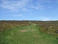
 A long flog up is about to start - geograph.org.uk - 3040663.jpg 979 × 734; 287 KB
-
 Access lane to Leasowes Bank Farm - geograph.org.uk - 2179427.jpg 819 × 614; 286 KB
-
 Across the valley towards Coppice Farm - geograph.org.uk - 3107381.jpg 1,142 × 857; 636 KB
-
 Adstone Hill - geograph.org.uk - 5025216.jpg 6,000 × 4,000; 3.32 MB
-
 Along the Shropshire Way at Darnford - geograph.org.uk - 1242797.jpg 640 × 480; 114 KB
-
 Approaching Coates Farm - geograph.org.uk - 5635583.jpg 640 × 480; 66 KB
-
 Approaching Lower Darnford - geograph.org.uk - 1113052.jpg 640 × 480; 82 KB
-
 Approaching the Devil's Chair - geograph.org.uk - 6095841.jpg 6,000 × 4,000; 3.49 MB
-
 Around the Bend - geograph.org.uk - 399475.jpg 640 × 427; 63 KB
-
 Avenue of Trees Leading To Linley Hall - geograph.org.uk - 255649.jpg 640 × 480; 101 KB
-
 Barn at Upper Stitt farm - geograph.org.uk - 3040666.jpg 979 × 734; 270 KB
-
 Barns and traction engine at Brow Farm - geograph.org.uk - 3478927.jpg 1,600 × 1,200; 444 KB
-
 Beech row at Gatten - geograph.org.uk - 2179480.jpg 614 × 819; 270 KB
-
 Beech tree-lined lane - geograph.org.uk - 5688904.jpg 1,600 × 901; 735 KB
-
 Beech trees above Ratlinghope - geograph.org.uk - 5688896.jpg 1,600 × 901; 749 KB
-
 Belmore Farm - geograph.org.uk - 5023998.jpg 6,000 × 4,000; 4.44 MB
-
 Bench below the Stiperstones - geograph.org.uk - 5956925.jpg 6,000 × 4,000; 5.55 MB
-
 Bilbatch Brook valley - geograph.org.uk - 1113582.jpg 640 × 480; 102 KB
-

-
 Bilbatch Brook valley and Shaw Wood - geograph.org.uk - 1113645.jpg 640 × 480; 101 KB
-
 Blue Sky and Cars. - geograph.org.uk - 623540.jpg 640 × 480; 48 KB
-
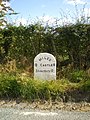 Bridges milestone - detail - geograph.org.uk - 1500154.jpg 480 × 640; 175 KB
-
 Bridleway and the lake at Gatten Lodge - geograph.org.uk - 2179434.jpg 819 × 614; 284 KB
-
 Bridleway below Leasowes Bank Farm - geograph.org.uk - 2179431.jpg 819 × 614; 274 KB
-
 Bridleway below the Stiperstones - geograph.org.uk - 5956902.jpg 6,000 × 4,000; 4.74 MB
-
 Cairn where paths meet at the Shepherd Rock - geograph.org.uk - 6300385.jpg 3,857 × 2,006; 4.15 MB
-
 Castle Ring earthworks (closeup 1) - geograph.org.uk - 1242871.jpg 640 × 480; 111 KB
-
 Castle Ring earthworks (closeup 2) - geograph.org.uk - 1242872.jpg 640 × 480; 116 KB
-
 Castle Ring from the southeast - geograph.org.uk - 1242866.jpg 640 × 480; 101 KB
-
 Cattle grid near Coates Farm - geograph.org.uk - 4895314.jpg 1,200 × 780; 367 KB
-
 Cattle grid near Ratlinghope - geograph.org.uk - 4895210.jpg 1,200 × 799; 458 KB
-
 Cattle on each side of the road above Ratlinghope - geograph.org.uk - 5024020.jpg 6,000 × 4,000; 5.03 MB
-
 Coates Farm - geograph.org.uk - 3040631.jpg 979 × 734; 296 KB
-
 Colliersford Gutter valley - geograph.org.uk - 2008985.jpg 870 × 653; 180 KB
-

-
 Cottages at Coates Farm - geograph.org.uk - 5635599.jpg 640 × 480; 72 KB
-
 Country road near Ratlinghope (1) - geograph.org.uk - 6005776.jpg 640 × 403; 106 KB
-
 Country road near Ratlinghope (2) - geograph.org.uk - 6005777.jpg 640 × 480; 176 KB
-
 Country road near Ratlinghope (3) - geograph.org.uk - 6005779.jpg 480 × 640; 282 KB
-
 Country road near Ratlinghope (4) - geograph.org.uk - 6005782.jpg 539 × 640; 311 KB
-
 Country road near Ratlinghope (5) - geograph.org.uk - 6005784.jpg 640 × 480; 156 KB
-
 Country road near Ratlinghope (6) - geograph.org.uk - 6005785.jpg 640 × 480; 241 KB
-
 Country road near Ratlinghope (8) - geograph.org.uk - 6041509.jpg 1,024 × 692; 310 KB
-
 Cows below the Stiperstones - geograph.org.uk - 5955120.jpg 6,000 × 4,000; 4.24 MB
-
 Cows graze below the Stiperstones - geograph.org.uk - 2960958.jpg 640 × 480; 66 KB
-
 Curve on the lane - geograph.org.uk - 5635561.jpg 640 × 480; 72 KB
-
 Darnford Brook - geograph.org.uk - 1112839.jpg 640 × 480; 106 KB
-
 Darnford Brook amid frosty trees - geograph.org.uk - 1113005.jpg 640 × 480; 95 KB
-
 Darnford Brook at Ratlinghope - geograph.org.uk - 846664.jpg 640 × 480; 104 KB
-
 Dead tree trunks by the Shropshire Way - geograph.org.uk - 1112704.jpg 539 × 640; 150 KB
-
 Deep in the valley - geograph.org.uk - 1217609.jpg 600 × 450; 343 KB
-
 Descending the western side of The Mynd - geograph.org.uk - 2366992.jpg 1,306 × 979; 507 KB
-
 Disk Barrow at Shooting Box (geograph 7383349).jpg 1,600 × 900; 680 KB
-
 Down to The Hollows in Bilbatch - geograph.org.uk - 3197420.jpg 1,142 × 857; 365 KB
-
 Driveway to England Shelve Farm - geograph.org.uk - 672007.jpg 640 × 480; 89 KB
-
 Dropping towards Leasowes - geograph.org.uk - 2179518.jpg 819 × 614; 273 KB
-
 Edge of the moorland above Belmore Farm - geograph.org.uk - 2367000.jpg 1,044 × 783; 333 KB
-
 Exit from the car park - geograph.org.uk - 2952327.jpg 2,592 × 1,944; 1.4 MB
-
 Farm buildings at Lower Darnford. - geograph.org.uk - 5044818.jpg 640 × 480; 54 KB
-
 Farm debris above Far Gatten - geograph.org.uk - 3555651.jpg 979 × 734; 342 KB
-
 Farm road leaving The Hollies - geograph.org.uk - 5762075.jpg 5,184 × 3,888; 6.28 MB
-
 Farm track from Gatten to Leasowes - geograph.org.uk - 2179512.jpg 819 × 614; 265 KB
-
 Farm track near Gatten - geograph.org.uk - 5763520.jpg 5,184 × 3,888; 4.59 MB
-
 Farmhouse at Upper Overs - geograph.org.uk - 5635552.jpg 640 × 480; 88 KB
-
 Farmland near Coates Farm - geograph.org.uk - 4895330.jpg 1,200 × 799; 275 KB
-
 Farmland near Overs - geograph.org.uk - 5025194.jpg 6,000 × 4,000; 6.06 MB
-
 Farmland near Ratlinghope (1) - geograph.org.uk - 6005780.jpg 640 × 409; 167 KB
-
 Farmland near Ratlinghope (2) - geograph.org.uk - 6005781.jpg 640 × 480; 229 KB
-
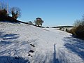 Farmland under snow near Cothercott Hill - geograph.org.uk - 2179426.jpg 819 × 614; 281 KB
-
 Fenceline and boundary on Wildmoor - geograph.org.uk - 2312762.jpg 640 × 480; 77 KB
-
 Field between Near and Far Gatten - geograph.org.uk - 5763489.jpg 5,184 × 3,888; 4.6 MB
-
 Field, Ratlinghope - geograph.org.uk - 2010307.jpg 640 × 480; 96 KB
-
 Fingerpost in Ratlinghope, Shropshire, England.jpg 640 × 485; 110 KB
-
 Footpath fingerpost in Ratlinghope, Shropshire, England.jpg 640 × 480; 105 KB
-
 Footpath near Upper Overs - geograph.org.uk - 4895309.jpg 1,200 × 799; 544 KB
-
 Footpath to Cranberry Rocks - geograph.org.uk - 3481712.jpg 1,600 × 1,200; 362 KB
-
 Footpath to Stiperstones - geograph.org.uk - 5954459.jpg 6,000 × 4,000; 4.4 MB
-
 Ford at Lower Darnford - geograph.org.uk - 4715765.jpg 1,086 × 724; 383 KB
-
 Ford at Lower Darnford - geograph.org.uk - 4715771.jpg 1,086 × 724; 512 KB
-
 Ford at Walford's Rough - geograph.org.uk - 4715531.jpg 1,086 × 724; 569 KB
-
 Ford East of Ratlinghope - geograph.org.uk - 4715749.jpg 1,086 × 724; 556 KB
-
 Ford West of Ratlinghope - geograph.org.uk - 4715741.jpg 1,086 × 724; 533 KB
-
 Ford, Ratlinghope - geograph.org.uk - 1112765.jpg 480 × 640; 124 KB
-
 From Walford's Rough to Paulith Bank - geograph.org.uk - 3555626.jpg 979 × 734; 314 KB
-
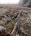
 Frost on fence, Ratlinghope - geograph.org.uk - 1112770.jpg 640 × 451; 71 KB
-
 Frosted conifer, Shaw Wood - geograph.org.uk - 1113660.jpg 640 × 480; 102 KB
-
 Frosty trees by Darnford Brook - geograph.org.uk - 1112823.jpg 464 × 640; 101 KB
-
 Fungi in Drive Coppice - geograph.org.uk - 1112624.jpg 464 × 640; 121 KB
-
 Gated road near Coates Farm - geograph.org.uk - 4895327.jpg 1,200 × 833; 370 KB
-
 Gateway and stile - geograph.org.uk - 2168670.jpg 640 × 480; 110 KB
-
 Gatten Lodge and cottages - geograph.org.uk - 2179443.jpg 819 × 614; 266 KB
-
 Gatten Lodge stable block - geograph.org.uk - 2179440.jpg 819 × 614; 340 KB
-
 Glebe House - geograph.org.uk - 3559630.jpg 1,142 × 857; 447 KB
-
 Goats in a field near Cranberry Rock - geograph.org.uk - 2393017.jpg 640 × 480; 102 KB
-
 Goats in a field near Cranberry Rock - geograph.org.uk - 2393029.jpg 640 × 480; 121 KB
-
 Hay meadows above Coates Farm - geograph.org.uk - 5044812.jpg 640 × 480; 59 KB
-
 Heather in flower - geograph.org.uk - 2010308.jpg 640 × 480; 143 KB
-
 Heather moorland - geograph.org.uk - 5981057.jpg 800 × 600; 105 KB
-
 High farmland - geograph.org.uk - 838760.jpg 640 × 480; 135 KB
-
 Hill from a field gate - geograph.org.uk - 6410506.jpg 640 × 480; 70 KB
-
 Hill top fence - geograph.org.uk - 838967.jpg 640 × 457; 75 KB
-
 Hills above Snape Cottage - geograph.org.uk - 2179462.jpg 819 × 614; 259 KB
-
 Hillside below Devil's Chair - geograph.org.uk - 5954305.jpg 6,000 × 4,000; 4.26 MB
-
 Hillside north west of Pole Bank - geograph.org.uk - 5016805.jpg 6,000 × 4,000; 4.22 MB
-
 Ice on Darnford Brook (2) - geograph.org.uk - 1112758.jpg 640 × 480; 119 KB
-
 Ice on Darnford Brook - geograph.org.uk - 1112714.jpg 640 × 480; 114 KB
-
 Immediately above Priory Cottage - geograph.org.uk - 3197434.jpg 1,142 × 857; 379 KB
-

-
 In the Shropshire Hills in May - geograph.org.uk - 3490235.jpg 640 × 480; 84 KB
-
 Lake near Gatten Lodge - geograph.org.uk - 672019.jpg 640 × 480; 66 KB
-
-
 Lamb leaping out of the heather - geograph.org.uk - 5954427.jpg 6,000 × 4,000; 4.45 MB
-

-
 Lane high above the Bilbatch - geograph.org.uk - 5688886.jpg 1,600 × 901; 705 KB
-
 Lane near Ratlinghope - geograph.org.uk - 1113783.jpg 640 × 480; 135 KB
-
 Lane past Shaw Wood - geograph.org.uk - 1113676.jpg 586 × 640; 165 KB
-
 Lane to Medlicott from Coates Farm - geograph.org.uk - 5635596.jpg 640 × 480; 101 KB
-
 Lane to Ratlinghope (2) - geograph.org.uk - 1113771.jpg 640 × 480; 121 KB
-
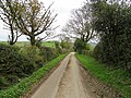
 Lane to Ratlinghope - geograph.org.uk - 1113732.jpg 640 × 480; 133 KB
-
 Lane to Ratlinghope below Shaw Wood - geograph.org.uk - 1113686.jpg 640 × 485; 132 KB
-
 Leasowes Bank Farm - geograph.org.uk - 1972817.jpg 2,848 × 2,136; 1.72 MB
-
 Leasowes Bank from Gatten Lodge - geograph.org.uk - 2179437.jpg 819 × 614; 271 KB
-
 Lonely tree on the hillside - geograph.org.uk - 846661.jpg 640 × 480; 94 KB
-

-
 Looking down the valley - geograph.org.uk - 846649.jpg 640 × 480; 77 KB
-
 Looking from the tumulus to the car park - geograph.org.uk - 1635842.jpg 640 × 480; 122 KB
-
 Looking over Darnford Brook - geograph.org.uk - 399469.jpg 640 × 427; 39 KB
-
 Looking towards Ratlinghope - geograph.org.uk - 399479.jpg 640 × 427; 69 KB
-
 Looking up towards "Ice Hill" - geograph.org.uk - 399482.jpg 640 × 427; 98 KB
-
 Losted frosted glove - geograph.org.uk - 1113534.jpg 640 × 480; 139 KB
-
 Lower Darnford - geograph.org.uk - 1113060.jpg 640 × 480; 96 KB
-
 Lower Darnford - geograph.org.uk - 1593078.jpg 640 × 428; 69 KB
-
 Lower Darnford from the northwest - geograph.org.uk - 1113127.jpg 640 × 480; 135 KB
-
 Manor House, Ratlinghope - geograph.org.uk - 1113798.jpg 480 × 640; 104 KB
-
 Marker on Shropshire Way - geograph.org.uk - 4031843.jpg 1,600 × 1,200; 692 KB
-

-

-
 New build at Lower Darnford - geograph.org.uk - 2310044.jpg 640 × 480; 92 KB
-
 New stile and footbridge - geograph.org.uk - 2310021.jpg 640 × 480; 97 KB
-

-
 Northern end of Adstone Hill - geograph.org.uk - 1113806.jpg 640 × 480; 79 KB
-
 Old barns at Lower Darnford - geograph.org.uk - 2310051.jpg 640 × 480; 69 KB
-
 On Adstone Hill - geograph.org.uk - 3107394.jpg 1,142 × 857; 623 KB
-
 On Adstone Hill, Shropshire in May - geograph.org.uk - 3490427.jpg 640 × 480; 72 KB
-
 One odd-looking sheep - geograph.org.uk - 3045106.jpg 979 × 734; 311 KB
-

-

-
 Pasture with hawthorn - geograph.org.uk - 5996370.jpg 800 × 600; 111 KB
-
 Path down to Ratlinghope - geograph.org.uk - 5023985.jpg 6,000 × 4,000; 3.65 MB
-
 Path from Cranberry Rock - geograph.org.uk - 1592994.jpg 640 × 480; 122 KB
-
 Path improvements and a new footbridge - geograph.org.uk - 1242794.jpg 640 × 480; 123 KB
-
 Path north from Pole Bank - geograph.org.uk - 5016804.jpg 6,000 × 4,000; 3.99 MB
-
 Path to Cranberry Rock - geograph.org.uk - 1592975.jpg 640 × 480; 149 KB
-
 Path to Ratlinghope - geograph.org.uk - 5023961.jpg 6,000 × 4,000; 4.55 MB
-

-
 Path up to Pole Bank - geograph.org.uk - 5017260.jpg 6,000 × 4,000; 7.59 MB
-
 Periglacial tor - geograph.org.uk - 5969240.jpg 800 × 600; 114 KB
-
 Picklescott to Ratlinghope road - geograph.org.uk - 383579.jpg 640 × 480; 88 KB
-
 Pool on Darnford Brook - geograph.org.uk - 1112750.jpg 640 × 454; 108 KB
-
 Public road at Coates Farm - geograph.org.uk - 4895319.jpg 1,200 × 799; 452 KB
-
 Public road at Coates Farm - geograph.org.uk - 4895323.jpg 1,200 × 799; 462 KB
-
 Public road at Coates Farm - geograph.org.uk - 4895325.jpg 1,200 × 830; 444 KB
-
 Ratlinghope - geograph.org.uk - 5024035.jpg 6,000 × 4,000; 4.65 MB
-
 Ratlinghope to Church Stretton road - geograph.org.uk - 5063280.jpg 800 × 534; 165 KB
-
 Ratlinghope to Church Stretton road - geograph.org.uk - 5063284.jpg 800 × 534; 203 KB
-
 Ratlinghope, milestone - geograph.org.uk - 1239903.jpg 640 × 480; 106 KB
-
 Red Kite above Gatten - geograph.org.uk - 3555636.jpg 2,448 × 1,836; 441 KB
-
 Riders on the lane into Coates - geograph.org.uk - 3040629.jpg 979 × 734; 314 KB
-
 River East Onny - geograph.org.uk - 3477288.jpg 1,600 × 1,200; 688 KB
-
 Road from Ratlinghope to Bridges - geograph.org.uk - 3478940.jpg 1,600 × 1,200; 465 KB
-
 Road leading to Medlicott - geograph.org.uk - 4895334.jpg 1,200 × 799; 348 KB
-
 Road leading to Medlicott - geograph.org.uk - 4895337.jpg 1,200 × 799; 322 KB
-
 Road leading to Ratlinghope - geograph.org.uk - 4895204.jpg 1,200 × 780; 284 KB
-
 Road near Pole Bank - geograph.org.uk - 5015510.jpg 6,000 × 4,000; 3.53 MB
-
 Road to Ratlinghope - geograph.org.uk - 5688893.jpg 1,600 × 901; 677 KB
-
 Road to Ratlinghope from Mynd - geograph.org.uk - 1770093.jpg 1,867 × 2,800; 1.21 MB
-
 Rough grazing above Ratlinghope - geograph.org.uk - 3478899.jpg 1,600 × 1,200; 378 KB
-
 Ruined Building below the Stiperstones - geograph.org.uk - 6089252.jpg 6,000 × 4,000; 4.1 MB
-
 Sheds at Coates Farm - geograph.org.uk - 5635592.jpg 640 × 480; 62 KB
-
 Sheep below the Stiperstones - geograph.org.uk - 5956910.jpg 6,000 × 4,000; 3.93 MB
-
 Sheep below the Stiperstones - geograph.org.uk - 5956916.jpg 6,000 × 4,000; 7 MB
-
 Sheep by Darnford Brook - geograph.org.uk - 1112762.jpg 640 × 480; 156 KB
-
 Sheep on Adstone Hill - geograph.org.uk - 5025210.jpg 6,000 × 4,000; 4.35 MB
-
 Shropshire Way approaching Ratlinghope - geograph.org.uk - 1112833.jpg 640 × 480; 111 KB
-
 Shropshire Way beside the Golden Valley - geograph.org.uk - 1113151.jpg 640 × 480; 106 KB
-
 Shropshire Way towards Pole Bank - geograph.org.uk - 4895196.jpg 1,200 × 799; 364 KB
-
 Shropshire Way towards Shooting Box - geograph.org.uk - 4895200.jpg 1,200 × 799; 335 KB
-
 Snape Cottage in the East Onny valley - geograph.org.uk - 2179486.jpg 819 × 614; 253 KB
-
 Spot height 428m - geograph.org.uk - 3197453.jpg 1,142 × 857; 292 KB
-
 Springtime along the Darnford Brook - geograph.org.uk - 1242807.jpg 640 × 480; 125 KB
-
 Stile into field near Leasowes Bank Farm - geograph.org.uk - 1972768.jpg 2,304 × 1,728; 741 KB
-
 Stone runs - geograph.org.uk - 5996761.jpg 800 × 600; 118 KB
-
 Sunlit hillside - geograph.org.uk - 5592691.jpg 1,600 × 997; 514 KB
-

-

-
 The Bilbatch Valley - geograph.org.uk - 5688891.jpg 1,600 × 901; 757 KB
-
 The Bridges, Ratlinghope - geograph.org.uk - 5762090.jpg 5,184 × 3,888; 3.71 MB
-
 The bridleway down to Far Gatten - geograph.org.uk - 3555646.jpg 979 × 734; 411 KB
-
 The east ford at Ratlinghope - geograph.org.uk - 846644.jpg 640 × 480; 144 KB


_-_geograph.org.uk_-_1242871.jpg)
_-_geograph.org.uk_-_1242872.jpg)


_-_geograph.org.uk_-_6005776.jpg)
_-_geograph.org.uk_-_6005777.jpg)
_-_geograph.org.uk_-_6005779.jpg)
_-_geograph.org.uk_-_6005782.jpg)
_-_geograph.org.uk_-_6005784.jpg)
_-_geograph.org.uk_-_6005785.jpg)
_-_geograph.org.uk_-_6041509.jpg)


.jpg)


_-_geograph.org.uk_-_6005780.jpg)
_-_geograph.org.uk_-_6005781.jpg)


_-_geograph.org.uk_-_1112758.jpg)


_-_geograph.org.uk_-_1113771.jpg)


_-_geograph.org.uk_-_5479645.jpg)


