Category:Reading Street, Ashford
Jump to navigation
Jump to search
English: Reading Street is a hamlet approximately 3 miles (4.8km) south east of Tenterden in Kent, England. It is situated on the B2080 road between Tenterden and Appledore at a point where a bridge crosses the Reading Sewer, and tributary of the River Rother.
village in United Kingdom | |||||
| Upload media | |||||
| Instance of | |||||
|---|---|---|---|---|---|
| Location | Tenterden, Ashford, Kent, South East England, England | ||||
 | |||||
Subcategories
This category has the following 2 subcategories, out of 2 total.
R
- Ramsden Oast, Tenterden (3 F)
Media in category "Reading Street, Ashford"
The following 35 files are in this category, out of 35 total.
-
 Barrowsland Farm from Reading Sewer - geograph.org.uk - 388781.jpg 640 × 479; 152 KB
-
 Ebony Cottages, Stone Corner, Ebony - geograph.org.uk - 388735.jpg 640 × 479; 179 KB
-
 Feeding Time - geograph.org.uk - 388746.jpg 640 × 479; 138 KB
-
 Lane past Rats Castle - geograph.org.uk - 1764226.jpg 640 × 428; 146 KB
-
 View towards Woodchurch - geograph.org.uk - 410165.jpg 640 × 428; 140 KB
-

-
 Appledore Road - geograph.org.uk - 996997.jpg 640 × 427; 59 KB
-
 Appledore Road - geograph.org.uk - 996998.jpg 640 × 427; 80 KB
-

-

-
 Bridge, Reading Sewer - geograph.org.uk - 388773.jpg 640 × 479; 170 KB
-
 Chapel Bank - geograph.org.uk - 388754.jpg 640 × 479; 120 KB
-
 Chapel Bank - geograph.org.uk - 408917.jpg 640 × 480; 68 KB
-
 Cherry blossom and bluebells - geograph.org.uk - 409566.jpg 428 × 640; 474 KB
-
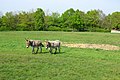 Donkeys - geograph.org.uk - 409687.jpg 640 × 428; 368 KB
-
 Footpath diversion - geograph.org.uk - 412286.jpg 640 × 428; 459 KB
-
 Footpath towards Leigh Green - geograph.org.uk - 409543.jpg 640 × 428; 387 KB
-
 Footpath towards The Century Farm - geograph.org.uk - 409600.jpg 428 × 640; 423 KB
-
 Frenchay Farm - geograph.org.uk - 409509.jpg 640 × 424; 326 KB
-
 Gibbet Oak Farm - geograph.org.uk - 410197.jpg 640 × 428; 325 KB
-
 Great Hanging Wood - geograph.org.uk - 388776.jpg 640 × 479; 197 KB
-
 High Bank Farm - geograph.org.uk - 410190.jpg 640 × 403; 248 KB
-
 Lane and Drain near Rats Castle - geograph.org.uk - 388778.jpg 479 × 640; 137 KB
-
 Orchard near Stemps Wood - geograph.org.uk - 388733.jpg 640 × 479; 116 KB
-
 Reading Sewer - geograph.org.uk - 388795.jpg 640 × 479; 156 KB
-
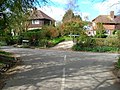
 Reading Street - geograph.org.uk - 374183.jpg 640 × 480; 83 KB
-
 Reading Street - geograph.org.uk - 388767.jpg 640 × 479; 155 KB
-
 Rushgreen Wood - geograph.org.uk - 388731.jpg 640 × 451; 102 KB
-
 Stile at corner of Frenchay Wood - geograph.org.uk - 410204.jpg 640 × 428; 456 KB
-

-

-

-
 White Owl Barn - geograph.org.uk - 388785.jpg 640 × 479; 210 KB
-
 Wittersham Grain Store at Rose Hill - geograph.org.uk - 413667.jpg 640 × 427; 64 KB
-
 Wittersham Grain Store at Rose Hill - geograph.org.uk - 413675.jpg 508 × 640; 99 KB


