Category:Rechtestraat 74, De Rijp
Jump to navigation
Jump to search
| Object location | | View all coordinates using: OpenStreetMap |
|---|
 | |||||
| Upload media | |||||
| Instance of |
| ||||
|---|---|---|---|---|---|
| Location |
| ||||
| Street address |
| ||||
| Located on street | |||||
| Heritage designation |
| ||||
 | |||||
|
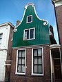
This is a category about rijksmonument number 17146
|
| Address |
|
Media in category "Rechtestraat 74, De Rijp"
The following 4 files are in this category, out of 4 total.
-
 Rechtestraat 51-53, De Rijp, Netherlands - panoramio (8).jpg 4,896 × 3,264; 2.22 MB
-
 Rijp Rechtestraat 74.JPG 2,448 × 3,264; 1.75 MB
-
 Voorgevel - De Rijp - 20187316 - RCE.jpg 1,200 × 956; 236 KB
-
 Voorgevels - De Rijp - 20187315 - RCE.jpg 804 × 1,200; 183 KB
.jpg)

