Category:Reconstructions of old maps
Jump to navigation
Jump to search
Subcategories
This category has the following 9 subcategories, out of 9 total.
A
- Atlas composé de Mappe-mondes (15 F)
R
Media in category "Reconstructions of old maps"
The following 129 files are in this category, out of 129 total.
-
 Si0149x1024.jpg 1,024 × 774; 250 KB
-
-

-

-
-

-
 Münster Africa 1538 UTA.jpg 2,504 × 1,630; 2.95 MB
-
 155 of 'A Popular History of the Mexican People' (11291439694).jpg 1,384 × 1,310; 404 KB
-
 156 of 'A Popular History of the Mexican People' (11289454614).jpg 1,384 × 945; 265 KB
-
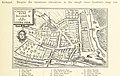
 Norden's Map of Essex of 1607 (1840 reproduction) (14798757603).jpg 3,438 × 2,714; 1.63 MB
-

-
 163 of 'Landmarks of Old Stirling' (11249538536).jpg 1,808 × 1,306; 374 KB
-

-
 165 of 'Le Continent austral. Hypothèses et découvertes' (11302353346).jpg 1,117 × 1,031; 183 KB
-

-
-

-

-

-
 Ancient Gloucester from Speed's map of 1610 and Hall & Pinnell, ex Fosbroke.jpg 5,806 × 4,629; 3.23 MB
-
-
 1836 map of canal system in Lowell, Massachusetts.jpg 500 × 376; 114 KB
-
 258 Skizze Skythiens nach Herodot.jpg 3,071 × 2,506; 1.66 MB
-
 Figg copy of Kelton 1747 map of Ashdown Forest.jpg 1,020 × 828; 117 KB
-
 William Figg 1858 copy of Kelton 1747 map of Ashdown Forest.jpg 880 × 690; 85 KB
-
 CANE(1859) p122 MAP OF LONDONDERRY AS BESIEGED IN 1688.jpg 4,755 × 3,037; 3.79 MB
-

-

-

-
 RAINAUD(1893) Fig. 1 L'Antichlhone de Mêla restituée.jpg 893 × 895; 196 KB
-
 RAINAUD(1893) Fig. 3. Système de Macrobe d'après le Codex Parisinus.jpg 861 × 861; 302 KB
-

-
 RAINAUD(1893) Fig. 7. L'Antichthone sur un mss. de Macrobe.jpg 904 × 905; 291 KB
-
 RAINAUD(1893) Fig. 15. L'Antichthone sur un médaillon du XV. siècle.jpg 890 × 888; 275 KB
-
 RUIDIAZ(1893) 1.033 LA FLORIDA EN EL AÑO 1591.jpg 4,121 × 3,549; 8.46 MB
-

-

-
 EB 1911 Map Fig 6.png 2,350 × 1,596; 2.25 MB
-
 1911 EB Map Fig 15.png 2,274 × 2,280; 2.84 MB
-

-

-
 200 of 'Sea Pictures, drawn with pen and pencil' (11153911746).jpg 1,573 × 2,372; 679 KB
-

-

-

-
-
-

-

-

-

-
-
 271 of 'Antique Views of ye Towne of Boston. (With plates.)' (11149761694).jpg 4,222 × 2,972; 2.97 MB
-

-

-

-
-

-
 41 of 'Antique Views of ye Towne of Boston. (With plates.)' (11153401484).jpg 1,922 × 2,105; 625 KB
-

-
 45 of 'Antique Views of ye Towne of Boston. (With plates.)' (11148869705).jpg 1,922 × 2,919; 971 KB
-

-

-
-
 68 of 'Geschichte der Wiener-Stadt u. Vorstädte' (11240672043).jpg 1,631 × 1,055; 510 KB
-

-
 69 of 'Madagascar. 51 gravures et cartes. Deuxième édition' (11232162246).jpg 1,381 × 1,706; 557 KB
-
 70 of 'The Book of the Ocean ... Illustrated' (11294971905).jpg 1,941 × 1,015; 495 KB
-

-
-
 Antique views of ye towne of Boston (1882) (14767847914).jpg 2,142 × 2,988; 1.07 MB
-
 Antique views of ye towne of Boston (1882) (14770000682).jpg 1,712 × 2,156; 491 KB
-
 Antiquissima orbis delineatio - btv1b53179325z (1 of 2).jpg 2,488 × 1,984; 929 KB
-

-
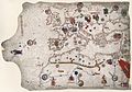
 Atlantic Ocean, Toscanelli, 1474.jpg 1,990 × 1,215; 3.01 MB
-
 BabylonianWorldMap2.jpg 585 × 480; 93 KB
-
 Bodleian Library MS. Marsh 294 f 5b.jpg 789 × 1,000; 693 KB
-
 Boston 1814.jpg 1,580 × 1,444; 573 KB
-

-
 Carte babylonienne du monde, exposition Perds pas le Nord, Muséum Henri-Lecoq, 2022.jpg 2,448 × 3,264; 2.46 MB
-

-

-
 Development-1300-modern.jpg 1,632 × 3,780; 338 KB
-
 Die Weltkarte von Albi.jpg 1,110 × 1,217; 481 KB
-
 Earth Globe by StrabonJPG.JPG 558 × 538; 51 KB
-
 EB1911 Map - Fig. 28.jpg 527 × 632; 235 KB
-
 EB 1911 Map Fig 7.png 1,432 × 1,522; 1.14 MB
-
 European knowledge of the World, 500 BC-1900.jpg 1,180 × 535; 224 KB
-

-
 From Map of North America by Edward Wells, M.A. 1722 - NARA - 135841385.jpg 2,981 × 2,122; 548 KB
-
 From Map of North America by Thomas Jefferys 1782 - NARA - 135841387.jpg 2,507 × 2,128; 701 KB
-
 Heinrich Kiepert. Orbis terrarum altero p. Chr. saeculo antiquis notus.jpg 7,104 × 5,625; 6.57 MB
-
 Ibn Howqal World map-001.jpg 460 × 473; 178 KB
-

-

-
 Istakhri map 2.jpg 550 × 601; 259 KB
-
 Karpaten BV042518404.jpg 3,984 × 3,465; 2.15 MB
-

-

-

-
 Map of Sissek - Siscia - Marsigli.jpg 962 × 1,349; 745 KB
-
 Map Vienna 1547.jpg 3,840 × 3,072; 3.71 MB
-
 Mapa de Thomas Harriot.jpg 1,232 × 911; 1.69 MB
-
 Mapping of the world, 1922.jpg 5,651 × 4,026; 4.61 MB
-
-
 Meissner Babylonien und Assyrien clay map 1925.jpg 382 × 420; 50 KB
-
 Mela codanus sinus.jpg 830 × 649; 497 KB
-
 Monachus 1527 globe map 01.png 1,804 × 976; 1.43 MB
-
 Oceanus-hyperboreus.jpg 731 × 456; 62 KB
-

-
 Orbis Terrarum ad Mentem Ptolemaei.jpg 896 × 637; 256 KB
-
 Ordnance Survey reproduction Bodleian map Britain 1325-1350.jpg 16,986 × 10,427; 47.6 MB
-
 Page 100 of Story of geographical discovery (Jacobs).png 2,172 × 1,608; 1.68 MB
-
 Palestine (1889 book) 06.jpg 1,781 × 1,471; 400 KB
-
 Pauly-Wissowa X,2, 2117 b2.jpg 1,244 × 292; 107 KB
-
 Periplus 100 Pomponius Mela World Map.png 3,428 × 2,842; 11.89 MB
-
 PSM V16 D512 Map of the world 10th century.jpg 967 × 969; 164 KB
-

-

-
 Russia stamp 1997 № 364.jpg 773 × 1,071; 305 KB
-
 Ruysch map, Gruenlant-Antilia.jpg 1,500 × 1,500; 861 KB
-
 Sebastian Cabot's Map, 1544.jpg 2,190 × 1,874; 647 KB
-
 Taakeheim ill 103.png 601 × 603; 590 KB
-
-

-
 Toscanelli map.jpg 3,806 × 2,491; 1.72 MB
-

-
 Venice - an historical sketch of the republic (1893) (14595503488).jpg 1,412 × 1,402; 277 KB
-
 Zeni 3.png 1,359 × 738; 388 KB

.jpg)
_vol._1%27_(11245718506).jpg)
_vol._1%27_(11093365125).jpg)
_de_Jean_Stabius,_1515_(Reproduction_en_fac-simil%C3%A9)_-_btv1b53025194f_(1_of_2).jpg)
_vol._1%27_(11245111556).jpg)

.jpg)
.jpg)
_(14798757603).jpg)
%27_(11247041635).jpg)
.jpg)
%27_(11184523193).jpg)
.jpg)
.jpg)
%27_(11181001693).jpg)
_vol._1%27_(11092709425).jpg)
.jpg)
.jpg)


_p122_MAP_OF_LONDONDERRY_AS_BESIEGED_IN_1688.jpg)
%27_(11122115273).jpg)
.jpg)
.jpg)
_Fig._1_L%27Antichlhone_de_M%C3%AAla_restitu%C3%A9e.jpg)
_Fig._3._Syst%C3%A8me_de_Macrobe_d%27apr%C3%A8s_le_Codex_Parisinus.jpg)
_Fig._4._Syst%C3%A8me_de_Macrobe_d%27apr%C3%A8s_l%27%C3%A9dit._du_Commentaire_du_Songe_de_Scipion_publi%C3%A9c_%C3%A0_Brixen_en_1483.jpg)
_Fig._7._L%27Antichthone_sur_un_mss._de_Macrobe.jpg)
_Fig._15._L%27Antichthone_sur_un_m%C3%A9daillon_du_XV._si%C3%A8cle.jpg)
_1.033_LA_FLORIDA_EN_EL_A%C3%91O_1591.jpg)
.jpg)
_vol._1%27_(11058648883).jpg)


%27_(11160827094).jpg)
.jpg)
.jpg)
.jpg)
.jpg)
%27_(11146718544).jpg)
_hung_on_a_horn%27_(11212030205).jpg)
.jpg)
.jpg)
_vol._1%27_(11093622343).jpg)
%27_(11234729464).jpg)
.jpg)
.jpg)
%27_(11149761694).jpg)
.jpg)
.jpg)
.jpg)
%27_(11153401484).jpg)
.jpg)
%27_(11148869705).jpg)
.jpg)
.jpg)
%27_(11129954664).jpg)
.jpg)
.jpg)
.jpg)
.jpg)
.jpg)
_(14598006967).jpg)
_(14767847914).jpg)
_(14770000682).jpg)
.jpg)


que_Royale_(r%C3%A9duction_au_quart_(corrig%C3%A9_-_1-5)_de_la_grandeur)_-_btv1b84466070.jpg)
_-_btv1b59055658_(1_of_2).jpg)


.jpg)


%27_(11219567715).jpg)


.png)
_06.jpg)


.jpg)
_de_Jean_Stabius,_1515_(Reproduction_en_fac-simil%C3%A9)_-_btv1b53025194f_(2_of_2).jpg)


_(14579033930).jpg)


_(14595503488).jpg)

%27_(11195405225).jpg)
%27_(11196281713).jpg)
%27_(16589006161).jpg)
%27_(16590211285).jpg)