Category:Redbourne
Jump to navigation
Jump to search
English: Redbourne is a village and civil parish in the North Lincolnshire district of Lincolnshire, England. According to the 2001 census it had a population of 386. It is just off the A15 5 miles south of Brigg.
village in Lincolnshire, England, UK  | |||||
| Upload media | |||||
| Instance of | |||||
|---|---|---|---|---|---|
| Location | North Lincolnshire, Lincolnshire, Yorkshire and the Humber, England | ||||
| Population |
| ||||
 | |||||
Subcategories
This category has the following 9 subcategories, out of 9 total.
A
H
- Hedges in Redbourne (3 F)
O
- Old Smithy, Redbourne (9 F)
R
- Roads in Redbourne (4 F)
S
- Streets in Redbourne (4 F)
T
- The Red Lion Inn, Redbourne (8 F)
Media in category "Redbourne"
The following 200 files are in this category, out of 223 total.
(previous page) (next page)-
 "The Red Lion" in Redbourne - geograph.org.uk - 6473461.jpg 4,987 × 3,481; 3.06 MB
-
 A farm track, south of Redbourne Hall - geograph.org.uk - 2350795.jpg 800 × 600; 285 KB
-
 A15 - geograph.org.uk - 5350437.jpg 640 × 426; 47 KB
-
 A15 near Springcliff Farm - geograph.org.uk - 3791728.jpg 1,600 × 1,043; 273 KB
-
 A15, northbound - geograph.org.uk - 5355743.jpg 640 × 426; 41 KB
-
 Ahead is the gateway to Redbourne Hall - geograph.org.uk - 4152213.jpg 1,024 × 768; 146 KB
-
 America Plantation - geograph.org.uk - 1957583.jpg 1,024 × 768; 155 KB
-
 An inviting prospect (28001809288).jpg 5,250 × 3,568; 6.86 MB
-
 Approaching Ermine Street - geograph.org.uk - 3740480.jpg 1,024 × 768; 181 KB
-
 Approaching the irrigation pond - geograph.org.uk - 3903265.jpg 1,024 × 768; 203 KB
-
 B1206 heading north - geograph.org.uk - 3918834.jpg 640 × 480; 57 KB
-
 B1206 junction with A15 - geograph.org.uk - 3800711.jpg 1,024 × 709; 100 KB
-
 B1206 to Redbourne - geograph.org.uk - 4152203.jpg 1,024 × 768; 121 KB
-
 Barn at Riverhead - geograph.org.uk - 3902827.jpg 1,024 × 768; 211 KB
-
 Beck Lane - geograph.org.uk - 3792110.jpg 800 × 533; 241 KB
-
 Boundary bank - geograph.org.uk - 2964257.jpg 1,024 × 768; 187 KB
-

-
 Brandy Wharf, Easter Sunday 2015, aerial - geograph.org.uk - 4420208.jpg 2,496 × 1,664; 916 KB
-
 Buildings at Pyewipe House Farm - geograph.org.uk - 2350804.jpg 800 × 600; 221 KB
-
 Collapsing piers - geograph.org.uk - 2243941.jpg 1,024 × 768; 198 KB
-
 Country view at Old Park, Redbourne - geograph.org.uk - 6473490.jpg 5,067 × 3,801; 5.35 MB
-
 Crop field off Redbourne Mere - geograph.org.uk - 3918410.jpg 640 × 480; 52 KB
-
 Crop field south of River Head - geograph.org.uk - 3918825.jpg 640 × 480; 76 KB
-

-
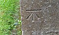
 Cut Mark, Redbourne, Pumping Station Entrance - geograph.org.uk - 4764358.jpg 956 × 1,280; 578 KB
-
 Cut Mark, Redbourne, Red Lion PH - geograph.org.uk - 2904656.jpg 480 × 640; 129 KB
-
 Cut Mark, Redbourne, Tower Near Old Park - geograph.org.uk - 4764339.jpg 956 × 1,280; 471 KB
-
 Derelict farm buildings, Pyewipe Farm - geograph.org.uk - 1959060.jpg 1,024 × 768; 143 KB
-

-
 Drain and farm track in the parish of Redbourne - geograph.org.uk - 6473496.jpg 5,184 × 3,888; 5.11 MB
-
 Drain at Beechwood - geograph.org.uk - 6473485.jpg 3,888 × 5,184; 7.56 MB
-
 Drain beside track - geograph.org.uk - 3918815.jpg 640 × 480; 91 KB
-
 Drain south of River Head - geograph.org.uk - 3918828.jpg 478 × 640; 118 KB
-
 Ducklings in School Lane, Redbourne - geograph.org.uk - 4534283.jpg 640 × 427; 135 KB
-
 Duke's Drain - geograph.org.uk - 1106704.jpg 640 × 480; 39 KB
-
 Dutch barn at Riverhead - geograph.org.uk - 3902822.jpg 1,024 × 768; 185 KB
-
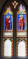
 East window, St Andrew's church, Redbourne - geograph.org.uk - 5766053.jpg 2,655 × 4,941; 6.28 MB
-
 Easter Bank Holiday on the Ancholme - geograph.org.uk - 4418480.jpg 640 × 427; 49 KB
-
 Embankment along the New River Ancholme - geograph.org.uk - 5083778.jpg 3,696 × 2,448; 2.3 MB
-

-

-
 Entering Redbourne - geograph.org.uk - 3918434.jpg 640 × 480; 78 KB
-

-

-
 Ermine Street Roman Road (A15) - geograph.org.uk - 3918396.jpg 640 × 480; 58 KB
-
 Ermine Street Roman Road (A15) - geograph.org.uk - 3918404.jpg 640 × 480; 65 KB
-
 Ermine Street Roman Road (A15) - geograph.org.uk - 3918407.jpg 640 × 480; 41 KB
-

-
 Farm track and footpath - geograph.org.uk - 5768002.jpg 5,568 × 3,712; 6.16 MB
-

-
 Farm track heading south - geograph.org.uk - 3918827.jpg 640 × 480; 94 KB
-
 Farm track near Pyewipe Farm - geograph.org.uk - 1957597.jpg 1,024 × 768; 143 KB
-
 Farm Track near Pyewipe house - geograph.org.uk - 4144256.jpg 3,088 × 2,056; 2.47 MB
-
 Farm track near Redbourne - geograph.org.uk - 1957497.jpg 1,024 × 768; 164 KB
-
 Farm track near Redbourne Hall - geograph.org.uk - 1959073.jpg 1,024 × 768; 153 KB
-
 Farm track near Stoneholme Farm - geograph.org.uk - 5083570.jpg 3,696 × 2,448; 2.26 MB
-
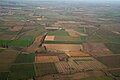
 Farmland east of Redbourne - geograph.org.uk - 3918449.jpg 640 × 480; 60 KB
-
 Farmland near River Head - geograph.org.uk - 3918819.jpg 640 × 480; 46 KB
-
 Farmland north of Redbourne Mere - geograph.org.uk - 3918414.jpg 640 × 480; 61 KB
-
 Farmland, Redbourne Grange Farm - geograph.org.uk - 3918398.jpg 640 × 480; 35 KB
-
 Farmland, Springcliff Farm - geograph.org.uk - 3918400.jpg 640 × 480; 73 KB
-
 Field and farm track by the Catchwater Drain - geograph.org.uk - 1957512.jpg 1,024 × 768; 129 KB
-
 Field boundary near Kirton - geograph.org.uk - 545006.jpg 640 × 480; 113 KB
-
 Field north of Redbourne - geograph.org.uk - 3918833.jpg 640 × 480; 77 KB
-
 Field of oilseed rape - geograph.org.uk - 5214983.jpg 1,024 × 768; 130 KB
-
 Field of oilseed rape and Hayes Wood - geograph.org.uk - 5214978.jpg 1,024 × 768; 148 KB
-
 Field west of Redbourne Road - geograph.org.uk - 3918424.jpg 640 × 480; 78 KB
-
 Flooded fields east of the River Ancholme - geograph.org.uk - 6332722.jpg 1,024 × 768; 166 KB
-
 Footbridge at Pyewipe Farm - geograph.org.uk - 6474102.jpg 4,585 × 3,449; 4.58 MB
-

-
 Footpath near Redbourne - geograph.org.uk - 1957474.jpg 1,024 × 768; 225 KB
-
 Footpath to Ermine Street - geograph.org.uk - 2964131.jpg 1,024 × 768; 196 KB
-
 Footpath to Redbourne - geograph.org.uk - 2964134.jpg 1,024 × 768; 162 KB
-
 Footpath to Redbourne Grange Farm - geograph.org.uk - 4534272.jpg 640 × 427; 62 KB
-
 Gateway to Redbourne Hall - geograph.org.uk - 3918420.jpg 640 × 480; 77 KB
-
 Gateway to Redbourne Hall - geograph.org.uk - 3918428.jpg 640 × 480; 85 KB
-
 GOC Redbourn 157 Nickey Line (24203566872).jpg 4,288 × 3,216; 4.45 MB
-
 Golfer at Redbourne Golf Club (33950813696).jpg 1,366 × 1,829; 863 KB
-
 Grazing, Stoneholme - geograph.org.uk - 3918807.jpg 640 × 480; 76 KB
-
 Great Fish Pond, Redbourne Hall - geograph.org.uk - 4534291.jpg 640 × 427; 104 KB
-
 Hawthorn hedgerow in the parish of Redbourne - geograph.org.uk - 6473506.jpg 5,024 × 3,539; 4.88 MB
-

-
 Hibaldstow airfield, aerial 2019 - geograph.org.uk - 6351955.jpg 612 × 800; 75 KB
-
 High Street, Redbourne - geograph.org.uk - 5785615.jpg 1,600 × 1,065; 734 KB
-
 Houses and footbridge at Pyewpie Farm - geograph.org.uk - 1957593.jpg 1,024 × 768; 192 KB
-

-
 Irrigation pond - geograph.org.uk - 3902829.jpg 1,024 × 768; 197 KB
-
 Lane near Stoneholme (2) - geograph.org.uk - 1959043.jpg 1,024 × 768; 285 KB
-
 Lane near Stoneholme - geograph.org.uk - 1957486.jpg 1,024 × 768; 215 KB
-
 Layby on A15 Ermine Street (Roman Road) - geograph.org.uk - 4152198.jpg 1,024 × 768; 104 KB
-
 Lincolnshire arable land - geograph.org.uk - 2440977.jpg 800 × 600; 355 KB
-
 Lincolnshire pea field and big sky - geograph.org.uk - 6473508.jpg 5,183 × 3,887; 4.41 MB
-
 Looking north from Redbourne Old River - geograph.org.uk - 2243998.jpg 1,024 × 768; 250 KB
-
-

-
 Mini roundabout near Redbourne Hall - geograph.org.uk - 5785206.jpg 1,600 × 1,067; 675 KB
-
 Minor road leading to Waddingham - geograph.org.uk - 5785212.jpg 1,600 × 1,137; 693 KB
-
 New River Ancholme - geograph.org.uk - 887974.jpg 640 × 426; 84 KB
-
 New road off the B1206 - geograph.org.uk - 3918835.jpg 640 × 480; 56 KB
-
 No longer a road - geograph.org.uk - 2723014.jpg 1,024 × 768; 386 KB
-
-

-

-
 Opium poppies, Redbourne Park - geograph.org.uk - 4534274.jpg 640 × 427; 97 KB
-
 Ordnance Survey Cut Mark - geograph.org.uk - 5480267.jpg 640 × 385; 110 KB
-
 Parachutists over Hibaldstow - geograph.org.uk - 5768059.jpg 2,173 × 2,959; 3.63 MB
-
 Path along the River Ancholme - geograph.org.uk - 5653509.jpg 1,600 × 1,064; 537 KB
-
 Path along the River Ancholme - geograph.org.uk - 5653514.jpg 1,600 × 1,064; 711 KB
-
 Path and footbridge by America Plantation - geograph.org.uk - 6473915.jpg 3,888 × 5,184; 7.53 MB
-

-
 Path to Little Redbourne - geograph.org.uk - 1957467.jpg 1,024 × 768; 206 KB
-
 Path to Redbourne - geograph.org.uk - 2985333.jpg 682 × 1,024; 241 KB
-
 Plantation by Ermine Street - geograph.org.uk - 3740476.jpg 1,024 × 768; 143 KB
-
 Plantation near Springcliff Farm - geograph.org.uk - 2964281.jpg 1,024 × 768; 224 KB
-

-
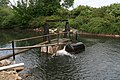
 Pumping station and the Ancholme Rivers - geograph.org.uk - 2243967.jpg 1,024 × 768; 205 KB
-
 Pumping Station at the River Ancholme - geograph.org.uk - 5653519.jpg 1,600 × 1,064; 669 KB
-
 Pumping Station at the River Ancholme - geograph.org.uk - 5653557.jpg 1,600 × 1,064; 891 KB
-
 Pumping Station by the New River Ancholme - geograph.org.uk - 2243957.jpg 1,024 × 768; 161 KB
-
 Pyewipe Farm - geograph.org.uk - 1957589.jpg 1,024 × 768; 135 KB
-

-
 Quiet corner - geograph.org.uk - 1957460.jpg 1,024 × 768; 309 KB
-
 Rape crop in early summer - geograph.org.uk - 2441033.jpg 800 × 600; 394 KB
-

-

-
 Redboune Hayes - geograph.org.uk - 3902839.jpg 1,024 × 768; 157 KB
-
 Redbourn, Dunstable Road - geograph.org.uk - 142125.jpg 640 × 480; 93 KB
-

-

-
 Redbourne farmland - geograph.org.uk - 1596520.jpg 640 × 426; 97 KB
-
 Redbourne Fire Station - geograph.org.uk - 110220.jpg 640 × 480; 91 KB
-
 Redbourne Fire Station - geograph.org.uk - 3918442.jpg 640 × 480; 57 KB
-
 Redbourne Hall - geograph.org.uk - 1957602.jpg 1,024 × 768; 216 KB
-
 Redbourne Hall - geograph.org.uk - 6473922.jpg 5,102 × 3,629; 4.55 MB
-
 Redbourne Hall Gateway - geograph.org.uk - 1329092.jpg 640 × 480; 110 KB
-
 Redbourne Hall Gateway - geograph.org.uk - 2844266.jpg 3,499 × 2,333; 7.42 MB
-
 Redbourne Hall gateway - geograph.org.uk - 2920356.jpg 640 × 480; 151 KB
-
 Redbourne Hall gateway - geograph.org.uk - 2920358.jpg 640 × 427; 110 KB
-
 Redbourne Hall summerhouse - geograph.org.uk - 2844291.jpg 3,629 × 2,419; 7.42 MB
-
 Redbourne Hall, aerial 2019 - geograph.org.uk - 6201442.jpg 640 × 427; 58 KB
-
 Redbourne Hayes - geograph.org.uk - 2244008.jpg 1,024 × 768; 101 KB
-
 Redbourne Mere (B1206) - geograph.org.uk - 3918412.jpg 640 × 480; 53 KB
-
 Redbourne Mere (B1206) - geograph.org.uk - 3918416.jpg 640 × 480; 63 KB
-
 Redbourne Mere (road) at the A15 - geograph.org.uk - 2350776.jpg 800 × 600; 231 KB
-
 Redbourne Mere at the A15 - geograph.org.uk - 5785203.jpg 1,600 × 1,065; 361 KB
-
 Redbourne Mere B1206 - geograph.org.uk - 3800708.jpg 1,024 × 768; 95 KB
-
 Redbourne Old River - geograph.org.uk - 6332712.jpg 1,024 × 768; 124 KB
-
 Redbourne Old River and Decoy Wood - geograph.org.uk - 2243974.jpg 1,024 × 768; 167 KB
-
 Redbourne Old River joins the River Ancholme - geograph.org.uk - 5650490.jpg 1,600 × 1,064; 792 KB
-
 Redbourne Old River, footbridge - geograph.org.uk - 2904631.jpg 640 × 480; 129 KB
-

-
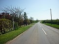
 Redbourne Road - geograph.org.uk - 3918427.jpg 640 × 480; 84 KB
-
 Redbourne Road towards Waddingham - geograph.org.uk - 5785254.jpg 1,600 × 1,009; 443 KB
-
 Redbourne village sign (detail) - geograph.org.uk - 6260637.jpg 3,072 × 4,608; 5.48 MB
-
 Redbourne village sign - geograph.org.uk - 6260625.jpg 4,608 × 3,072; 4.26 MB
-
 Redbourne village sign - geograph.org.uk - 6474196.jpg 3,782 × 4,921; 6.47 MB
-
 Redbourne, track leading to a pumping station - geograph.org.uk - 4764360.jpg 1,280 × 956; 390 KB
-
 Ripening barley - geograph.org.uk - 2724011.jpg 800 × 600; 363 KB
-
 Road to Redbourne Hayes - geograph.org.uk - 109760.jpg 640 × 480; 93 KB
-
 Road to Redbourne Hayes - geograph.org.uk - 3918812.jpg 640 × 480; 64 KB
-
 Road to Redbourne Hayes - geograph.org.uk - 3918821.jpg 640 × 480; 104 KB
-
 Road to Redbourne Hayes - geograph.org.uk - 5083582.jpg 3,696 × 2,448; 2.25 MB
-
 Road to River Head - geograph.org.uk - 3918804.jpg 640 × 480; 91 KB
-
 Road to River Head - geograph.org.uk - 5083558.jpg 3,696 × 2,448; 2.27 MB
-
 Roadway and rubble - geograph.org.uk - 2723028.jpg 1,024 × 768; 191 KB
-
 Rookery in Redbourne - geograph.org.uk - 6474120.jpg 5,069 × 3,888; 6.38 MB
-

-
 Springcliff Farm - geograph.org.uk - 3918406.jpg 640 × 469; 66 KB
-
 St Andrew's Church in Redbourne - geograph.org.uk - 6473463.jpg 5,184 × 3,888; 7.24 MB
-
 St Andrew's Church, Redbourne - geograph.org.uk - 5852476.jpg 1,600 × 1,065; 683 KB
-
 St Andrew's Church, Redbourne - geograph.org.uk - 5852479.jpg 1,600 × 1,065; 420 KB
-
 St Andrew's Church, Redbourne - geograph.org.uk - 5852483.jpg 745 × 1,600; 536 KB
-
 St Andrew's Church, Redbourne - geograph.org.uk - 5852484.jpg 758 × 1,600; 478 KB
-
 St Andrew's Church, Redbourne - geograph.org.uk - 5852485.jpg 1,065 × 1,600; 460 KB
-
 St Andrew's Church, Redbourne - geograph.org.uk - 5852493.jpg 756 × 1,600; 521 KB
-
 St Andrew's Church, Redbourne - geograph.org.uk - 5852495.jpg 1,065 × 1,600; 463 KB
-
 St Andrew's Church, Redbourne - geograph.org.uk - 5852497.jpg 1,065 × 1,600; 438 KB
-
 St Andrew's Church, Redbourne - geograph.org.uk - 5852500.jpg 1,238 × 1,600; 796 KB
-
 St Andrew's Church, Redbourne - geograph.org.uk - 5852502.jpg 1,065 × 1,600; 428 KB
-
 St Andrew's Church, Redbourne - geograph.org.uk - 5852503.jpg 763 × 1,600; 550 KB
-
 St Andrew's Church, Redbourne - geograph.org.uk - 5852506.jpg 816 × 1,600; 484 KB
-
 St.Albans Arms (geograph 2918648).jpg 480 × 640; 133 KB
-
 St.Albans Cottages - geograph.org.uk - 2918637.jpg 640 × 448; 112 KB
-
 Stone gateway and bridge in School Lane - geograph.org.uk - 4448376.jpg 640 × 427; 121 KB
-
 Stoneholme Farm - geograph.org.uk - 1959032.jpg 1,024 × 768; 143 KB
-
 Stubble Field near Redbourne Hayes - geograph.org.uk - 2243987.jpg 1,024 × 768; 183 KB
-
 Telegraph pole in ploughed field - geograph.org.uk - 6420192.jpg 768 × 1,024; 119 KB
-
 Telephone box on School Lane, Redbourne - geograph.org.uk - 5852210.jpg 1,600 × 1,065; 1,014 KB
-
 Temporary rainbow - geograph.org.uk - 2440965.jpg 800 × 600; 422 KB
-

-
 The entrance to Redbourne Hall - geograph.org.uk - 2350786.jpg 800 × 600; 292 KB
-
 The Entrance to Redbourne Hall - geograph.org.uk - 6500228.jpg 1,280 × 960; 560 KB
-
 The flat, fertile Ancholme valley - geograph.org.uk - 2440973.jpg 800 × 600; 371 KB
-
 The former A15 - geograph.org.uk - 2964268.jpg 1,024 × 768; 198 KB
-

-
 The New River Ancholme - geograph.org.uk - 3501864.jpg 640 × 480; 65 KB
-
 The old A15 - geograph.org.uk - 2723023.jpg 1,024 × 768; 229 KB
-
 The old A15 - geograph.org.uk - 2920363.jpg 640 × 480; 139 KB
-
 The Old School in Redbourne - geograph.org.uk - 6473471.jpg 5,042 × 3,718; 5.44 MB
-
 The Old Schoolyard, Redbourne - geograph.org.uk - 6473467.jpg 4,933 × 3,699; 4.35 MB


.jpg)


_by_the_road_to_River_Head,_Redbourne_-_geograph.org.uk_-_4448416.jpg)


_-_geograph.org.uk_-_3918396.jpg)
_-_geograph.org.uk_-_3918404.jpg)
_-_geograph.org.uk_-_3918407.jpg)


.jpg)
.jpg)


_-_geograph.org.uk_-_1959043.jpg)

_-_geograph.org.uk_-_4152198.jpg)


_-_geograph.org.uk_-_6201438.jpg)
_-_geograph.org.uk_-_6201441.jpg)


_-_geograph.org.uk_-_3918412.jpg)
_-_geograph.org.uk_-_3918416.jpg)
_at_the_A15_-_geograph.org.uk_-_2350776.jpg)


_-_geograph.org.uk_-_6260637.jpg)


.jpg)


