Category:Redcliff, Humber Estuary
Jump to navigation
Jump to search
Media in category "Redcliff, Humber Estuary"
The following 24 files are in this category, out of 24 total.
-
 Channel Buoy 29 - geograph.org.uk - 225833.jpg 480 × 640; 104 KB
-
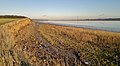
 Crumbling Red Cliff on the Humber Bank (geograph 4976042).jpg 640 × 427; 56 KB
-
 From Red Cliff looking across Redcliff Sand (geograph 4343115).jpg 4,000 × 2,248; 5.49 MB
-
 Long Plantation, North Ferriby - geograph.org.uk - 280427.jpg 640 × 480; 142 KB
-
 Looking towards East Clough - geograph.org.uk - 220297.jpg 640 × 480; 147 KB
-
 Mudflat, Redcliff Channel - geograph.org.uk - 1604730.jpg 640 × 480; 76 KB
-
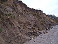
 On top of the Red Cliff (geograph 3898325).jpg 1,024 × 768; 136 KB
-
 Red Cliff (geograph 4343110).jpg 3,964 × 2,180; 5.77 MB
-
 Red Cliff - geograph.org.uk - 1604745.jpg 640 × 480; 80 KB
-
 Red Cliff, North Ferriby - geograph.org.uk - 220275.jpg 640 × 480; 139 KB
-
 Red Cliff, North Ferriby - geograph.org.uk - 220282.jpg 640 × 479; 164 KB
-
 Red Cliff, North Ferriby - geograph.org.uk - 220289.jpg 640 × 479; 135 KB
-
 Red Cliff, North Ferriby - geograph.org.uk - 280430.jpg 640 × 474; 143 KB
-
 Red Cliff, North Ferriby - geograph.org.uk - 528935.jpg 640 × 426; 157 KB
-
 Red Cliff, North Ferriby - geograph.org.uk - 688475.jpg 640 × 289; 45 KB
-
 Red Cliff, on the north bank of the Humber (geograph 4664316).jpg 1,024 × 768; 166 KB
-
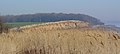
 Redcliff and the Humber from East Clough (geograph 4976033).jpg 640 × 427; 53 KB
-
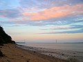 Sunset at East Clough (geograph 4361149).jpg 2,208 × 1,655; 460 KB
-
 Swing by the Humber (geograph 7155655).jpg 683 × 1,024; 1.51 MB
-
 The Humber foreshore at Red Cliff (geograph 5325748).jpg 800 × 600; 151 KB
-
 The River Humber at Redcliff, on a falling tide (geograph 5613601).jpg 1,024 × 768; 113 KB
-
 The River Humber from Red Cliff - geograph.org.uk - 755333.jpg 640 × 480; 75 KB
-
 The Trans-Pennine Trail - geograph.org.uk - 688445.jpg 640 × 448; 110 KB
-
 Willow clinging to a crumbling cliff (geograph 4976056).jpg 640 × 427; 65 KB

.jpg)
.jpg)


.jpg)
.jpg)


.jpg)
.jpg)
.jpg)
.jpg)
.jpg)
.jpg)

.jpg)