Category:Reformed church, rectory and outbuildings (Kirchgasse 9–11, Schlatt ZH)
Jump to navigation
Jump to search
| Object location | | View all coordinates using: OpenStreetMap |
|---|
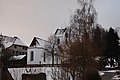
church buildings in Schlatt in the canton of Zürich, Switzerland  | |||||
| Upload media | |||||
| Instance of | |||||
|---|---|---|---|---|---|
| Part of | |||||
| Location |
| ||||
| Street address |
| ||||
| Heritage designation | |||||
 | |||||
Media in category "Reformed church, rectory and outbuildings (Kirchgasse 9–11, Schlatt ZH)"
This category contains only the following file.
-
 Schlatt preghejo 181.jpg 3,872 × 2,592; 3.88 MB