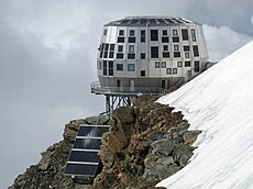
Category:Refuge du Goûter
Jump to navigation
Jump to search
| Object location | | View all coordinates using: OpenStreetMap |
|---|
|
Refuge du Goûter has an entry on OpenStreetMap (show). |
mountain refuge in the French department of Haute-Savoie | |||||
| Upload media | |||||
| Instance of | |||||
|---|---|---|---|---|---|
| Location | Saint-Gervais-les-Bains, canton of Saint-Gervais-les-Bains | ||||
| Street address |
| ||||
| Owned by | |||||
| Inception |
| ||||
| Date of official opening |
| ||||
| Mountain range | |||||
| Elevation above sea level |
| ||||
| official website | |||||
 | |||||
Media in category "Refuge du Goûter"
The following 17 files are in this category, out of 17 total.
-
74920 Combloux, France - panoramio (2).jpg 3,648 × 2,736; 5.93 MB
-
Aiguille du Gouter e rifugio du Gouter.JPG 1,632 × 1,232; 469 KB
-
Aiguille-du-Midi-summer.jpg 3,072 × 2,304; 2.72 MB
-
Aiguille-du-Midi-sundown.JPG 1,200 × 1,596; 657 KB
-
Bundesarchiv Bild 102-10940, Aiguille du Bionnassay.jpg 796 × 581; 65 KB
-
Gouter infrastructure 20130823.jpg 3,988 × 2,991; 1.82 MB
-
Gouter nord 20130823.jpg 4,608 × 3,456; 3.07 MB
-
Gouter old 20130823.jpg 4,096 × 3,072; 2.42 MB
-
Gouter solar 20130823.jpg 4,608 × 3,456; 3.1 MB
-
Gouter.jpg 2,848 × 2,136; 2.82 MB
-
Gouter1900.JPG 600 × 425; 82 KB
-
Gouter2.jpg 1,326 × 994; 424 KB
-
Mont Blanc - Goûter route.jpg 1,990 × 1,612; 801 KB
-
Refuge du Goûter, Path from Nid d'Aigle to Bellevue.jpg 5,472 × 3,648; 8.54 MB
-
Refugedugouter.jpg 1,116 × 877; 277 KB
-
Refugi de Goûter i muntanyes al fons.jpeg 1,024 × 420; 53 KB
-
Soleil du Mont-Blanc.jpg 5,184 × 3,456; 4.65 MB


