Category:Reichenberger Straße 19 (Bad Honnef)
Jump to navigation
Jump to search
| Object location | | View all coordinates using: OpenStreetMap |
|---|
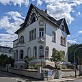
| This category shows a heritage building in Germany, located in the North Rhine-Westphalian city Bad Honnef (no. A 233). |
Media in category "Reichenberger Straße 19 (Bad Honnef)"
This category contains only the following file.
-
 BdHnnf-ReichenbergerStr19.jpg 2,764 × 2,764; 2.3 MB
