Category:Rembrandtplein 16, Amsterdam
Jump to navigation
Jump to search
|
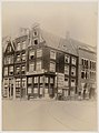
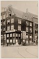
This is a category about rijksmonument number 4978
|
| Object location | | View all coordinates using: OpenStreetMap |
|---|
 | |||||
| Upload media | |||||
| Instance of | |||||
|---|---|---|---|---|---|
| Location | Amsterdam, North Holland, Netherlands | ||||
| Street address |
| ||||
| Heritage designation |
| ||||
 | |||||
Media in category "Rembrandtplein 16, Amsterdam"
The following 3 files are in this category, out of 3 total.
-
 Amsterdam - Rembrandtplein 16.jpg 2,736 × 3,648; 3.99 MB
-
 Stadsarchief Amsterdam, Afb 012000001911.jpg 1,912 × 2,572; 607 KB
-
 Stadsarchief Amsterdam, Afb 012000001912.jpg 1,416 × 2,140; 481 KB

