Category:Remote views of Gablenzbrücke (1910)
Jump to navigation
Jump to search
Media in category "Remote views of Gablenzbrücke (1910)"
The following 16 files are in this category, out of 16 total.
-
 Barkauer Kreisel (Kiel 47.265).jpg 1,024 × 682; 105 KB
-
 Barkauer Kreuz (Kiel 65.494).jpg 1,024 × 669; 99 KB
-
 Barkauer Kreuz (Kiel 65.495).jpg 1,024 × 681; 115 KB
-
 Bollhörnkai (Kiel 48.672).jpg 1,024 × 678; 135 KB
-
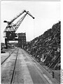 Bundesarchiv Bild 183-16437-0010, Kiel, Schrottlager im Hafen.jpg 602 × 800; 70 KB
-
 Gaarden (Kiel 13.502).jpg 1,024 × 674; 128 KB
-
 Hafen und Förde (Kiel 66.149).jpg 1,024 × 680; 165 KB
-
 Hoernspitze Kiel2007.jpg 1,600 × 1,200; 480 KB
-
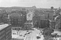 Kreuzung Andreas-Gayk-Straße, Sophienblatt und Ziegelteich (Kiel 43.282).jpg 1,024 × 678; 114 KB
-
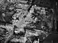
 Luftaufnahme Hörn (Kiel 53.661).jpg 1,024 × 1,534; 323 KB
-
 Luftbilder Kiel (Kiel 36.324).jpg 988 × 724; 156 KB
-
 Luftbilder Kiel (Kiel 36.387).jpg 988 × 726; 88 KB
-
 Parkplatz Hauptbahnhof am Sophienblatt (Kiel 68.808).jpg 1,024 × 684; 69 KB
-
 Vorstadt und Kieler Hafen (Kiel 55.506).jpg 1,001 × 666; 120 KB
-
 Vorstadt und Kieler Hafen (Kiel 55.510).jpg 1,002 × 670; 118 KB
-
 Vorstadt und Kieler Hafen (Kiel 56.605).jpg 1,024 × 682; 169 KB
.jpg)
.jpg)
.jpg)
.jpg)

.jpg)
.jpg)

.jpg)
.jpg)
.jpg)
.jpg)
.jpg)
.jpg)
.jpg)
.jpg)