Category:Remote views of Lake Biwa
Jump to navigation
Jump to search
Subcategories
This category has only the following subcategory.
V
Media in category "Remote views of Lake Biwa"
The following 26 files are in this category, out of 26 total.
-
 20080813AdoGawa.JPG 1,280 × 960; 182 KB
-
 20080813AnegawaBiwaKo.JPG 1,280 × 960; 166 KB
-
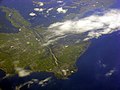
 Aerial view of the Lake Biwa.jpg 3,264 × 2,448; 2.9 MB
-
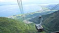
 Biwako Valley - panoramio (38).jpg 4,592 × 2,576; 7.77 MB
-
 Biwako Valley - panoramio (40).jpg 4,592 × 2,576; 7.58 MB
-
 Biwako Valley - panoramio (41).jpg 4,592 × 2,576; 8.16 MB
-
 Biwako Valley - panoramio (47).jpg 4,592 × 2,576; 5.9 MB
-
 Biwako Valley - panoramio (48).jpg 4,592 × 2,576; 6.46 MB
-
 Biwako Valley - panoramio (6).jpg 4,592 × 2,576; 8.85 MB
-
 Drone panorama of Mount Hiei beside Takano River valley.jpg 8,192 × 3,296; 10.19 MB
-
 Drone panorama of Mount Hiei from the north.jpg 8,192 × 3,292; 10.48 MB
-
 Drone panorama of Mount Hiei from the northeast.jpg 8,192 × 3,290; 9.41 MB
-
 Drone panorama of Mount Hiei from the south.jpg 8,192 × 3,294; 10.45 MB
-
 Drone panorama of Mount Hiei from the southwest.jpg 8,192 × 3,292; 10.93 MB
-
 Drone shot of Otsu and Lake Biwa 2.jpg 4,000 × 3,000; 11.03 MB
-
 Drone shot of Otsu and Lake Biwa.jpg 4,000 × 3,000; 10.65 MB
-
 Flight Haneda-Hanoi 01.jpg 3,264 × 2,448; 877 KB
-
 Iwane, Konan, Shiga Prefecture 520-3252, Japan - panoramio.jpg 4,592 × 3,448; 8.59 MB
-
 Lake Biwa form Higashiamagoidake 2009-10-11.jpg 1,280 × 854; 285 KB
-
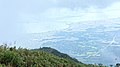
 Lake Biwa from Chano.jpg 3,000 × 1,354; 1.06 MB
-
 Mount Kojin and Lake Biwa.jpg 2,560 × 1,707; 703 KB
-
 Mount Kojin and Oki Island (Lake Biwa).JPG 5,184 × 3,456; 5.46 MB
-
 Oki Island (Lake Biwa).JPG 5,184 × 3,456; 4.39 MB
-
 Otsu 20131231 - panoramio.jpg 4,592 × 3,448; 10.21 MB
-
 Shiga satellite view.jpg 639 × 435; 341 KB
-
 View of Otsu from Mount Hiei in summer.jpg 4,000 × 3,000; 3.4 MB


.jpg)
.jpg)
.jpg)
.jpg)
.jpg)
.jpg)


.JPG)
.JPG)


