Category:Rempstone
Jump to navigation
Jump to search
village and civil parish in Nottinghamshire, United Kingdom | |||||
| Upload media | |||||
| Instance of | |||||
|---|---|---|---|---|---|
| Location | Rushcliffe, Nottinghamshire, East Midlands, England | ||||
| Population |
| ||||
 | |||||
Subcategories
This category has the following 2 subcategories, out of 2 total.
R
- All Saint's Church, Rempstone (22 F)
- Rempstone Hall (3 F)
Media in category "Rempstone"
The following 200 files are in this category, out of 221 total.
(previous page) (next page)-
 5-barred gate (with additions) - geograph.org.uk - 750201.jpg 640 × 480; 279 KB
-
 A pair of oak trees - geograph.org.uk - 3433886.jpg 640 × 427; 93 KB
-
 A pile of muck - geograph.org.uk - 6805532.jpg 1,600 × 1,115; 182 KB
-
 A tree on west side of Wysall Road - geograph.org.uk - 6805533.jpg 1,600 × 1,238; 257 KB
-
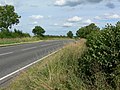
 A60 at King's Bridge, south of Rempstone - geograph.org.uk - 4020264.jpg 1,024 × 768; 209 KB
-
 A60 King's Bridge - geograph.org.uk - 17767.jpg 640 × 432; 108 KB
-
 A60 Loughborough Road near Rempstone - geograph.org.uk - 905854.jpg 640 × 484; 100 KB
-

-
 A60 towards Loughborough - geograph.org.uk - 3079430.jpg 640 × 480; 81 KB
-

-
 A6006 at Rempstone village boundary - geograph.org.uk - 3604198.jpg 640 × 481; 70 KB
-
 A6006 eastbound near Lings Farm - geograph.org.uk - 3604172.jpg 640 × 480; 48 KB
-
 A6006 heading west - geograph.org.uk - 3079426.jpg 640 × 480; 63 KB
-
 A6006 looking west - geograph.org.uk - 3433977.jpg 640 × 427; 121 KB
-
 A6006 Melton Road eastbound - geograph.org.uk - 2788739.jpg 3,648 × 2,736; 3.43 MB
-
 A6006 Melton Road westbound - geograph.org.uk - 2788725.jpg 3,648 × 2,736; 3.88 MB
-
 A6006 Wymeswold Road near Rempstone - geograph.org.uk - 906184.jpg 640 × 478; 97 KB
-
 Abandoned Churchyard - geograph.org.uk - 5546.jpg 640 × 458; 122 KB
-
 Abandoned Graveyard - geograph.org.uk - 1294956.jpg 640 × 480; 163 KB
-
 Alternative build dates - geograph.org.uk - 4001931.jpg 960 × 1,280; 383 KB
-
 Ashby Road, Rempstone - geograph.org.uk - 2086629.jpg 640 × 480; 52 KB
-
 Bales at Wolds Farm - geograph.org.uk - 5453233.jpg 640 × 466; 74 KB
-

-
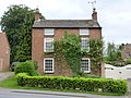 Beech House, Rempstone - geograph.org.uk - 4001366.jpg 1,280 × 960; 413 KB
-
 Bench mark, Loughborough Road, Rempstone - geograph.org.uk - 4001346.jpg 907 × 1,280; 399 KB
-
 Bridleway crossing a quarry road - geograph.org.uk - 5804054.jpg 1,280 × 960; 446 KB
-
 Bridleway sign on the edge of the quarry - geograph.org.uk - 5804029.jpg 1,280 × 960; 358 KB
-
 Building the DNRC - geograph.org.uk - 5222205.jpg 4,896 × 3,672; 6.27 MB
-
 Building work at Rempstone Hall Farm Bungalow - geograph.org.uk - 6121314.jpg 1,024 × 683; 901 KB
-
 Canaan Farm Equestrian Centre - geograph.org.uk - 2870678.jpg 1,280 × 960; 538 KB
-
 Caution Public Footpath - geograph.org.uk - 5804032.jpg 1,280 × 960; 477 KB
-
 Crop field near Rempstone - geograph.org.uk - 3079416.jpg 640 × 480; 82 KB
-
 Driveway to Wolds Farm - geograph.org.uk - 5453234.jpg 640 × 464; 153 KB
-
 East Leake gravel pits from the air - geograph.org.uk - 2725387.jpg 640 × 480; 117 KB
-
 Emergency Water Supply - geograph.org.uk - 775328.jpg 640 × 480; 136 KB
-

-
 Entrance to Rempstone - geograph.org.uk - 3624630.jpg 640 × 480; 51 KB
-
 Entrance to Rempstone - geograph.org.uk - 3823693.jpg 640 × 480; 67 KB
-
 Entrance to Wolds Farm - geograph.org.uk - 1333194.jpg 640 × 480; 54 KB
-
 Entrances to Wolds Farm - geograph.org.uk - 5453235.jpg 640 × 466; 117 KB
-
 Ex church yard path away from East Leake - geograph.org.uk - 1294985.jpg 640 × 480; 176 KB
-
 Exit from field - geograph.org.uk - 6805534.jpg 1,600 × 1,189; 266 KB
-

-
 Farm track near Rempstone - geograph.org.uk - 3079428.jpg 640 × 480; 56 KB
-
 Farmland off Wymeswold Road - geograph.org.uk - 3079413.jpg 640 × 480; 95 KB
-
 Farmland south of Rempstone - geograph.org.uk - 3079432.jpg 640 × 480; 67 KB
-
 Field east of Stanford Hall - geograph.org.uk - 4017044.jpg 1,024 × 768; 182 KB
-
 Field edge path towards Rempstone - geograph.org.uk - 4017047.jpg 1,024 × 768; 181 KB
-
 Fieldside track away from the road - geograph.org.uk - 6805535.jpg 1,600 × 1,211; 183 KB
-
 Fieldside track back to the road - geograph.org.uk - 6805536.jpg 1,600 × 1,256; 137 KB
-
 Fieldside track crosses the ditch - geograph.org.uk - 6805517.jpg 1,600 × 1,152; 284 KB
-
 Fieldside track towards Wolds Farm - geograph.org.uk - 6805563.jpg 1,600 × 1,199; 196 KB
-
 Fieldside track towards Wysall Road - geograph.org.uk - 6805564.jpg 1,600 × 1,301; 196 KB
-
 Finger Post - geograph.org.uk - 789434.jpg 597 × 640; 133 KB
-
 Football posts 2 Rugby posts 1 - geograph.org.uk - 1333180.jpg 640 × 480; 64 KB
-
 Footpath at Rempstone - geograph.org.uk - 4001952.jpg 1,280 × 960; 305 KB
-
 Footpath sign on Wysall Road - geograph.org.uk - 5453236.jpg 640 × 455; 72 KB
-
 Footpath to Rempstone - geograph.org.uk - 5804059.jpg 1,280 × 960; 306 KB
-
 Footpath to Rempstone on Sutcliffe Hill - geograph.org.uk - 4020275.jpg 1,024 × 768; 157 KB
-
 Footpath to Wymeswold - geograph.org.uk - 5453237.jpg 640 × 458; 75 KB
-
 Former churchyard west of Rempstone - geograph.org.uk - 4020297.jpg 1,024 × 768; 242 KB
-
 Gap in the hedge - geograph.org.uk - 6805565.jpg 1,600 × 1,147; 150 KB
-
 Gravel working south east of East Leake - geograph.org.uk - 4022631.jpg 1,024 × 768; 176 KB
-
 Hill Farm - geograph.org.uk - 5453228.jpg 640 × 475; 118 KB
-
 Hill Farm Costock - geograph.org.uk - 1333182.jpg 640 × 480; 58 KB
-
 Hill Farm near Costock - geograph.org.uk - 1333175.jpg 640 × 480; 69 KB
-
 Hrempis Farmhouse, Rempstone - geograph.org.uk - 4001363.jpg 1,280 × 966; 406 KB
-
 Invisible footpath east of Stanford Hall - geograph.org.uk - 4017036.jpg 1,024 × 768; 131 KB
-
 Junction in Rempstone - geograph.org.uk - 6450811.jpg 768 × 1,024; 172 KB
-
 Lings Farm - geograph.org.uk - 3433897.jpg 640 × 427; 75 KB
-
 Main Street in Rempstone, Notts - geograph.org.uk - 906178.jpg 640 × 423; 68 KB
-
 Main Street, Rempstone - geograph.org.uk - 4020276.jpg 1,024 × 768; 226 KB
-
 Main Street, Rempstone - geograph.org.uk - 4505886.jpg 4,517 × 1,653; 4.92 MB
-
 Near Rempstone - geograph.org.uk - 1294049.jpg 640 × 480; 195 KB
-
 Old manor house.jpg 640 × 480; 47 KB
-
 Path across field to Rempstone - geograph.org.uk - 1294945.jpg 480 × 640; 171 KB
-
 Path off Wysall Road - geograph.org.uk - 1333473.jpg 640 × 480; 67 KB
-
 Path off Wysall road to Wysall - geograph.org.uk - 1333476.jpg 640 × 480; 85 KB
-
 Path to East Leake from Rempstone - geograph.org.uk - 1294940.jpg 480 × 640; 173 KB
-
 Path to Rempstone - geograph.org.uk - 1294953.jpg 640 × 480; 155 KB
-
 Path to Wymeswold - geograph.org.uk - 1333192.jpg 640 × 480; 53 KB
-
 Path to Wysall - geograph.org.uk - 1333478.jpg 480 × 640; 106 KB
-
 Pond on the Sheepwash Brook - geograph.org.uk - 5804061.jpg 1,280 × 960; 593 KB
-
 Pool on Sheepwash brook - geograph.org.uk - 1294992.jpg 640 × 480; 188 KB
-
 Quarry road - geograph.org.uk - 5804046.jpg 1,280 × 960; 317 KB
-
 Ready for harvesting - geograph.org.uk - 919602.jpg 640 × 480; 98 KB
-
 Remains of a tree on Wysall Road - geograph.org.uk - 6805537.jpg 1,600 × 1,028; 355 KB
-
 Rempstone field - geograph.org.uk - 1294927.jpg 640 × 480; 158 KB
-
 Rempstone field - geograph.org.uk - 1294933.jpg 640 × 480; 144 KB
-
 Rempstone fields and farm - geograph.org.uk - 1294859.jpg 640 × 480; 143 KB
-
 Rempstone fields and trees - geograph.org.uk - 1294869.jpg 640 × 480; 155 KB
-
 Rempstone from the air - geograph.org.uk - 4906969.jpg 3,264 × 2,448; 4.44 MB
-
 Rempstone Hall - geograph.org.uk - 1294877.jpg 640 × 480; 149 KB
-
 Rempstone Hall in the distance - geograph.org.uk - 6118966.jpg 1,024 × 768; 890 KB
-
 Rempstone Hill triangulation pillar - geograph.org.uk - 5453238.jpg 640 × 461; 75 KB
-

-

-

-
 Rempstone Horses - geograph.org.uk - 1294396.jpg 640 × 480; 172 KB
-
 Rempstone Horses - geograph.org.uk - 1294401.jpg 640 × 480; 207 KB
-
 Rempstone Horses - geograph.org.uk - 1294404.jpg 640 × 480; 201 KB
-
 Rempstone Horses - geograph.org.uk - 1294405.jpg 640 × 480; 152 KB
-
 Rempstone house for sale - geograph.org.uk - 1295264.jpg 480 × 640; 190 KB
-

-

-

-
 Rempstone Main Street on an April morning - geograph.org.uk - 6119209.jpg 1,024 × 768; 887 KB
-
 Rempstone Sutcliffe Hill path - geograph.org.uk - 1294372.jpg 640 × 480; 166 KB
-
 Rempstone Sutcliffe Hill path - geograph.org.uk - 1294389.jpg 640 × 480; 155 KB
-
 Rempstone Sutcliffe Hill path stile - geograph.org.uk - 1294377.jpg 640 × 480; 185 KB
-
 Rempstone Sutcliffe Hills - geograph.org.uk - 1293568.jpg 640 × 480; 93 KB
-
 Rempstone Sutcliffe Hills - geograph.org.uk - 1294054.jpg 640 × 480; 178 KB
-
 Rempstone Village - geograph.org.uk - 1294394.jpg 640 × 480; 158 KB
-
 Rempstone Village - geograph.org.uk - 1294408.jpg 640 × 480; 162 KB
-
 Rempstone Village - geograph.org.uk - 1294411.jpg 480 × 640; 210 KB
-
 Rempstone Village - geograph.org.uk - 1294418.jpg 640 × 480; 189 KB
-
 Rempstone Village - geograph.org.uk - 1294420.jpg 640 × 480; 189 KB
-
 Rempstone Village - geograph.org.uk - 1294423.jpg 640 × 480; 178 KB
-
 Rempstone Village Hall - geograph.org.uk - 3079420.jpg 640 × 480; 62 KB
-
 Rempstone Village Hall - geograph.org.uk - 4001371.jpg 1,280 × 924; 221 KB
-
 Rempstone Village kiln^ - geograph.org.uk - 1294414.jpg 640 × 480; 198 KB
-
 Rempstone Village Main Street - geograph.org.uk - 1294428.jpg 640 × 480; 172 KB
-
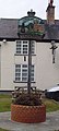
 Rempstone Village Sign - geograph.org.uk - 4001374.jpg 960 × 1,280; 226 KB
-
 Rempstone village sign - geograph.org.uk - 906175.jpg 543 × 640; 83 KB
-
 Rempstone, All Saints - geograph.org.uk - 6119185.jpg 819 × 1,024; 1,002 KB
-

-
 Rempstone, at the corner of Wysall Lane - geograph.org.uk - 6119398.jpg 1,024 × 682; 811 KB
-
 Rempstone, Fox Yard - geograph.org.uk - 6119408.jpg 1,024 × 1,024; 1.13 MB
-
 Rempstone, frost first thing - geograph.org.uk - 6119414.jpg 1,024 × 768; 893 KB
-
 Rempstone, frosted field - geograph.org.uk - 6119390.jpg 1,024 × 731; 764 KB
-
 Rempstone, in All Saints' churchyard on a frosty morning - geograph.org.uk - 6119193.jpg 1,024 × 1,024; 1.32 MB
-
 Rempstone, looking into Leicestershire - geograph.org.uk - 6118950.jpg 1,024 × 768; 1,007 KB
-
 Rempstone, Main Street and the crossroads - geograph.org.uk - 6118654.jpg 819 × 1,024; 1.01 MB
-
 Rempstone, Main Street near the crossroads - geograph.org.uk - 6220993.jpg 1,024 × 682; 760 KB
-
 Rempstone, near the crossroads - geograph.org.uk - 6119047.jpg 1,024 × 1,024; 1.13 MB
-
 Rempstone, on Wysall Lane - geograph.org.uk - 6119380.jpg 1,024 × 683; 601 KB
-
 Rempstone, over the hedge on Sutcliffe Hill - geograph.org.uk - 6118746.jpg 1,024 × 768; 1,024 KB
-
 Rempstone, quite early on an April morning - geograph.org.uk - 6119214.jpg 819 × 1,024; 1.22 MB
-
 Rempstone, south of the crossroads - geograph.org.uk - 6119019.jpg 1,024 × 683; 906 KB
-
 Rempstone, the edge of Sutcliffe Plantation - geograph.org.uk - 6118956.jpg 1,024 × 768; 1.17 MB
-
 Rempstone, the entrance to the Hall - geograph.org.uk - 6119039.jpg 1,024 × 1,024; 1.39 MB
-
 Rempstone, The Guesthouse at the crossroads - geograph.org.uk - 6119009.jpg 1,024 × 683; 918 KB
-
 Rempstone, the path over Sutcliffe Hill - geograph.org.uk - 6118987.jpg 1,024 × 768; 979 KB
-
 Rempstone, the road to Wysall - geograph.org.uk - 6119241.jpg 1,024 × 768; 976 KB
-
 Rempstone, The White Lion - geograph.org.uk - 6118717.jpg 1,024 × 1,024; 1.18 MB
-
 Rempstone, three trees on Sutcliffe Hill - geograph.org.uk - 6118873.jpg 819 × 1,024; 1.05 MB
-
 Rempstone, towards Grange Farm - geograph.org.uk - 6119234.jpg 1,024 × 768; 975 KB
-
 Rempstone, towards Lings Farm - geograph.org.uk - 6118977.jpg 1,024 × 768; 942 KB
-
 Rempstone, waiting at the lights - geograph.org.uk - 6119051.jpg 1,024 × 683; 790 KB
-
 Road from Hill Farm Costock - geograph.org.uk - 1333184.jpg 640 × 480; 60 KB
-
 School Lane, Rempstone - geograph.org.uk - 4020286.jpg 1,024 × 768; 189 KB
-
 Sheepwash brook trees - geograph.org.uk - 1294989.jpg 640 × 480; 150 KB
-
 Sluicegate at Floodgate Plantation - geograph.org.uk - 748212.jpg 640 × 480; 187 KB
-

-
 Stanford Hall - geograph.org.uk - 17754.jpg 640 × 355; 80 KB
-
 Stile and gate into Wysall Road - geograph.org.uk - 5453242.jpg 640 × 466; 113 KB
-
 Sutcliffe Hill - geograph.org.uk - 1294045.jpg 640 × 480; 163 KB
-
 Sutcliffe Hill - geograph.org.uk - 1294052.jpg 640 × 480; 170 KB
-
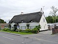
 Thatched cottage in Rempstone - geograph.org.uk - 3079422.jpg 640 × 385; 45 KB
-
 Thatched Cottage in Rempstone - geograph.org.uk - 4254.jpg 640 × 480; 97 KB
-
 The Cottage, Rempstone (geograph 7372287).jpg 1,024 × 768; 146 KB
-
 The Cottage, Rempstone - geograph.org.uk - 4001368.jpg 1,280 × 963; 227 KB
-
 The Old Rectory, Rempstone - geograph.org.uk - 4001376.jpg 1,280 × 950; 348 KB
-
 The Thatch, Rempstone - geograph.org.uk - 4001380.jpg 1,280 × 980; 231 KB
-
 The Thatch, Rempstone, awaiting repair (geograph 7370746).jpg 1,024 × 768; 131 KB
-
 The White Lion at Rempstone - geograph.org.uk - 2004377.jpg 640 × 480; 80 KB
-
 The White Lion in Rempstone - geograph.org.uk - 906173.jpg 640 × 405; 81 KB
-
 The White Lion, Rempstone (1) - geograph.org.uk - 4020278.jpg 1,024 × 768; 200 KB
-
 The White Lion, Rempstone (2) - geograph.org.uk - 4020281.jpg 1,024 × 768; 201 KB
-
 The White Lion, Rempstone - geograph.org.uk - 3079423.jpg 1,024 × 655; 139 KB
-
 The White Lion, Rempstone - geograph.org.uk - 4001946.jpg 1,280 × 960; 266 KB
-
 Top Farm, Rempstone - geograph.org.uk - 15625.jpg 640 × 588; 150 KB
-
 Top Farm, Rempstone - geograph.org.uk - 4001359.jpg 1,280 × 948; 295 KB
-
 Towards Rempstone - geograph.org.uk - 6118730.jpg 1,024 × 768; 985 KB
-
 Trackside fencing - geograph.org.uk - 6805566.jpg 1,600 × 1,154; 315 KB
-
 Trackside fencing and track - geograph.org.uk - 6805567.jpg 1,600 × 1,303; 308 KB
-
 Tree in the middle of a field - geograph.org.uk - 6803555.jpg 1,600 × 1,108; 581 KB
-
 Trees at Hill Farm - geograph.org.uk - 1333115.jpg 640 × 480; 72 KB
-
 Trees at Hill Farm - geograph.org.uk - 1333118.jpg 640 × 480; 74 KB
-
 Trough in the middle of the field - geograph.org.uk - 6805538.jpg 1,600 × 1,162; 194 KB
-
 UK Rempstone.jpg 807 × 1,787; 239 KB
-
 Unidentified building, Rempstone - geograph.org.uk - 4001350.jpg 1,280 × 954; 548 KB
-
 Walking the dog - geograph.org.uk - 5453229.jpg 640 × 456; 84 KB
-
 Wolds Farm sign - geograph.org.uk - 5453243.jpg 640 × 438; 125 KB
-
 Workings near East Leake - geograph.org.uk - 4906908.jpg 3,264 × 2,448; 3.93 MB
-

-

-
 Wymeswold Road, Rempstone - geograph.org.uk - 3604208.jpg 640 × 481; 73 KB
-
 Wysall Road near Wolds Farm - geograph.org.uk - 1333459.jpg 640 × 480; 51 KB
-

-
 Wysall Road passes Hill Farm from south - geograph.org.uk - 6805539.jpg 1,600 × 1,152; 216 KB
-
 Wysall Road towards Rempstone - geograph.org.uk - 5453231.jpg 640 × 461; 102 KB
-
 Wysall Road towards Wysall - geograph.org.uk - 5453232.jpg 640 × 479; 112 KB
-
 Wysall Road towards Wysall - geograph.org.uk - 5453244.jpg 640 × 473; 76 KB
-
 Wysall Road, Rempstone - geograph.org.uk - 4001354.jpg 1,280 × 960; 231 KB
-
 Bridleway on Hoton Hill - geograph.org.uk - 750190.jpg 640 × 480; 253 KB
-
 Bridleway to Hoton Hills - geograph.org.uk - 750183.jpg 640 × 480; 201 KB
-
 Canaan Farm, Rempstone - geograph.org.uk - 15627.jpg 640 × 345; 87 KB
-
 Cottage at Rempstone - geograph.org.uk - 15629.jpg 640 × 384; 109 KB
-
 Cows at Wolds Farm - geograph.org.uk - 15622.jpg 640 × 476; 144 KB
_-_geograph.org.uk_-_750201.jpg)


.jpg)


.jpg)


_-_geograph.org.uk_-_4020278.jpg)
_-_geograph.org.uk_-_4020281.jpg)


_towards_Rempstone_-_geograph.org.uk_-_3079415.jpg)
_towards_Rempstone_-_geograph.org.uk_-_3079418.jpg)


