Category:Residential area "Hermann Göring Stadt" of Pirna 1938
Jump to navigation
Jump to search
| Object location | | View all coordinates using: OpenStreetMap |
|---|
Subcategories
This category has only the following subcategory.
R
- Robert-Schumann-Platz (Pirna) (30 F)
Media in category "Residential area "Hermann Göring Stadt" of Pirna 1938"
The following 187 files are in this category, out of 187 total.
-
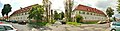 Pirna-Südvorstadt Franz-Schubert-Straße (02-2).jpg 1,600 × 420; 178 KB
-
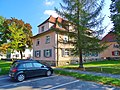
 Rottwerndorfer Straße, Pirna 124422169.jpg 5,184 × 3,888; 13.84 MB
-
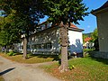
 Rottwerndorfer Straße, Pirna 124422181.jpg 5,184 × 3,888; 11.83 MB
-
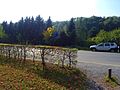
 Rottwerndorfer Straße, Pirna 124422182.jpg 5,184 × 3,888; 14.03 MB
-
 Rottwerndorfer Straße, Pirna 124422185.jpg 5,184 × 3,888; 12.59 MB
-
 Rottwerndorfer Straße, Pirna 124422187.jpg 5,184 × 3,888; 10.62 MB
-
 Rottwerndorfer Straße, Pirna 124422190.jpg 5,184 × 3,888; 11.81 MB
-
 Rottwerndorfer Straße, Pirna 124422197.jpg 5,184 × 3,888; 12.3 MB
-
 Rottwerndorfer Straße, Pirna 124422201.jpg 5,184 × 3,888; 13.49 MB
-
 Rottwerndorfer Straße, Pirna 124422206.jpg 5,184 × 3,888; 13.54 MB
-
 Rottwerndorfer Straße, Pirna 124422209.jpg 5,184 × 3,888; 13.65 MB
-
 Rottwerndorfer Straße, Pirna 124422215.jpg 5,184 × 3,888; 14.58 MB
-
 Rottwerndorfer Straße, Pirna 124422226.jpg 3,888 × 5,184; 10.03 MB
-
 Rottwerndorfer Straße, Pirna 124422232.jpg 5,184 × 3,888; 11.88 MB
-
 Rottwerndorfer Straße, Pirna 124422234.jpg 5,184 × 3,888; 12.03 MB
-
 Rottwerndorfer Straße, Pirna 124422240.jpg 5,184 × 3,888; 11.78 MB
-
 Rottwerndorfer Straße, Pirna 124422247.jpg 5,184 × 3,888; 11.85 MB
-
 Rottwerndorfer Straße, Pirna 124422252.jpg 5,184 × 3,888; 12.06 MB
-
 Rottwerndorfer Straße, Pirna 124422259.jpg 5,184 × 3,888; 13.42 MB
-
 Rottwerndorfer Straße, Pirna 124422261.jpg 5,184 × 3,888; 12.82 MB
-
 Rottwerndorfer Straße, Pirna 124422264.jpg 5,184 × 3,888; 11.54 MB
-
 Rottwerndorfer Straße, Pirna 124422268.jpg 5,036 × 3,682; 10.58 MB
-
 Rottwerndorfer Straße, Pirna 124422272.jpg 5,184 × 3,888; 12.43 MB
-
 Rottwerndorfer Straße, Pirna 124422275.jpg 5,184 × 3,888; 11.4 MB
-
 Rottwerndorfer Straße, Pirna 124422278.jpg 5,022 × 3,662; 10.96 MB
-
 Rottwerndorfer Straße, Pirna 124422281.jpg 5,184 × 3,888; 11.71 MB
-
 Rottwerndorfer Straße, Pirna 124422285.jpg 5,184 × 3,888; 11.65 MB
-
 Rottwerndorfer Straße, Pirna 124422289.jpg 5,028 × 3,672; 10.88 MB
-
 Rottwerndorfer Straße, Pirna 124422292.jpg 5,184 × 3,888; 12.31 MB
-
 Rottwerndorfer Straße, Pirna 124422296.jpg 5,184 × 3,888; 12.2 MB
-
 Rottwerndorfer Straße, Pirna 124422300.jpg 5,184 × 3,888; 13.8 MB
-
 Rottwerndorfer Straße, Pirna 124422304.jpg 5,184 × 3,888; 11.8 MB
-
 Rottwerndorfer Straße, Pirna 124422311.jpg 5,184 × 3,888; 11.77 MB
-
 Rottwerndorfer Straße, Pirna 124422314.jpg 5,184 × 3,888; 11.85 MB
-
 Rottwerndorfer Straße, Pirna 124422317.jpg 5,114 × 3,792; 11.21 MB
-
 Rottwerndorfer Straße, Pirna 124422323.jpg 5,184 × 3,888; 14.05 MB
-
 Rottwerndorfer Straße, Pirna 124422326.jpg 5,184 × 3,888; 12.7 MB
-
 Rottwerndorfer Straße, Pirna 124422330.jpg 5,184 × 3,888; 10.57 MB
-
 Rottwerndorfer Straße, Pirna 124422337.jpg 5,184 × 3,888; 11.62 MB
-
 Rottwerndorfer Straße, Pirna 124422342.jpg 5,184 × 3,888; 13.61 MB
-
 Rottwerndorfer Straße, Pirna 124422345.jpg 5,184 × 3,888; 13.12 MB
-
 Rottwerndorfer Straße, Pirna 124422349.jpg 5,184 × 3,888; 13.21 MB
-
 Rottwerndorfer Straße, Pirna 124422354.jpg 5,184 × 3,888; 12.01 MB
-
 Rottwerndorfer Straße, Pirna 124422357.jpg 5,184 × 3,888; 10.89 MB
-
 Rottwerndorfer Straße, Pirna 124422361.jpg 5,184 × 3,888; 13.94 MB
-
 Rottwerndorfer Straße, Pirna 124422365.jpg 5,184 × 3,888; 11.83 MB
-
 Rottwerndorfer Straße, Pirna 124422367.jpg 5,184 × 3,888; 12.4 MB
-
 Rottwerndorfer Straße, Pirna 124422372.jpg 5,184 × 3,888; 12.3 MB
-
 Rottwerndorfer Straße, Pirna 124422376.jpg 5,184 × 3,888; 15.23 MB
-
 Rottwerndorfer Straße, Pirna 124422379.jpg 5,184 × 3,888; 11.43 MB
-
 Rottwerndorfer Straße, Pirna 124422382.jpg 5,184 × 3,888; 12.17 MB
-
 Rottwerndorfer Straße, Pirna 124422387.jpg 5,184 × 3,888; 13.71 MB
-
 Rottwerndorfer Straße, Pirna 124422392.jpg 5,184 × 3,888; 14.19 MB
-
 Rottwerndorfer Straße, Pirna 124422395.jpg 5,184 × 3,888; 11.92 MB
-
 Rottwerndorfer Straße, Pirna 124422398.jpg 5,184 × 3,888; 13.75 MB
-
 Rottwerndorfer Straße, Pirna 124422401.jpg 5,184 × 3,888; 13.24 MB
-
 Rottwerndorfer Straße, Pirna 124422403.jpg 5,184 × 3,888; 13.32 MB
-
 Rottwerndorfer Straße, Pirna 124422409.jpg 5,184 × 3,888; 14.2 MB
-
 Rottwerndorfer Straße, Pirna 124422411.jpg 5,184 × 3,888; 12.56 MB
-
 Rottwerndorfer Straße, Pirna 124422414.jpg 5,184 × 3,888; 12.4 MB
-
 Rottwerndorfer Straße, Pirna 124422419.jpg 5,184 × 3,888; 13.34 MB
-
 Rottwerndorfer Straße, Pirna 124422426.jpg 5,184 × 3,888; 12.41 MB
-
 Rottwerndorfer Straße, Pirna 124422428.jpg 5,184 × 3,888; 15.4 MB
-
 Rottwerndorfer Straße, Pirna 124422430.jpg 5,184 × 3,888; 12.51 MB
-
 Rottwerndorfer Straße, Pirna 124422433.jpg 5,184 × 3,888; 13.08 MB
-
 Rottwerndorfer Straße, Pirna 124422437.jpg 5,184 × 3,888; 11.89 MB
-
 Rottwerndorfer Straße, Pirna 124422440.jpg 5,184 × 3,888; 12.37 MB
-
 Rottwerndorfer Straße, Pirna 124422443.jpg 5,184 × 3,888; 14.69 MB
-
 Rottwerndorfer Straße, Pirna 124422447.jpg 5,184 × 3,888; 13.71 MB
-
 Rottwerndorfer Straße, Pirna 124422450.jpg 5,184 × 3,888; 13.06 MB
-
 Rottwerndorfer Straße, Pirna 124422454.jpg 5,184 × 3,888; 14.01 MB
-
 Rottwerndorfer Straße, Pirna 124422457.jpg 5,184 × 3,888; 11.57 MB
-
 Rottwerndorfer Straße, Pirna 124422460.jpg 5,184 × 3,888; 12.2 MB
-
 Rottwerndorfer Straße, Pirna 124422462.jpg 5,184 × 3,888; 10.65 MB
-
 Rottwerndorfer Straße, Pirna 124422466.jpg 5,184 × 3,888; 12.54 MB
-
 Rottwerndorfer Straße, Pirna 124422469.jpg 5,136 × 3,824; 10.92 MB
-
 Rottwerndorfer Straße, Pirna 124422476.jpg 5,184 × 3,888; 10.78 MB
-
 Rottwerndorfer Straße, Pirna 124422482.jpg 5,184 × 3,888; 10.82 MB
-
 Rottwerndorfer Straße, Pirna 124422486.jpg 5,184 × 3,888; 11.17 MB
-
 Rottwerndorfer Straße, Pirna 124422490.jpg 5,184 × 3,888; 12.3 MB
-
 Rottwerndorfer Straße, Pirna 124422498.jpg 5,184 × 3,888; 13.17 MB
-
 Rottwerndorfer Straße, Pirna 124422503.jpg 5,184 × 3,888; 12.73 MB
-
 Rottwerndorfer Straße, Pirna 124422508.jpg 5,184 × 3,888; 12.68 MB
-
 Rottwerndorfer Straße, Pirna 124422511.jpg 5,184 × 3,888; 11.21 MB
-
 Rottwerndorfer Straße, Pirna 124422513.jpg 3,888 × 5,184; 10.75 MB
-
 Rottwerndorfer Straße, Pirna 124422516.jpg 5,184 × 3,888; 12.17 MB
-
 Rottwerndorfer Straße, Pirna 124422519.jpg 5,000 × 3,630; 10.17 MB
-
 Rottwerndorfer Straße, Pirna 124422939.jpg 5,184 × 3,888; 12.12 MB
-
 Rottwerndorfer Straße, Pirna 124422940.jpg 5,122 × 3,806; 10.82 MB
-
 Rottwerndorfer Straße, Pirna 124422942.jpg 3,888 × 5,184; 14.6 MB
-
 Rottwerndorfer Straße, Pirna 124422943.jpg 5,184 × 3,888; 11.7 MB
-
 Rottwerndorfer Straße, Pirna 124422945.jpg 5,184 × 3,888; 10.84 MB
-
 Rottwerndorfer Straße, Pirna 124422947.jpg 3,888 × 5,184; 14.4 MB
-
 Rottwerndorfer Straße, Pirna 124422948.jpg 5,184 × 3,888; 10.94 MB
-
 Rottwerndorfer Straße, Pirna 124422949.jpg 5,184 × 3,888; 10.64 MB
-
 Rottwerndorfer Straße, Pirna 124422952.jpg 5,184 × 3,888; 12.01 MB
-
 Rottwerndorfer Straße, Pirna 124422953.jpg 5,184 × 3,888; 14.79 MB
-
 Rottwerndorfer Straße, Pirna 124422955.jpg 5,184 × 3,888; 11.45 MB
-
 Rottwerndorfer Straße, Pirna 124422956.jpg 4,900 × 3,474; 10.43 MB
-
 Rottwerndorfer Straße, Pirna 124422957.jpg 5,184 × 3,888; 12.96 MB
-
 Rottwerndorfer Straße, Pirna 124422959.jpg 5,184 × 3,888; 11.69 MB
-
 Rottwerndorfer Straße, Pirna 124422960.jpg 5,184 × 3,888; 12.28 MB
-
 Rottwerndorfer Straße, Pirna 124422963.jpg 5,184 × 3,888; 13.29 MB
-
 Rottwerndorfer Straße, Pirna 124422965.jpg 5,184 × 3,888; 13.38 MB
-
 Rottwerndorfer Straße, Pirna 124422966.jpg 4,892 × 3,460; 9.89 MB
-
 Rottwerndorfer Straße, Pirna 124422967.jpg 5,184 × 3,888; 11.17 MB
-
 Rottwerndorfer Straße, Pirna 124422968.jpg 5,184 × 3,888; 12.78 MB
-
 Rottwerndorfer Straße, Pirna 124422969.jpg 5,184 × 3,888; 10.57 MB
-
 Rottwerndorfer Straße, Pirna 124422973.jpg 5,184 × 3,888; 12.39 MB
-
 Rottwerndorfer Straße, Pirna 124422974.jpg 5,184 × 3,888; 12.23 MB
-
 Rottwerndorfer Straße, Pirna 124422976.jpg 5,184 × 3,888; 11.43 MB
-
 Rottwerndorfer Straße, Pirna 124422977.jpg 5,184 × 3,888; 10.77 MB
-
 Rottwerndorfer Straße, Pirna 124422980.jpg 5,184 × 3,888; 12.93 MB
-
 Rottwerndorfer Straße, Pirna 124422981.jpg 5,184 × 3,888; 11.2 MB
-
 Rottwerndorfer Straße, Pirna 124422982.jpg 5,184 × 3,888; 12.56 MB
-
 Rottwerndorfer Straße, Pirna 124422984.jpg 5,184 × 3,888; 11.45 MB
-
 Rottwerndorfer Straße, Pirna 124424045.jpg 3,334 × 1,740; 4.47 MB
-
 Rottwerndorfer Straße, Pirna 124424052.jpg 3,648 × 2,736; 7.42 MB
-
 Rottwerndorfer Straße, Pirna 124424061.jpg 3,648 × 2,736; 8.38 MB
-
 Rottwerndorfer Straße, Pirna 124424063.jpg 3,648 × 2,736; 8.02 MB
-
 Rottwerndorfer Straße, Pirna 124424064.jpg 3,648 × 2,736; 4.87 MB
-
 Rottwerndorfer Straße, Pirna 124424065.jpg 3,648 × 2,736; 7.5 MB
-
 Rottwerndorfer Straße, Pirna 124424068.jpg 3,648 × 2,736; 7.57 MB
-
 Rottwerndorfer Straße, Pirna 124424069.jpg 2,736 × 3,648; 7.43 MB
-
 Rottwerndorfer Straße, Pirna 124424071.jpg 3,648 × 2,736; 7.73 MB
-
 Rottwerndorfer Straße, Pirna 124424073.jpg 3,648 × 2,736; 7.44 MB
-
 Rottwerndorfer Straße, Pirna 124424074.jpg 2,736 × 3,648; 6.44 MB
-
 Rottwerndorfer Straße, Pirna 124424075.jpg 3,648 × 2,736; 6.47 MB
-
 Rottwerndorfer Straße, Pirna 124424077.jpg 3,648 × 2,736; 6.94 MB
-
 Rottwerndorfer Straße, Pirna 124424078.jpg 3,648 × 2,736; 8.47 MB
-
 Rottwerndorfer Straße, Pirna 124424079.jpg 3,648 × 2,736; 8.95 MB
-
 Rottwerndorfer Straße, Pirna 124424080.jpg 3,648 × 2,736; 6.15 MB
-
 Rottwerndorfer Straße, Pirna 124424082.jpg 2,736 × 3,648; 7.46 MB
-
 Rottwerndorfer Straße, Pirna 124424083.jpg 3,648 × 2,736; 7.58 MB
-
 Rottwerndorfer Straße, Pirna 124424086.jpg 2,736 × 3,648; 8.03 MB
-
 Rottwerndorfer Straße, Pirna 124424087.jpg 3,648 × 2,736; 6.61 MB
-
 Rottwerndorfer Straße, Pirna 124424090.jpg 2,690 × 3,614; 6.9 MB
-
 Rottwerndorfer Straße, Pirna 124424091.jpg 3,648 × 2,736; 7.47 MB
-
 Rottwerndorfer Straße, Pirna 124424094.jpg 3,648 × 2,736; 7.6 MB
-
 Rottwerndorfer Straße, Pirna 124424095.jpg 3,648 × 2,736; 7.37 MB
-
 Rottwerndorfer Straße, Pirna 124424096.jpg 3,648 × 2,736; 7.04 MB
-
 Rottwerndorfer Straße, Pirna 124424097.jpg 3,648 × 2,736; 7.17 MB
-
 Rottwerndorfer Straße, Pirna 124424099.jpg 3,548 × 2,598; 6.59 MB
-
 Rottwerndorfer Straße, Pirna 124424100.jpg 3,648 × 2,736; 6.98 MB
-
 Rottwerndorfer Straße, Pirna 124424101.jpg 3,648 × 2,736; 8.07 MB
-
 Rottwerndorfer Straße, Pirna 124424103.jpg 3,648 × 2,736; 7.52 MB
-
 Rottwerndorfer Straße, Pirna 124424105.jpg 3,648 × 2,736; 8.98 MB
-
 Rottwerndorfer Straße, Pirna 124424108.jpg 3,648 × 2,736; 7.22 MB
-
 Rottwerndorfer Straße, Pirna 124424109.jpg 3,648 × 2,736; 6.08 MB
-
 Rottwerndorfer Straße, Pirna 124424111.jpg 2,736 × 3,648; 7.02 MB
-
 Rottwerndorfer Straße, Pirna 124424113.jpg 3,594 × 2,664; 6.72 MB
-
 Rottwerndorfer Straße, Pirna 124424468.jpg 3,648 × 2,736; 8.76 MB
-
 Rottwerndorfer Straße, Pirna 124424471.jpg 3,648 × 2,736; 6.54 MB
-
 Rottwerndorfer Straße, Pirna 124424472.jpg 3,648 × 2,736; 6.75 MB
-
 Rottwerndorfer Straße, Pirna 124424477.jpg 3,648 × 2,736; 5.78 MB
-
 Rottwerndorfer Straße, Pirna 124424479.jpg 3,648 × 2,736; 8.16 MB
-
 Rottwerndorfer Straße, Pirna 124424481.jpg 3,648 × 2,736; 9.12 MB
-
 Rottwerndorfer Straße, Pirna 124424482.jpg 5,184 × 3,888; 13.81 MB
-
 Rottwerndorfer Straße, Pirna 124424485.jpg 2,736 × 3,648; 8.54 MB
-
 Rottwerndorfer Straße, Pirna 124424487.jpg 3,648 × 2,736; 7.2 MB
-
 Rottwerndorfer Straße, Pirna 124424490.jpg 2,736 × 3,648; 7.78 MB
-
 Rottwerndorfer Straße, Pirna 124424491.jpg 3,648 × 2,736; 7.8 MB
-
 Rottwerndorfer Straße, Pirna 124424494.jpg 5,184 × 3,888; 17.21 MB
-
 Rottwerndorfer Straße, Pirna 124424497.jpg 5,184 × 3,888; 14.11 MB
-
 Rottwerndorfer Straße, Pirna 124424499.jpg 5,184 × 3,888; 13.26 MB
-
 Rottwerndorfer Straße, Pirna 124424501.jpg 5,184 × 3,888; 14.72 MB
-
 Rottwerndorfer Straße, Pirna 124424503.jpg 5,184 × 3,888; 14 MB
-
 Rottwerndorfer Straße, Pirna 124424505.jpg 5,184 × 3,888; 11.85 MB
-
 Rottwerndorfer Straße, Pirna 124424512.jpg 5,184 × 3,888; 14.95 MB
-
 Rottwerndorfer Straße, Pirna 124424513.jpg 5,184 × 3,888; 13.67 MB
-
 Rottwerndorfer Straße, Pirna 124424514.jpg 5,184 × 3,888; 14.94 MB
-
 Rottwerndorfer Straße, Pirna 124424516.jpg 5,184 × 3,888; 7.66 MB
-
 Rottwerndorfer Straße, Pirna 125102577.jpg 5,184 × 3,888; 12.97 MB
-
 Rottwerndorfer Straße, Pirna 125102578.jpg 5,184 × 3,888; 13.94 MB
-
 Rottwerndorfer Straße, Pirna 125102581.jpg 5,184 × 3,888; 12.06 MB
-
 Rottwerndorfer Straße, Pirna 125102588.jpg 5,184 × 3,888; 13.1 MB
-
 Rottwerndorfer Straße, Pirna 125102593.jpg 5,184 × 3,888; 14.72 MB
-
 Rottwerndorfer Straße, Pirna 125102595.jpg 5,184 × 3,888; 13.03 MB
-
 Rottwerndorfer Straße, Pirna 125102596.jpg 2,592 × 1,944; 4.61 MB
-
 Rottwerndorfer Straße, Pirna 125102611.jpg 3,648 × 2,736; 6.59 MB
-
 Rottwerndorfer Straße, Pirna 125102612.jpg 5,028 × 3,672; 10.08 MB
-
 Rottwerndorfer Straße, Pirna 125102615.jpg 5,080 × 3,746; 8.7 MB
-
 Rottwerndorfer Straße, Pirna 125102617.jpg 5,184 × 3,888; 12.18 MB
-
 Rottwerndorfer Straße, Pirna 125102622.jpg 5,184 × 3,888; 11.41 MB
-
 Rottwerndorfer Straße, Pirna 125353754.jpg 5,184 × 3,888; 11.39 MB
-
 Rottwerndorfer Straße, Pirna 125353756.jpg 5,184 × 3,888; 11.99 MB
-
 Rottwerndorfer Straße, Pirna 125353757.jpg 5,184 × 3,888; 12.42 MB


.jpg)