Category:Rhätsandsteinbruch nördlich von Buch
Jump to navigation
Jump to search
former quarry north of Buch in the municipality of Untermerzbach, Haßberge district, Germany  | |||||
| Upload media | |||||
| Instance of | |||||
|---|---|---|---|---|---|
| Made from material | |||||
| Location | Buch (Untermerzbach), Untermerzbach, Haßberge, Lower Franconia, Bavaria, Germany | ||||
| Width |
| ||||
| Length |
| ||||
| Area |
| ||||
| Elevation above sea level |
| ||||
| official website | |||||
 | |||||
Geotop 674A023 Rhätsandsteinbruch nördlich von Buch an der Ellenleite nordwestlich von Wüstenwelsberg
Media in category "Rhätsandsteinbruch nördlich von Buch"
The following 25 files are in this category, out of 25 total.
-
 Abfluss des Sees im Geotop Rhätsandsteinbruch nördlich von Buch.jpg 6,000 × 4,000; 16.76 MB
-

-
 Geotop Rhätsandsteinbruch nördlich von Buch, oberhalb der südlichen Abbruchkante.jpg 6,959 × 5,612; 25.24 MB
-
 Geotop Rhätsandsteinbruch nördlich von Buch, Panorama vom Grashügel östlich des Sees.jpg 9,586 × 4,329; 33.39 MB
-
 See im Geotop Rhätsandsteinbruch nördlich von Buch, nordwestliche Ecke.jpg 6,000 × 4,000; 15.76 MB
-
 See im Geotop Rhätsandsteinbruch nördlich von Buch, nördwestliche Ecke von Osten.jpg 6,000 × 4,000; 15.71 MB
-
 See im Geotop Rhätsandsteinbruch nördlich von Buch, Panorama von Nordosten.jpg 10,762 × 3,305; 26.89 MB
-
 See im Geotop Rhätsandsteinbruch nördlich von Buch, Panorama von Osten.jpg 12,607 × 7,646; 61.42 MB
-
 See im Geotop Rhätsandsteinbruch nördlich von Buch, Panorama von Süden 2.jpg 12,096 × 7,277; 46.57 MB
-
 See im Geotop Rhätsandsteinbruch nördlich von Buch, Panorama von Süden 4.jpg 6,434 × 3,781; 15.69 MB
-
 See im Geotop Rhätsandsteinbruch nördlich von Buch, südliche Abbruchkante von Norden.jpg 6,000 × 4,000; 15.39 MB
-
 See im Geotop Rhätsandsteinbruch nördlich von Buch, südliche Kante von Nordosten.jpg 6,000 × 4,000; 16.72 MB
-
 See im Geotop Rhätsandsteinbruch nördlich von Buch, von Norden 2.jpg 9,718 × 3,916; 21.23 MB
-
 See im Geotop Rhätsandsteinbruch nördlich von Buch, von Norden 3.jpg 8,997 × 6,005; 31 MB
-
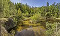
 See im Geotop Rhätsandsteinbruch nördlich von Buch, von Norden.jpg 9,794 × 5,560; 40.56 MB
-
 See im Geotop Rhätsandsteinbruch nördlich von Buch, von Nordosten 2.jpg 9,549 × 8,219; 49.84 MB
-
 See im Geotop Rhätsandsteinbruch nördlich von Buch, von Nordosten 3.jpg 6,000 × 4,000; 15.3 MB
-
 See im Geotop Rhätsandsteinbruch nördlich von Buch, von Nordosten.jpg 6,165 × 7,312; 23.79 MB
-
 See im Geotop Rhätsandsteinbruch nördlich von Buch, von Süden.jpg 5,939 × 5,491; 20.43 MB
-
 See im Geotop Rhätsandsteinbruch nördlich von Buch, von Südosten.jpg 5,967 × 7,541; 26.81 MB
-
 See im Geotop Rhätsandsteinbruch nördlich von Buch, Westseite von Osten.jpg 6,000 × 4,000; 15.93 MB
-
 See im Geotop Rhätsandsteinbruch nördlich von Buch, östliche Abbruchkante von Nordwesten 3.jpg 6,000 × 4,000; 14.29 MB
-
 See im Geotop Rhätsandsteinbruch nördlich von Buch, östliche Abbruchkante von Nordwesten.jpg 4,000 × 6,000; 13.39 MB
-
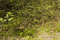
 Waldrand beim Geotop Rhätsandsteinbruch nördlich von Buch.jpg 6,000 × 4,000; 13.71 MB
-
 Wiese beim Geotop Rhätsandsteinbruch nördlich von Buch.jpg 6,000 × 4,000; 12.13 MB


