Category:Rhederoord
Jump to navigation
Jump to search
| Object location | | View all coordinates using: OpenStreetMap |
|---|
 | |||||
| Upload media | |||||
| Instance of | |||||
|---|---|---|---|---|---|
| Location | De Steeg, Rheden, Gelderland, Netherlands | ||||
| Has part(s) | |||||
| Heritage designation |
| ||||
 | |||||
|
This is a category about rijksmonumentcomplex number 519356
|
Media in category "Rhederoord"
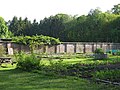
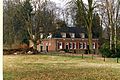
The following 11 files are in this category, out of 11 total.
-

-
 De Steeg, Hoofdstraat 1 RM 519357 foto2 2012-03-15 08.22.JPG 4,416 × 3,312; 8.67 MB
-
 De Steeg, monumentaal pand aan de Parkweg 21 foto6 2011-07-08 12.41.JPG 4,416 × 3,312; 8.6 MB
-
 De Steeg, Rhederoord hist aanleg RM519361 (1) bew.jpg 3,648 × 2,736; 2.8 MB
-
 DeSteeg-parkweg-196618.jpg 3,264 × 2,448; 3.5 MB
-
 DeSteeg-parkweg-196619.jpg 3,264 × 2,448; 3.04 MB
-
 Landschap bij het Huis Rhederoord in De Steeg, RP-P-OB-64.458.jpg 2,806 × 3,928; 2.17 MB
-
 Rhederoord koetshuis.jpg 2,208 × 1,476; 750 KB
-
 Rhederoord sequoiadendron.jpg 3,096 × 4,128; 8.69 MB
-
 Rhederoord, park - De Steeg - 20205108 - RCE.jpg 1,184 × 1,200; 361 KB
-
 Rhederoord, siervaas - De Steeg - 20205109 - RCE.jpg 1,200 × 1,195; 372 KB


_bew.jpg)


