Category:Rhenegge
Jump to navigation
Jump to search
| Object location | | View all coordinates using: OpenStreetMap |
|---|
borough of Diemelsee, Germany | |||||
| Upload media | |||||
| Instance of |
| ||||
|---|---|---|---|---|---|
| Location | Diemelsee, Waldeck-Frankenberg, Kassel Government Region, Hesse, Germany | ||||
| Area |
| ||||
| Elevation above sea level |
| ||||
 | |||||
Subcategories
This category has only the following subcategory.
E
Media in category "Rhenegge"
This category contains only the following file.
-
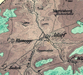 Adorf Map 1866.png 545 × 495; 635 KB
