Category:Rijksstraatweg 101, Baambrugge
Jump to navigation
Jump to search
| Object location | | View all coordinates using: OpenStreetMap |
|---|
building in De Ronde Venen, Netherlands  | |||||
| Upload media | |||||
| Instance of | |||||
|---|---|---|---|---|---|
| Location | Baambrugge, Utrecht, Netherlands | ||||
| Street address |
| ||||
| Located on street |
| ||||
| Heritage designation |
| ||||
 | |||||
|
This is a category about rijksmonument number 7025
|
| Address |
|
Media in category "Rijksstraatweg 101, Baambrugge"
The following 9 files are in this category, out of 9 total.
-
 Aanzicht - Baambrugge - 20026715 - RCE.jpg 1,200 × 1,200; 407 KB
-
 Baambrugge - Middelvaart RM7025.JPG 4,488 × 3,435; 2.23 MB
-
 Baambrugge, Middelvaart RM7025.jpg 3,648 × 2,736; 8.48 MB
-
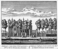 Gravure Middelvaart rond 1730.jpg 580 × 489; 303 KB
-
 Middelvaart Baambrugge met ijs.jpg 1,600 × 1,200; 427 KB
-
 Middelvaart met blauwe regen.jpg 1,600 × 1,200; 479 KB
-
 Middelvaart vanaf het ijs van de rivier de Angstel.jpg 1,200 × 1,600; 270 KB
-
 Middelvaart vanuit de lucht.jpg 1,600 × 900; 192 KB
-
 Zijgevel - Baambrugge - 20026716 - RCE.jpg 1,193 × 1,200; 389 KB


