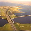
Category:Rijksweg 29
Jump to navigation
Jump to search
Nederlands: Afbeeldingen van de Rijksweg A29 een rijks- en autosnelweg in de provincie Zuid-Holland. Daarnaast wordt een gedeelte van de A 4 door Zuid-Holland en Noord-Brabant (het traject tussen Klaaswaal en Dinteloord) bewegwijzerd als A29
English: Pictures of Rijksweg 29 (A29) a Dutch motorway located in the province of South Holland in the Southwest of the Netherlands. Besides, a section of A 4 through South Holland and North Brabant (the section between Klaaswaal and Dinteloord) is signed as A29
freeway in the Netherlands | |||||
| Upload media | |||||
| Instance of |
| ||||
|---|---|---|---|---|---|
| Location | South Holland, Netherlands | ||||
| Transport network |
| ||||
| Maintained by | |||||
| Length |
| ||||
| Terminus | |||||
| Different from | |||||
| Partially coincident with | |||||
| |||||
Subcategories
This category has the following 5 subcategories, out of 5 total.
Media in category "Rijksweg 29"
The following 9 files are in this category, out of 9 total.
-
Haringvlietbrug2.jpg 433 × 430; 26 KB
-
KnooppuntHellegatsplein.PNG 225 × 261; 15 KB
-
A29 Rotterdam.jpg 2,592 × 1,944; 1.91 MB
-
Haringvlietbrug1a.jpg 2,499 × 1,582; 741 KB
-
Motor way A29 Barendrecht.JPG 4,928 × 3,264; 5.25 MB
-
NL-A29.png 557 × 288; 11 KB
-
NL-A29.svg 531 × 253; 5 KB
-
Oude Kreek A29.jpg 2,592 × 1,944; 1.87 MB
-
Rijksweg29.svg 801 × 924; 959 KB


