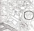
Category:Rione XI - Sant'Angelo
Zur Navigation springen
Zur Suche springen
Districts of Rome: Monti (I) · Trevi (II) · Colonna (III) · Campo Marzio (IV) · Ponte (V) · Parione (VI) · Regola (VII) · Sant’Eustachio (VIII) · Pigna (IX) · Campitelli (X) · Sant’Angelo (XI) · Ripa (XII) · Trastevere (XIII) · Borgo (XIV) · Esquilino (XV) · Ludovisi (XVI) · Sallustiano (XVII) · Castro Pretorio (XVIII) · Celio (XIX) · Testaccio (XX) · San Saba (XXI) · Prati (XXII)
Stadtteil von Rom | |||||
| Medium hochladen | |||||
| Ist ein(e) |
| ||||
|---|---|---|---|---|---|
| Ort |
| ||||
| Datum der Gründung, Erstellung, Entstehung, Erbauung |
| ||||
| Einwohnerzahl |
| ||||
| Fläche |
| ||||
 | |||||
Unterkategorien
Es werden 10 von insgesamt 10 Unterkategorien in dieser Kategorie angezeigt:
In Klammern die Anzahl der enthaltenen Kategorien (K), Seiten (S), Dateien (D)
A
B
F
G
P
S
U
Seiten in der Kategorie „Rione XI - Sant'Angelo“
Folgende 2 Seiten sind in dieser Kategorie, von 2 insgesamt.
Medien in der Kategorie „Rione XI - Sant'Angelo“
Folgende 9 Dateien sind in dieser Kategorie, von 9 insgesamt.
-
CoA Rione XI Sant'Angelo.svg 306 × 306; 4,35 MB
-
RioneSAngeloInRomaByMonaldini.jpg 541 × 486; 249 KB
-
Roma l tevere cenci.jpg 1.275 × 877; 307 KB
-
Roma Rione XI Sant'Angelo locator map.svg 555 × 489; 26 KB
-
Rome - Muni 1 - Angelo.PNG 796 × 618; 25 KB
-
Rome rione XI sant angelo (logo).svg 651 × 645; 131 KB
-
Rome rione XI sant angelo logo.png 651 × 645; 207 KB
-
Rome subdivisions locator map - R. XI Sant'Angelo.svg 799 × 832; 727 KB
-
Sant'Angelo banner.jpg 999 × 142; 126 KB


