Category:Rittergut Prestewitz
Jump to navigation
Jump to search
| Object location | | View all coordinates using: OpenStreetMap |
|---|
human settlement in Germany  | |||||
| Upload media | |||||
| Instance of | |||||
|---|---|---|---|---|---|
| Location | Uebigau-Wahrenbrück, Elbe-Elster District, Brandenburg, Germany | ||||
| Heritage designation | |||||
 | |||||
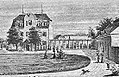
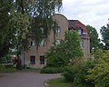
This is the category of the Brandenburger Baudenkmal (cultural heritage monument) with the ID 09135683 (Wikidata)
|
Media in category "Rittergut Prestewitz"
The following 5 files are in this category, out of 5 total.
-
 Gut Prestewitz19.jpg 1,729 × 1,406; 892 KB
-
 Karte Prestewitz01 Ausschnitt a.jpg 744 × 353; 151 KB
-
 Karte Prestewitz01 Ausschnitt b.jpg 549 × 353; 113 KB
-
 Karte Prestewitz01.jpg 996 × 620; 399 KB
-
 Rittergut Prestewitz 19 b.jpg 1,390 × 1,110; 418 KB


