Category:River-related diagrams
Jump to navigation
Jump to search
Subcategories
This category has the following 12 subcategories, out of 12 total.
*
C
D
- Diagrams of braided rivers (3 F)
- Diagrams of meanders (57 F)
- Diagrams of oxbow lakes (7 F)
- Diagrams of river banks (6 F)
- Diagrams of the Elbe (33 F)
O
R
- River delta diagrams (11 F)
- River length comparison diagrams (40 F)
Media in category "River-related diagrams"
The following 56 files are in this category, out of 56 total.
-

-

-
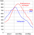 2013 Khabarovsk and Komsomolsk-na-Amure flood chart.svg 435 × 439; 116 KB
-
 Alluvial fan.jpg 3,356 × 1,012; 197 KB
-
 Alluvial plain general.PNG 720 × 960; 223 KB
-
 Bank types on a model map.PNG 1,020 × 640; 139 KB
-
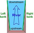 Banks left and right V2.jpg 239 × 231; 32 KB
-
 Classic-stream-order.png 1,347 × 619; 40 KB
-
 Classic-stream-order.svg 1,347 × 619; 2 KB
-
 Confronto torrente permanente temporaneo.jpg 567 × 507; 110 KB
-
 Cross-section of perstratic aluvium.JPG 2,219 × 1,311; 358 KB
-
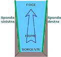 Destra sinistra idrografica.png 246 × 231; 27 KB
-
 Diagramme d'un estuaire.png 1,002 × 404; 16 KB
-
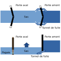 Ecluse a Sas.svg 900 × 900; 21 KB
-
 Esclusa de un canal.svg 900 × 900; 24 KB
-
 Flussanzapfung Schema ReiKi.png 1,290 × 806; 62 KB
-
 Geomorphology of Old River.jpg 959 × 847; 153 KB
-
 Gewaesserdiagramm.svg 3,200 × 2,200; 48 KB
-
 Schema Gierfähre.png 767 × 1,067; 33 KB
-
 Kasumitei.jpg 566 × 365; 80 KB
-
 L Fluss.jpg 787 × 270; 22 KB
-
 L Flussprofil.jpg 779 × 269; 20 KB
-
 Linkes rechtes ufer en.svg 396 × 356; 21 KB
-
 Lits d'un fleuve.png 825 × 388; 6 KB
-
 Meander Oxbow development.svg 250 × 677; 15 KB
-
 MéandresArtificialisationFleuvesFL.jpg 1,024 × 349; 64 KB
-
 Nuova raccolta d'autori, che trattano del moto dell'acque (1766) (14576776299).jpg 3,100 × 1,304; 772 KB
-
 Nuova raccolta d'autori, che trattano del moto dell'acque (1766) (14589607810).jpg 2,268 × 1,264; 470 KB
-
-
 Point bar.png 960 × 360; 296 KB
-
 Pont de Châtillon-sur-Loire (6).JPG 1,936 × 1,288; 1.14 MB
-
 Poster- Mängel herkömmlicher Abwassersysteme (deutsch) (2888418365).jpg 8,152 × 9,999; 3.42 MB
-
 PSM V69 D253 Cross section of a river valley.png 1,215 × 249; 18 KB
-
 River Bank Undercutting.pdf 1,183 × 858; 226 KB
-
 River banks left and right V1.jpg 233 × 213; 31 KB
-
 River Confluence & Distributary zh-hans.png 2,598 × 3,388; 262 KB
-
 River Confluence & Distributary zh-hant.png 2,598 × 3,388; 265 KB
-
 River scheme.svg 720 × 508; 147 KB
-
 Rives gauche et droite V1.jpg 250 × 213; 28 KB
-
 Rives gauche et droite V2.jpg 256 × 231; 31 KB
-
 Rives gauche et droite V3.jpg 256 × 231; 35 KB
-
 Rivierbedding.gif 390 × 225; 14 KB
-
 SAIH.jpg 506 × 340; 46 KB
-
 Schaardijk.png 374 × 72; 2 KB
-
 Schema Gierfähre.svg 512 × 585; 59 KB
-
 Schnarch-Egal-Index.GIF 1,047 × 715; 28 KB
-
 Scolmatore1.jpg 736 × 308; 20 KB
-
 Scolmatore2.jpg 728 × 316; 31 KB
-
 Slip-off slope diagram.svg 512 × 396; 35 KB
-
 Strahler-stream-order.png 1,346 × 615; 38 KB
-
 Stream capture.png 320 × 480; 22 KB
-
 Thomas Sterling - Map of Comparative River Lengths.jpg 5,037 × 6,138; 9.97 MB
-
 Toplak.JPG 201 × 373; 6 KB
-
 Vazuza hydrotechnical system.svg 1,040 × 320; 127 KB
-
 Vodskok1.png 1,005 × 1,221; 27 KB
-
 Yoshida-river siphon(sectional drawing).png 800 × 334; 61 KB
.jpg)


_(14576776299).jpg)
_(14589607810).jpg)

.JPG)
_(2888418365).jpg)


.png)