Category:River Aire at Ferrybridge
Jump to navigation
Jump to search
Subcategories
This category has the following 5 subcategories, out of 5 total.
A
- A162 bridge, Ferrybridge (26 F)
B
- Brotherton railway bridge (14 F)
F
J
- John Carr's bridge, Ferrybridge (32 F)
T
- The Golden Lion, Ferrybridge (10 F)
Media in category "River Aire at Ferrybridge"
The following 48 files are in this category, out of 48 total.
-
 All's quiet on the power front - geograph.org.uk - 5652087.jpg 4,608 × 3,456; 2.4 MB
-
 Almost gone ^ - geograph.org.uk - 5656875.jpg 4,608 × 3,456; 3.84 MB
-

-
 Boat mooring pontoon - geograph.org.uk - 5674054.jpg 1,600 × 1,067; 468 KB
-
 Brotherton Bound - geograph.org.uk - 5656902.jpg 4,608 × 3,456; 3.55 MB
-
 Dredging the lock entrance - geograph.org.uk - 5651819.jpg 4,608 × 3,456; 3.21 MB
-
 Ferrybridge 'Flyover' Bridge - geograph.org.uk - 225094.jpg 640 × 423; 57 KB
-
 Ferrybridge at sunset - geograph.org.uk - 5652095.jpg 4,608 × 3,456; 1.53 MB
-
 Ferrybridge lock - geograph.org.uk - 579163.jpg 640 × 427; 99 KB
-
 Ferrybridge Power Station - geograph.org.uk - 3405426.jpg 3,628 × 2,721; 2.54 MB
-
 Ferrybridge Power Station Old Generating Hall - geograph.org.uk - 3405477.jpg 3,420 × 2,565; 2.13 MB
-
 Ferrybridge West Yorks 1797 River Aire (old) A1(T).jpg 3,072 × 2,048; 4.11 MB
-
 Ferrybridge, Knottingley WF11, UK - panoramio.jpg 2,592 × 1,952; 1.08 MB
-
 Footpath between canal and river Aire at Ferrybridge - geograph.org.uk - 6148029.jpg 3,889 × 2,876; 3.7 MB
-
 Lazy Daze on the river - geograph.org.uk - 5666182.jpg 4,608 × 3,456; 4.78 MB
-

-
 Making ripples - geograph.org.uk - 2694966.jpg 1,600 × 1,049; 244 KB
-
 Messing about on the river - geograph.org.uk - 5656872.jpg 4,608 × 3,456; 3.6 MB
-

-
 Narrowboat "Milly Molly Mandy" - geograph.org.uk - 2694943.jpg 1,600 × 1,047; 399 KB
-
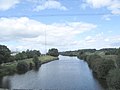
 Newly erected communications mast - geograph.org.uk - 2694952.jpg 1,176 × 1,600; 266 KB
-
 North from Ferrybridge - geograph.org.uk - 462450.jpg 640 × 384; 51 KB
-
 Old and new at Ferrybridge - geograph.org.uk - 579148.jpg 640 × 403; 100 KB
-
 Old and new at Ferrybridge - geograph.org.uk - 579159.jpg 630 × 416; 74 KB
-
 Old and new at Ferrybridge - geograph.org.uk - 579162.jpg 636 × 418; 109 KB
-
 Outfall, River Aire, Brotherton Ings - geograph.org.uk - 4580268.jpg 1,024 × 768; 167 KB
-
 Past Reflections - geograph.org.uk - 6017600.jpg 4,608 × 3,072; 4.04 MB
-
 Pipe bridge, Ferrybridge B power station - geograph.org.uk - 4580251.jpg 1,024 × 768; 131 KB
-
 Power silhouette - geograph.org.uk - 6017613.jpg 4,608 × 3,072; 2.56 MB
-
 Power station stockpile part 2 - geograph.org.uk - 2794991.jpg 2,435 × 2,803; 1,015 KB
-
 Redundant Power Station - geograph.org.uk - 5647114.jpg 4,121 × 2,584; 2.56 MB
-
 River Aire - geograph.org.uk - 3357074.jpg 640 × 427; 63 KB
-
-
 The Aire and Calder Navigation at Fairburn - geograph.org.uk - 5973103.jpg 3,391 × 1,906; 1.4 MB
-

-
 The Aire and Calder Navigation Canal at Ferrybridge - geograph.org.uk - 3739006.jpg 3,648 × 2,736; 3.73 MB
-
 The barge "Wheldale" heading upstream - geograph.org.uk - 3405516.jpg 2,907 × 2,178; 1.36 MB
-

-
 The boundary between West and North Yorkshire - geograph.org.uk - 4580258.jpg 1,024 × 768; 147 KB
-
 The dark clouds gather - geograph.org.uk - 6017621.jpg 4,608 × 3,072; 1.67 MB
-
 The old and the New - geograph.org.uk - 5649789.jpg 4,608 × 3,072; 2.44 MB
-
 The River Aire and Ferrybridge Power Station - geograph.org.uk - 2803007.jpg 2,930 × 3,213; 2.09 MB
-
 The River Aire and Ferrybridge Power Station - geograph.org.uk - 3640371.jpg 4,288 × 3,216; 1.9 MB
-
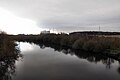
 The River Aire at Ferrybridge - geograph.org.uk - 4120517.jpg 1,600 × 1,064; 519 KB
-
 The river Aire at Ferrybridge - geograph.org.uk - 5652080.jpg 3,906 × 2,689; 1.8 MB
-
 The River Aire at Ferrybridge - geograph.org.uk - 579154.jpg 640 × 427; 71 KB
-
 The River Aire at Ferrybridge B power station - geograph.org.uk - 4557830.jpg 1,024 × 768; 157 KB
-
 Topping up the Stockpile - geograph.org.uk - 2794970.jpg 2,600 × 1,733; 625 KB


_A1(T).jpg)


