Category:River Medway
Aller à la navigation
Aller à la recherche
English: The River Medway divides the county of Kent, south-east England into east and west. It emerges into the Thames Estuary between the Hoo Peninsula and Isle of Sheppey.
rivière du Mid Sussex, Angleterre, Royaume-Uni  | |||||
| Téléverser des médias | |||||
| Nature de l’élément | |||||
|---|---|---|---|---|---|
| Lieu |
| ||||
| Longueur |
| ||||
| Source | |||||
| Se jette dans | |||||
| Affluent |
| ||||
 | |||||
Sous-catégories
Cette catégorie comprend 26 sous-catégories, dont les 26 ci-dessous.
B
- Battle of the Medway (1 F)
- Broomhill Park Medway views (15 F)
C
E
G
- Gillingham, Victory Pier (26 F)
H
- Holborough Stream (1 F)
M
- Maps of the River Medway (16 F)
- Medway Valley Walk (64 F)
P
- Parsonage Farm Oast, Yalding (13 F)
R
- Raid on the Medway (116 F)
- River Medway in Rochester (77 F)
T
- Temple Manor (18 F)
- Thames barges on the Medway (578 F)
W
- Wateringbury Stream (6 F)
Média dans la catégorie « River Medway »
Cette catégorie comprend 809 fichiers, dont les 200 ci-dessous.
(page précédente) (page suivante)-
 A distributary of the River Medway - geograph.org.uk - 2732124.jpg 640 × 430 ; 127 kio
-
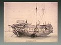 A ship at Chatham docks, Kent. Lithograph. Wellcome V0012454.jpg 648 × 486 ; 78 kio
-
 A view of Fort Amherst & the River Medway.jpg 4 048 × 3 036 ; 4,54 Mio
-
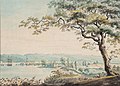 A View on the Medway - Joseph Farington - ref Farington-K07754.jpg 2 250 × 1 606 ; 555 kio
-
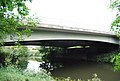
 A21 Flyover - geograph.org.uk - 1526430.jpg 640 × 430 ; 133 kio
-
 A21 flyover across Haysden Lake - geograph.org.uk - 1526332.jpg 640 × 430 ; 106 kio
-
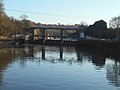
 A228 bridge, River Medway - geograph.org.uk - 2740109.jpg 640 × 430 ; 78 kio
-
 HMS Abercrombie (F109).jpg 800 × 596 ; 39 kio
-
 Across the Medway, East Farleigh, Kent - geograph.org.uk - 187913.jpg 640 × 480 ; 345 kio
-
 Allington - Barges - River Medway.jpg 600 × 737 ; 611 kio
-
 Allington Lock - geograph.org.uk - 1230.jpg 640 × 480 ; 58 kio
-
 Allington Sluices 01.jpg 5 152 × 3 864 ; 4,33 Mio
-
 Allington Sluices 02.jpg 5 152 × 3 864 ; 4,41 Mio
-
 Allington Sluices 03.jpg 5 152 × 3 864 ; 4,32 Mio
-
 Allington Sluices 04.jpg 5 152 × 3 864 ; 4,33 Mio
-
 Allington Sluices 05.jpg 5 152 × 3 864 ; 4,43 Mio
-
 Allington Sluices 06.jpg 3 864 × 5 152 ; 11,23 Mio
-
 AllingtonLock2.JPG 2 016 × 1 512 ; 720 kio
-
 Archaeological excavation of gunpowder works - geograph.org.uk - 935307.jpg 640 × 480 ; 324 kio
-
 Archbishop Palace and All Saints Maidstone.jpg 6 000 × 4 000 ; 9,31 Mio
-
 Archbishops Palace in the sunshine - geograph.org.uk - 1135629.jpg 482 × 640 ; 71 kio
-
-

-
 Aylesford at night.jpg 1 600 × 1 200 ; 416 kio
-
 Aylesford Kent - Flickr - John K Thorne.jpg 5 472 × 3 648 ; 11,42 Mio
-
 Aylesford's Medieval bridge - panoramio.jpg 4 288 × 2 848 ; 7,8 Mio
-
 Aylesford, Kent 06.jpg 5 152 × 3 864 ; 4,3 Mio
-
 Aylesford, Kent 07.jpg 5 152 × 3 864 ; 4,32 Mio
-
 Aylesford, Kent 08.jpg 5 152 × 3 864 ; 9,03 Mio
-
 Aylesford, Kent 10.jpg 5 152 × 3 864 ; 9,26 Mio
-
 Aylesford, Kent 11.jpg 5 152 × 3 864 ; 7,92 Mio
-
 Balconies over the Botany - geograph.org.uk - 1200121.jpg 640 × 430 ; 87 kio
-
 Bank maintenance, River Medway - geograph.org.uk - 1159149.jpg 640 × 430 ; 114 kio
-
 Banks of the River Medway, Halling - geograph.org.uk - 1467267.jpg 640 × 480 ; 104 kio
-
 Banks of the River Medway, near Wouldham - geograph.org.uk - 1467243.jpg 640 × 480 ; 51 kio
-
 Barden Park Rd Allotments (2) - geograph.org.uk - 1199654.jpg 640 × 430 ; 113 kio
-
 Barming Bridge - geograph.org.uk - 1265816.jpg 640 × 430 ; 92 kio
-
 Below the East Peckham bypass (A228) - geograph.org.uk - 2740108.jpg 640 × 430 ; 57 kio
-
 Bench by the River Medway - geograph.org.uk - 1199612.jpg 640 × 430 ; 122 kio
-
 Bench by the River Medway, Haysden Country Park - geograph.org.uk - 1502579.jpg 640 × 430 ; 171 kio
-

-

-

-
 BlueBellHill0002.JPG 2 048 × 1 536 ; 765 kio
-
 BlueBellHill0003.JPG 2 048 × 1 536 ; 746 kio
-
 BlueBellHill0005.JPG 2 048 × 1 536 ; 767 kio
-
 BlueBellHill000P.jpg 3 294 × 1 191 ; 1,69 Mio
-
 Boat by Barming Bridge - geograph.org.uk - 1265814.jpg 640 × 430 ; 71 kio
-
 Boat moored on the Medway - geograph.org.uk - 1603378.jpg 640 × 522 ; 105 kio
-

-
 Boat winch near Yalding - geograph.org.uk - 1267454.jpg 640 × 430 ; 87 kio
-
 Boats at anchor on the River Medway - geograph.org.uk - 1603092.jpg 640 × 414 ; 75 kio
-
 Boats moored in the Medway - geograph.org.uk - 1603103.jpg 640 × 363 ; 73 kio
-
 Boats Moored near Yalding, River Medway (2) - geograph.org.uk - 1267443.jpg 640 × 430 ; 87 kio
-
 Boats Moored near Yalding, River Medway - geograph.org.uk - 1267438.jpg 640 × 430 ; 79 kio
-
 Boats moored on the Medway - geograph.org.uk - 1603113.jpg 640 × 406 ; 65 kio
-
 Boats moored on the Medway - geograph.org.uk - 1603361.jpg 640 × 430 ; 100 kio
-
 Boats moored on the Medway - geograph.org.uk - 1603439.jpg 640 × 430 ; 99 kio
-
 Boats moored on the Medway - geograph.org.uk - 1609787.jpg 640 × 429 ; 51 kio
-

-
 Boats on Medway below Tonbridge Castle.JPG 2 048 × 1 536 ; 1,59 Mio
-
 Boats on River Medway at Sandling - geograph.org.uk - 1354220.jpg 640 × 427 ; 95 kio
-
 Boats on the Medway, Strood - geograph.org.uk - 1346246.jpg 640 × 480 ; 84 kio
-
 Boats on the River Medway - geograph.org.uk - 1603456.jpg 640 × 284 ; 60 kio
-

-
 Botany Stream in Tonbridge - geograph.org.uk - 175035.jpg 640 × 480 ; 99 kio
-
 Botany Stream, Tonbridge High St - geograph.org.uk - 1126106.jpg 640 × 430 ; 78 kio
-
-
 Bradley's Mill, Speldhurst.jpg 640 × 478 ; 98 kio
-

-
 Breakwater on the River Medway - geograph.org.uk - 1743149.jpg 3 488 × 2 616 ; 2,08 Mio
-
 Bridge by the River Medway, The Wealdway - geograph.org.uk - 1502002.jpg 640 × 430 ; 198 kio
-
 Bridge in the trees - geograph.org.uk - 2740119.jpg 640 × 430 ; 128 kio
-
 Bridge over the Gas or Ks Stream, Tonbridge - geograph.org.uk - 2648490.jpg 2 816 × 2 112 ; 1,86 Mio
-
 Bridge over the River Medway - geograph.org.uk - 2732104.jpg 640 × 430 ; 83 kio
-
 Brown River Medway - geograph.org.uk - 1200418.jpg 640 × 481 ; 88 kio
-
 Burham Marsh and River Medway.jpg 4 896 × 3 672 ; 6,79 Mio
-
 Bydews Wood across the River Medway (2) - geograph.org.uk - 1264948.jpg 640 × 430 ; 86 kio
-
 Bydews Wood across the River Medway (3) - geograph.org.uk - 1265005.jpg 640 × 430 ; 73 kio
-
 Bydews Wood across the River Medway (4) - geograph.org.uk - 1265029.jpg 640 × 430 ; 78 kio
-
 Bydews Wood across the River Medway - geograph.org.uk - 1264930.jpg 640 × 430 ; 64 kio
-
 Cannon Wharf - geograph.org.uk - 1540348.jpg 640 × 430 ; 142 kio
-
 Canoe Pass at East Lock - geograph.org.uk - 4606216.jpg 640 × 480 ; 80 kio
-
 Canoe slide, East Lock - geograph.org.uk - 2730685.jpg 640 × 430 ; 78 kio
-
 Canoe slide, Oak Weir Lock - geograph.org.uk - 2730718.jpg 640 × 430 ; 86 kio
-
 Canoe view of Ford Green Bridge - geograph.org.uk - 4606222.jpg 640 × 480 ; 78 kio
-
 Canoe view of Mill Stream - geograph.org.uk - 4606207.jpg 480 × 640 ; 130 kio
-
 Canoe view of the River Medway - geograph.org.uk - 4606199.jpg 480 × 640 ; 81 kio
-
 Canoe view of the River Medway - geograph.org.uk - 4606203.jpg 480 × 640 ; 92 kio
-
 Canoe view of the River Medway - geograph.org.uk - 4606205.jpg 480 × 640 ; 58 kio
-
 Canoe view of the River Medway - geograph.org.uk - 4606208.jpg 480 × 640 ; 35 kio
-
 Canoe view of the River Medway - geograph.org.uk - 4606211.jpg 480 × 640 ; 50 kio
-
 Canoe view of the River Medway - geograph.org.uk - 4606212.jpg 480 × 640 ; 38 kio
-
 Canoe view of the River Medway - geograph.org.uk - 4606213.jpg 480 × 640 ; 37 kio
-
 Canoe view of the River Medway - geograph.org.uk - 4606214.jpg 640 × 480 ; 59 kio
-
 Canoe view of the River Medway - geograph.org.uk - 4606219.jpg 480 × 640 ; 53 kio
-
 Canoe view of the River Medway - geograph.org.uk - 4606220.jpg 480 × 640 ; 73 kio
-
 Canoe view of the River Medway - geograph.org.uk - 4606223.jpg 480 × 640 ; 82 kio
-
 Canoe view of the River Medway - geograph.org.uk - 4606224.jpg 480 × 640 ; 56 kio
-
 Canoe view of the River Medway - geograph.org.uk - 4606226.jpg 480 × 640 ; 59 kio
-
 Canoe view of the River Medway - geograph.org.uk - 4606231.jpg 480 × 640 ; 72 kio
-
 Canoe view of the River Medway - geograph.org.uk - 4606233.jpg 640 × 480 ; 85 kio
-
 Canoe view of the River Medway - geograph.org.uk - 4606235.jpg 480 × 640 ; 80 kio
-
 Canoe view of the River Medway - geograph.org.uk - 4606237.jpg 640 × 480 ; 63 kio
-
 Canoe view of the River Medway - geograph.org.uk - 4606238.jpg 640 × 480 ; 79 kio
-
 Canoe view of the River Medway - geograph.org.uk - 4606240.jpg 640 × 480 ; 79 kio
-
 Canoe view of the River Medway - geograph.org.uk - 4606243.jpg 480 × 640 ; 65 kio
-
 Canoe view of the River Medway - geograph.org.uk - 4606244.jpg 480 × 640 ; 83 kio
-
 Canoe view of the River Medway - geograph.org.uk - 4606246.jpg 640 × 480 ; 70 kio
-
 Canoist in the River Medway - geograph.org.uk - 1344721.jpg 640 × 480 ; 88 kio
-
 Canoists in the River Medway - geograph.org.uk - 1344706.jpg 640 × 480 ; 87 kio
-
 Canon Bridge, Tonbridge. - geograph.org.uk - 1040448.jpg 640 × 430 ; 91 kio
-
 Chafford Weir - geograph.org.uk - 1550153.jpg 640 × 430 ; 182 kio
-
 Chafford Weir from upstream - geograph.org.uk - 1550171.jpg 640 × 430 ; 158 kio
-

-
 Charles Dickens and Rochester (1880) (14788138483).jpg 1 660 × 932 ; 292 kio
-
 Chatham & River Medway from Amherst Fort - panorama.jpg 7 128 × 2 264 ; 3,02 Mio
-
 Chatham & River Medway from Amherst Fort 1.jpg 4 048 × 3 036 ; 2,02 Mio
-
 Chatham & River Medway from Amherst Fort 2.jpg 4 048 × 3 036 ; 3,4 Mio
-
 Chatham & River Medway from Amherst Fort 3.jpg 4 048 × 3 036 ; 3,51 Mio
-
 Chatham & River Medway from Amherst Fort 4.jpg 4 048 × 3 036 ; 4,53 Mio
-
 Chatham & River Medway from Amherst Fort 5.jpg 4 048 × 3 036 ; 2,54 Mio
-
 Chatham & River Medway from Amherst Fort 6.jpg 4 048 × 3 036 ; 2,05 Mio
-
 Chatham church across the River Medway - geograph.org.uk - 1148157.jpg 640 × 430 ; 47 kio
-
 Chatham Docks - geograph.org.uk - 846543.jpg 640 × 480 ; 41 kio
-
 Chatham Reach, Kent, by Daniel Turner KT HDCH 02 004.jpg 1 200 × 988 ; 205 kio
-
 Chatham riverfront in Winter - geograph.org.uk - 1671788.jpg 2 580 × 1 932 ; 1,05 Mio
-
 Chatham Town Centre - geograph.org.uk - 292458.jpg 640 × 480 ; 80 kio
-
 ChathamAmherst.jpg 2 613 × 1 391 ; 3,43 Mio
-
 ChathamAmherst6650.JPG 2 048 × 1 536 ; 752 kio
-
 ChathamAmherst6651.JPG 2 048 × 1 536 ; 741 kio
-
 ChathamHDDryDock0085.JPG 2 016 × 1 512 ; 690 kio
-
 ChathamHDGalvanising0004.JPG 2 016 × 1 512 ; 1,02 Mio
-
 ChathamHDGalvanising0006.JPG 2 016 × 1 512 ; 878 kio
-
 ChathamHDJoiners0068.JPG 2 016 × 1 512 ; 696 kio
-
 ChathamHDStables0031.JPG 2 016 × 1 512 ; 747 kio
-
 ChathamHDY Muster Bell 3144.JPG 1 512 × 2 016 ; 602 kio
-
 ChathamHDY Thunderbolt 3108.JPG 2 016 × 1 512 ; 725 kio
-
 ChathamHDY0010.JPG 2 016 × 1 512 ; 866 kio
-
 ChathamHDY0016.JPG 2 016 × 1 512 ; 861 kio
-
 ChathamHDY0022.JPG 2 016 × 1 512 ; 853 kio
-
 ChathamHDY0049.JPG 2 016 × 1 512 ; 760 kio
-
 ChathamHDY0050.JPG 2 016 × 1 512 ; 693 kio
-
 ChathamHDY0063.JPG 2 016 × 1 512 ; 772 kio
-
 ChathamHDYAQHO3106.JPG 2 016 × 1 512 ; 799 kio
-
 ChathamHDYBrunel0004.JPG 2 016 × 1 512 ; 767 kio
-
 ChathamHDYChurch0006.JPG 2 016 × 1 512 ; 744 kio
-
 ChathamHDYChurch0008.JPG 2 016 × 1 512 ; 791 kio
-
 ChathamHDYCoveredS0004.JPG 2 016 × 1 512 ; 885 kio
-
 ChathamHDYCoveredS0005.JPG 2 011 × 1 241 ; 612 kio
-
 ChathamHDYCoveredS0007.JPG 2 016 × 1 512 ; 769 kio
-
 ChathamHDYGate0009.JPG 2 016 × 1 512 ; 763 kio
-
 ChathamHDYIceHouse0006.JPG 2 016 × 1 512 ; 717 kio
-
 ChathamHDYIceHouse0009.JPG 2 016 × 1 512 ; 746 kio
-
 ChathamHDYLowerBoatHouse3101.JPG 2 016 × 1 512 ; 750 kio
-
 ChathamHDYOfficersTerr0006.JPG 2 016 × 1 512 ; 695 kio
-
 ChathamHDYOfficersTerr0007.JPG 2 016 × 1 512 ; 707 kio
-
 ChathamHDYOfficersTerr0012.JPG 2 016 × 1 512 ; 785 kio
-
 ChathamHDYOfficersTerr0013.JPG 2 016 × 1 512 ; 658 kio
-
 ChathamHDYOfficersTerr0014.JPG 2 016 × 1 512 ; 666 kio
-
 ChathamHDYSail0004.JPG 2 016 × 1 512 ; 753 kio
-
 ChathamHDYSail0005.JPG 2 016 × 1 512 ; 761 kio
-
 ChathamMedway.jpg 862 × 524 ; 433 kio
-
 ChathamMedway2644.JPG 2 016 × 1 512 ; 784 kio
-
 ChathamMedway2645.JPG 2 016 × 1 512 ; 761 kio
-
 ChathamMedway2646.JPG 2 016 × 1 512 ; 728 kio
-
 ChathamMedway2647.JPG 2 016 × 1 512 ; 707 kio
-
 ChathamMedway2648.JPG 2 016 × 1 512 ; 768 kio
-
 ChathamMedway2654.JPG 2 016 × 1 512 ; 807 kio
-
 ChathamMedway2655.JPG 2 016 × 1 512 ; 777 kio
-
 ChathamMedway2656.JPG 2 016 × 1 512 ; 785 kio
-
 ChathamMedway2657.JPG 2 016 × 1 512 ; 722 kio
-
 ChathamMedway2660.JPG 2 016 × 1 512 ; 811 kio
-
 ChathamMedway2663.JPG 2 016 × 1 512 ; 728 kio
-
 ChathamMedwaySwans2669.JPG 2 016 × 1 512 ; 669 kio
-
 ChathamReach4234.JPG 2 048 × 1 536 ; 779 kio
-
 ChathamSunPier4162.JPG 2 048 × 1 536 ; 787 kio
-
 ChathamSunPier4163.JPG 2 048 × 1 536 ; 788 kio
-
 ChathamSunPier4164.JPG 2 048 × 1 536 ; 794 kio
-
 ChathamSunPier4165.JPG 2 048 × 1 536 ; 780 kio
-
 ChathamSunPier4166.JPG 2 048 × 1 536 ; 781 kio
-
 ChathamSunPier4167.JPG 2 048 × 1 536 ; 796 kio
-
 ChathamSunPier4167P.JPG 7 002 × 1 500 ; 1,91 Mio
-
 ChathamSunPier4169.JPG 2 048 × 1 536 ; 797 kio
-
 ChathamSunPier4170.JPG 2 048 × 1 536 ; 847 kio
-
 ChathamSunPier4171.JPG 2 048 × 1 536 ; 802 kio
-
 ChathamSunPier4172.JPG 2 048 × 1 536 ; 788 kio
-
 ChathamSunPier4174.JPG 2 048 × 1 536 ; 794 kio
-

-
 Circle of Life - geograph.org.uk - 1217688.jpg 640 × 480 ; 129 kio
-
 Closed Sluice Gates near East Lock - geograph.org.uk - 1345022.jpg 640 × 480 ; 72 kio
-
 Coastal Pill Box on the River Medway - geograph.org.uk - 150850.jpg 640 × 480 ; 119 kio
-
 Cobtree Wharf.jpg 5 152 × 3 864 ; 4,39 Mio
-
 Conveyor belt crossing the River Medway - geograph.org.uk - 1159055.jpg 640 × 430 ; 113 kio
-
 Coppiced trees by the River Medway - geograph.org.uk - 1159047.jpg 640 × 430 ; 126 kio
-
 Crane ship in the River Medway - geograph.org.uk - 1671784.jpg 2 580 × 1 932 ; 869 kio
-
 Cruise boat on the River Medway - geograph.org.uk - 1512457.jpg 640 × 430 ; 148 kio
-
 Distributary of the River Medway - geograph.org.uk - 1526298.jpg 640 × 430 ; 191 kio
-

-
 Downstream from Peters Bridge 8409.jpg 4 604 × 2 800 ; 1,7 Mio


.jpg)


_-_geograph.org.uk_-_1199654.jpg)

_-_geograph.org.uk_-_2740108.jpg)


_-_geograph.org.uk_-_1267443.jpg)


_-_geograph.org.uk_-_1264948.jpg)
_-_geograph.org.uk_-_1265005.jpg)
_-_geograph.org.uk_-_1265029.jpg)


_(14788138483).jpg)


