Category:River Ouse at Naburn
Jump to navigation
Jump to search
Subcategories
This category has the following 5 subcategories, out of 5 total.
Media in category "River Ouse at Naburn"
The following 42 files are in this category, out of 42 total.
-
 Approach to Naburn Bridge - geograph.org.uk - 1512256.jpg 640 × 480; 60 KB
-
 Downstream from Naburn Bridge - geograph.org.uk - 3320353.jpg 4,300 × 2,160; 1.04 MB
-
 Downstream from Naburn Bridge - geograph.org.uk - 3834476.jpg 640 × 480; 57 KB
-
 Early morning at Naburn - geograph.org.uk - 5189.jpg 640 × 480; 35 KB
-
 Entrance to Naburn Marina - geograph.org.uk - 5149339.jpg 1,024 × 614; 157 KB
-
 Entrance to York Marina - geograph.org.uk - 1512252.jpg 640 × 480; 78 KB
-
 House at Naburn Grange, seen from the River Ouse - geograph.org.uk - 5148517.jpg 1,024 × 768; 201 KB
-
 Houses in Ferry Farm Close, Naburn - geograph.org.uk - 5149233.jpg 1,024 × 768; 177 KB
-
 Lock Reach, River Ouse - geograph.org.uk - 5148505.jpg 1,024 × 615; 103 KB
-
 Logs by the riverside - geograph.org.uk - 6343050.jpg 1,280 × 1,280; 590 KB
-
 Logs by the riverside - geograph.org.uk - 6343051.jpg 1,280 × 960; 537 KB
-
 Naburn Reach, River Ouse - geograph.org.uk - 5149226.jpg 1,024 × 614; 128 KB
-
 Naburn, River Ouse - geograph.org.uk - 270002.jpg 640 × 426; 75 KB
-
 Naburn. Disused barge on the River Ban. - geograph.org.uk - 230996.jpg 423 × 640; 121 KB
-
 Ouse at Naburn - geograph.org.uk - 2734568.jpg 640 × 480; 62 KB
-
 Ouse from Naburn bridge - geograph.org.uk - 2734569.jpg 640 × 480; 68 KB
-
 Ouse from Naburn Bridge - geograph.org.uk - 6783662.jpg 1,024 × 683; 384 KB
-
 Red sails in the sun - geograph.org.uk - 1512262.jpg 480 × 640; 100 KB
-
 River Ouse - geograph.org.uk - 6342426.jpg 1,280 × 960; 363 KB
-
 River Ouse - geograph.org.uk - 821521.jpg 640 × 480; 53 KB
-
 River Ouse at Naburn. - geograph.org.uk - 211308.jpg 640 × 480; 80 KB
-
 River Ouse from Naburn Bridge - geograph.org.uk - 2648539.jpg 1,600 × 1,200; 221 KB
-
 River Ouse from Naburn Bridge - geograph.org.uk - 3717948.jpg 640 × 427; 79 KB
-
 River Ouse from Naburn Bridge - geograph.org.uk - 3851305.jpg 640 × 480; 78 KB
-
 River Ouse from Naburn Bridge - geograph.org.uk - 5766587.jpg 640 × 427; 198 KB
-
 River Ouse toward Naburn - geograph.org.uk - 2376041.jpg 3,264 × 2,448; 1.23 MB
-
 River Ouse, south of Naburn Bridge - geograph.org.uk - 4107081.jpg 1,600 × 1,064; 875 KB
-
 Riverbank moorings near Naburn Marina - geograph.org.uk - 5149345.jpg 1,024 × 615; 127 KB
-
 Sailing on the Ouse - geograph.org.uk - 5949890.jpg 683 × 1,024; 428 KB
-
 Slipway at Naburn - geograph.org.uk - 6342407.jpg 1,280 × 960; 326 KB
-

-
 The Ouse at Naburn - geograph.org.uk - 6342408.jpg 1,280 × 960; 335 KB
-
 The River Ouse at Naburn - geograph.org.uk - 4105579.jpg 1,600 × 1,064; 891 KB
-
 The River Ouse at Naburn Bridge - geograph.org.uk - 5079228.jpg 800 × 483; 65 KB
-
 The River Ouse south of Naburn Bridge - geograph.org.uk - 4107037.jpg 1,600 × 1,064; 515 KB
-
 The River Ouse, Naburn Reach - geograph.org.uk - 5638820.jpg 1,024 × 768; 151 KB
-
 The River Ouse, north of Naburn - geograph.org.uk - 5149246.jpg 1,024 × 614; 108 KB
-
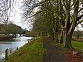 Towpath at Naburn - geograph.org.uk - 6343047.jpg 1,280 × 960; 548 KB
-
 Upstream from Naburn Bridge - geograph.org.uk - 3320364.jpg 4,320 × 2,160; 1.27 MB
-
 Upstream from Naburn Bridge - geograph.org.uk - 3834469.jpg 640 × 480; 53 KB
-
 Yachts on the Ouse - geograph.org.uk - 5949889.jpg 1,024 × 683; 504 KB
-
 York Marina on the River Ouse - geograph.org.uk - 4107083.jpg 1,600 × 1,064; 759 KB


