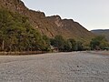
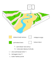
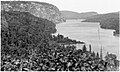
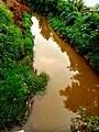
Category:Rivers
둘러보기로 이동
검색으로 이동

자연적으로 생겨난 물길 .jpg) | |||||
| 미디어 올리기 | |||||
| 발음 (음성 파일) | |||||
|---|---|---|---|---|---|
| 다음 종류에 속함 |
| ||||
| 다음의 하위 개념임 |
| ||||
| 다음의 한 부분임 |
| ||||
| 용도 | |||||
| 다음으로 이루어져 있음 | |||||
| 다음과 다름 | |||||
| 다음과 같다고 여겨짐 | perennial stream | ||||
| 다음과 일부가 일치 | |||||
| |||||
Deutsch: Flüsse sind größere Fließgewässer.
English: Rivers are large flowing bodies of water.
Esperanto: Riveroj.
Español: Los ríos son corrientes naturales de agua que fluyen con continuidad.
Français : Les cours d'eau sont des chenaux dans lesquels s'écoulent des flux d'eau.
Italiano: I fiumi sono canali naturali in cui l'acqua scorre con continuità.
日本語: 河川に関するカテゴリ。
Polski: Rzeki są wielkimi płynącymi akwenami.
ไทย: แม่น้ำ เป็นทางน้ำธรรมชาติที่มีขนาดใหญ่
Slovenščina: Reke so veliki vodotoki.
Українська: Річка — великий природний водний потік, що тече під дією сили тяжіння.
하위 분류
다음은 이 분류에 속하는 하위 분류 112개 가운데 112개입니다.
*
+
- Long exposures (rivers) (415 F)
.
?
A
B
- River backwaters (3 F)
- Bridges within rivers (6 F)
C
D
E
- Entrenched rivers (4 F)
F
G
H
I
L
- Log booms (39 F)
M
- Misfit river (4 F)
N
P
R
- Rain in rivers (4 F)
- River deoxygenation (2 F)
- Riverbed farming (2 F)
S
- Shut-ins (4 F)
- Stream offsets (3 F)
T
U
- Urban rivers (46 F)
W
"Rivers" 분류에 속하는 미디어
다음은 이 분류에 속하는 파일 588개 가운데 200개입니다.
(이전 페이지) (다음 페이지)-
De-Fluss.ogg 0.8 s; 15 KB
-
De-Fluss2.ogg 1.7 s; 16 KB
-
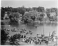
 20230718050548 IMG 3165.jpg 6,960 × 4,640; 3.99 MB
-
 20230924 183033sabinas.jpg 4,032 × 3,024; 7.38 MB
-
 A boat man.jpg 4,496 × 3,000; 7.03 MB
-
 A crane at Yangtze, Changzhou 2.jpg 4,032 × 3,024; 1.56 MB
-
 A crane near the Yangtze, Changzhou.jpg 4,032 × 3,024; 2.11 MB
-
 A fisherman 02.jpg 4,496 × 3,000; 5.02 MB
-
 A flowing river in Kazakhstan, Karashyk.jpg 5,600 × 4,200; 3.86 MB
-
 A golden goodbye of the day.jpg 2,268 × 4,032; 1.81 MB
-
 A Journey to Lhasa and Central Tibet p219.jpg 1,440 × 1,231; 549 KB
-
 A river is a natural.jpg 960 × 1,280; 188 KB
-
 A San Francisco 1006 (10) (17291148781).jpg 800 × 535; 142 KB
-
 A series of paired river terraces plains (ms).svg 1,904 × 2,165; 75 KB
-
 Algoma, Gabrielle Rock (I0012362).jpg 6,160 × 3,686; 8.64 MB
-
Alpha Binaural River Rapids and Box Fan ASMR 1 hour - JD Savanyu.webm 1 h 0 min 0 s; 38.04 MB
-
 Am Ludwigskanal bei Schwarzenbruck.jpg 1,907 × 2,420; 1.27 MB
-

-
 Ariel view of the Lakeside Estate River.jpg 1,620 × 2,160; 4.35 MB
-
 ArmoryWindow20231007 122024.jpg 4,000 × 2,252; 7.93 MB
-
 Baang Moyog 2024 01.jpg 4,032 × 3,024; 5 MB
-
 Baang Moyog 2024 02.jpg 4,032 × 3,024; 4.83 MB
-
 Baang Moyog 2024 03.jpg 4,032 × 3,024; 4.7 MB
-
 Baang Moyog 2024 04.jpg 4,032 × 3,024; 4.1 MB
-
 Baang Moyog 2024 05.jpg 4,032 × 3,024; 4.14 MB
-
 Bad river.jpg 605 × 807; 217 KB
-
 Bamnera River.jpg 814 × 533; 177 KB
-
 Banana fruit at Nguruman Kenya.jpg 3,120 × 4,160; 5.47 MB
-
 Bandos de Gaivotas.jpg 5,974 × 4,480; 16.62 MB
-
 Barlanche flottante sur le canal du midi.jpg 1,080 × 1,670; 458 KB
-
 Barskoon river pointer.jpg 4,032 × 2,268; 2.55 MB
-
 Baspa River, Chitkul, Himachal Pradesh.jpg 1,040 × 780; 93 KB
-
 Batang Lunang.png 605 × 203; 209 KB
-
 Beaurainville - Rivière-1.jpg 7,675 × 5,119; 43.55 MB
-
 Beaurainville - Rivière-2.jpg 7,952 × 5,304; 54.49 MB
-
 Beaurainville - Rivière-3.jpg 5,304 × 7,952; 51.58 MB
-
 Beneath the bypass.jpg 3,120 × 4,160; 2.69 MB
-
 Bibit tanaman bakau di pesisir pantai.jpg 5,184 × 2,912; 2.26 MB
-
 Boat on a river.jpg 1,080 × 1,440; 833 KB
-
 Boats on the Avon River, Stratford (I0004159).jpg 3,700 × 2,923; 4.16 MB
-
 Buna River.jpg 4,032 × 2,268; 2.37 MB
-
 Buna,.jpg 4,032 × 2,268; 2.24 MB
-
 Caminho das águas (16078320167).jpg 3,872 × 2,592; 4.72 MB
-
 Canale Baltis Vallis (4078292846).jpg 1,956 × 2,808; 402 KB
-
 Canoe on river ayensu.jpg 5,760 × 3,840; 17.3 MB
-
 Canterbury UK.jpg 2,048 × 1,536; 771 KB
-
 Carte hydrologique de la rivière Le Marverand.jpg 1,920 × 720; 446 KB
-
 Celtic Knot 2024 Blackwater River.png 969 × 728; 1 MB
-
 Celtic Knot 2024 Waterford.png 640 × 512; 627 KB
-
 Celtic Knot River Suir.png 2,560 × 1,065; 4.04 MB
-
 Cerro tindirica.jpg 3,024 × 4,032; 3.55 MB
-
 Chakrateertha, Hampi.jpg 9,248 × 6,936; 13.15 MB
-
 Chanan River, Banka.png 1,295 × 823; 1.11 MB
-
 Channelsea River from the Greenway.jpg 2,016 × 1,512; 909 KB
-
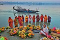 Chhat pujo.jpg 1,915 × 1,280; 1.9 MB
-
 Chirchiq daryosi.jpg 4,000 × 1,800; 4.5 MB
-
 Chirchiq kanali 01.jpg 3,120 × 4,160; 4.77 MB
-
 Circuit 2008 126.jpg 2,496 × 1,664; 2.53 MB
-
-
-
 Coral shells in Gurara River.jpg 3,456 × 2,304; 2.48 MB
-

-
 Creigiau Nofio Cwm Rheidol swimming rocks.jpg 2,448 × 3,264; 3.63 MB
-
 Cross-section of a river channel and its valley.webp 950 × 526; 26 KB
-
 Danushkodi river.jpg 1,632 × 752; 175 KB
-
De-Bach2.ogg 1.4 s; 14 KB
-
 Dehing river margherita.jpg 4,032 × 3,024; 1.63 MB
-
 Del Valle River.jpg 1,600 × 1,200; 453 KB
-
 Die Schwarzach bei Schwarzenbruck.jpg 1,908 × 2,908; 1.2 MB
-
 Donau mit Spiegelung im Wasser.jpg 2,208 × 1,218; 646 KB
-
 Dragonfly on a part of bamboo.jpg 6,000 × 3,376; 6.38 MB
-
 Duck... duck... goose! (8087544916).jpg 1,024 × 768; 326 KB
-
 Düden Çayı 01.jpg 5,568 × 3,712; 18.59 MB
-
 Düden Çayı 02.jpg 5,568 × 3,712; 15.96 MB
-
 Early autumn (29756195766).jpg 4,928 × 3,264; 796 KB
-
 Earlymorningriver WeyGuildfordUK.jpg 3,024 × 4,032; 1.68 MB
-
 Egypt - Nile-Aswan.jpg 4,320 × 3,240; 1.82 MB
-
 El rio de Choele choel.jpg 1,280 × 640; 68 KB
-
 Embarcadère à l'entrée de la rivière noire à Adjarra au Bénin 01.jpg 9,216 × 6,912; 17.33 MB
-
 Embarcadère à l'entrée de la rivière noire à Adjarra au Bénin 02.jpg 9,216 × 6,912; 17.2 MB
-
 Embarcadère à l'entrée de la rivière noire à Adjarra au Bénin.jpg 4,608 × 3,456; 6.21 MB
-
 Embouchure rivière Batiscan, Batiscan 001.jpg 1,536 × 2,048; 1.79 MB
-
 Embouchure rivière Batiscan, Batiscan 003.jpg 1,536 × 2,048; 913 KB
-
 Embouchure rivière Batiscan, Batiscan 008.jpg 2,048 × 1,536; 660 KB
-
 Embouchure rivière Batiscan, Batiscan 010.jpg 1,536 × 2,048; 719 KB
-
 Endpoint of the Colorado River.jpg 1,100 × 894; 635 KB
-
 Erlenbach 1.jpg 2,048 × 1,536; 842 KB
-
 Eskişehir, Adalar nehri original.jpg 1,241 × 2,214; 804 KB
-
 Example of a riparian area.png 1,320 × 769; 395 KB
-
 Fishing 6.jpg 3,349 × 2,160; 1.23 MB
-
 Fishing at Tanguar Hoar, Sunamganj, Bangladesh.jpg 6,000 × 4,000; 10.26 MB
-
 Flight at a small height (15375531588).jpg 1,200 × 794; 609 KB
-
 Floyd's Fork April 2024.jpg 8,160 × 6,120; 14.23 MB
-
 Flussabschnitt der Lauter in Lauterbach (Hessen).jpg 4,000 × 3,000; 3.78 MB
-
 Forest vegetation adjacent to a river.jpg 4,608 × 3,456; 6.65 MB
-
 Foz Rio Simão (Serras do Porto).jpg 5,445 × 3,630; 11.91 MB
-
 Gabriel Santiago 2014-12-06 (Unsplash NLSi8Hsb1PA).jpg 5,184 × 3,456; 14.33 MB
-
 Galway, Ireland, Friars River.jpg 5,056 × 3,792; 10.73 MB
-
 Ganga River near Roorkee.jpg 1,040 × 492; 23 KB
-
 Ganye main river.jpg 2,560 × 1,536; 1.68 MB
-
 Gembala Bebek.jpg 4,000 × 2,666; 8.16 MB
-
 Girona 20 21 37 089000.jpeg 3,024 × 4,032; 3.1 MB
-
 Godavari river view img02.jpg 4,080 × 3,072; 3.75 MB
-
 Godavari river view img3.jpg 3,919 × 2,951; 1.2 MB
-
 Godavari river view img4.jpg 3,072 × 4,080; 4.19 MB
-
 Godavari view img01.jpg 4,080 × 3,072; 4.99 MB
-
 Good morning Varanasi.jpg 4,288 × 2,848; 5.62 MB
-
 Gray's Charity Quarters20231007 121906.jpg 4,000 × 2,252; 3.2 MB
-
 Green lake from upper viewpoint - panoramio.jpg 3,264 × 1,836; 2.27 MB
-
 Guiacurús crossing river (detail).jpg 3,050 × 2,196; 3.29 MB
-
 Gukura umusenyi muruzi vyonona ikirere.jpg 3,648 × 2,736; 2.56 MB
-
 Gula Talheintha.jpg 5,119 × 3,072; 5.19 MB
-
 Gurara River bank.jpg 3,456 × 2,304; 3.71 MB
-
 Gurara River overview LHS 1.jpg 3,456 × 2,304; 3.58 MB
-
 Gurara River overview LHS 2.jpg 3,456 × 2,304; 3.41 MB
-
 Gurara River overview RHS 1.jpg 3,456 × 2,304; 4.38 MB
-
 Gurara River overview RHS 2.jpg 3,456 × 2,304; 2.98 MB
-
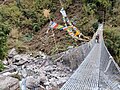
 Hanging Bridge Kyanjin Gompa.jpg 3,456 × 4,608; 5.97 MB
-
 Hanging Bridge Langtang Trekking Rasuwa.jpg 3,456 × 4,608; 6.66 MB
-
 Hanging Bridge Langtang Trekking.jpg 4,000 × 3,000; 7.1 MB
-
 Haron, Tirón errekaren ondoko Bide Berdea.jpg 4,000 × 3,000; 8.67 MB
-
 Havva.jpg 1,200 × 1,600; 479 KB
-
 HeritageTrailMarker20231007 121614.jpg 4,000 × 2,252; 3.83 MB
-
 Hlriver.png 1,513 × 708; 1.06 MB
-
 Hojaipok ota tog'lari.jpg 4,080 × 3,060; 3.22 MB
-
 Hollands Diep bij Moerdijk 2.jpg 4,608 × 2,184; 2.54 MB
-
 House on the river bank.jpg 2,567 × 3,209; 4.58 MB
-
 Huma River at Tahe County.jpg 4,000 × 3,000; 2.37 MB
-
 Human impact factors on river–floodplain systems.jpg 1,594 × 2,068; 337 KB
-
 I Chontal 1103 (20) (17295161985).jpg 800 × 535; 140 KB
-
 I love Banjarmasin.jpg 4,624 × 3,468; 5.14 MB
-
 Ikirere be n'uruzi.jpg 3,648 × 2,736; 2.53 MB
-
 Ikirere inzuri.jpg 3,648 × 2,736; 2.53 MB
-
 Ikirere kirononwa n'ibicafu biri munzuzi.jpg 3,648 × 2,736; 2.58 MB
-
 Ikongo vue générale.jpg 2,853 × 2,854; 3.1 MB
-
 IMGP1124 (2701660840).jpg 1,000 × 668; 429 KB
-
 Imisenyi n'amabuye bikugwa Munzuzi bironona cane ikirere cacu.jpg 3,648 × 2,736; 2.54 MB
-
 Inbound2839251836337402429.jpg 1,041 × 437; 257 KB
-
 Inbound3363463981283888029.jpg 1,080 × 2,400; 1.07 MB
-
 Ireland, Galway, waterbodies, urban river, a man fishing.jpg 3,648 × 2,736; 1.78 MB
-
 Island park, Niles, St. Joseph river (Michigan).jpg 13,046 × 3,868; 11.53 MB
-
 Jadukata river.jpg 4,608 × 3,456; 6.27 MB
-
 Jembatan Ci Janggala di kampung Nanggerang, desa Pabuaran, Sukamakmur, kabupaten Bogor.jpg 2,048 × 1,536; 1.24 MB
-
 Jembatan di Sungai Bahorok 1.jpg 3,648 × 4,864; 7.57 MB
-
 Jembatan di Sungai Bahorok 2.jpg 3,648 × 4,864; 8.76 MB
-
 Jokelanjoki.jpg 3,982 × 2,522; 3.54 MB
-
 JungleLand River View.jpg 1,024 × 768; 243 KB
-
 Jóvenes pescadores en el rio.jpg 4,032 × 3,024; 3.53 MB
-
 Kabyiek Tityong Waterflow 1.jpg 6,000 × 4,000; 13.83 MB
-
 Kaiser Creek Cataract.png 1,372 × 1,800; 5.15 MB
-
 Kaiser Creek Waterfall.png 1,374 × 1,800; 5.15 MB
-

-
 Kanjon Drine 2024 01.jpg 4,624 × 3,399; 7.03 MB
-
 Kanjon Drine 2024 02.jpg 4,000 × 3,000; 4.38 MB
-
 Kanjon Drine 2024 04.jpg 4,624 × 3,468; 7.1 MB
-
 Kanjon Drine 2024 05.jpg 4,624 × 3,336; 5.49 MB
-
 Kanjon Drine 2024 06.jpg 4,624 × 3,468; 4.56 MB
-
 Kanjon Drine 2024 07.jpg 4,624 × 3,468; 2.92 MB
-
 Kanjon Drine 2024 08.jpg 4,624 × 3,468; 4.76 MB
-
 Kapal di Sungai Martapura.jpg 3,648 × 4,864; 5.35 MB
-
 Karst formations 08.jpg 1,440 × 1,083; 836 KB
-
 Karuma falls in Kiryandongo.jpg 480 × 640; 158 KB
-
 Katahdin Woods and Waters National Monument (5755efc4-1dd8-b71b-0bd6-58d2392718e0).jpg 2,376 × 1,709; 1.44 MB
-
 Katni-river-kataighat.jpg 500 × 300; 39 KB
-
 Katonga River Bridge in Mpigi District along Kampala-Masaka Highway.jpg 3,264 × 2,293; 1.31 MB
-
 Katonga River Swamp in Mpigi District along Kampala-Masaka Highway.jpg 2,994 × 2,222; 1.1 MB
-
 Katonga River View along Kampala-Masaka Highway.jpg 3,264 × 2,279; 1.54 MB
-
 Kayaker on the Speed River in Riverside Park 1.jpg 2,604 × 4,624; 5.1 MB
-
 Kayaker on the Speed River in Riverside Park 2.jpg 4,365 × 1,783; 2.15 MB
-
 Kg. Tudan Tuaran.jpg 3,000 × 4,000; 5.79 MB
-
 Kichi Ak Suu Sanctuary, Issyk Kul Region, Kyrgyzstan 001.jpg 5,500 × 3,819; 14.64 MB
-
 Kichi Ak Suu Sanctuary, Issyk Kul Region, Kyrgyzstan 06.jpg 5,500 × 3,865; 15.78 MB
-
 Kids play 2.jpg 4,937 × 3,291; 6.89 MB
-
 Kids playing after on weekend.jpg 5,184 × 3,456; 6.06 MB
-
 Kilten z Damby.jpg 8,192 × 6,144; 6.61 MB
-
 Ko'ksuv.jpg 640 × 640; 170 KB
-
 Kobylanka.png 3,000 × 4,000; 15.08 MB
-
 Kogum River 2.jpg 6,000 × 4,000; 11.86 MB
-
 Kosi River.jpg 1,078 × 947; 400 KB
-
 Kowsika river flood December 18,2023.jpg 1,080 × 1,920; 860 KB
-
 Kronhorster Trebel (Blick nach Osten).jpg 3,456 × 4,608; 8.91 MB
-
 L'Erve dans le canyon de Saulges.jpg 3,264 × 2,448; 1.61 MB
-
 La Peñota.jpg 1,440 × 967; 363 KB
-
 La rue de l'Yvette franchie par le viaduc du chemin de fer à Orsay.jpg 3,456 × 4,608; 5.17 MB
-
 Laguna de yarinacocha.jpg 1,200 × 1,600; 523 KB
-
 Lakeside Estate River Sideway View.jpg 1,152 × 864; 1.51 MB
-
 Landing 26R (525771516).jpg 2,272 × 1,704; 1.87 MB
-
 Langtang Khola and Mountain.jpg 4,608 × 3,456; 7.94 MB
-
 Langtang Khola Gosainkund Rasuwa.jpg 4,000 × 3,000; 5.79 MB
-
 Langtang Khola Rasuwa District.jpg 3,000 × 4,000; 5.23 MB
-
Langtang Khola Rasuwa District.webm 8.8 s, 1,080 × 1,920; 16.28 MB
-
 Langtang Khola Rasuwa Jilla.jpg 3,000 × 4,000; 5.64 MB
-
 Langtang Khola Rasuwa.jpg 4,000 × 3,000; 6.74 MB
-
 Langtang Khola Syapru Besi.jpg 4,000 × 3,000; 4.53 MB
-
 Langtang Khola Trekking Rasuwa.jpg 3,000 × 4,000; 5.33 MB
-
 Langtang Trekking Trail.jpg 4,000 × 3,000; 5.91 MB
-
 Le Jaur dans Saint-Pons de Thomières.jpg 4,032 × 3,024; 3.32 MB
-
 Le pont Tenanianivorano.jpg 3,840 × 5,120; 5.13 MB
-
 Le viaduc du chemin de fer à Orsay, qui franchit la rivière l'Yvette au crépuscule..jpg 3,456 × 4,608; 4.99 MB
-
 Limay River.jpg 408 × 306; 91 KB


_(17291148781).jpg)
.svg)
.jpg)

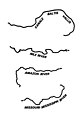
_%26_Modern_Meitei_(Contemporary_Manipuri)_terms_for_river_(in_traditional_Meetei_Mayek_writing_system).jpg)


.jpg)


.jpg)
.jpg)


_-_Essd-15-541-2023-f01-web.png)


.jpg)


.jpg)


.jpg)


.jpg)

.jpg)

.jpg)
.jpg)


.jpg)


_(17295161985).jpg)


.jpg)


.jpg)


.jpg)


.jpg)


.jpg)