Category:Road III/24635 (Czech Republic)
Jump to navigation
Jump to search
 | |||||
| Upload media | |||||
| Instance of | |||||
|---|---|---|---|---|---|
| Location | Mělník District, Central Bohemian Region, Czechia | ||||
| Transport network | |||||
| Length |
| ||||
 | |||||
Subcategories
This category has only the following subcategory.
Media in category "Road III/24635 (Czech Republic)"
The following 17 files are in this category, out of 17 total.
-
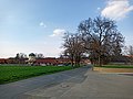
 Hořín, cesta.JPG 3,888 × 2,592; 3.33 MB
-
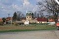 Hořín, kostel a obec.JPG 3,888 × 2,592; 3.99 MB
-
 Hořín, pole před obcí.JPG 2,848 × 2,136; 1.41 MB
-
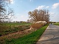
 Hořín, silnice.jpg 4,608 × 3,456; 4.9 MB
-
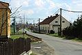
 Hořín, Vrbno, křižovatka.JPG 3,888 × 2,592; 3.69 MB
-
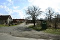
 Hořín, Vrbno, příjezd do vsi.JPG 3,888 × 2,592; 4 MB
-
 Hořín, Zelčín, cesta.JPG 3,888 × 2,592; 4.87 MB
-
 Hořín, Zelčín, příjezd do vsi.JPG 3,888 × 2,592; 4.92 MB
-
 Hořín, Zelčín, zástavba.JPG 3,888 × 2,592; 3.46 MB
-
 Lužec nad Vltavou, cesta II.JPG 2,848 × 2,136; 1.5 MB
-
 Lužec nad Vltavou, Chramostek, pohled na osadu.JPG 3,888 × 2,592; 4.64 MB
-
 Lužec nad Vltavou, Chramostek, příjezd do osady.JPG 3,888 × 2,592; 4.75 MB
-
 Lužec nad Vltavou, konec obce.JPG 3,888 × 2,592; 5.58 MB
-
 Vraňany, cesta.JPG 3,762 × 2,168; 2.85 MB
-
 Vrbno, silnice do Hořína 01.jpg 4,608 × 3,456; 6.25 MB
-
 Vrbno, silnice do Hořína 02.jpg 4,608 × 3,456; 7.84 MB
-
 Vrbno, silnice do Hořína 03.jpg 4,608 × 3,456; 4.73 MB


