Category:Road III/4875 (Czech Republic)
Jump to navigation
Jump to search
,_Vset%C3%ADn_District,_Zl%C3%ADn_Region,_Czech_Republic_14.jpg) | |||||
| Upload media | |||||
| Instance of | |||||
|---|---|---|---|---|---|
| Location |
| ||||
| Transport network | |||||
| Length |
| ||||
 | |||||
Media in category "Road III/4875 (Czech Republic)"
The following 23 files are in this category, out of 23 total.
-
-

-
 Kychová (Huslenky), Vsetín District, Zlín Region, Czech Republic 08.jpg 5,472 × 3,648; 18.16 MB
-

-

-

-

-

-
-

-

-
-

-

-

-

-

-

-

-
 Road III-4875 in Kychová (Huslenky), Vsetín District, Zlín Region, Czech Republic 18.jpg 5,472 × 3,648; 18.23 MB
-
 Road III-4875, Kychová (Huslenky), Vsetín District, Zlín Region, Czech Republic 14.jpg 5,472 × 3,648; 15.62 MB
-
 Road III-4875, Kychová (Huslenky), Vsetín District, Zlín Region, Czech Republic 19.jpg 5,472 × 3,648; 16.81 MB
-
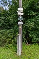 Tourist sign in Kychová (Huslenky), Vsetín District, Zlín Region, Czech Republic 20.jpg 3,648 × 5,472; 16.41 MB
,_Vset%C3%ADn_District,_Zl%C3%ADn_Region,_Czech_Republic_10.jpg)

,_Vset%C3%ADn_District,_Zl%C3%ADn_Region,_Czech_Republic_08.jpg)
,_Vset%C3%ADn_District,_Zl%C3%ADn_Region,_Czech_Republic_15.jpg)
,_Vset%C3%ADn_District,_Zl%C3%ADn_Region,_Czech_Republic_16.jpg)
,_Vset%C3%ADn_District,_Zl%C3%ADn_Region,_Czech_Republic_17.jpg)
,_Vset%C3%ADn_District,_Zl%C3%ADn_Region,_Czech_Republic_21.jpg)
,_Vset%C3%ADn_District,_Zl%C3%ADn_Region,_Czech_Republic_24.jpg)
,_Vset%C3%ADn_District,_Zl%C3%ADn_Region,_Czech_Republic_27.jpg)
,_Vset%C3%ADn_District,_Zl%C3%ADn_Region,_Czech_Republic_28.jpg)
,_Vset%C3%ADn_District,_Zl%C3%ADn_Region,_Czech_Republic_31.jpg)
,_Vset%C3%ADn_District,_Zl%C3%ADn_Region,_Czech_Republic_33.jpg)
,_Vset%C3%ADn_District,_Zl%C3%ADn_Region,_Czech_Republic_23.jpg)
,_Vset%C3%ADn_District,_Zl%C3%ADn_Region,_Czech_Republic_25.jpg)
,_Vset%C3%ADn_District,_Zl%C3%ADn_Region,_Czech_Republic_26.jpg)
,_Vset%C3%ADn_District,_Zl%C3%ADn_Region,_Czech_Republic_29.jpg)
,_Vset%C3%ADn_District,_Zl%C3%ADn_Region,_Czech_Republic_32.jpg)
,_Vset%C3%ADn_District,_Zl%C3%ADn_Region,_Czech_Republic_22.jpg)
,_Vset%C3%ADn_District,_Zl%C3%ADn_Region,_Czech_Republic_09.jpg)
,_Vset%C3%ADn_District,_Zl%C3%ADn_Region,_Czech_Republic_18.jpg)
,_Vset%C3%ADn_District,_Zl%C3%ADn_Region,_Czech_Republic_19.jpg)
,_Vset%C3%ADn_District,_Zl%C3%ADn_Region,_Czech_Republic_20.jpg)