Category:Road bridges in the Metropolitan Borough of Kirklees
Jump to navigation
Jump to search
Subcategories
This category has the following 7 subcategories, out of 7 total.
C
- Cleckheaton Viaduct (7 F)
- Cooper Bridge, Brighouse (9 F)
D
- Cleggford Bridge (4 F)
H
- Hollowgate bridge, Holmfirth (4 F)
M
- M62 bridge, River Calder (8 F)
S
- Shepley Bridge, Mirfield (3 F)
T
- Thunder Bridge (5 F)
Media in category "Road bridges in the Metropolitan Borough of Kirklees"
The following 43 files are in this category, out of 43 total.
-

-
 A629 passing under Lindley Moor Road - geograph.org.uk - 3436800.jpg 800 × 519; 75 KB
-
 Advertising to the M62 from Whitehall Road West - geograph.org.uk - 3536427.jpg 4,608 × 2,390; 1.96 MB
-
 Battyeford Hauling Bridge - geograph.org.uk - 3896905.jpg 1,600 × 1,200; 386 KB
-
 Branch Street Bridge MLV3-84 - geograph.org.uk - 5608763.jpg 1,600 × 1,200; 692 KB
-
 Branch Street Railway Bridge MLV3-84 - geograph.org.uk - 5608753.jpg 1,600 × 1,200; 474 KB
-
 Bridge and tunnel, Liversedge (geograph 3273125).jpg 1,931 × 2,701; 1.28 MB
-
 Bridge BRB ROY 38 - Headfield Road - geograph.org.uk - 3932742.jpg 640 × 480; 66 KB
-
 Bridge DRS 2-1 - Bretton Street - geograph.org.uk - 3932872.jpg 640 × 480; 71 KB
-
 Bridge MVN 2-210 - Headfield Road - geograph.org.uk - 3932760.jpg 640 × 480; 62 KB
-
 Bridge on New Hey Road (A640) - geograph.org.uk - 5966100.jpg 640 × 480; 64 KB
-
 Bridge on Thornhill Road, B6117, Dewsbury - geograph.org.uk - 3957609.jpg 1,600 × 1,064; 725 KB
-

-

-
 Bridge over the Spen Valley Ringway - geograph.org.uk - 6152280.jpg 2,000 × 1,500; 3.14 MB
-
 Bridge ^45, Huddersfield Narrow Canal - geograph.org.uk - 5058223.jpg 1,200 × 799; 624 KB
-
 Calder Road bridge, Ravensthorpe - geograph.org.uk - 6077290.jpg 1,024 × 768; 266 KB
-

-
 Deighton station bridge 2018.jpg 4,608 × 3,456; 4.12 MB
-
 Double decker bus filter, Marsden. - geograph.org.uk - 145692.jpg 640 × 480; 96 KB
-
 Double Lock Bridge - geograph.org.uk - 2538787.jpg 800 × 555; 136 KB
-
-
 Fall Ing Bridge - geograph.org.uk - 5629392.jpg 1,024 × 768; 178 KB
-

-
 Hunsworth Lane crosses the M62 - geograph.org.uk - 3536430.jpg 4,142 × 2,401; 1.76 MB
-
 Kirklees Way crossing a disused Railway - geograph.org.uk - 159016.jpg 640 × 480; 111 KB
-
 Lane Head Road Bridge - geograph.org.uk - 500189.jpg 640 × 383; 46 KB
-
 Lane Head Road Bridge, Holmfirth - geograph.org.uk - 3345347.jpg 640 × 480; 492 KB
-
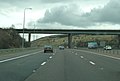
 M62 eastbound at Junction 26 - geograph.org.uk - 3029263.jpg 640 × 480; 59 KB
-

-
 M62 passing under Round Ings Road - geograph.org.uk - 3422986.jpg 640 × 409; 39 KB
-
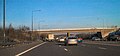
 M62 passing under the A640 - geograph.org.uk - 3422983.jpg 640 × 434; 47 KB
-
 M62, Round Ings Road Bridge - geograph.org.uk - 2241320.jpg 1,020 × 480; 196 KB
-

-
 Old milestone (geograph 6739909).jpg 1,200 × 1,600; 369 KB
-
 Paddock Railway Bridge MVL3-82, Church Street - geograph.org.uk - 5608741.jpg 1,600 × 1,200; 505 KB
-

-

-

-
 Station Approach Bridge, Marsden - geograph.org.uk - 1883608.jpg 1,024 × 768; 165 KB
-

-
 The M62 crosses the A6107 - geograph.org.uk - 3895304.jpg 1,024 × 768; 114 KB
-
 Under the M62 motorway viaduct - geograph.org.uk - 3363197.jpg 2,000 × 1,500; 894 KB


.jpg)


_-_geograph.org.uk_-_5966100.jpg)


.jpg)


