Category:Road embankments in the East Riding of Yorkshire
Jump to navigation
Jump to search
Media in category "Road embankments in the East Riding of Yorkshire"
The following 14 files are in this category, out of 14 total.
-
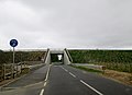
 A1079 (geograph 5386598).jpg 640 × 378; 53 KB
-
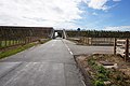
 Embankment, A1079 (geograph 5399441).jpg 640 × 426; 58 KB
-
 Embankment, A164 (geograph 5386469).jpg 640 × 426; 56 KB
-
 Long Lane towards Beverley (geograph 4399995).jpg 1,600 × 1,062; 784 KB
-
 Long Lane towards Beverley (geograph 4400009).jpg 1,600 × 1,062; 812 KB
-
 Long Lane towards Beverley (geograph 4979580).jpg 4,078 × 2,962; 3.3 MB
-
 Long Lane towards Beverleys Southern Bypass (geograph 5100397).jpg 1,600 × 1,065; 646 KB
-
 New Beverley bypass from Long Lane (geograph 4400019).jpg 1,600 × 1,062; 578 KB
-
 New Beverley bypass on Long Lane (geograph 4400016).jpg 1,600 × 1,062; 634 KB
-
 New plantings by the A164 (geograph 5401764).jpg 640 × 426; 43 KB
-
 Road opened early 2015 (geograph 4446637).jpg 1,280 × 719; 863 KB
-
 Saltend Flyover during its construction - geograph.org.uk - 275148.jpg 640 × 480; 101 KB
-
 The new Beverley bypass from Long Lane (geograph 4400006).jpg 1,600 × 1,062; 1.09 MB
-
 Tree planting off Long Lane (geograph 4400013).jpg 1,600 × 1,062; 725 KB
.jpg)
.jpg)
.jpg)
.jpg)
.jpg)
.jpg)
.jpg)
.jpg)
.jpg)
.jpg)
.jpg)

.jpg)
.jpg)