Category:Road sign E-17a (Poland)
Jump to navigation
Jump to search
Subcategories
This category has only the following subcategory.
R
- Road sign E-17a with D-42 (Poland) (281 F)
Media in category "Road sign E-17a (Poland)"
The following 200 files are in this category, out of 594 total.
(previous page) (next page)-
 Znak E-17a.svg 3,657 × 1,881; 5 KB
-
 1 Pustkowo - 2024.06.26.jpg 2,136 × 4,624; 4.02 MB
-
 2006-06 Kunowice 01.jpg 2,272 × 1,704; 1.59 MB
-
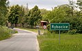 2006-06 Rybocice 03.jpg 2,271 × 1,403; 1.21 MB
-
 2009-05 Łódź 01.jpg 2,526 × 1,523; 1.16 MB
-
 2011-08 Ćwiercie 01.jpg 1,280 × 852; 1.08 MB
-
 2011-10 Grodzisko 01.jpg 1,280 × 853; 973 KB
-
 2011-10 Mierzęcin 03.jpg 1,280 × 853; 1.3 MB
-
 2012 Powiat cieszyński, Marklowice Górne, Tablica wjazdu do miasta Jastrzębie-Zdrój.jpg 2,207 × 3,310; 6.6 MB
-
 2012 Sławnikowice 01.jpg 4,749 × 3,166; 3.83 MB
-
 2012-03 Ogrody 02.jpg 2,222 × 1,481; 3.89 MB
-
 2012-04 Kłębanowice 01.jpg 2,222 × 1,477; 4.16 MB
-
 2012-04 Kłębanowice 02.jpg 2,222 × 1,473; 4.31 MB
-
 2012-04 Niekazanice 01.jpg 4,157 × 2,772; 2.83 MB
-
 2012-04 Nowa Wieś Głubczycka 02.jpg 4,826 × 3,217; 3.73 MB
-
 2012-04 Pociękarb 01.jpg 2,222 × 1,481; 4.3 MB
-
 2012-04 Pomorzowiczki 01.jpg 2,222 × 1,481; 3.68 MB
-
 2012-04 Równe 05.jpg 2,222 × 1,481; 5.26 MB
-
 2012-04 Uciechowice 01.jpg 3,258 × 2,172; 3.47 MB
-
 2012-04 Urbanowice 01.jpg 2,222 × 1,468; 4.42 MB
-
 2012-04 Wódka 01.jpg 4,877 × 3,252; 4.84 MB
-
 2012-04 Wódka 02.jpg 4,020 × 2,680; 3.74 MB
-
 2012-04 Wódka 21.jpg 3,688 × 2,458; 4.26 MB
-
 2012-04 Włodzienin Kolonia 1.jpg 2,222 × 1,473; 3.57 MB
-
 2012-05 Bielawa Dolna 01.jpg 4,763 × 3,176; 4.17 MB
-
 2012-05 Kościelna Wieś 02.jpg 4,571 × 3,048; 4.84 MB
-
 2012-05 Pokrzywnik 01.jpg 4,819 × 3,213; 5.18 MB
-
 2012-05 Stojanów 01.jpg 4,988 × 3,325; 4.92 MB
-
 2012-05 Trójca 02.jpg 4,657 × 3,105; 3.73 MB
-
 2012-06 Borek 1.jpg 4,976 × 3,317; 3.64 MB
-
 2012-06 Charbielin 01.jpg 4,878 × 3,252; 4.32 MB
-
 2012-06 Dębowiec 01.jpg 3,720 × 2,480; 3.87 MB
-
 2012-06 Kępnica 01.jpg 3,597 × 2,398; 4.84 MB
-
 2012-06 Nowy Las 01.jpg 4,431 × 2,954; 3.49 MB
-
 2012-06 Nowy Las 02.jpg 4,655 × 3,103; 3.86 MB
-
 2012-06 Podlesie 03.jpg 4,049 × 2,699; 3.38 MB
-
 2012-06 Pokrzywna 01.jpg 4,604 × 3,069; 5.03 MB
-
 2012-06 Sowin 01.jpg 4,652 × 3,102; 4.25 MB
-
 2012-06 Wieszczyna 01.jpg 4,374 × 2,916; 3.6 MB
-
 2012-06 Zielonkowice 2.jpg 4,635 × 3,089; 4.45 MB
-
 2012-06 Zielonkowice 3.jpg 4,678 × 3,118; 4.77 MB
-
 2012-08 Ligota Tułowicka 01.jpg 5,184 × 3,456; 4.99 MB
-
 2012-08 Ligota Tułowicka 08.jpg 4,809 × 3,206; 3.77 MB
-
 2012-09 Dobieszów 06 wjazd do miejscowości.jpg 3,456 × 5,184; 4.39 MB
-
 2012-09 Przedborowice 03.jpg 5,184 × 3,456; 4.53 MB
-
 2013 Koperniki 15 wjazd do miejscowości.jpg 4,679 × 3,119; 4.33 MB
-
 2013 Markowice 01 wjazd.jpg 4,549 × 3,033; 4.65 MB
-
 2013 Morów 05.jpg 5,045 × 2,726; 4.49 MB
-
 2014- 04 Stara Jamka (3) Wjazd.jpg 4,838 × 3,225; 4.65 MB
-
 2014-04 Domaszkowice 01 wjazd.JPG 4,532 × 3,021; 3.25 MB
-
 2014-04 Jasienica Dolna 03 wjazd do miejscowości.JPG 4,482 × 2,988; 3.23 MB
-
 2014-04 Jasienica Dolna 14 wjazd do miejscowości.JPG 4,327 × 2,885; 3.19 MB
-
 2014-04 Myszowice 01 wjazd do miejscowości.JPG 5,184 × 2,596; 3.65 MB
-
 2014-04 Rynarcice (04) wjazd do miejscowości.JPG 4,308 × 2,872; 3.83 MB
-
 2014-04 Wielkie Łąki (01).jpg 5,165 × 2,612; 4.62 MB
-
 2014-04 Włodary 01 wjazd do miejscowości.JPG 5,184 × 3,456; 5.66 MB
-
 2014-08 Chociebórz (04) wjazd.JPG 5,184 × 3,456; 5.14 MB
-
 2014-08 Cieszanowice (09) wjazd.JPG 5,184 × 3,456; 3.91 MB
-
 2014-08 Goworowice (19) wjazd.JPG 2,304 × 3,456; 3.2 MB
-
 2014-08 Karłowice Małe (01) wjazd.JPG 4,925 × 3,283; 3.8 MB
-
 2014-08 Rogów (01) wjazd.jpg 5,184 × 3,456; 4.42 MB
-
 2014-08 Rogów (02) wjazd.jpg 4,242 × 2,828; 2.73 MB
-
 2014-08 Rogów (05) wjazd.jpg 3,456 × 5,184; 5.66 MB
-
 2014-08 Siedlec (01).JPG 4,688 × 3,125; 3.5 MB
-
 2014-08 Zurzyce (05) Wjazd.JPG 4,103 × 2,736; 1.91 MB
-
 2015-09 Duje 04.jpg 4,733 × 3,155; 3.8 MB
-
 2015-09 Duje 05.jpg 5,184 × 2,651; 4.82 MB
-
 2015-09 Michałkowo 01 Wjazd do miejscowośc.jpg 5,017 × 3,344; 4.05 MB
-
 2018 Warszawa Trakt Brzeski wjazd do miasta, 1.jpg 4,320 × 3,240; 5.28 MB
-
 2018 Warszawa Trakt Brzeski wjazd do miasta, 2.jpg 3,240 × 4,320; 5.51 MB
-
 2020 Stanisławów Pierwszy, 1.jpg 5,328 × 4,000; 5.11 MB
-
 2020-06 Chróścielów (01) Początek miejscowości.jpg 4,951 × 3,301; 5.51 MB
-
 2020-06 Chróścielów (02) Początek miejscowości.jpg 4,658 × 3,105; 4.85 MB
-
 2020-06 Lubotyń (01) Początek miejscowości.jpg 5,472 × 3,648; 4.64 MB
-
 2020-06 Tłustomosty (01) Początek miejscowości.jpg 5,472 × 3,648; 5.08 MB
-
 2020-10 Jasiona (02) wejscie.jpg 4,395 × 2,930; 4.77 MB
-
 2020-10 Stare Siołkowice (01) wjazd.jpg 5,101 × 3,401; 6.09 MB
-
 2020-10 Stare Siołkowice (02) Wyjazd.jpg 5,472 × 3,648; 4.98 MB
-
 2021 Wojsławice (27) Wjazd.jpg 3,960 × 2,640; 6.2 MB
-
 2023-04 Dłużec (02) Wjazd.jpg 5,283 × 3,522; 3.84 MB
-
 20240502 Laśmiady.jpg 3,120 × 4,160; 12.52 MB
-
 20240504 Malinówka 2.jpg 3,120 × 4,160; 11.48 MB
-
 20240717 185439 Miluki, tablica.jpg 3,120 × 4,160; 9.2 MB
-
 20240717 185824 Miluki, tablica.jpg 4,160 × 3,120; 9.43 MB
-
 20240717 191350 Krokocie.jpg 4,160 × 3,120; 9.78 MB
-
 20240717 192157 Przykopka.jpg 3,120 × 4,160; 9.77 MB
-
 20240717 192910 Przykopka.jpg 4,160 × 3,120; 9.22 MB
-
 20240717 193559 Chełchy.jpg 4,160 × 3,120; 9.28 MB
-
 20240717 200013 Czaple.jpg 4,160 × 3,120; 9.1 MB
-
 20240717 200540 Czaple.jpg 3,120 × 4,160; 8.83 MB
-
 20240717 202023 Babki Gąseckie.jpg 4,160 × 3,120; 10.17 MB
-
 20240717 202117 Kijewo.jpg 3,120 × 4,160; 8.94 MB
-
 20240717 203354 Wólka Kijewska.jpg 4,160 × 3,120; 8.91 MB
-
 20240717 203832 Dzięgiele Oleckie.jpg 4,160 × 3,120; 8.67 MB
-
 20240717 204559 Świdry.jpg 4,160 × 3,120; 7.72 MB
-
 20240717 211230 Płociczno.jpg 3,120 × 4,160; 8.48 MB
-
 20240717 212317 Płociczno.jpg 4,160 × 3,120; 7.81 MB
-
 20240718 174647 Piaski.jpg 4,160 × 3,120; 12.35 MB
-
 20240718 175402 Piaski.jpg 3,120 × 4,160; 10.32 MB
-
 20240718 175610 Sajzy.jpg 4,160 × 3,120; 11.73 MB
-
 20240718 180444 Sajzy.jpg 3,120 × 4,160; 10.17 MB
-
 20240718 182159 Połom.jpg 4,160 × 3,120; 10.4 MB
-
 20240718 191140 Wronki.jpg 4,160 × 3,120; 13.32 MB
-
 20240718 192233 Wronki.jpg 4,160 × 3,120; 9.2 MB
-
 20240718 194754 Wronki.jpg 4,160 × 3,120; 10.77 MB
-
 20240718 202647 Sulejki, Świętajno.jpg 4,160 × 3,120; 9.4 MB
-
 20240718 203507 Sulejki.jpg 3,120 × 4,160; 10.77 MB
-
 20240718 203715 Jurkowo.jpg 4,160 × 3,120; 7.88 MB
-
 20240718 204019 Jurkowo.jpg 4,160 × 3,120; 8.56 MB
-
 20240718 204726 Krzywe.jpg 4,160 × 3,120; 8.67 MB
-
 20240718 205958 Krzywe.jpg 4,160 × 3,120; 7.97 MB
-
 20240719 160201 Leśniki.jpg 4,160 × 3,120; 11.43 MB
-
 20240719 160612 Kukówko.jpg 4,160 × 3,120; 11.9 MB
-
 20240719 161129 Kukówko.jpg 3,120 × 4,160; 10.74 MB
-
 20240719 162359 Ślepie (cropped).jpg 651 × 347; 148 KB
-
 20240719 162359 Ślepie.jpg 4,160 × 3,120; 9.48 MB
-
 20240719 163807 Kukowo.jpg 4,160 × 3,120; 8.85 MB
-
 20240719 184024 Rosochackie (cropped).jpg 1,621 × 700; 698 KB
-
 20240719 184024 Rosochackie.jpg 4,160 × 3,120; 10.39 MB
-
 20240809 153400 Olszewo.jpg 3,120 × 4,160; 8.52 MB
-
 20240809 154006 Kaltki.jpg 4,160 × 3,120; 11.73 MB
-
 20240809 154442 Kaltki.jpg 3,120 × 4,160; 10.79 MB
-
 20240809 154724 Panistruga.jpg 4,160 × 3,120; 8.74 MB
-
 20240809 155310 Panistruga.jpg 3,120 × 4,160; 9.61 MB
-
 20240809 161517 Wydminy.jpg 4,160 × 3,120; 8.75 MB
-
 65 Downary-Plac.JPG 2,048 × 1,536; 1.54 MB
-
 8126 March 2022 in Lublin Voivodeship.jpg 5,520 × 3,680; 11.42 MB
-
 Adamów - wjazd do wsi.JPG 4,320 × 2,432; 4.66 MB
-
 Antonin województwo podlaskie.JPG 1,465 × 977; 1.16 MB
-
 Babice - znak.jpg 3,029 × 2,006; 4.27 MB
-
 Babichy.JPG 3,648 × 2,736; 1.3 MB
-
 Bagniuki - Road.jpg 2,788 × 1,861; 759 KB
-
 BAGNO 01.jpg 3,741 × 2,400; 1.82 MB
-
 Barchaczów - znak.jpg 4,928 × 3,264; 14.03 MB
-
 Barycz (powiat pabianicki) (2).jpg 3,648 × 2,736; 2.18 MB
-
 Bałamutowo, tablica.jpg 4,160 × 3,120; 11.49 MB
-
 Bechcice Parcela.JPG 3,648 × 2,736; 1.87 MB
-
 Bechcice Wieś.JPG 3,648 × 2,736; 2.24 MB
-
 Bezezyszcze-wjazd-S-1.jpg 3,968 × 2,976; 5.27 MB
-
 Bielanka znak 1.jpg 2,816 × 2,112; 3.59 MB
-
 Bielanka.jpg 996 × 830; 166 KB
-
 Bielawy rail station (1).jpg 3,527 × 2,645; 2.33 MB
-
 Bielkowo (powiat koszaliński) 02.jpg 4,138 × 2,585; 3.06 MB
-
 Blinek (1).jpg 3,805 × 2,853; 3.35 MB
-
 Blinek (2020).jpg 3,764 × 2,398; 2.18 MB
-
 Blizne łaszczyńskiego-warszawa.jpg 4,374 × 2,989; 7.12 MB
-
 Błotnica disambig 2009.jpg 597 × 800; 203 KB
-
 Bluskajmy Wielkie.jpg 4,375 × 3,281; 4.24 MB
-
 Bobrowka-gmCzeremcha-wjazd.jpg 3,968 × 2,976; 4.52 MB
-
 Bodzyniewo1.jpg 1,024 × 768; 255 KB
-
 Bolechowko PL.jpg 2,048 × 1,536; 665 KB
-
 Bolesław, granica państwa.jpg 7,915 × 5,936; 7.65 MB
-
 Bondary - Road.jpg 3,456 × 2,304; 1.87 MB
-
 Borek ph1.JPG 2,048 × 1,536; 1.57 MB
-
 Borkowice - tablica.JPG 3,648 × 2,736; 2.86 MB
-
 Borkowice WLKP (2).JPG 2,048 × 1,360; 637 KB
-
 Borsuk - tablica z nazwą miejscowości - DSC03038 v3.jpg 2,922 × 2,192; 2.84 MB
-
 Borsuki--21prapql.jpg 2,160 × 2,160; 1.14 MB
-
 Borysówka 2023.jpg 1,186 × 927; 299 KB
-
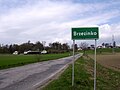 Brzezinko.jpg 1,024 × 768; 579 KB
-
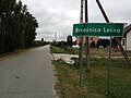 Brzeźnica Leśna.jpg 4,160 × 3,120; 3.91 MB
-
 Brzeźno.jpg 1,024 × 768; 656 KB
-
 Brzozówka gmina Jakubów.jpg 5,152 × 3,864; 4.47 MB
-
 Bródek - znak.jpg 4,559 × 3,020; 8.26 MB
-
 Brójce.JPG 3,648 × 2,736; 3.13 MB
-
 Budki Wierzchowskie - Drogowy znak miejscowości.JPG 1,632 × 1,224; 1,013 KB
-
 BudyDłutowskie.JPG 3,648 × 2,736; 2.18 MB
-
 Budynin - znak.jpg 4,070 × 2,696; 5.45 MB
-
 Budzyń - tablica z nazwą miejscowości.jpg 3,343 × 2,507; 3.76 MB
-
 Budzyń - znak.jpg 4,722 × 3,128; 9.71 MB
-
 Buków, vjezd do obce.jpg 4,510 × 2,722; 1.89 MB
-
 Bystrzek i Olsza.jpg 3,447 × 2,366; 1.71 MB
-
 Bystrzek.jpg 3,420 × 2,274; 1.66 MB
-
 Tablica wyjazdowa z Bystrzycy Klodzkiej.jpg 3,296 × 2,472; 1,006 KB
-
 Wjazd od strony starej bystrzycy.jpg 3,296 × 2,472; 1.06 MB
-
 Bzianka, silnice na Trześniów.jpg 4,770 × 3,178; 1.77 MB
-
 Bądzyń - tablica.JPG 3,648 × 2,736; 2.5 MB
-
 Bąki.JPG 3,648 × 2,736; 2.46 MB
-
 Charbice Dolne.JPG 3,648 × 2,736; 2.58 MB
-
 Chmielno.jpg 2,592 × 3,888; 3.97 MB
-
 Choiny gmina Stanisławów.jpg 5,152 × 3,864; 4.38 MB
-
 MOs810, WG 2014 56 Oledry nowotomyskie (Chojniki) (2).JPG 2,048 × 1,360; 923 KB
-
 Chorzeszów.JPG 3,648 × 2,736; 3.91 MB
-
 Chrabostowka-wjazd-1.jpg 3,968 × 2,976; 4.98 MB
-
 Chrostkowo, tablica miejscowości.jpg 3,623 × 2,349; 4.26 MB
-
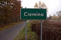 Ciemino - E-17a - 2015-11-06 12-22-10.jpg 3,008 × 2,000; 2.29 MB
-
 Cimochy-droga-na-Rybaki.jpg 3,968 × 2,976; 5.28 MB
-
 Ciszewo (województwo wielkopolskie). cz. wsi Milcz (2).jpg 4,363 × 2,790; 1.16 MB
-
 Cyncynopol - znak.jpg 4,200 × 2,782; 6.86 MB
-
 Czarlin, tablica drogowskazowa.jpg 1,600 × 1,200; 608 KB
-
 Czarnokurz, Mosina.jpg 3,648 × 2,736; 2.04 MB
-
 Czarnówka, tablica.jpg 3,120 × 4,160; 12.06 MB
-
 Czernikowo 1.JPG 1,024 × 768; 593 KB
-
 Czerwieniec (D.Slask).jpg 3,508 × 2,353; 1.01 MB
-
 Czołczyn.JPG 3,648 × 2,736; 2.54 MB
-
 Dłusko Blankenhagen bei Wangerin 20050902 Ortsschild.JPG 1,280 × 960; 333 KB
-
 Dobiesław - osada.jpg 2,560 × 1,920; 1.45 MB
-
 Dobiezyn (2).jpg 4,075 × 2,922; 2.72 MB
-
 Dobra Wola, tablica.jpg 4,160 × 3,120; 10.05 MB
-


_Wjazd.jpg)


_wjazd_do_miejscowo%C5%9Bci.JPG)
.jpg)

_wjazd.JPG)
_wjazd.JPG)
_wjazd.JPG)
_wjazd.JPG)
_wjazd.jpg)
_wjazd.jpg)
_wjazd.jpg)
.JPG)
_Wjazd.JPG)


_Pocz%C4%85tek_miejscowo%C5%9Bci.jpg)
_Pocz%C4%85tek_miejscowo%C5%9Bci.jpg)
_Pocz%C4%85tek_miejscowo%C5%9Bci.jpg)
_Pocz%C4%85tek_miejscowo%C5%9Bci.jpg)
_wejscie.jpg)
_wjazd.jpg)
_Wyjazd.jpg)
_Wjazd.jpg)
_Wjazd.jpg)


.jpg)


.jpg)


_(2).jpg)


.jpg)
_02.jpg)
.jpg)
.jpg)


.JPG)


_(2).JPG)


._cz._wsi_Milcz_(2).jpg)


.jpg)


.jpg)

.jpg)
&filefrom=Dobromierzyce-znak.jpg#mw-category-media)