Category:Road signs in Derbyshire
Jump to navigation
Jump to search
Ceremonial counties of England: Bedfordshire · Berkshire · Buckinghamshire · Cambridgeshire · Cheshire · Cornwall · Cumbria · Derbyshire · Devon · Dorset · Durham · East Riding of Yorkshire · East Sussex · Essex · Gloucestershire · Greater London · Greater Manchester · Hampshire · Herefordshire · Hertfordshire · Kent · Lancashire · Leicestershire · Lincolnshire · Merseyside · Norfolk · North Yorkshire · Northamptonshire · Northumberland · Nottinghamshire · Oxfordshire · Rutland · Shropshire · Somerset · South Yorkshire · Staffordshire · Suffolk · Surrey · Tyne and Wear · Warwickshire · West Midlands · West Sussex · West Yorkshire · Wiltshire · Worcestershire
City-counties: City of London
Former historic counties:
Other former counties:
City-counties: City of London
Former historic counties:
Other former counties:
Subcategories
This category has the following 3 subcategories, out of 3 total.
- Fingerposts in Derbyshire (195 F)
Media in category "Road signs in Derbyshire"
The following 46 files are in this category, out of 46 total.
-
 20 mph please - geograph.org.uk - 941349.jpg 640 × 394; 114 KB
-
 A515 north from Parsley Hay - geograph.org.uk - 2870339.jpg 1,024 × 768; 197 KB
-
 A628 and New Sign - geograph.org.uk - 264442.jpg 640 × 386; 24 KB
-
 Alton Hill - geograph.org.uk - 345504.jpg 640 × 480; 121 KB
-
 B5035 at Godfreyhole.jpg 640 × 480; 100 KB
-

-
 Beighton Fields.jpg 640 × 480; 78 KB
-

-
 Birch Vale Fork - geograph.org.uk - 40302.jpg 640 × 480; 141 KB
-
 BotanyBayDerbyshire0.JPG 610 × 445; 241 KB
-
-
 Corner Shop - geograph.org.uk - 689792.jpg 427 × 640; 218 KB
-
 Creswell 113072 b019cb56.jpg 640 × 425; 61 KB
-
 Edward Street, Glossop - geograph.org.uk - 1755055.jpg 640 × 462; 85 KB
-
 Glossop Welcome Sign.JPG 690 × 686; 82 KB
-
 Glossop4816.JPG 2,048 × 1,536; 774 KB
-
 Hayfield Frog Sign 0145.JPG 2,592 × 1,944; 1.21 MB
-
 Hayfield Frog Sign 0146.JPG 2,592 × 1,944; 1.19 MB
-
 Heanor Road, Ilkeston - geograph.org.uk - 876526.jpg 640 × 480; 114 KB
-

-
 Hippo sign.jpg 3,264 × 2,448; 3.42 MB
-
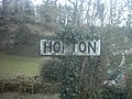 Hopton village, Derbyshire.jpg 640 × 480; 97 KB
-
 If only we could go back to "Peak" times (4422228545).jpg 2,484 × 950; 543 KB
-
 Junction 39, M1 southbound - geograph.org.uk - 1779313.jpg 640 × 480; 121 KB
-
 Litton Mill 0535.JPG 2,592 × 1,944; 1.21 MB
-
 LullingtonChurch8.JPG 960 × 1,280; 607 KB
-
 Mackworth Estate, Derby.jpg 640 × 480; 131 KB
-
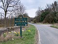 Matlock boundary sign. - geograph.org.uk - 152609.jpg 640 × 480; 137 KB
-
 Melting frost - geograph.org.uk - 707837.jpg 427 × 640; 217 KB
-
 Middleton - B5035 View - geograph.org.uk - 349871.jpg 640 × 480; 139 KB
-
 Military ducks^ - geograph.org.uk - 1100128.jpg 640 × 480; 122 KB
-
 New Whittington, Nr Chesterfield - geograph.org.uk - 122012.jpg 640 × 479; 116 KB
-
 Oops too late! - geograph.org.uk - 559754.jpg 640 × 428; 108 KB
-
 Promising signs, in every sense.jpg 3,349 × 2,566; 5.36 MB
-
 Railway Bridge - geograph.org.uk - 117697.jpg 640 × 427; 100 KB
-
 Road junction near Melbourne - geograph.org.uk - 1430864.jpg 640 × 480; 64 KB
-
 Road Sign, entrance to Cockyard on B5470 - geograph.org.uk - 25473.jpg 480 × 640; 138 KB
-
 Roundabout ahead - geograph.org.uk - 1651227.jpg 640 × 480; 65 KB
-
 The Centre of England - geograph.org.uk - 372568.jpg 640 × 360; 101 KB
-
 The road into Scropton - geograph.org.uk - 445590.jpg 640 × 379; 50 KB
-
 Two Signs - geograph.org.uk - 881214 (cropped).jpg 387 × 227; 81 KB
-
 Two Signs - geograph.org.uk - 881214.jpg 640 × 427; 181 KB
-
 Welcome to Morton - geograph.org.uk - 288662.jpg 640 × 480; 361 KB
-

-
 Road signs at junction near Alfreton - geograph.org.uk - 103982.jpg 640 × 425; 78 KB
-
 Welcome to Bolsover District - geograph.org.uk - 44439.jpg 640 × 428; 55 KB


.jpg)


.jpg)