Category:Road signs in Nassau County, New York
Jump to navigation
Jump to search
Subcategories
This category has the following 2 subcategories, out of 2 total.
Media in category "Road signs in Nassau County, New York"
The following 105 files are in this category, out of 105 total.
-
 02-Jones Beach Parking Field 10.jpg 3,648 × 2,736; 1.53 MB
-
 03-Jones Beach Parking Field 10.jpg 3,648 × 2,736; 2.04 MB
-
 08-Nassau Blvd LIRR; 2017-11-15.jpg 3,648 × 2,736; 2.04 MB
-
 09-Nassau Blvd LIRR; 2017-11-15.jpg 3,648 × 2,736; 2.05 MB
-
 20-Nassau Blvd LIRR; 2017-11-15.jpg 3,648 × 2,736; 2.04 MB
-
 21-Nassau Blvd LIRR; 2017-11-15.jpg 3,648 × 2,736; 2.09 MB
-
 Begin NY 101 Southbound.jpg 3,648 × 2,736; 2.06 MB
-
 Belmont Park td (2021-12-19) 006.jpg 5,472 × 3,648; 5.62 MB
-
 Belmont Park td (2021-12-19) 007 - Gate 5.jpg 5,472 × 3,648; 5.63 MB
-
 Bethpage Circle.jpg 1,024 × 768; 157 KB
-
 Bethpage near Exit B4.jpg 1,024 × 768; 163 KB
-
 Brookville Entrance Sign, Brookville, Long Island, New York August 29, 2021.jpg 4,032 × 3,024; 4.62 MB
-
 Cross Island Pkwy td (2021-12-19) 001.jpg 5,472 × 3,648; 4.31 MB
-
 Cross Island Pkwy td (2021-12-19) 005.jpg 5,472 × 3,648; 6.37 MB
-
 Cross Island Pkwy td (2021-12-19) 014.jpg 5,472 × 3,648; 6.76 MB
-
 Drive Like Your Kids Live Here Safety Sign, Flower Hill, NY, February 2021.jpg 4,032 × 3,024; 4.07 MB
-
 East Island, Glen Cove Historical Marker.jpg 3,648 × 2,736; 2.07 MB
-
 EB I-495; Exit 33 to Great Neck and Manhasset.jpg 3,648 × 2,736; 2.02 MB
-
 EB NY 25A @ NY 107.jpg 3,648 × 2,736; 2.06 MB
-
 EB NY 25A near NY 106.jpg 3,648 × 2,736; 2.05 MB
-
 EB Ocean Parkway; Last U-Turn to Jones Beach.jpg 3,648 × 2,736; 1.99 MB
-
 EB Ocean Parkway; Tobay Beach U-Turn Sign.jpg 3,648 × 2,736; 2.03 MB
-
 Entrance to Greenvale, New York (1).jpg 6,000 × 4,000; 5.91 MB
-
 Entrance to Greenvale, New York (2).jpg 6,000 × 4,000; 7.1 MB
-
 Entrance to Greenvale, New York (3).jpg 6,000 × 4,000; 6.57 MB
-
 Erroneous NY 25C shield.JPG 4,608 × 3,456; 2.34 MB
-
 Grace-ave-e-shore-rd-thomaston.jpg 2,195 × 2,818; 3.94 MB
-
 IU Willets from EB Northern State Off-On-Ramp.jpg 3,648 × 2,736; 2.04 MB
-
 Jones Beach Amphitheatre; VIP Premium Parking.jpg 3,648 × 2,736; 2.03 MB
-
 Jones Beach Water Tower and Parking Field 4 from Bay Parkway.jpg 3,648 × 2,736; 2.03 MB
-
 Keep Left for Left Turn, North Hempstead.jpg 6,000 × 4,000; 8.12 MB
-
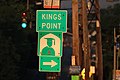 Kings Point sign.jpg 6,000 × 4,000; 6.04 MB
-
 Lake Success Shopping Center td (2021-06-20) 16 - Shake Shack.jpg 5,472 × 3,648; 4.41 MB
-
 Laurel Hollow Entrance Sign, Laurel Hollow, Long Island, New York August 15, 2021.jpg 4,032 × 3,024; 2.97 MB
-
 Loop Parkway at Meadowbrook.jpg 2,048 × 1,536; 856 KB
-
 Loop Parkway at Point Lookout.jpg 1,024 × 768; 146 KB
-
 Manhasset Hills Welcome Sign, Manhasset Hills, New York.jpg 4,032 × 3,024; 4.21 MB
-
 Meadowbrook approaching exit M7.jpg 3,648 × 2,736; 4.67 MB
-
 Meadowbrook State Parkway - New York - 6819261639.jpg 2,816 × 2,112; 306 KB
-
 Meadowbrook State Parkway at Southern State Parkway west.jpg 1,024 × 768; 171 KB
-
 Meadowbrook State Parkway at toll barrier.jpg 1,024 × 768; 142 KB
-
 Middle Neck Road, Great Neck, New York.jpg 6,000 × 4,000; 10.9 MB
-
 Mineola Memorial Pk td 06.jpg 5,472 × 3,648; 9 MB
-
 Mineola Memorial Pk td 48 - Mineola Library.jpg 3,648 × 5,472; 7.97 MB
-

-

-

-
 Muttontown Entrance Sign, Muttontown, Long Island, New York August 29, 2021.jpg 4,032 × 3,024; 4.48 MB
-
 New Hyde Park Road Opening (50429334847).jpg 4,032 × 3,024; 1.76 MB
-
 New York State Park Police Station; Bay Parkway; Jones Beach West End.jpg 3,648 × 2,736; 2.04 MB
-
 NICE Bus Stop 1570, Roslyn Estates, Long Island, New York September 26, 2021.jpg 4,032 × 3,024; 1.07 MB
-
 NICE Northern Bl 07.jpg 1,500 × 2,000; 610 KB
-
 North Hempstead Beach Park-4.jpg 5,152 × 3,864; 8.28 MB
-
 Northern State approaching Willis Avenue.jpg 1,024 × 768; 178 KB
-
 Northern State Parkway at Exit 26S.jpg 1,024 × 768; 162 KB
-
 Northern State Parkway Exit 38.jpg 640 × 480; 60 KB
-
 NY 101 Sign, Flower Hill, NY July 30, 2023 A.jpg 4,032 × 3,024; 2 MB
-
 NY 107 north in Glen Head.jpg 1,600 × 1,200; 425 KB
-
 NY 107S at NY 105.jpg 1,024 × 768; 212 KB
-
 NY 135 at Exit 12.jpg 1,024 × 768; 294 KB
-
 NY 25C shield.jpg 972 × 1,296; 244 KB
-
 NY 878 Northbound in Nassau County.jpg 1,600 × 1,200; 330 KB
-
 Ocean Parkway WB approaching the Wantagh.jpg 2,048 × 1,536; 898 KB
-

-
 Rock Hall; Lawrence, NY-9; 2017-11-16.jpg 3,648 × 2,736; 2.03 MB
-
 Rockville Centre LIRR Station; Do Not Enter Sign.JPG 4,000 × 3,000; 2.47 MB
-
 Rockville Centre LIRR Station; Two-Way Traffic Sign.JPG 4,000 × 3,000; 2.31 MB
-
 Roslyn Clock Tower; Old NY 495 Sign.jpg 5,152 × 3,864; 7.73 MB
-
 Sands Point Preserve-4.jpg 3,648 × 2,736; 2.01 MB
-
 SB Wantagh State Parkway; Green Island Fishing Access Sign-1.jpg 3,648 × 2,736; 1.52 MB
-
 SB Wantagh State Parkway; Green Island Fishing Access Sign-2.jpg 3,648 × 2,736; 1.51 MB
-
 SB Wantagh State Parkway; Green Island Fishing Access Sign-3.jpg 3,648 × 2,736; 2.04 MB
-
 SB Wantagh State Parkway; Ocean Parkway 4 Miles.jpg 3,648 × 2,736; 1.53 MB
-
 School Street Grade Crossing Eliminated and Road Reopened (50609947822).jpg 5,184 × 3,456; 1.39 MB
-
 Sea Cliff Avenue; School Bus Stop Pentagon with Words.jpg 3,648 × 2,736; 2.04 MB
-
 Shelter Rock Long Island.jpg 702 × 464; 368 KB
-
 Southern State Entrances from Valley Stream State Park.jpg 3,648 × 2,736; 2.1 MB
-
 St. Paul's Complex LI td (2021-08-28) 048.jpg 5,472 × 3,648; 4.85 MB
-
 St. Paul's Complex LI td (2021-08-28) 057.jpg 3,648 × 5,472; 7.47 MB
-
 Stonytown Road, Flower Hill, NY September 2, 2022 III.jpg 4,032 × 3,024; 6.93 MB
-
 Stonytown Road, Flower Hill, NY September 2, 2022 VIII.jpg 4,032 × 3,024; 5.25 MB
-
 Stonytown Road, Flower Hill, NY September 2, 2022 X.jpg 4,032 × 3,024; 6.09 MB
-
 Tobay Beach Entrance and Exit from WB Ocean Parkway-2.jpg 3,648 × 2,736; 2.05 MB
-
 Tobay Beach Entrance and Exit from WB Ocean Parkway-3.jpg 3,648 × 2,736; 2.05 MB
-
 Tobay Beach Entrance and Exit from WB Ocean Parkway-4.jpg 3,648 × 2,736; 1.7 MB
-
 Tobay Beach Spray Park-1.jpg 3,648 × 2,736; 2.07 MB
-
 Two Jericho Plaza alongside New York State Route 25 in Jericho.jpg 1,600 × 1,200; 429 KB
-
 Union Tpk (NY 25C) & Lakeville Rd; New Hyde Park, NY-2.jpg 3,648 × 2,736; 2 MB
-
 Union Tpk (NY 25C) & Lakeville Rd; New Hyde Park, NY-3.jpg 3,648 × 2,736; 2.05 MB
-
 Union Tpk (NY 25C) & Lakeville Rd; New Hyde Park, NY-4.jpg 3,648 × 2,736; 2.04 MB
-
 Union Tpk (NY 25C) & Lakeville Rd; New Hyde Park, NY-5.jpg 3,648 × 2,736; 2.08 MB
-
 Union Tpk (NY 25C) & Lakeville Rd; New Hyde Park, NY-6.jpg 3,648 × 2,736; 2.04 MB
-
 Union Tpk (NY 25C) & Lakeville Rd; New Hyde Park, NY-7.jpg 3,648 × 2,736; 2.04 MB
-
 Wantagh at NY 24.jpg 640 × 480; 39 KB
-
 WB @ East Island Bridge, Glen Cove Historical Marker.jpg 3,648 × 2,736; 2.06 MB
-
 WB Bay Parkway; 35 MPH near Meadowbrook Pkwy.jpg 3,648 × 2,736; 2.05 MB
-
 WB Bay Parkway; Jones Beach West End Toll Booth.jpg 3,648 × 2,736; 2.04 MB
-
 WB Bay Parkway; North Meadowbrook Pkwy Shield.jpg 3,648 × 2,736; 1.72 MB
-
 WB Bay Parkway; Stop Ahead Sign West of Meadowbrook-Ocean Interchange.jpg 3,648 × 2,736; 1.56 MB
-
 WB Ocean Parkway from the EB Tobay Beach U-Turn.jpg 3,648 × 2,736; 2.04 MB
-
 WB Ocean Parkway; Tobay Beach Road Sign in Median.jpg 3,648 × 2,736; 2.07 MB
-
 WB Ocean Pkwy from Jones Beach Traffic Circle.jpg 3,648 × 2,736; 2.08 MB
-
 West End Avenue RR Xing; Oyster Bay, New York.jpg 3,648 × 2,736; 2.05 MB
-
 Westwood LIRR Station Entrance; Whitehall Street in Lynbrook.jpg 3,648 × 2,736; 2.07 MB
-
 Williston Pk Dartmouth St clock jeh.jpg 1,393 × 1,194; 371 KB


_006.jpg)
_007_-_Gate_5.jpg)


_001.jpg)
_005.jpg)
_014.jpg)


.jpg)
.jpg)
.jpg)


_16_-_Shake_Shack.jpg)


.jpg)
.jpg)
.jpg)

.jpg)


.jpg)


_048.jpg)
_057.jpg)


_%26_Lakeville_Rd;_New_Hyde_Park,_NY-2.jpg)
_%26_Lakeville_Rd;_New_Hyde_Park,_NY-3.jpg)
_%26_Lakeville_Rd;_New_Hyde_Park,_NY-4.jpg)
_%26_Lakeville_Rd;_New_Hyde_Park,_NY-5.jpg)
_%26_Lakeville_Rd;_New_Hyde_Park,_NY-6.jpg)
_%26_Lakeville_Rd;_New_Hyde_Park,_NY-7.jpg)


