Category:Road signs in North Carolina
Jump to navigation
Jump to search
States of the United States: Alabama · Alaska · Arizona · Arkansas · California · Colorado · Connecticut · Delaware · Florida · Georgia · Hawaii · Idaho · Illinois · Indiana · Iowa · Kansas · Kentucky · Louisiana · Maine · Maryland · Massachusetts · Michigan · Minnesota · Mississippi · Missouri · Montana · Nebraska · Nevada · New Hampshire · New Jersey · New Mexico · New York · North Carolina · North Dakota · Ohio · Oklahoma · Oregon · Pennsylvania · Rhode Island · South Carolina · South Dakota · Tennessee · Texas · Utah · Vermont · Virginia · Washington · West Virginia · Wisconsin · Wyoming – District of Columbia: Washington, D.C.
Guam · Puerto Rico
Guam · Puerto Rico
Subcategories
This category has the following 24 subcategories, out of 24 total.
C
- County signs in North Carolina (45 F)
D
G
H
I
M
R
S
- Stop signs in North Carolina (13 F)
- Street signs in North Carolina (45 F)
U
V
W
Media in category "Road signs in North Carolina"
The following 136 files are in this category, out of 136 total.
-
 "Comfort Station, 4 Miles" sign (7bbbf13fb828446e9e8f04e60beeadfb).tif 2,409 × 1,506; 10.38 MB
-
 2008-07-30 Misoriented manhole cover in a handicapped parking space at UNC.jpg 2,448 × 3,859; 3.43 MB
-
 AppalCART Green-red bus stop.jpg 4,016 × 3,016; 2.11 MB
-
 Bat Cave Sign.JPG 4,288 × 2,848; 3.01 MB
-
 Blue Ridge Parkway - North Carolina (14584469208).jpg 2,304 × 3,072; 840 KB
-
 Blue Ridge Parkway - North Carolina (14584541698).jpg 3,072 × 2,304; 803 KB
-
 Blue Ridge Parkway - North Carolina (14584543498).jpg 3,072 × 2,304; 954 KB
-
 Blue Ridge Parkway - North Carolina (14584635708).jpg 3,072 × 2,304; 890 KB
-
 Blue Ridge Parkway - North Carolina (14748100046).jpg 3,072 × 2,304; 869 KB
-
 Blue Ridge Parkway - North Carolina (14768018051).jpg 3,072 × 2,304; 641 KB
-
 Blue Ridge Parkway - North Carolina (14790976203).jpg 3,072 × 2,304; 973 KB
-
 Blue Ridge Parkway-27527-2.jpg 2,000 × 1,500; 1.36 MB
-
 Buck Creek Gap-2014.jpg 5,520 × 3,684; 5.35 MB
-
 Castle Hayne 01.jpg 5,184 × 3,456; 6.54 MB
-
 Charlotte, NC, USA - panoramio.jpg 1,920 × 2,560; 1.23 MB
-
 Chief Justice Henry E. Frye Bridge dedication.jpg 1,798 × 1,200; 1.28 MB
-
 Deals Gap-Welcome to NC.jpg 5,520 × 3,684; 8.05 MB
-
 Devil's Tramping Ground Road sign.jpg 4,608 × 3,456; 3.86 MB
-
 Dr Mary Martin Sloop Highway.jpg 3,648 × 2,736; 4.45 MB
-
 2004-02-02 No Parking Fire Lane.jpg 2,560 × 1,920; 1.36 MB
-
 East I-440 End-Raleigh.jpg 3,684 × 5,520; 5.79 MB
-
 Eastern Terminus of the Cherohala Skyway at Santeetlah Gap, NC - panoramio.jpg 3,072 × 2,304; 2 MB
-
 Elwell Ferry Status Sign.jpg 5,346 × 3,564; 12.1 MB
-
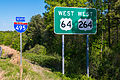
 End I-495 & US 264 Raleigh.jpg 5,520 × 3,105; 11.53 MB
-
 Estatoe Sign 2011.jpg 4,288 × 2,848; 2.94 MB
-
 Exit 13 on I-885.jpg 4,000 × 3,000; 1.68 MB
-
 Exit 312 on I-40.jpg 4,000 × 3,000; 1.79 MB
-
 Exit 49 on Interstate 85 North 01.jpg 6,000 × 2,299; 1.76 MB
-
 Forest Heritage National Scenic Byway - Byway Begins - NARA - 7718469.jpg 2,150 × 1,250; 2.88 MB
-
 Forest Heritage National Scenic Byway - Byway to the Right - NARA - 7718468.jpg 1,250 × 2,048; 522 KB
-
 Future I-495-Knightdale.jpg 5,520 × 3,684; 6.94 MB
-
 Future73nb.jpg 1,600 × 1,200; 1.04 MB
-
 Harris, NC, USA - panoramio.jpg 988 × 1,024; 650 KB
-
 Highway sign at Newfound Gap IMG 5141.JPG 4,608 × 3,456; 5.16 MB
-
 Holder Road Harnett County Idalia road closed sign down tree.jpg 1,200 × 1,600; 1.85 MB
-
 I-40 BUS, US 421, NC 150.jpg 1,568 × 980; 315 KB
-
 I-40W 2012 Rockslide Cleanup.jpg 1,529 × 2,048; 1,010 KB
-
 I-495 South and US 264 West End.jpg 5,520 × 3,684; 14.83 MB
-
 I-495 US 64 US 264 Raleigh (2014).jpg 5,520 × 3,684; 9.68 MB
-
 I-495 US 64 US 264 Raleigh (2016).jpg 5,520 × 3,684; 17.49 MB
-
 I-73 I-74 Tabernacle Church Road.jpg 5,441 × 2,481; 3.13 MB
-
 I840greensboro.jpg 1,600 × 1,200; 941 KB
-
 Jockeys Ridge State Park, Nags Head, North Carolina (14260797530).jpg 4,000 × 3,000; 2.98 MB
-
 Lakeview Drive West Entrance Sign.jpg 5,520 × 3,684; 7.68 MB
-
 Lambsburg I-77N Welcome Center-01.jpg 5,520 × 3,684; 16.68 MB
-
 Laurinburg City Limit Sign.jpg 5,103 × 4,000; 4.08 MB
-
 Little Switzerland Tunnel.jpg 502 × 376; 142 KB
-
 Micaville-Post Office.jpg 4,288 × 2,848; 2.98 MB
-
 Mount Gilead City Limit Sign on North Carolina Highway 73.jpg 6,000 × 2,079; 3.09 MB
-
 N Church Street and Davie Street Greensboro, NC - panoramio.jpg 1,536 × 2,048; 1.01 MB
-
 NB I-95 in NC @ Exit 171; No Camping or Attractions.jpg 3,648 × 2,736; 1.78 MB
-
 NC 105 End Sign.jpg 1,037 × 1,565; 1.41 MB
-
 NC 105 with Truck Signs.jpg 1,037 × 1,565; 1.48 MB
-
 NC 134 End - Ulah.jpg 5,520 × 3,684; 7.26 MB
-
 NC 147 Toll North.jpg 4,288 × 2,848; 2.93 MB
-
 NC 194 Truck Warning (Banner Elk).jpg 5,520 × 3,684; 7.79 MB
-
 NC 522 End.jpg 5,520 × 3,684; 4.68 MB
-
 NC 75 End.jpg 5,520 × 3,684; 7.06 MB
-
 NC107-Cashiers.jpg 3,684 × 5,520; 6.81 MB
-
 NC128-North.jpg 5,041 × 3,129; 4.51 MB
-
 NC128-South-Vertical.jpg 3,684 × 5,520; 6.06 MB
-
 NC128-South.jpg 5,520 × 3,684; 6.7 MB
-
 NC141-Peachtree.jpg 5,520 × 3,105; 5.97 MB
-
 NC161-NC274-Bessemer City.jpg 3,684 × 5,520; 4.63 MB
-
 NC175End.jpg 4,265 × 5,520; 7.19 MB
-
 NC180-Shelby.jpg 3,684 × 5,520; 6.36 MB
-
 NC181-Beatrice Cobb Highway.jpg 3,648 × 2,736; 3.76 MB
-
 NC181-Old Beatrice Cobb Highway-2001.jpg 1,037 × 1,565; 1.53 MB
-
 NC184-End in 4 Miles Sign.jpg 1,037 × 1,565; 1.78 MB
-
 NC215North.jpg 3,684 × 5,520; 6.67 MB
-
 NC225End.jpg 5,520 × 3,684; 5.99 MB
-
 NC226-Grover.jpg 5,520 × 3,684; 5.15 MB
-
 NC226A-Blue Ridge Parkway.JPG 1,565 × 1,037; 1.62 MB
-
 NC226A-Woodlawn.JPG 1,565 × 1,037; 1.95 MB
-
 NC27-NC182-Lincolnton.jpg 5,520 × 3,578; 7.8 MB
-
 NC28-Fontana Village.jpg 5,520 × 3,684; 6.16 MB
-
 NC281-State Line.jpg 3,684 × 5,520; 6.05 MB
-
 NC3 Concord.jpg 5,520 × 3,684; 6.62 MB
-
 NC581-NT-Louisburg.jpg 3,648 × 2,736; 3.45 MB
-
 NC742 NC109 US52 US74 Wadesboro.jpg 5,520 × 3,684; 5.79 MB
-
 NC751-Eno.jpg 5,520 × 3,684; 15.11 MB
-
 NC8-NC73-End New London.jpg 3,684 × 5,520; 8.1 MB
-
 NC89nNC66JctSign (28973146202).jpg 2,400 × 1,600; 2.79 MB
-
 NC901-N-Union Grove.jpg 5,520 × 3,105; 10.62 MB
-
 New Salem Parkway Sign.jpg 3,264 × 2,448; 1.94 MB
-
 No Trespassing Sign on Cherry Street.jpg 4,000 × 6,000; 12.69 MB
-
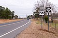
 North NC 200.jpg 5,520 × 3,684; 7.94 MB
-
 Odum Village Road Sign UNCCH 20140928.jpg 1,552 × 2,168; 1.19 MB
-
 Outer Banks Scenic Byway - Signage at Cedar Island - NARA - 7720861.jpg 1,719 × 1,146; 406 KB
-
 Outer Banks Scenic Byway - Wayfinding Signs at Davis - NARA - 7720863.jpg 2,272 × 1,704; 1.08 MB
-
 Rest Area Sign on I-40 I-85.jpg 6,000 × 2,112; 1.73 MB
-
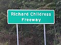 Richard Childress Freeway sign.jpg 1,440 × 1,080; 582 KB
-
 Sign on Cherry Street in Winston-Salem.jpg 6,000 × 4,000; 6.24 MB
-
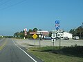
 Signs along NC 705 Pottery Highway.jpg 1,319 × 1,039; 581 KB
-
 Soco Gap-2014.jpg 5,520 × 3,684; 8.23 MB
-
 Sugar Grove Sign.jpg 3,648 × 2,736; 1.79 MB
-
 Surry Co I-77S Welcome Center-03.jpg 5,520 × 3,684; 15.75 MB
-
 Surry Co I-77S Welcome Center-05.jpg 5,520 × 3,684; 17.43 MB
-
 Triangle Expressway Toll Rate Sign.jpg 4,288 × 2,848; 2.99 MB
-
 US 19E-NC 194 Cranberry.jpg 3,684 × 5,520; 7.64 MB
-
 US 220 Alt-Bus-Ulah.jpg 5,520 × 3,684; 6.49 MB
-
 US 220 Alt-Ulah.jpg 5,520 × 3,684; 6.35 MB
-
 US 23A.jpg 4,288 × 2,848; 2.94 MB
-
 US 321 and SR-159 in NC.JPG 2,736 × 3,648; 1.93 MB
-
 US 64 Bus-NC 18-NC 181-Meeting Street.jpg 3,684 × 5,520; 4.66 MB
-
 US1 North - Jct US74 Future I-74 Signs (49206381462).jpg 3,600 × 2,400; 3.13 MB
-
 US1 North at Future I-74 US74 Signs (49206167151).jpg 3,600 × 2,400; 2.59 MB
-
 US1 US220 North Signs - Rockingham (49206381682).jpg 3,600 × 2,400; 3.26 MB
-
 US19-US74-US129-Murphy.jpg 5,520 × 3,684; 6.67 MB
-
 US19Conn-South.jpg 3,684 × 5,520; 6.59 MB
-
 US19connUS74-Bryson City.jpg 5,520 × 3,684; 7.03 MB
-
 US29SB&US74WB NC Weigh Station-02.jpg 5,520 × 3,684; 8.07 MB
-
 US29SB&US74WB NC Weigh Station-03.jpg 5,520 × 3,684; 8.04 MB
-
 US401northend.jpg 1,600 × 1,200; 836 KB
-
 US52 NC742 South US74 East Signs (49202026406).jpg 3,600 × 2,400; 3.21 MB
-
 US601 North NC73 Truck West - Jct NC3 (30874606828).jpg 2,400 × 1,600; 2.37 MB
-
 US64 US264 I-495-Knightdale Ver 2.jpg 5,520 × 3,365; 11.8 MB
-
 US64 US264 I-495-Knightdale Ver 2A.jpg 5,520 × 3,684; 13.6 MB
-
 US64 US264 I-495-Knightdale.jpg 5,520 × 3,684; 7.79 MB
-
 US74 East - NC18 NC150 Signs (44744652751).jpg 2,400 × 1,600; 2.1 MB
-
 US74 East - NC180 Signs (44026175654).jpg 2,400 × 1,600; 1.84 MB
-
 US74 East - NC226 Signs (44744650961).jpg 2,400 × 1,600; 2.15 MB
-
 US74 East Andrew Jackson Highway Signs (49202027316).jpg 3,600 × 2,400; 3.34 MB
-
 US74 East By-Pass NC226 South Signs (44026173364).jpg 2,400 × 1,600; 1.9 MB
-
 US74 East NC742 US52 South at NC109 Signs (49201539908).jpg 3,600 × 2,400; 3.09 MB
-
 US74 East Sign - Near I-26 (44026168114).jpg 2,400 × 1,600; 2.12 MB
-
 US74 East US29 North Signs (44744656381).jpg 2,400 × 1,600; 1.86 MB
-
 US74 NC27 East Signs - Charlotte (49202021741).jpg 3,600 × 2,400; 2.99 MB
-
 US74eRoad-FutureInt74corridor (29425753671).jpg 1,200 × 800; 513 KB
-
 Vass North Corolina Road Signs image 1.jpg 3,648 × 2,736; 2.85 MB
-
 Vass North Corolina Road Signs image 2.jpg 3,648 × 2,736; 2.83 MB
-

-
 W T Roundy Motor Court and house New Hill NC.JPG 3,264 × 2,448; 1.62 MB
-
 Warning Sign on Cherry Street.jpg 6,000 × 4,000; 5.05 MB
-
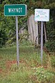 Whynot North Carolina sign 5-17-2011.jpg 2,000 × 3,008; 1.34 MB
-
 Winston-Salem Welcome Sign on I-74.jpg 6,000 × 4,000; 5.61 MB


.jpg)
.jpg)
.jpg)
.jpg)
.jpg)
.jpg)
.jpg)


.jpg)
.jpg)


.jpg)


.jpg)


.jpg)


.jpg)
.jpg)
.jpg)


.jpg)
.jpg)


.jpg)
.jpg)
.jpg)
.jpg)
.jpg)
.jpg)
.jpg)
.jpg)
.jpg)
.jpg)


