Category:Road signs in Turner County, Georgia
Jump to navigation
Jump to search
Counties of Georgia: Appling · Atkinson · Bacon · Baker · Banks · Barrow · Bartow · Ben Hill · Berrien · Brantley · Brooks · Bryan · Butts · Calhoun · Camden · Carroll · Catoosa · Charlton · Chatham · Chattooga · Cherokee · Clay · Clayton · Clinch · Cobb · Coffee · Colquitt · Columbia · Cook · Coweta · Crawford · Crisp · Dade · Dawson · Decatur · DeKalb · Dodge · Dooly · Dougherty · Douglas · Early · Effingham · Evans · Floyd · Forsyth · Franklin · Fulton · Gilmer · Glynn · Gordon · Grady · Greene · Gwinnett · Habersham · Hall · Haralson · Harris · Hart · Henry · Houston · Irwin · Jasper · Jeff Davis · Jefferson · Lamar · Lanier · Laurens · Lee · Liberty · Long · Lowndes · Lumpkin · Macon · Madison · Marion · McIntosh · Miller · Mitchell · Monroe · Montgomery · Murray · Peach · Pierce · Pike · Polk · Pulaski · Putnam · Randolph · Rockdale · Schley · Seminole · Spalding · Stephens · Stewart · Sumter · Talbot · Tattnall · Taylor · Telfair · Terrell · Thomas · Tift · Toombs · Towns · Treutlen · Troup · Turner · Upson · Walker · Ware · Wayne · Wheeler · White · Whitfield · Wilcox · Worth
City-counties: Athens–Clarke · Augusta–Richmond · Columbus–Muscogee · Georgetown–Quitman · Macon–Bibb · Preston–Webster · Statenville–Echols
City-counties: Athens–Clarke · Augusta–Richmond · Columbus–Muscogee · Georgetown–Quitman · Macon–Bibb · Preston–Webster · Statenville–Echols
Subcategories
This category has the following 2 subcategories, out of 2 total.
Media in category "Road signs in Turner County, Georgia"
The following 19 files are in this category, out of 19 total.
-
 Arabi, Crisp County limit US41NB.jpg 5,184 × 3,456; 8.25 MB
-
 Ashburn City limit, US41NB.JPG 4,320 × 3,240; 4.42 MB
-
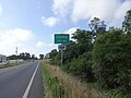
 Ben Hill County border, GA90EB.JPG 4,608 × 3,456; 4.19 MB
-
 GA107-112 Int, Turner County.JPG 4,608 × 3,456; 5.15 MB
-
 GA107rightGA112signs (31008601605).jpg 1,600 × 2,400; 2.4 MB
-
 GA112nRoadCurveSign (25372812289).jpg 2,400 × 1,600; 2.16 MB
-
 GA159nGA90nRoadSigns (22830068618).jpg 2,400 × 1,600; 1.76 MB
-
 GA159nRoadSign (25372768909).jpg 2,400 × 1,600; 2.18 MB
-
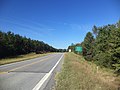
 Georgia I75sb Exit 84.jpg 5,184 × 3,456; 4.32 MB
-
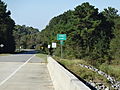
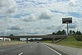 Georgia I75sb Rockhouse Rd Overpass.jpg 5,184 × 3,456; 4.77 MB
-
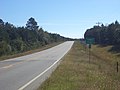
 Georgia I75sb Tift County limit.jpg 5,184 × 3,456; 4.19 MB
-
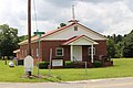 Piney Grove Baptist Church, Rebecca.jpg 5,184 × 3,456; 6.27 MB
-
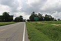 Rebecca city limit GA112 SB.jpg 5,184 × 3,456; 5.74 MB
-
 Sycamore city limit, US41SB.JPG 4,608 × 3,456; 4.82 MB
-
 Turner County border, GA90WB.JPG 4,608 × 3,456; 5.21 MB
-
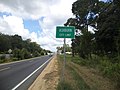
 Turner County limit US41SB.jpg 5,184 × 3,456; 9.05 MB
-
 Turner County Line, GA 32.JPG 4,320 × 3,240; 4.53 MB
-
 US41GA32signsJunctionBlack (30706987480).jpg 1,600 × 2,400; 2.05 MB
-
 Worth County Line, GA 32.JPG 4,320 × 3,240; 4.6 MB


.jpg)
.jpg)
.jpg)
.jpg)


.jpg)
