Category:Roads in Colquitt County, Georgia
Jump to navigation
Jump to search
Counties of Georgia: Appling · Atkinson · Bacon · Baker · Baldwin · Banks · Barrow · Bartow · Ben Hill · Berrien · Bleckley · Brantley · Brooks · Bryan · Bulloch · Burke · Butts · Calhoun · Camden · Campbell · Candler · Carroll · Catoosa · Charlton · Chatham · Chattooga · Cherokee · Clay · Clayton · Clinch · Cobb · Coffee · Colquitt · Columbia · Cook · Coweta · Crawford · Crisp · Dade · Dawson · Decatur · DeKalb · Dodge · Dooly · Dougherty · Douglas · Early · Effingham · Elbert · Emanuel · Evans · Fannin · Fayette · Floyd · Forsyth · Franklin · Fulton · Gilmer · Glascock · Glynn · Gordon · Grady · Greene · Gwinnett · Habersham · Hall · Hancock · Haralson · Harris · Hart · Heard · Henry · Houston · Irwin · Jackson · Jasper · Jeff Davis · Jefferson · Jenkins · Johnson · Jones · Lamar · Lanier · Laurens · Lee · Liberty · Lincoln · Long · Lowndes · Lumpkin · Macon · Madison · Marion · McDuffie · McIntosh · Meriwether · Miller · Milton · Mitchell · Monroe · Montgomery · Morgan · Murray · Newton · Oconee · Oglethorpe · Paulding · Peach · Pickens · Pierce · Pike · Polk · Pulaski · Putnam · Rabun · Randolph · Rockdale · Schley · Screven · Seminole · Spalding · Stephens · Stewart · Sumter · Talbot · Taliaferro · Tattnall · Taylor · Telfair · Terrell · Thomas · Tift · Toombs · Towns · Treutlen · Troup · Turner · Twiggs · Union · Upson · Walker · Walton · Ware · Warren · Washington · Wayne · Wheeler · White · Whitfield · Wilcox · Wilkes · Wilkinson · Worth
City-counties: Athens–Clarke · Augusta–Richmond · Columbus–Muscogee · Cusseta–Chattahoochee · Georgetown–Quitman · Macon–Bibb · Preston–Webster · Statenville–Echols
City-counties: Athens–Clarke · Augusta–Richmond · Columbus–Muscogee · Cusseta–Chattahoochee · Georgetown–Quitman · Macon–Bibb · Preston–Webster · Statenville–Echols
Subcategories
This category has the following 9 subcategories, out of 9 total.
Media in category "Roads in Colquitt County, Georgia"
The following 20 files are in this category, out of 20 total.
-
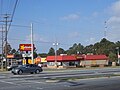
 Chevron gas, 1350 N Veterans Pkwy, Moultrie.JPG 4,608 × 3,456; 4.97 MB
-
 Chick-fil-a, US319, Moultrie.jpg 5,184 × 3,456; 6.78 MB
-
 Commercial Banking Company, GA 35 133, Moultrie.JPG 4,320 × 3,240; 4.48 MB
-
 Dollar General, GA 37 133, Moultrie.JPG 4,320 × 3,240; 4.39 MB
-
 Ellenton City limits, Ellenton Omega Rd SB.JPG 5,152 × 3,864; 7.85 MB
-
 Friedlander's Building.JPG 3,072 × 2,304; 2.94 MB
-
 GA 133 270 Junction, Doerun.JPG 4,320 × 3,240; 4.38 MB
-
 Hamilton Elementary School, Colquitt County.JPG 5,152 × 3,864; 7.83 MB
-
 Hardee's GA 37 133, Moultrie.JPG 4,320 × 3,240; 4.44 MB
-
 McDonald St Railroad Crossing, Ellenton.JPG 4,320 × 3,240; 4.4 MB
-
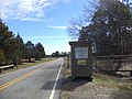
 Moultrie Bus Terminal (NW corner).JPG 3,072 × 2,304; 2.96 MB
-
 Raceway Gas Station, 1301 N Veterans Pkwy, Moultrie.jpg 4,608 × 3,456; 5.88 MB
-
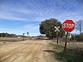
 Reed Bingham State Park Colquitt County entrance.JPG 4,320 × 3,240; 4.54 MB
-
 Reed Bingham State Park Colquitt County Toll Gate.JPG 4,320 × 3,240; 4.5 MB
-
 Shell, Blimpie, US319, Moultrie.jpg 5,184 × 3,456; 7.52 MB
-
 South Georgia Bank.JPG 3,072 × 2,304; 3.12 MB
-
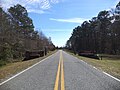
 Thomas County border, GA202SB.jpg 5,184 × 3,456; 7.45 MB
-
 US319BusGA33SignsRoad (25372798949).jpg 2,400 × 1,600; 2.22 MB
-
 US319nGA33nGA133Signs-Moultrie (22830118628).jpg 2,400 × 1,600; 2.5 MB
-
 Walgreens, GA 37 133, Moultrie.JPG 4,320 × 3,240; 4.51 MB


.JPG)


.jpg)
.jpg)
