Category:Roads in Paull
Jump to navigation
Jump to search
Subcategories
This category has the following 3 subcategories, out of 3 total.
Media in category "Roads in Paull"
The following 55 files are in this category, out of 55 total.
-
 'High Light' Thorngumbald Clough - geograph.org.uk - 400577.jpg 475 × 640; 94 KB
-
 'Low Light' Thorngumbald Clough - geograph.org.uk - 400564.jpg 480 × 640; 85 KB
-
 Aerial view of Paull from the east - geograph.org.uk - 325330.jpg 640 × 471; 112 KB
-
 Another Workday Begins - geograph.org.uk - 1051590.jpg 640 × 480; 36 KB
-
 Boreas Hill - geograph.org.uk - 12565.jpg 640 × 480; 98 KB
-
 Boreas Hill from the east. - geograph.org.uk - 12830.jpg 640 × 480; 104 KB
-
 Cherry Cobb Sands - geograph.org.uk - 296020.jpg 454 × 640; 86 KB
-
 Cherry Cobb Sands Bank - geograph.org.uk - 295767.jpg 475 × 640; 76 KB
-
 Cherry Cobb Sands Road - geograph.org.uk - 1473717.jpg 640 × 480; 35 KB
-
 Cherry Cobb Sands Road - geograph.org.uk - 1473722.jpg 640 × 480; 31 KB
-
 Cherry Cobb Sands Road - geograph.org.uk - 1473742.jpg 640 × 480; 36 KB
-
 Cherry Cobb Sands Road - geograph.org.uk - 1473753.jpg 640 × 480; 39 KB
-
 Cherry Cobb Sands Road - geograph.org.uk - 295730.jpg 640 × 465; 92 KB
-
 Cherry Cobb Sands Road - geograph.org.uk - 339426.jpg 640 × 480; 89 KB
-
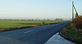
 Early Morning near Newton Garth - geograph.org.uk - 922681.jpg 640 × 478; 56 KB
-
 Entering Paull - geograph.org.uk - 1473966.jpg 640 × 480; 55 KB
-
 Entrance to Low Paull Farm - geograph.org.uk - 757669.jpg 480 × 640; 200 KB
-
 Farm track - geograph.org.uk - 13002.jpg 640 × 480; 76 KB
-
 Farm track - geograph.org.uk - 13009.jpg 640 × 480; 93 KB
-
 Farm track - geograph.org.uk - 16337.jpg 640 × 473; 102 KB
-
 GSU886 at Stone Creek (Front Right).jpg 4,320 × 3,240; 5.37 MB
-
 GSU886 at Stone Creek (Front).jpg 4,320 × 3,240; 5.77 MB
-
 GSU886 at Stone Creek (Rear Right).jpg 4,320 × 3,240; 5.66 MB
-
 Lakes Farm - geograph.org.uk - 1084797.jpg 640 × 480; 102 KB
-
 Looking towards Oxgoddes Farm - geograph.org.uk - 12829.jpg 640 × 480; 82 KB
-
 Muddy Puddles - geograph.org.uk - 728680.jpg 480 × 640; 134 KB
-
 New House Farm, Cherry Cobb Sands - geograph.org.uk - 295713.jpg 640 × 465; 110 KB
-
 Newlands Lane - geograph.org.uk - 1473773.jpg 640 × 321; 15 KB
-
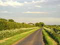
 Newlands Lane, Paull - geograph.org.uk - 306350.jpg 640 × 447; 68 KB
-
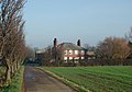
 Newton Garth, Paull - geograph.org.uk - 289764.jpg 640 × 426; 78 KB
-
 Old Little Humber - geograph.org.uk - 295662.jpg 640 × 468; 91 KB
-
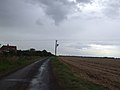
 "Lean Power" - geograph.org.uk - 13149.jpg 640 × 480; 107 KB
-
 Paull Road, near Salt End - geograph.org.uk - 757534.jpg 640 × 459; 147 KB
-
 Pipeline works on Cow Hill - geograph.org.uk - 1473928.jpg 640 × 480; 70 KB
-
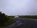
 Road Junction - geograph.org.uk - 12431.jpg 640 × 480; 85 KB
-
 Road to Sands Bridge - geograph.org.uk - 1473768.jpg 640 × 480; 39 KB
-
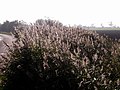 Roadside Reeds - geograph.org.uk - 274406.jpg 640 × 480; 105 KB
-
 Sands Farm - geograph.org.uk - 295752.jpg 640 × 446; 76 KB
-
 Sands House, Cherry Cobb Sands - geograph.org.uk - 295718.jpg 640 × 448; 148 KB
-
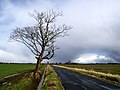 Solitary Roadside Tree - geograph.org.uk - 735190.jpg 640 × 480; 71 KB
-
 The Paull to Hedon Road - geograph.org.uk - 397573.jpg 640 × 480; 71 KB
-
 The Road to Hedon - geograph.org.uk - 393978.jpg 640 × 480; 121 KB
-
 The road to Little Humber - geograph.org.uk - 295688.jpg 470 × 640; 106 KB
-
 The Road to Newton Garth - geograph.org.uk - 651358.jpg 640 × 345; 32 KB
-
 The Road to Paull at Dawn - geograph.org.uk - 1412929.jpg 480 × 640; 70 KB
-
 The Road to Stone Creek - geograph.org.uk - 417725.jpg 640 × 480; 69 KB
-
 The Road to Stone(y) Creek - geograph.org.uk - 13006.jpg 640 × 480; 70 KB
-
 The road to Stoney Creek - geograph.org.uk - 13001.jpg 640 × 480; 91 KB
-

-

-
 Thorgumbald Road and Paull Church - geograph.org.uk - 1473953.jpg 640 × 480; 50 KB
-
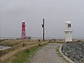 Thorngumbald Clough Lights, Paull - geograph.org.uk - 52140.jpg 640 × 480; 56 KB
-
 Thorngumbald Road, near Paull - geograph.org.uk - 757666.jpg 640 × 480; 154 KB
-
 Track to Sands Farm - geograph.org.uk - 1473732.jpg 640 × 480; 51 KB
-
 Track to the Humber River Bank - geograph.org.uk - 472756.jpg 640 × 480; 90 KB


.jpg)
.jpg)
.jpg)


_Creek_-_geograph.org.uk_-_13006.jpg)


