Category:Roads in the United States
Jump to navigation
Jump to search
Countries of the Americas: Argentina · The Bahamas · Barbados · Belize · Bolivia · Brazil · Canada · Chile · Colombia · Costa Rica · Cuba · Dominican Republic · Ecuador · El Salvador · Grenada · Guatemala · Guyana · Haiti · Honduras · Jamaica · Mexico · Nicaragua · Panama · Paraguay · Peru · Saint Lucia · Suriname · Trinidad and Tobago · United States of America · Uruguay · Venezuela
Other areas: Aruba · Bermuda · British Virgin Islands · Falkland Islands · French Guiana · Greenland · Guadeloupe · Martinique · Puerto Rico · Saint Barthélemy · Saint Pierre and Miquelon · Sint Maarten · Turks and Caicos Islands
Other areas: Aruba · Bermuda · British Virgin Islands · Falkland Islands · French Guiana · Greenland · Guadeloupe · Martinique · Puerto Rico · Saint Barthélemy · Saint Pierre and Miquelon · Sint Maarten · Turks and Caicos Islands
Wikimedia category | |||||
| Upload media | |||||
| Instance of | |||||
|---|---|---|---|---|---|
| Category combines topics | |||||
| Category contains | |||||
 | |||||
Subcategories
This category has the following 45 subcategories, out of 45 total.
+
B
C
D
G
J
L
M
N
O
P
R
S
T
V
~
Media in category "Roads in the United States"
The following 52 files are in this category, out of 52 total.
-
 "Steep grade causes problems for tourists." - NARA - 292832.jpg 3,000 × 1,733; 2.2 MB
-
 America's Highways 1776–1976 - 1820—General Jackson's Military Road.jpg 2,181 × 1,761; 2.88 MB
-
 America's Highways 1776–1976 - 1862—The Mullan Road.jpg 2,194 × 1,431; 2.25 MB
-
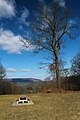
 At July 4th cookout outside car road.jpg 3,664 × 2,748; 1.88 MB
-
 Autumn-trees-country-road-fence - ForestWander.jpg 5,616 × 3,744; 12.17 MB
-
 Banneredhighways.svg 629 × 700; 89 KB
-
 Cars in snowstorm.JPG 640 × 480; 115 KB
-
 Chin 000546 172493 517766 4578 (36794578282).jpg 1,920 × 1,440; 481 KB
-
 Chin 000547 172494 517762 4578 (36156908433).jpg 1,920 × 1,440; 339 KB
-
 Columbia Gorge (10488335886).jpg 2,048 × 1,536; 991 KB
-
 Country road in rural America LCCN2011630198.tif 4,313 × 3,462; 85.46 MB
-
 Covie's 2nd or 3rd appearance on a billboard - panoramio.jpg 1,600 × 1,200; 473 KB
-
 Dandelion Patch (48297550121).jpg 3,600 × 2,400; 4.56 MB
-
 Danvers Route 1 Bridges Reopen November 23, 2009 (4128199901).jpg 2,048 × 1,536; 365 KB
-
 Dark Storm a Curve Ahead PLC-HW-23.jpg 3,872 × 2,592; 6.9 MB
-
 Delta N135EV Bombardier CRJ-900 (28973140797).jpg 2,400 × 1,600; 1.16 MB
-
 Drive Ended Here (101672000).jpg 1,024 × 682; 358 KB
-
 Driving along. (14259087152).jpg 4,000 × 3,000; 2.98 MB
-
 Dustin's Modeling Debut - panoramio.jpg 2,032 × 1,354; 379 KB
-
 Endless (199412723).jpeg 2,048 × 1,366; 990 KB
-
 FedEx Truck.jpg 1,132 × 849; 299 KB
-
 Freeway 215 San Bernardino CA.JPG 2,592 × 1,728; 509 KB
-
 FrenchLickRoutepolemarking.png 102 × 132; 26 KB
-
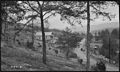 Furnace Branch dam site on Stony Creek - NARA - 280761.jpg 3,000 × 1,791; 1.84 MB
-

-
 Highway To... (51120404615).jpg 2,048 × 1,152; 1.46 MB
-
 Intersection of Life (Unsplash).jpg 3,888 × 1,815; 4.18 MB
-
 Laying Down on Highway 80 (14872016748).jpg 3,870 × 2,903; 3.55 MB
-
 Lee Highway Assn. LCCN2016825551.jpg 6,378 × 5,141; 5 MB
-
 Legend2.svg 481 × 361; 12 KB
-
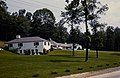 Motel viewed from the road. (e0b2cc833c5e4edb853f57181442e740).jpg 7,922 × 5,160; 3.47 MB
-
 Obálka publikace Toulky s Karlem Amerikou.jpg 1,782 × 2,597; 342 KB
-
 On the Road Again (50337108176).jpg 4,356 × 2,450; 15.69 MB
-
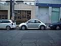 Parallel Parking cars.jpg 1,600 × 1,200; 1.13 MB
-
 Road (16760720050).jpg 4,423 × 2,088; 7.81 MB
-
 Road blocked to traffic.jpg 2,048 × 1,350; 215 KB
-
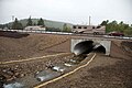 Road crossing constructed above river.jpg 2,920 × 1,947; 798 KB
-
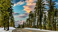
 Road to NH 1.jpg 2,448 × 3,264; 2.06 MB
-
 Roadside Tree off I-80 West - March 2014 (43191839964).jpg 1,600 × 2,400; 2.92 MB
-
 Roadway in USA - Town Planning photos USA(GN01942).jpg 3,264 × 2,448; 1.35 MB
-
 Sidewalk and road after rain.jpg 1,600 × 1,200; 775 KB
-
 Sign on rural road in United States (1920).jpg 1,392 × 952; 861 KB
-
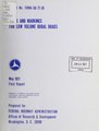 Signs and markings for low volume rural roads (IA signsmarkingsfor00walt).pdf 1,200 × 1,583, 154 pages; 6.04 MB
-
 Storm Clouds gather 2 (15363018670).jpg 5,184 × 3,456; 10.74 MB
-
 Stormy Monday (50348718143).jpg 4,087 × 2,299; 8.65 MB
-
 Stormy Weather Ahead PLC-HW-12.jpg 3,872 × 2,592; 5.79 MB
-
 T-T-Turn Around (49916426866).jpg 1,620 × 1,080; 1.16 MB
-
 Through the Storm PLC-HW-25.jpg 3,872 × 2,524; 3.92 MB
-
 Tractor scraper in AASHO Road Test.jpg 400 × 300; 51 KB
-
 Traffic Counter on BIA Road J-9.jpg 575 × 306; 29 KB
-
 Uk carriageway guide.png 200 × 470; 3 KB
-
 Way in the fog.jpg 2,100 × 1,380; 175 KB


.jpg)
.jpg)
.jpg)

.jpg)
.jpg)

.jpg)
.jpg)
.jpg)

.jpeg)


_Volume_I_113.jpg_(439b88511c984ea3a343f59ea024237c).jpg)
.jpg)
.jpg)
.jpg)


.jpg)

.jpg)

.jpg)


.jpg)
.jpg)

.jpg)
.jpg)
.jpg)

.jpg)


