Category:Roeburndale
Jump to navigation
Jump to search
English: Roeburndale is a civil parish in the City of Lancaster and the English county of Lancashire. It has a population of 76. The parish includes the village of Salter. (→Roeburndale)
Nederlands: Roeburndale is een plaats en civil parish in het bestuurlijke gebied Lancaster, in het Engelse graafschap Lancashire met 76 inwoners. (→Roeburndale)
civil parish in Lancashire, UK  | |||||
| Upload media | |||||
| Instance of | |||||
|---|---|---|---|---|---|
| Location | Lancaster, Lancashire, North West England, England | ||||
| Population |
| ||||
 | |||||
Subcategories
This category has the following 2 subcategories, out of 2 total.
W
- Wolfhole Crag (5 F)
Media in category "Roeburndale"
The following 200 files are in this category, out of 339 total.
(previous page) (next page)-
 A car on the Roeburndale Road - geograph.org.uk - 2651515.jpg 640 × 466; 85 KB
-
 A feeder of Bushy Clough - geograph.org.uk - 3354720.jpg 700 × 480; 127 KB
-
 A Footpath in Roeburndale - geograph.org.uk - 6527859.jpg 5,184 × 3,456; 5.39 MB
-
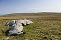
 A scatter of boulders on Goodber Common - geograph.org.uk - 4133119.jpg 800 × 600; 122 KB
-
 A Splendid View from the Edge of Goodber Common - geograph.org.uk - 6525617.jpg 5,184 × 3,456; 5.74 MB
-
 Access gate above Closegill Beck - geograph.org.uk - 3549473.jpg 640 × 425; 345 KB
-
 Access road to Storage Barns - geograph.org.uk - 3241003.jpg 640 × 425; 323 KB
-
 Another Fence Heading towards Hawkshead - geograph.org.uk - 6172418.jpg 5,184 × 3,456; 5.22 MB
-
 Approaching Scale Farm - geograph.org.uk - 6525588.jpg 5,184 × 3,456; 5.75 MB
-
 Approaching Stauvin - geograph.org.uk - 6526155.jpg 5,184 × 3,456; 6.64 MB
-
 At the head of Well Beck - geograph.org.uk - 4133111.jpg 640 × 480; 111 KB
-
 Azers Gill, Haylot Fell - geograph.org.uk - 3352498.jpg 640 × 480; 100 KB
-
 Azers Wood, Mallow Gill - geograph.org.uk - 4395872.jpg 640 × 480; 158 KB
-
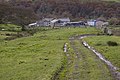
 Back Farm - geograph.org.uk - 6741985.jpg 5,090 × 2,820; 1.58 MB
-
 Backsbottom Farm - geograph.org.uk - 5851544.jpg 1,024 × 768; 259 KB
-
 Barkin Bridge over the River Roeburn - geograph.org.uk - 5851560.jpg 1,024 × 768; 305 KB
-
 Barkin Bridge, Roeburndale - geograph.org.uk - 2150385.jpg 640 × 426; 328 KB
-
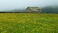 Barn and buttercups, Lower Salter - geograph.org.uk - 4533125.jpg 4,320 × 2,432; 4.41 MB
-
 Barn at Haylot Farm - geograph.org.uk - 3431069.jpg 4,320 × 3,240; 5.49 MB
-
 Barn at Winder - geograph.org.uk - 467264.jpg 640 × 480; 158 KB
-
 Barn at Winder Farm - geograph.org.uk - 3240998.jpg 640 × 425; 245 KB
-
 Barn near Four Lane Ends - geograph.org.uk - 3431547.jpg 4,320 × 3,240; 5.21 MB
-
 Barn north of Wray Wood Moor - geograph.org.uk - 3431556.jpg 3,240 × 4,320; 4.87 MB
-
 Barn southwest of High Salter - geograph.org.uk - 3431634.jpg 4,320 × 3,240; 5.53 MB
-
 Battered Barn in Roeburndale - geograph.org.uk - 6526160.jpg 5,184 × 3,456; 7.02 MB
-
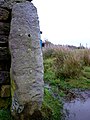
 Bench mark - geograph.org.uk - 6819046.jpg 3,120 × 4,160; 5.67 MB
-
-

-
 Bench mark on gate post - geograph.org.uk - 2138508.jpg 480 × 640; 104 KB
-
-

-
 Bench mark on gate post, Hornby Road - geograph.org.uk - 4247397.jpg 640 × 510; 173 KB
-

-

-
 Bench mark on the Caton Moor trig pillar - geograph.org.uk - 2648758.jpg 419 × 640; 125 KB
-
 Benchmark on Gallows Hill - geograph.org.uk - 4396084.jpg 480 × 640; 159 KB
-
 Beside a Tributary of Goodber Beck - geograph.org.uk - 6526180.jpg 5,184 × 3,456; 6.69 MB
-
 Bladder Stone Beck (geograph 3236045).jpg 3,648 × 2,736; 1.16 MB
-
 Boulder, Alderstone Bank - geograph.org.uk - 1193693.jpg 640 × 389; 63 KB
-
 Boulders near Grey Crag - geograph.org.uk - 1819779.jpg 2,592 × 1,944; 1.2 MB
-
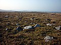 Boulders, Goodber Common - geograph.org.uk - 2323427.jpg 640 × 480; 137 KB
-
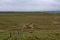 Boundary Fence on Goodber Common - geograph.org.uk - 6173418.jpg 5,184 × 3,456; 4.6 MB
-
 Boundary Fence on Summersgill Fell - geograph.org.uk - 6173415.jpg 5,177 × 3,422; 4.91 MB
-
 Boundary stone and fence Goodber Fell - geograph.org.uk - 4041684.jpg 640 × 426; 373 KB
-
 Boundary stone on Goodber Fell - geograph.org.uk - 4133162.jpg 640 × 480; 151 KB
-
 Broken wall on Hawkshead - geograph.org.uk - 4134262.jpg 800 × 600; 165 KB
-
 Brown Syke - geograph.org.uk - 1819784.jpg 2,592 × 1,944; 1.28 MB
-
 Burnscale Cottage - geograph.org.uk - 6525594.jpg 5,184 × 3,456; 5.27 MB
-
 By Azers Gill - geograph.org.uk - 4395878.jpg 600 × 800; 153 KB
-
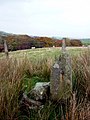
 Cairn near High Stephen's Head - geograph.org.uk - 2385791.jpg 640 × 426; 207 KB
-
 Cairn on Mallowdale Pike - geograph.org.uk - 3352099.jpg 600 × 800; 187 KB
-
 Cairn on Marking Fold Hill - geograph.org.uk - 2385813.jpg 640 × 426; 237 KB
-
 Cairn on Marking Fold Hill - geograph.org.uk - 3352060.jpg 800 × 600; 172 KB
-
 Cairn shelter, High Stephen's Head - geograph.org.uk - 4396096.jpg 800 × 600; 180 KB
-
 Cairn-shelter on High Stephen's Head - geograph.org.uk - 2385804.jpg 640 × 426; 259 KB
-

-
 Cattle Grid and Barn, Higher Salter - geograph.org.uk - 2385810.jpg 640 × 426; 231 KB
-

-
 Cattle grid and Stauvin Farm - geograph.org.uk - 2150433.jpg 640 × 426; 318 KB
-
 Cattle Grid at Stauvin - geograph.org.uk - 6526158.jpg 5,184 × 3,456; 5.98 MB
-
 Cattle Grid Moor Lane - geograph.org.uk - 4041595.jpg 640 × 426; 282 KB
-
 Cattle grid on road to Harterbeck - geograph.org.uk - 2150435.jpg 640 × 426; 243 KB
-
 Cattle grid on road to Harterbeck - geograph.org.uk - 2150441.jpg 640 × 426; 223 KB
-
 Cattle grid, Moor Lane - geograph.org.uk - 1946913.jpg 640 × 480; 94 KB
-
 Chapel - Roeburndale - geograph.org.uk - 1673576.jpg 1,909 × 1,273; 1.44 MB
-
 Claughton Moor - geograph.org.uk - 2690433.jpg 640 × 536; 76 KB
-
 Colross Gill - geograph.org.uk - 3352485.jpg 640 × 480; 84 KB
-
 Concessionary bridleway sign at Backsbottom Farm - geograph.org.uk - 5851550.jpg 1,024 × 768; 145 KB
-
 Cottage at Scale - geograph.org.uk - 2323658.jpg 640 × 480; 98 KB
-
 Cows in the long grass above Deep Clough Farm - geograph.org.uk - 4140860.jpg 3,872 × 2,592; 4.07 MB
-
 Damp area south of High Stephen's Head - geograph.org.uk - 4091082.jpg 3,872 × 2,592; 6.36 MB
-
 Date stone, former house at Stauvin - geograph.org.uk - 2323415.jpg 960 × 720; 220 KB
-
 Deep Clough - geograph.org.uk - 1421621.jpg 640 × 480; 67 KB
-
 Deep Clough - geograph.org.uk - 4093491.jpg 3,872 × 2,592; 5.52 MB
-
 Derelict barn on path to Wray - geograph.org.uk - 5851471.jpg 1,024 × 768; 238 KB
-
-
-
 Drystone wall northeast of High Salter - geograph.org.uk - 3431611.jpg 4,320 × 3,240; 5.61 MB
-
 East of the Boundary Fence on Goodber Fell - geograph.org.uk - 6172432.jpg 5,184 × 3,456; 5.26 MB
-
 East top of Rushbed Gutter - geograph.org.uk - 1819773.jpg 2,592 × 1,944; 1.2 MB
-
 Entering Bowskill Wood - geograph.org.uk - 2150431.jpg 640 × 426; 435 KB
-
 Entrance to Thornbush Farm - geograph.org.uk - 3431474.jpg 4,320 × 3,240; 5.81 MB
-
 Entrance to Thornbush Farm - geograph.org.uk - 5851554.jpg 1,024 × 768; 187 KB
-
 Faint Grass Track on Goodber Common - geograph.org.uk - 6526171.jpg 5,184 × 3,456; 6 MB
-
 Farm building, Stauvin.jpg 640 × 480; 132 KB
-
 Farm Buildings at Stauvin - geograph.org.uk - 1166883.jpg 640 × 433; 79 KB
-
 Farmstead at Outhwaite - geograph.org.uk - 5851473.jpg 1,024 × 768; 190 KB
-
 Fence, gate and signpost near Wolfhole Crag - geograph.org.uk - 2385659.jpg 2,592 × 1,944; 1.48 MB
-
 Fencing near Wolfhole Crag - geograph.org.uk - 1819791.jpg 2,592 × 1,944; 1.21 MB
-
 Fields by Swaintly Hill - geograph.org.uk - 2690464.jpg 640 × 480; 87 KB
-
 Flooded mine shaft, Wray Wood Moor - geograph.org.uk - 2464119.jpg 1,200 × 1,600; 960 KB
-
 Following the fence, Foxdale Head - geograph.org.uk - 4396328.jpg 640 × 480; 91 KB
-
 Following the wall down Goodber Common - geograph.org.uk - 2323598.jpg 640 × 480; 118 KB
-
 Footbridge above falls near Harterbeck - geograph.org.uk - 2150426.jpg 640 × 426; 369 KB
-
 Footbridge and River Roeburn - geograph.org.uk - 2150418.jpg 640 × 426; 353 KB
-
 Footbridge in Mallow Gill - geograph.org.uk - 4395865.jpg 800 × 600; 277 KB
-
 Footbridge near Harterbeck - geograph.org.uk - 1165754.jpg 640 × 480; 104 KB
-
 Footbridge near Harterbeck - geograph.org.uk - 4533135.jpg 2,560 × 1,920; 3.04 MB
-
 Footbridge over Pedder Gill at Harterbeck - geograph.org.uk - 5851467.jpg 1,024 × 768; 266 KB
-
 Footbridge over River Roeburn - geograph.org.uk - 2150421.jpg 640 × 426; 379 KB
-
 Footbridge over the River Roeburn - geograph.org.uk - 1253953.jpg 640 × 480; 120 KB
-
 Footbridge over the River Roeburn - geograph.org.uk - 5851534.jpg 1,024 × 768; 400 KB
-
 Footbridge, Mallow Gill - geograph.org.uk - 2138438.jpg 640 × 480; 174 KB
-
 Footpath east of the Roeburn - geograph.org.uk - 1948563.jpg 640 × 480; 100 KB
-

-
 Footpath in Melling Wood, Mallow Gill - geograph.org.uk - 4395849.jpg 800 × 600; 286 KB
-
 Footpath junction in Outhwaite Wood - geograph.org.uk - 2153303.jpg 640 × 426; 469 KB
-
 Footpath on Wray Wood Moor - geograph.org.uk - 6527863.jpg 5,184 × 3,456; 7.49 MB
-
 Footpath to High Stephen's Head - geograph.org.uk - 4091038.jpg 3,872 × 2,592; 5.84 MB
-

-

-
 Ford at Haylot - geograph.org.uk - 4289550.jpg 3,872 × 2,592; 4.16 MB
-
 Ford at Swaintley Hill (geograph 3236056).jpg 3,648 × 2,736; 1.51 MB
-
 Ford near Harterbeck - geograph.org.uk - 2150427.jpg 640 × 426; 360 KB
-
 Ford over Closegill Beck - geograph.org.uk - 4093533.jpg 3,872 × 2,592; 7.54 MB
-
 Ford under Swaintley Hill - geograph.org.uk - 3240986.jpg 640 × 425; 318 KB
-
 Frozen Tarn - geograph.org.uk - 2183481.jpg 2,560 × 1,920; 1 MB
-
 Frozen waterfall in Roeburndale - geograph.org.uk - 4825175.jpg 5,040 × 3,360; 1.63 MB
-
 Frozen waterfall near Harterbeck - geograph.org.uk - 2255763.jpg 2,592 × 3,888; 3.51 MB
-
 Gallows Hill from Haylot Fell - geograph.org.uk - 4091151.jpg 3,872 × 2,592; 4.45 MB
-
 Gate leading to Deep Clough - geograph.org.uk - 4093473.jpg 3,872 × 2,592; 6.01 MB
-

-
 Gate on the Hornby Road - geograph.org.uk - 4247386.jpg 640 × 425; 164 KB
-
 Gate on The Hornby Road below Hawkshead - geograph.org.uk - 2385853.jpg 640 × 426; 275 KB
-
 Gate to Middlewood Farm - geograph.org.uk - 1700604.jpg 1,600 × 1,067; 283 KB
-
 Gated track near Brown Syke - geograph.org.uk - 2223016.jpg 3,008 × 2,000; 2.63 MB
-
 Gatepost near Haylot Farm - geograph.org.uk - 3016086.jpg 640 × 425; 189 KB
-
 Gates on the edge of the access land - geograph.org.uk - 4091533.jpg 3,872 × 2,592; 6.08 MB
-
 Goodber Common - geograph.org.uk - 2255789.jpg 1,600 × 1,025; 158 KB
-
 Goodber Fell - geograph.org.uk - 6741999.jpg 5,184 × 2,736; 1.86 MB
-
 Grassland by Pedder Gill, Lower Salter - geograph.org.uk - 4533132.jpg 4,176 × 2,784; 4.59 MB
-
 Grey Crag - Bowland Fells - geograph.org.uk - 2860131.jpg 3,264 × 2,448; 1.64 MB
-
 Grey Crag, Mallowdale Fell - geograph.org.uk - 2385780.jpg 640 × 426; 223 KB
-
 Grey Stone - geograph.org.uk - 6173408.jpg 5,184 × 3,456; 5.82 MB
-
 Gritstone boulders, Wray Wood Moor - geograph.org.uk - 2323020.jpg 640 × 480; 169 KB
-

-
 Gritstone outcrops, Hawkshead - geograph.org.uk - 4133177.jpg 800 × 600; 148 KB
-
 Gritstone rocks near Rushbed Gutter - geograph.org.uk - 4396346.jpg 640 × 480; 87 KB
-
 Grouse in flight - geograph.org.uk - 4091070.jpg 2,072 × 1,381; 847 KB
-
 Harterbeck Farm - geograph.org.uk - 6527556.jpg 5,184 × 3,456; 6.87 MB
-
 Harterbeck farmyard - geograph.org.uk - 3431588.jpg 4,320 × 3,240; 5.38 MB
-
 Hawkshead from the Salter Fell Road - geograph.org.uk - 2384174.jpg 640 × 426; 285 KB
-
 Haylot Farm - geograph.org.uk - 1108275.jpg 640 × 480; 81 KB
-
 Haylot Farm - geograph.org.uk - 6373665.jpg 4,320 × 3,240; 5.92 MB
-
 Haylot Farm cottage - geograph.org.uk - 4395825.jpg 640 × 480; 100 KB
-
 Haylot Farm near Salter (geograph 3236029).jpg 3,648 × 2,736; 948 KB
-
 Haylot Fell - geograph.org.uk - 4091196.jpg 3,872 × 2,592; 5.98 MB
-
 Haylot Fell - geograph.org.uk - 4091487.jpg 3,872 × 2,592; 5.19 MB
-
 Haylot Fell - geograph.org.uk - 5046859.jpg 5,184 × 3,888; 3.91 MB
-
 Haylot Fell below Haylot Crag - geograph.org.uk - 4091514.jpg 3,872 × 2,592; 5.78 MB
-
 Heading down to the Roeburn - geograph.org.uk - 3351772.jpg 800 × 600; 140 KB
-
 High Salter (geograph 2138479).jpg 640 × 480; 76 KB
-
 High Salter - geograph.org.uk - 5120485.jpg 5,032 × 2,991; 1.68 MB
-
 Hill Barn, Winder - geograph.org.uk - 2138346.jpg 640 × 480; 63 KB
-
 Hoonby Road - geograph.org.uk - 6741964.jpg 5,184 × 3,236; 1.81 MB
-
 Hornby Road - geograph.org.uk - 128853.jpg 640 × 480; 76 KB
-
 Hornby Road - geograph.org.uk - 6534362.jpg 5,184 × 3,456; 1.72 MB
-
 Hornby Road - geograph.org.uk - 6741989.jpg 5,184 × 3,138; 1.69 MB
-
 Hornby Road - geograph.org.uk - 6741990.jpg 5,082 × 3,161; 1.69 MB
-
 Hornby Road - geograph.org.uk - 6741991.jpg 5,176 × 3,110; 1.76 MB
-
 Hornby Road - geograph.org.uk - 6741993.jpg 5,039 × 2,950; 1.69 MB
-
 Hornby Road above Salter Clough - geograph.org.uk - 2138475.jpg 640 × 480; 65 KB
-
 Hornby Road above Salter Clough - geograph.org.uk - 2385830.jpg 640 × 426; 244 KB
-
 Hornby Road near Hawkshead - geograph.org.uk - 1193710.jpg 640 × 380; 64 KB
-
 Hornby Road near Middle Salter - geograph.org.uk - 4601115.jpg 1,024 × 767; 776 KB
-
 Injured seagull near Brown Syke - geograph.org.uk - 4129996.jpg 3,714 × 2,476; 3.36 MB
-
 Kissing gate near Wolfhole Crag - geograph.org.uk - 4129978.jpg 3,872 × 2,592; 5.98 MB
-
 Kissing gate, gate and wall corner near Grey Crag - geograph.org.uk - 2980365.jpg 4,320 × 3,240; 4.74 MB
-
 Livestock in the road - geograph.org.uk - 4601118.jpg 1,024 × 724; 650 KB
-
 Looking north into Roeburndale - geograph.org.uk - 4395834.jpg 640 × 480; 113 KB
-
 Looking North West across Goodber Fell - geograph.org.uk - 6172443.jpg 5,184 × 3,456; 4.5 MB
-
 Lower Salter - geograph.org.uk - 5120607.jpg 5,184 × 3,456; 1.8 MB
-
 Lower Salter Farm - geograph.org.uk - 2150388.jpg 640 × 426; 311 KB
-
 Lower Salter, Roeburndale - geograph.org.uk - 2139106.jpg 640 × 480; 105 KB
-
 Mallow Gill entering the River Roeburn - geograph.org.uk - 1700622.jpg 1,600 × 1,067; 498 KB
-
 Mallowdale - geograph.org.uk - 2138444.jpg 640 × 480; 89 KB
-
 Mallowdale - geograph.org.uk - 3431032.jpg 4,320 × 3,240; 5.56 MB
-
 Mallowdale Bridge over the River Roeburn (geograph 3236013).jpg 3,648 × 2,736; 1.28 MB
-
 Mallowdale Fell - geograph.org.uk - 6741987.jpg 5,126 × 3,175; 2.05 MB
-
 Mallowdale Pike (433m) - geograph.org.uk - 3354738.jpg 640 × 480; 69 KB
-
 Mallowdale Pike - geograph.org.uk - 2578822.jpg 800 × 396; 39 KB
-

-
 Mallowdale, near Salter (geograph 3236018).jpg 3,648 × 2,736; 1.44 MB
-

-
 Melling Wood, Roeburndale - geograph.org.uk - 2138432.jpg 640 × 480; 68 KB
-
 Memorial Cairn on Mallowdale Pike - geograph.org.uk - 2385821.jpg 640 × 426; 210 KB
-
 Middle Gate, Hornby Road - geograph.org.uk - 1193651.jpg 640 × 367; 48 KB
-
 Middle Gate, Hornby Road - geograph.org.uk - 2385828.jpg 640 × 426; 228 KB
-
 Middle Salter - geograph.org.uk - 5120610.jpg 5,184 × 3,456; 1.89 MB
-
 Moor Lane - geograph.org.uk - 3102032.jpg 640 × 425; 197 KB
-
 Moor Lane - geograph.org.uk - 4601110.jpg 1,024 × 767; 635 KB
-
 Moor Lane - geograph.org.uk - 5120487.jpg 4,820 × 3,143; 1.72 MB
-
 Moorland below Ward's Stone Top - geograph.org.uk - 2223035.jpg 3,008 × 2,000; 2.74 MB
-
 Moorland fencing west of Wolfhole Crag - geograph.org.uk - 2980353.jpg 4,320 × 3,240; 5.19 MB
-
 Moorland near Grey Crag - geograph.org.uk - 2223029.jpg 3,008 × 2,000; 2.53 MB
-
 Moorland south of High Stephen's Head - geograph.org.uk - 4091061.jpg 3,872 × 2,592; 7.06 MB
-
 Moorland wall above Stauvin - geograph.org.uk - 2323422.jpg 640 × 480; 74 KB
-
 Moorland Wall above Stauvin - geograph.org.uk - 6525609.jpg 5,184 × 3,456; 5.61 MB
-
 Moorland west of Gray Crag - geograph.org.uk - 4494749.jpg 3,264 × 2,448; 2.59 MB
-
 Near the bottom of Haylot Fell - geograph.org.uk - 4091599.jpg 3,872 × 2,592; 6.67 MB


.jpg)


.jpg)


.jpg)


.jpg)


.jpg)

_-_geograph.org.uk_-_3354738.jpg)


.jpg)


