Category:Romwegkarte (Erhard Etzlaub)
Jump to navigation
Jump to search
Die Via Romea (Romwegkarte) von Erhard Etzlaub ...
Media in category "Romwegkarte (Erhard Etzlaub)"
The following 16 files are in this category, out of 16 total.
-
 Erhard Etzlaub, Road Map of Central Europe, c. 1492, NGA 4592.jpg 2,875 × 4,000; 11.02 MB
-
 Etzlaub Landstrassen 1501.jpg 5,174 × 6,746; 32.4 MB
-
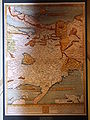
 Etzlaub Romweg 1500 thumb.jpg 220 × 304; 26 KB
-
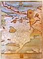
 Etzlaub Romwegkarte 1.JPG 1,944 × 2,592; 1.2 MB
-
 Etzlaub Romwegkarte 1stb.jpg 1,278 × 1,752; 1.33 MB
-
 Etzlaub Romwegkarte 1stb2.jpg 1,278 × 1,752; 1.36 MB
-
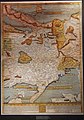
 Etzlaub Romwegkarte 2.JPG 1,944 × 2,592; 1.2 MB
-
 Etzlaub Romwegkarte 3.JPG 1,944 × 2,592; 1.22 MB
-
 Etzlaub Romwegkarte 4.JPG 1,574 × 2,252; 2.8 MB
-
 Etzlaub Romwegkarte 5.jpg 1,278 × 1,752; 1.49 MB
-
 First ever printed european roadmap by Erhard Etzlaub.JPG 1,803 × 2,451; 4.43 MB
-
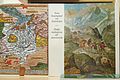
 Katalog zu Alpenüberquerung.jpg 4,968 × 3,288; 2.53 MB
-
 Rompilger-Karte (Erhard Etzlaub).jpg 2,196 × 3,188; 2.02 MB
-
 Rompilgerkarte von Erhard Etzlaub 1501.jpg 4,853 × 6,598; 19.18 MB
-
 Romweg-Karte.jpg 2,070 × 2,874; 1.22 MB
-
 Saumzug auf einem Alpenübergang.jpg 5,472 × 3,648; 6.44 MB


.jpg)


