Category:Rookhope
Jump to navigation
Jump to search
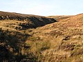
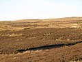
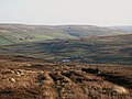
English: Rookhope is a former lead and fluorspar mining village in County Durham, in England. It first existed as a group of cattle farms in the 13th Century. It is situated in the Pennines to the north of Weardale. The village pub, the Rookhope Inn [1], is popular with cyclists on the coast to coast cycling route which runs from Sunderland on the east coast to Whitehaven on the west coast of northern England.
village in County Durham, United Kingdom  | |||||
| Upload media | |||||
| Instance of | |||||
|---|---|---|---|---|---|
| Location | Stanhope, County Durham, North East England, England | ||||
 | |||||
Subcategories
This category has the following 8 subcategories, out of 8 total.
B
- Bolt's Law (48 F)
- Breckensike Level (11 F)
H
- Hope Head, Rookhope (39 F)
I
- Rookhope Inn (7 F)
J
- St John's church, Rookhope (13 F)
N
- Nookton Burn (29 F)
R
- Rookhope War Memorial (2 F)
W
- Wolfcleugh Mine (13 F)
Media in category "Rookhope"
The following 200 files are in this category, out of 441 total.
(previous page) (next page)-

-

-
 Bank Foot - geograph.org.uk - 536916.jpg 640 × 480; 115 KB
-
 Below Rimey Law - geograph.org.uk - 701732.jpg 640 × 480; 82 KB
-
 Bolt's Grains (2) - geograph.org.uk - 1620915.jpg 640 × 480; 92 KB
-
 Bolt's Grains (3) - geograph.org.uk - 1620936.jpg 640 × 480; 81 KB
-
 Bolt's Grains - geograph.org.uk - 1620520.jpg 640 × 480; 80 KB
-
 Bolt's Walls (2) - geograph.org.uk - 1620843.jpg 640 × 480; 77 KB
-
 Bolt's Walls - geograph.org.uk - 1620529.jpg 640 × 480; 81 KB
-
 Boltslaw West (4) - geograph.org.uk - 1606012.jpg 640 × 480; 78 KB
-
 Boltslaw West (6) - geograph.org.uk - 1606041.jpg 640 × 480; 74 KB
-
 Bridleway and unmarked sheepfold - geograph.org.uk - 911232.jpg 500 × 375; 94 KB
-
 Brook Cottage, Rookhope - geograph.org.uk - 2939378.jpg 800 × 600; 116 KB
-

-
 C2C at Rookhope - geograph.org.uk - 1807231.jpg 640 × 480; 146 KB
-
 Chapel Row - geograph.org.uk - 728994.jpg 640 × 480; 87 KB
-
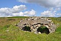
 Collapsed flue of Rookhope lead smelter - geograph.org.uk - 2255923.jpg 2,000 × 1,500; 2.45 MB
-
 Crow Land - geograph.org.uk - 365951.jpg 640 × 480; 111 KB
-
 Cyclists at Rookhope - geograph.org.uk - 1035637.jpg 640 × 480; 80 KB
-
 Derelict Building - geograph.org.uk - 536902.jpg 640 × 480; 128 KB
-
 Disused quarry on Bield Hill (2) - geograph.org.uk - 1629720.jpg 640 × 480; 88 KB
-

-
 Fallen mast on Longlaw End - geograph.org.uk - 1620425.jpg 640 × 480; 104 KB
-

-

-

-

-
 From one sheepfold to another - geograph.org.uk - 1620832.jpg 640 × 480; 75 KB
-
 Fungi on the moorland below Long Law - geograph.org.uk - 1620817.jpg 480 × 640; 92 KB
-
 Garage in Rookhope - geograph.org.uk - 1321603.jpg 640 × 427; 71 KB
-

-

-
 Grouse butts on Hawk Hill - geograph.org.uk - 1639557.jpg 640 × 480; 87 KB
-
 Grouse butts west of Hawk Hill - geograph.org.uk - 1639587.jpg 640 × 480; 97 KB
-
 Hawk Hill - geograph.org.uk - 1628863.jpg 640 × 480; 101 KB
-
 Hawk Hill - geograph.org.uk - 1629806.jpg 640 × 480; 79 KB
-
 Hawksike Quarry (disused) - geograph.org.uk - 1639570.jpg 640 × 480; 101 KB
-
 Lay-by and road sign - geograph.org.uk - 903649.jpg 640 × 427; 27 KB
-

-
 Lintzgarth Common (2) - geograph.org.uk - 703373.jpg 640 × 480; 72 KB
-
 Lintzgarth Common - geograph.org.uk - 703368.jpg 640 × 480; 92 KB
-
 Lintzgarth Common - geograph.org.uk - 703384.jpg 640 × 480; 86 KB
-
 Lintzgarth Rookhope - geograph.org.uk - 398885.jpg 640 × 426; 119 KB
-
 Lough near Cuthbert's Hill - geograph.org.uk - 516768.jpg 640 × 480; 115 KB
-
 Mineshaft, Rookhope - geograph.org.uk - 1131752.jpg 640 × 480; 143 KB
-
 Moorland above the Rookhope valley - geograph.org.uk - 1628805.jpg 640 × 480; 77 KB
-
 Moorland and pastures near Redburn - geograph.org.uk - 525977.jpg 640 × 480; 113 KB
-

-

-

-

-

-

-
 Moorland below Long Law (2) - geograph.org.uk - 1620868.jpg 640 × 480; 60 KB
-
 Moorland below Long Law - geograph.org.uk - 1601590.jpg 640 × 480; 74 KB
-
 Moorland below Long Law - geograph.org.uk - 1620813.jpg 640 × 480; 49 KB
-

-

-

-
 Moorland east of Bield Hill - geograph.org.uk - 1629742.jpg 640 × 480; 87 KB
-
 Moorland east of Hawk Hill - geograph.org.uk - 1629783.jpg 640 × 480; 69 KB
-
 Moorland east of Packlet's Gate - geograph.org.uk - 1606132.jpg 640 × 480; 93 KB
-
 Moorland east of Rispey Sike (2) - geograph.org.uk - 1629899.jpg 640 × 480; 64 KB
-
 Moorland east of Rispey Sike - geograph.org.uk - 1629890.jpg 640 × 480; 71 KB
-

-

-

-

-

-
-

-

-

-
 Moorland west of Dead Friars (3) - geograph.org.uk - 1611509.jpg 640 × 480; 84 KB
-
 Moorland west of Dead Friars - geograph.org.uk - 1611444.jpg 640 × 480; 89 KB
-
 Moorland west of Longlaw End - geograph.org.uk - 1620515.jpg 640 × 480; 82 KB
-

-

-

-
 Old farm machinery - geograph.org.uk - 640884.jpg 640 × 427; 166 KB
-
 Old railway goods van (2) - geograph.org.uk - 1599566.jpg 640 × 480; 72 KB
-
 Old railway goods van - geograph.org.uk - 1599558.jpg 640 × 480; 81 KB
-

-

-

-

-

-

-

-
 Ordnance Survey Alston & Weardale 1" Popular edition 1925 Rookhope area.jpg 2,400 × 1,700; 2.95 MB
-
 Packlet's Gate (3) - geograph.org.uk - 1729343.jpg 640 × 480; 88 KB
-
 Packlet's Gate (4) - geograph.org.uk - 1729346.jpg 640 × 480; 59 KB
-
 Path, Rookhope - geograph.org.uk - 1131313.jpg 640 × 480; 124 KB
-
 Peg's Hole Reservoir, Rookhope - geograph.org.uk - 1235060.jpg 640 × 480; 87 KB
-
 Pegs Hole Reservoir, nr. Rookhope - geograph.org.uk - 1568442.jpg 640 × 427; 72 KB
-
 Pine grove - geograph.org.uk - 1191809.jpg 640 × 426; 91 KB
-
 Prospect House in Rookhope village - geograph.org.uk - 2253748.jpg 2,000 × 1,298; 2.45 MB
-
 Redgate Head (2) - geograph.org.uk - 1604298.jpg 640 × 480; 100 KB
-
 Redgate Head - geograph.org.uk - 1604290.jpg 640 × 480; 97 KB
-

-

-
 Rispey sheepfold - geograph.org.uk - 1627330.jpg 640 × 480; 111 KB
-
 Rock outcrop west of Bell's Hill (2) - geograph.org.uk - 1612829.jpg 640 × 480; 100 KB
-
 Rock outcrop west of Bell's Hill (3) - geograph.org.uk - 1612835.jpg 640 × 480; 92 KB
-
 Rock outcrop west of Bell's Hill - geograph.org.uk - 1612811.jpg 640 × 480; 106 KB
-
 Rockhope.jpg 2,608 × 1,952; 2.18 MB
-
 Rook Hope - geograph.org.uk - 536877.jpg 640 × 480; 79 KB
-
 Rookhope - geograph.org.uk - 1740560.jpg 3,316 × 1,967; 1.36 MB
-
 Rookhope Chimney Flue - geograph.org.uk - 2531657.jpg 800 × 531; 128 KB
-
 Rookhope in Bloom - geograph.org.uk - 2201976.jpg 3,456 × 2,592; 3.27 MB
-
 Rookhope village (2) - geograph.org.uk - 1985588.jpg 640 × 480; 115 KB
-
 Rookhope village - geograph.org.uk - 1235247.jpg 640 × 480; 93 KB
-
 Rookhope village - geograph.org.uk - 1985574.jpg 640 × 480; 115 KB
-
 Rookhope, Upper Weardale - geograph.org.uk - 1581767.jpg 640 × 427; 90 KB
-
 Ruin of Rookhope Chimney - geograph.org.uk - 662927.jpg 640 × 427; 320 KB
-
 Shaft top - geograph.org.uk - 502498.jpg 640 × 427; 215 KB
-
 Sheepfold above Hope Head (2) - geograph.org.uk - 1616213.jpg 640 × 480; 95 KB
-
 Sheepfold above Hope Head - geograph.org.uk - 1616204.jpg 640 × 359; 53 KB
-
 Sheepfold above Whimsey Cleugh (2) - geograph.org.uk - 1230574.jpg 640 × 480; 90 KB
-
 Sheepfold above Whimsey Cleugh (3) - geograph.org.uk - 1293607.jpg 640 × 480; 76 KB
-
 Sheepfold above Whimsey Cleugh (4) - geograph.org.uk - 1293614.jpg 640 × 480; 100 KB
-
 Sheepfold above Whimsey Cleugh - geograph.org.uk - 1230565.jpg 640 × 480; 70 KB
-
 Sheepfold above Whitelees - geograph.org.uk - 707848.jpg 640 × 480; 76 KB
-

-

-
 Sheepfold at Heatheryburn - geograph.org.uk - 706122.jpg 640 × 480; 81 KB
-
 Sheepfold below Long Law - geograph.org.uk - 1620880.jpg 640 × 480; 97 KB
-
 Sheepfold near Bolt's Walls - geograph.org.uk - 1599842.jpg 640 × 480; 64 KB
-
 Sheepfold near the Boltslaw Incline (2) - geograph.org.uk - 1620948.jpg 640 × 480; 103 KB
-
 Sheepfold near the Boltslaw Incline - geograph.org.uk - 1599987.jpg 640 × 480; 65 KB
-
 Sheephole in drystone wall on Windy Hill - geograph.org.uk - 703395.jpg 640 × 480; 103 KB
-
 Sike on Redburn Common - geograph.org.uk - 516793.jpg 640 × 480; 122 KB
-
 Snow Wreaths (2) - geograph.org.uk - 1629776.jpg 640 × 480; 67 KB
-
 Snow Wreaths - geograph.org.uk - 1629770.jpg 640 × 480; 69 KB
-
 Snowy moorland - geograph.org.uk - 494841.jpg 640 × 454; 118 KB
-
 Spring above Catcleugh Folds (2) - geograph.org.uk - 1613903.jpg 640 × 480; 115 KB
-
 Spring above Catcleugh Folds - geograph.org.uk - 1613897.jpg 640 × 480; 106 KB
-
 Stile on the Weardale Way - geograph.org.uk - 728962.jpg 640 × 480; 127 KB
-

-
 The Boltslaw Incline (2) - geograph.org.uk - 1599824.jpg 640 × 480; 68 KB
-
 The Boltslaw Incline (3) - geograph.org.uk - 1599941.jpg 640 × 480; 82 KB
-
 The Boltslaw Incline (4) - geograph.org.uk - 1599945.jpg 640 × 480; 107 KB
-
 The Boltslaw Incline (5) - geograph.org.uk - 1599966.jpg 640 × 480; 79 KB
-
 The Boltslaw Incline (6) - geograph.org.uk - 1599991.jpg 640 × 480; 81 KB
-
 The Boltslaw Incline (7) - geograph.org.uk - 1600562.jpg 640 × 480; 89 KB
-
 The Boltslaw Incline (8) - geograph.org.uk - 1601609.jpg 640 × 480; 74 KB
-
 The cleugh of Hawk Sike (2) - geograph.org.uk - 1629917.jpg 640 × 480; 73 KB
-
 The cleugh of Hawk Sike (3) - geograph.org.uk - 1629921.jpg 640 × 480; 90 KB
-
 The cleugh of Hawk Sike (4) - geograph.org.uk - 1629928.jpg 640 × 480; 71 KB
-
 The cleugh of Hawk Sike (5) - geograph.org.uk - 1629933.jpg 640 × 480; 70 KB
-
 The cleugh of Hawk Sike - geograph.org.uk - 1629789.jpg 640 × 480; 71 KB
-
 The east flank of Hawk Hill - geograph.org.uk - 1629801.jpg 640 × 480; 74 KB
-
 The headwaters of Rispey Sike - geograph.org.uk - 1628880.jpg 640 × 480; 78 KB
-
 The parting of the ways - geograph.org.uk - 1606026.jpg 640 × 480; 96 KB
-
 The road from Middlehope to Rookhope - geograph.org.uk - 1807214.jpg 640 × 480; 126 KB
-
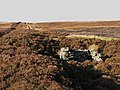
 The Rookhope lead smelting flue (2) - geograph.org.uk - 1627457.jpg 640 × 480; 92 KB
-
 The Rookhope lead smelting flue (2) - geograph.org.uk - 1628844.jpg 640 × 480; 70 KB
-
 The Rookhope lead smelting flue (3) - geograph.org.uk - 1627465.jpg 640 × 480; 79 KB
-
 The Rookhope lead smelting flue (3) - geograph.org.uk - 1628870.jpg 640 × 480; 92 KB
-
 The Rookhope lead smelting flue (4) - geograph.org.uk - 1627659.jpg 640 × 480; 87 KB
-
 The Rookhope lead smelting flue (4) - geograph.org.uk - 1639515.jpg 640 × 480; 95 KB
-
 The Rookhope lead smelting flue (5) - geograph.org.uk - 1627662.jpg 640 × 480; 98 KB
-
 The Rookhope lead smelting flue (5) - geograph.org.uk - 1639567.jpg 640 × 480; 95 KB
-
 The Rookhope lead smelting flue (6) - geograph.org.uk - 1628784.jpg 640 × 480; 84 KB
-
 The Rookhope lead smelting flue (6) - geograph.org.uk - 1639581.jpg 640 × 480; 70 KB
-
 The Rookhope lead smelting flue (6) - geograph.org.uk - 1639632.jpg 640 × 480; 69 KB
-
 The Rookhope lead smelting flue (7) - geograph.org.uk - 1639635.jpg 640 × 480; 86 KB
-
 The Rookhope lead smelting flue - geograph.org.uk - 1628793.jpg 640 × 480; 90 KB
-

-

-

-

-

-

-

-

-

-

-

-

-

-
 The Rookhope valley below Long Law - geograph.org.uk - 1997046.jpg 640 × 480; 89 KB
-
 The sike in Whimsey Cleugh - geograph.org.uk - 1284199.jpg 640 × 480; 87 KB
-

-
 The valley of Bolt's Burn (2) - geograph.org.uk - 1599802.jpg 640 × 480; 79 KB
-
 The valley of Bolt's Burn (3) - geograph.org.uk - 1599995.jpg 640 × 480; 82 KB
-
 The valley of Bolt's Burn (4) - geograph.org.uk - 1620546.jpg 640 × 480; 62 KB
-
 The valley of Bolt's Burn (5) - geograph.org.uk - 1620803.jpg 640 × 480; 63 KB
-
 The valley of Bolt's Burn (6) - geograph.org.uk - 1620850.jpg 640 × 480; 58 KB
-
 The valley of Bolt's Burn - geograph.org.uk - 1599781.jpg 640 × 480; 85 KB
-

-
 The valley of Red Burn - geograph.org.uk - 525988.jpg 640 × 480; 129 KB
-
 The valley of Rookhope Burn (2) - geograph.org.uk - 728995.jpg 640 × 480; 83 KB
-
 The valley of Rookhope Burn - geograph.org.uk - 1599585.jpg 640 × 480; 124 KB
-
 The valley of Rookhope Burn - geograph.org.uk - 701718.jpg 640 × 316; 37 KB
-
 The valley of Rookhope Burn - geograph.org.uk - 728991.jpg 640 × 395; 71 KB
-
 The village of Rookhope - geograph.org.uk - 255498.jpg 640 × 380; 202 KB
-
 The western flank of Bield Hill - geograph.org.uk - 1628849.jpg 640 × 480; 101 KB
-
 Tiny village green in Rookhope - geograph.org.uk - 6070685.jpg 640 × 480; 357 KB
-
 Track south of Whitelees - geograph.org.uk - 718683.jpg 640 × 480; 63 KB
_access_bay_to_the_Rookhope_lead_smelting_flue_-_geograph.org.uk_-_1639637.jpg)


_-_geograph.org.uk_-_1620915.jpg)
_-_geograph.org.uk_-_1620936.jpg)

_-_geograph.org.uk_-_1620843.jpg)

_-_geograph.org.uk_-_1606012.jpg)
_-_geograph.org.uk_-_1606041.jpg)


_-_geograph.org.uk_-_1629720.jpg)


_-_geograph.org.uk_-_1995842.jpg)


_-_geograph.org.uk_-_1639570.jpg)


_-_geograph.org.uk_-_703373.jpg)


_-_geograph.org.uk_-_1620792.jpg)

_-_geograph.org.uk_-_1629818.jpg)

_-_geograph.org.uk_-_1620868.jpg)


_-_geograph.org.uk_-_1629899.jpg)


_-_geograph.org.uk_-_1628897.jpg)
_-_geograph.org.uk_-_1628900.jpg)
_-_geograph.org.uk_-_1639663.jpg)


_-_geograph.org.uk_-_1611509.jpg)


_-_geograph.org.uk_-_1628889.jpg)


_-_geograph.org.uk_-_1599566.jpg)

_-_geograph.org.uk_-_1599604.jpg)

_-_geograph.org.uk_-_1601577.jpg)
_-_geograph.org.uk_-_1601586.jpg)


_-_geograph.org.uk_-_1729343.jpg)
_-_geograph.org.uk_-_1729346.jpg)


_-_geograph.org.uk_-_1604298.jpg)

_-_geograph.org.uk_-_1639654.jpg)


_-_geograph.org.uk_-_1612829.jpg)
_-_geograph.org.uk_-_1612835.jpg)


_-_geograph.org.uk_-_1985588.jpg)


_-_geograph.org.uk_-_1616213.jpg)

_-_geograph.org.uk_-_1230574.jpg)
_-_geograph.org.uk_-_1293607.jpg)
_-_geograph.org.uk_-_1293614.jpg)


_-_geograph.org.uk_-_1620948.jpg)


_-_geograph.org.uk_-_1629776.jpg)


_-_geograph.org.uk_-_1613903.jpg)


_-_geograph.org.uk_-_1599824.jpg)
_-_geograph.org.uk_-_1599941.jpg)
_-_geograph.org.uk_-_1599945.jpg)
_-_geograph.org.uk_-_1599966.jpg)
_-_geograph.org.uk_-_1599991.jpg)
_-_geograph.org.uk_-_1600562.jpg)
_-_geograph.org.uk_-_1601609.jpg)
_-_geograph.org.uk_-_1629917.jpg)
_-_geograph.org.uk_-_1629921.jpg)
_-_geograph.org.uk_-_1629928.jpg)
_-_geograph.org.uk_-_1629933.jpg)


_-_geograph.org.uk_-_1627457.jpg)
_-_geograph.org.uk_-_1628844.jpg)
_-_geograph.org.uk_-_1627465.jpg)
_-_geograph.org.uk_-_1628870.jpg)
_-_geograph.org.uk_-_1627659.jpg)
_-_geograph.org.uk_-_1639515.jpg)
_-_geograph.org.uk_-_1627662.jpg)
_-_geograph.org.uk_-_1639567.jpg)
_-_geograph.org.uk_-_1628784.jpg)
_-_geograph.org.uk_-_1639581.jpg)
_-_geograph.org.uk_-_1639632.jpg)
_-_geograph.org.uk_-_1639635.jpg)


_-_geograph.org.uk_-_1639561.jpg)


_-_geograph.org.uk_-_1998203.jpg)


_-_geograph.org.uk_-_1599802.jpg)
_-_geograph.org.uk_-_1599995.jpg)
_-_geograph.org.uk_-_1620546.jpg)
_-_geograph.org.uk_-_1620803.jpg)
_-_geograph.org.uk_-_1620850.jpg)


_-_geograph.org.uk_-_728995.jpg)


