Category:Roscrea
Jump to navigation
Jump to search
town in Ireland  | |||||
| Upload media | |||||
| Instance of | |||||
|---|---|---|---|---|---|
| Location | Tipperary, County Tipperary, Munster, Ireland | ||||
| Population |
| ||||
| Elevation above sea level |
| ||||
| official website | |||||
 | |||||
Subcategories
This category has the following 8 subcategories, out of 8 total.
C
F
- Roscrea Friary (8 F)
M
R
- Roscrea railway station (6 F)
- Roscrea Castle (9 F)
- Roscrea round tower (9 F)
Media in category "Roscrea"
The following 48 files are in this category, out of 48 total.
-
 A hive of activity - Main Street, Roscrea, Co. Tipperary.jpg 2,000 × 1,515; 1.49 MB
-
 An industrial building near Roscrea, County Tipperary - geograph.org.uk - 1821137.jpg 3,885 × 1,772; 3.64 MB
-
 Birchgrove House, RosCré.JPG 640 × 480; 150 KB
-
 BirchGrove.JPG 480 × 360; 51 KB
-
 Bunnow River, Roscrea - geograph.org.uk - 4630095.jpg 1,024 × 768; 287 KB
-
 Bunnow River, Roscrea - geograph.org.uk - 4633632.jpg 1,024 × 768; 317 KB
-
 Carrick Road Bridge over the M7 - geograph.org.uk - 6290144.jpg 800 × 533; 588 KB
-
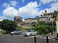
 Castles of Munster, Roscrea, Tipperary - geograph.org.uk - 1952510.jpg 1,024 × 708; 789 KB
-
 Church St. RosCré.jpg 3,504 × 2,552; 2.27 MB
-
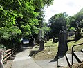 Churchyard at St. Cronan's church, Roscrea - geograph.org.uk - 4579270.jpg 1,024 × 843; 297 KB
-
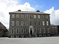 Damer House - geograph.org.uk - 4633657.jpg 1,024 × 768; 167 KB
-
 Damer House, Roscrea - geograph.org.uk - 1954964.jpg 640 × 431; 310 KB
-
 Fountain, Rosemary Square, Roscrea - geograph.org.uk - 4658168.jpg 640 × 480; 89 KB
-
 Jack Moyney V.C..jpg 2,560 × 1,920; 1.79 MB
-

-
 M7 Motorway Westbound - geograph.org.uk - 6289562.jpg 800 × 533; 505 KB
-
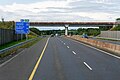
 M7 Westbound, approaching Junction 22 - geograph.org.uk - 6245743.jpg 800 × 533; 542 KB
-
 Main Street, Roscrea - geograph.org.uk - 4658162.jpg 640 × 480; 71 KB
-
 Main-St-Roscrea-Co-Tipperary.jpg 1,264 × 649; 241 KB
-
 Monastic Mechanic (6165643596).jpg 600 × 446; 65 KB
-
 Old St. Cronin's church, west front - geograph.org.uk - 4633707.jpg 1,024 × 768; 128 KB
-
 Parking Area on the M7 at Derrymore - geograph.org.uk - 6245202.jpg 800 × 533; 493 KB
-
 Rackett Hall, County Tipperary - geograph.org.uk - 1821122.jpg 3,333 × 2,311; 4.78 MB
-
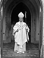 Rev. Cornelius Claffey, at church entrance, full-length portrait (32743700280).jpg 1,524 × 2,000; 1.72 MB
-
 Roscrea - Church Street - geograph.org.uk - 1609582.jpg 640 × 427; 82 KB
-
 Roscrea - geograph.org.uk - 1031970.jpg 640 × 426; 65 KB
-

-
 Roscrea - The Mall street scene - geograph.org.uk - 1609567.jpg 640 × 427; 73 KB
-
 Roscrea Castle and the rear of Damer House - geograph.org.uk - 4633647.jpg 1,024 × 768; 215 KB
-
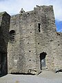
 Roscrea Castle, curtain wall - geograph.org.uk - 4633692.jpg 1,024 × 768; 210 KB
-
 Roscrea Castle, formal gardens - geograph.org.uk - 4561705.jpg 1,024 × 768; 231 KB
-
 Roscrea Castle, gatetower - geograph.org.uk - 4633683.jpg 899 × 1,024; 270 KB
-
 Roscrea Castle, sentry tower - geograph.org.uk - 4633676.jpg 768 × 1,024; 273 KB
-
 Roscrea main street - geograph.org.uk - 962551.jpg 640 × 427; 169 KB
-
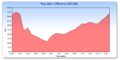 RoscreaPop.png 828 × 416; 17 KB
-
 Rosemary Street, Roscrea - geograph.org.uk - 4630036.jpg 1,024 × 768; 144 KB
-
 Ruins of the Franciscan Friary, Roscrea - geograph.org.uk - 4630064.jpg 768 × 1,024; 205 KB
-
-
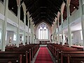
 St.Cronans Church complex.JPG 640 × 480; 131 KB
-
 The M7 - E20 at junction 22 - geograph.org.uk - 4148040.jpg 1,600 × 1,200; 1.04 MB
-
 The M7 - E20 towards junction 21 - geograph.org.uk - 4148049.jpg 1,600 × 1,200; 1.18 MB
-
 The M7 - E20 towards junction 22 - geograph.org.uk - 4148037.jpg 1,600 × 1,200; 1.12 MB
-
 The round tower, Roscrea - geograph.org.uk - 4629999.jpg 768 × 1,024; 100 KB
-
 Westbound M7 at Junction 22 - geograph.org.uk - 6245747.jpg 800 × 533; 502 KB
-
 Westbound M7, Derrymore Lower - geograph.org.uk - 6245198.jpg 800 × 533; 530 KB
-
 Westbound M7, Nore Valley - geograph.org.uk - 6245164.jpg 800 × 533; 485 KB
-
 Ye Olde Golden Arches, County Tipperary - geograph.org.uk - 1821144.jpg 3,888 × 2,286; 3.97 MB
-
 Yew and west front of old St. Cronan's church - geograph.org.uk - 4630022.jpg 1,024 × 768; 217 KB


.jpg)


.jpg)

_and_Castle_St_(R445)_-_geograph.org.uk_-_1609572.jpg)


