Category:Rossett
Jump to navigation
Jump to search
village and community in Wrexham county borough, Wales   | |||||
| Upload media | |||||
| Instance of | |||||
|---|---|---|---|---|---|
| Location | Wrexham County Borough, Wales | ||||
| Population |
| ||||
 | |||||
Cymraeg: Pentref a chymuned ym mwrdeistref sirol Wrecsam yw'r Orsedd (Saesneg: Rossett). Gorwedd yn ardal Wrecsam Maelor, ychydig i'r dwyrain o'r briffordd A483 tua hanner y ffordd rhwng Wrecsam a Chaer. Saif ar lannau Afon Alun a bron ar y ffin rhwng Cymru a Lloegr. Roedd y boblogaeth yn 3,386 yn 2001.
English: Rossett is a village and a local government community, the lowest tier of local government, part of Wrexham County Borough in Wales. Rossett is served by the A483 road.
Gaeilge: Baile i Wrecsam, an Bhreatain Bheag, is ea Yr Orsedd, 181.8 km ó Caerdydd agus 261 ó Londain. Tá daonra 3,137 ann, agus tá 266 (8.5%) in ann Breatnais a labhairt.
Gàidhlig: Tha am baile Yr Orsedd ann an Wrecsam, a' Chuimrigh. Tha e 112.9 mi (181.8 cilemeatair) bho Caerdydd, agus 162.5 mi (261.4 cilemeatair) bho Lunnainn. A rèir a' chunntais-shluaigh ann an 2011 bha 3137 daoine a' fuireach ann, agus bha Cuimris aig 266 (8.5%); rugadh 44% den t-sluagh anns a' Chuimrigh fhèin.

Subcategories
This category has the following 16 subcategories, out of 16 total.
A
- The Alyn, Rossett (4 F)
B
- Burton Green, Wrexham (7 F)
- Burton, Wrexham (12 F)
- Butchers Arms, Rossett (2 F)
C
G
- Golden Lion, Rossett (4 F)
- Golly, Wrexham (4 F)
H
- Rossett Hall (3 F)
- Honkley (5 F)
L
M
- Marford Mill (2 F)
N
- The Nags Head, Lavister (3 F)
R
- Rossett Mill (12 F)
T
V
- Rossett Village Hall (3 F)
W
- Rossett War Memorial (3 F)
Media in category "Rossett"
The following 200 files are in this category, out of 239 total.
(previous page) (next page)-
 66 840 of Colas Rail Freight with 6J37 Rossett 270312.jpg 2,176 × 1,396; 444 KB
-
 A field of stubble - geograph.org.uk - 4476614.jpg 640 × 426; 57 KB
-
 A long straight stretch south of Trevalyn - geograph.org.uk - 6031147.jpg 2,443 × 1,809; 988 KB
-
 A pile of railway sleepers - geograph.org.uk - 4476635.jpg 640 × 426; 107 KB
-

-
 A483 - geograph.org.uk - 219430.jpg 640 × 480; 57 KB
-
 A483 - junction 7 overbridge - geograph.org.uk - 2250377.jpg 640 × 480; 60 KB
-
 A483 at junction 7 (B5102) - geograph.org.uk - 2250372.jpg 640 × 480; 46 KB
-
 A483 at Welsh border - geograph.org.uk - 3950209.jpg 640 × 480; 33 KB
-
 A483 bypassing Gresford - geograph.org.uk - 5876715.jpg 1,024 × 683; 281 KB
-
 A483 east of Ball's Hall - geograph.org.uk - 3950222.jpg 640 × 481; 33 KB
-
 A483 layby heading south - geograph.org.uk - 4605827.jpg 1,024 × 660; 92 KB
-
 A483 near Gresford - geograph.org.uk - 2360709.jpg 640 × 480; 37 KB
-

-
 A483 north of junction 7 - geograph.org.uk - 2251243.jpg 640 × 480; 57 KB
-
 A483 running alongside the railway - geograph.org.uk - 2251249.jpg 640 × 480; 53 KB
-
-
 A483 west of Marford - geograph.org.uk - 2360707.jpg 640 × 480; 34 KB
-
 A483, Bridge at Broadoak Crossing - geograph.org.uk - 5503726.jpg 640 × 384; 233 KB
-
 Afon Alun - geograph.org.uk - 187753.jpg 640 × 480; 140 KB
-
 Afon Alun - geograph.org.uk - 4273408.jpg 1,800 × 1,200; 820 KB
-
 Afon Alun - geograph.org.uk - 4476623.jpg 640 × 426; 89 KB
-
 Afon Alun from Cook's Bridge - geograph.org.uk - 3450623.jpg 4,000 × 3,000; 3.49 MB
-
 Afon Alun-River Alyn - geograph.org.uk - 4273413.jpg 1,800 × 1,200; 1.11 MB
-
 Alun Bridge - geograph.org.uk - 2327943.jpg 4,000 × 3,000; 4.74 MB
-
 Alyn View - geograph.org.uk - 2327949.jpg 4,000 × 3,000; 4.49 MB
-
 B5102 Rossett Road looking east - geograph.org.uk - 3858667.jpg 640 × 480; 52 KB
-
 B5445, Pulford Bridge - geograph.org.uk - 6163304.jpg 800 × 600; 133 KB
-

-
 Border Crossing - geograph.org.uk - 1356740.jpg 640 × 480; 84 KB
-
 Bridge over Pulford Brook - geograph.org.uk - 4273305.jpg 1,800 × 1,200; 1.4 MB
-
 Bridge over Pulford Brook - geograph.org.uk - 4273345.jpg 1,800 × 1,200; 874 KB
-
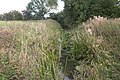
 Bridleway and drainage ditch - geograph.org.uk - 4272403.jpg 1,800 × 1,200; 956 KB
-
 Broadoak Crossing - geograph.org.uk - 4476673.jpg 640 × 426; 79 KB
-
 Broadoak Farm - geograph.org.uk - 4476660.jpg 640 × 426; 45 KB
-
 Broadoak Farm - geograph.org.uk - 4476664.jpg 640 × 426; 48 KB
-
 Broadoak Farm - geograph.org.uk - 4476675.jpg 640 × 426; 42 KB
-
 Broadoak Level Crossing - geograph.org.uk - 3362698.jpg 5,184 × 3,456; 4.18 MB
-
 Broadoak road bridge and transmitter mast - geograph.org.uk - 4488532.jpg 1,600 × 1,200; 1.36 MB
-
 Brookfield Farm - geograph.org.uk - 4273370.jpg 1,800 × 1,200; 697 KB
-
 Burton Rd-Station Rd junction. - geograph.org.uk - 1595755.jpg 640 × 480; 91 KB
-
 Burton Tower - geograph.org.uk - 1254744.jpg 640 × 480; 84 KB
-

-
 Cam-Yr-Alyn Farm - geograph.org.uk - 6393428.jpg 2,385 × 1,085; 699 KB
-
 Cam-yr-Alyn Hall, Burton - geograph.org.uk - 5725226.jpg 640 × 480; 66 KB
-
 Cattle at Cook's Bridge - geograph.org.uk - 4273409.jpg 1,800 × 1,200; 1.26 MB
-
 Chalet on the River Dee - geograph.org.uk - 2442675.jpg 3,888 × 2,592; 5.09 MB
-
 Cheshire Plain - geograph.org.uk - 1248560.jpg 640 × 483; 53 KB
-
 Chester Road, Rossett - geograph.org.uk - 1595746.jpg 640 × 480; 68 KB
-
 Chester Road, Rossett - geograph.org.uk - 5184067.jpg 2,000 × 1,449; 739 KB
-
 Chester Road, Rossett - geograph.org.uk - 6163321.jpg 800 × 536; 112 KB
-
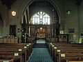
 Christ Church, Rossett - geograph.org.uk - 6031800.jpg 4,000 × 3,000; 2.62 MB
-
 Christ Church, Rossett - geograph.org.uk - 6031801.jpg 4,000 × 3,000; 2.71 MB
-
 Christ Church, Rossett - geograph.org.uk - 6031802.jpg 4,000 × 3,000; 2.32 MB
-
 Christ Church, Rossett - geograph.org.uk - 6031814.jpg 4,000 × 3,000; 2.64 MB
-
 Christ Church, Rossett - geograph.org.uk - 6163336.jpg 800 × 580; 88 KB
-

-
 Christ the King Catholic Church, Rossett - geograph.org.uk - 6031137.jpg 4,000 × 3,000; 2.26 MB
-
 Cobblers Lane at Burton Green - geograph.org.uk - 3362532.jpg 5,184 × 3,456; 4.14 MB
-
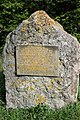 Commemorative plaque - geograph.org.uk - 2896226.jpg 427 × 640; 130 KB
-
 Commemorative plaque on Rossett bridge - geograph.org.uk - 1468644.jpg 640 × 480; 115 KB
-
 Cook's Bridge - geograph.org.uk - 6031144.jpg 4,000 × 3,000; 2.8 MB
-
 Cook's Bridge over the Afon Alun - geograph.org.uk - 3450591.jpg 4,000 × 3,000; 3.54 MB
-
 Cooks Bridge Farm - geograph.org.uk - 6031142.jpg 4,000 × 3,000; 2.93 MB
-
 Corner House, Rossett Road - geograph.org.uk - 3450401.jpg 6,000 × 4,500; 3.19 MB
-
 Cottages on Marford Hill - geograph.org.uk - 6031785.jpg 4,000 × 3,000; 2.46 MB
-
 Cox Lane - geograph.org.uk - 3495395.jpg 4,000 × 3,000; 2.47 MB
-

-
 Daisy Lane - geograph.org.uk - 6031148.jpg 4,000 × 3,000; 2.83 MB
-
 Darland Golf Course - geograph.org.uk - 968802.jpg 640 × 480; 67 KB
-
 Dawn on the Dee. 3 Aug 2003 - panoramio.jpg 1,280 × 960; 421 KB
-
 Drainage ditch south of Old Pulford Brook - geograph.org.uk - 4272350.jpg 1,800 × 1,200; 1,010 KB
-
 Drive to Cam-yr-Alyn Hall - geograph.org.uk - 5725217.jpg 640 × 480; 94 KB
-

-
 Entrance to Park Lane Kennels - geograph.org.uk - 6031218.jpg 4,000 × 3,000; 2.44 MB
-
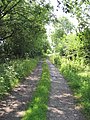
 Farm Track - geograph.org.uk - 3310494.jpg 800 × 450; 120 KB
-
 Farmland and view into Cheshire - geograph.org.uk - 1379983.jpg 640 × 480; 68 KB
-
 Farmland near Honkley - geograph.org.uk - 1379985.jpg 480 × 640; 85 KB
-
 Farmland near Marford - geograph.org.uk - 4476603.jpg 640 × 426; 48 KB
-
 Farmland near Rossett - geograph.org.uk - 4476644.jpg 640 × 426; 54 KB
-

-
 Field by the Wrexham to Chester Line - geograph.org.uk - 4476656.jpg 640 × 426; 58 KB
-
 Field by the Wrexham to Chester Line - geograph.org.uk - 4476688.jpg 640 × 426; 42 KB
-
 Field of Peas - geograph.org.uk - 1380303.jpg 480 × 640; 84 KB
-
 Field of Peas near Honkley - geograph.org.uk - 1380296.jpg 640 × 480; 86 KB
-
 Field of sheep near Rossett - geograph.org.uk - 2437346.jpg 3,888 × 2,592; 1.59 MB
-
 Field off Manor Lane, Rossett - geograph.org.uk - 5184082.jpg 2,000 × 1,500; 1,006 KB
-
 Flood defences at Meadow Farm - geograph.org.uk - 4273392.jpg 1,800 × 1,200; 676 KB
-
 Flood defences at Meadow Farm - geograph.org.uk - 4273399.jpg 1,800 × 1,200; 675 KB
-
 Footbridge near The Darland - geograph.org.uk - 4273351.jpg 1,800 × 1,200; 1.12 MB
-
 Footbridge over railway near Rossett - geograph.org.uk - 2422955.jpg 640 × 480; 88 KB
-
 Footpath and Farmland - geograph.org.uk - 1379988.jpg 640 × 480; 56 KB
-
 Footpath and Meadow Farm - geograph.org.uk - 1380318.jpg 480 × 640; 137 KB
-
 Footpath beside Pulford Brook - geograph.org.uk - 4273339.jpg 1,800 × 1,200; 1.13 MB
-
 Footpath between Pulford Brook and The Darland - geograph.org.uk - 4273349.jpg 1,800 × 1,200; 975 KB
-
 Footpath blockage - geograph.org.uk - 4273374.jpg 1,200 × 1,800; 1.24 MB
-
 Footpath from Park Lane to Cox Lane - geograph.org.uk - 6031224.jpg 4,000 × 3,000; 2.87 MB
-
 Footpath from The Darland - geograph.org.uk - 4273353.jpg 1,800 × 1,200; 1.04 MB
-
 Footpath to Coxwood Farm - geograph.org.uk - 6031203.jpg 4,000 × 3,000; 2.9 MB
-
 Footpath to Coxwood Farm - geograph.org.uk - 6031209.jpg 4,000 × 3,000; 2.89 MB
-
 Footpath to Harwood's Lane - geograph.org.uk - 5725177.jpg 640 × 480; 55 KB
-
 Footpath to the Afon Dyfrdwy (River Dee) and Holt - geograph.org.uk - 3495603.jpg 5,905 × 4,310; 4.31 MB
-
 Footpath under the A483 in Rossett - geograph.org.uk - 5725214.jpg 640 × 480; 75 KB
-

-

-
 Grassland, Burton Green - geograph.org.uk - 1508452.jpg 640 × 480; 90 KB
-
 Gravestones, Rossett Parish Church - geograph.org.uk - 6031812.jpg 4,000 × 3,000; 3.03 MB
-
 Grazing near Trevalyn Hall - geograph.org.uk - 6163563.jpg 800 × 600; 105 KB
-
 Griffin Inn, Trevalyn - geograph.org.uk - 6031141.jpg 4,000 × 3,000; 2.29 MB
-
 Halkyn Terrace, Rossett - geograph.org.uk - 6031134.jpg 4,000 × 3,000; 2.54 MB
-
 Harvested field in Rossett - geograph.org.uk - 1469691.jpg 640 × 480; 153 KB
-
 Home Rule - geograph.org.uk - 4274053.jpg 1,200 × 1,800; 1.14 MB
-
 Houses on Chester Road, Rossett - geograph.org.uk - 6163314.jpg 800 × 600; 103 KB
-
 Houses on Rossett Road near its junction with Gamford Lane - geograph.org.uk - 6031140.jpg 3,607 × 2,296; 1.33 MB
-
 Junction of Narrow Lane and Darland Lane - geograph.org.uk - 3451069.jpg 4,000 × 3,000; 2.22 MB
-
 Lane near Lower Parks Farm - geograph.org.uk - 3495561.jpg 4,000 × 3,000; 2.75 MB
-
 Lane to Meadow House - geograph.org.uk - 4273381.jpg 1,800 × 1,200; 1.11 MB
-
 Layby on A483 - geograph.org.uk - 4605735.jpg 1,024 × 590; 111 KB
-
 Layby on A483 near Marford - geograph.org.uk - 3556565.jpg 1,024 × 679; 128 KB
-
 Level crossing, Broadoak - geograph.org.uk - 3938406.jpg 640 × 452; 60 KB
-
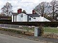
 Llyndir Hall Hotel - geograph.org.uk - 3938407.jpg 640 × 480; 65 KB
-
 Llyndir Hall Hotel, with fake sheep - geograph.org.uk - 3938409.jpg 640 × 480; 96 KB
-
 Manor Lane - geograph.org.uk - 2476268.jpg 4,000 × 3,000; 4.69 MB
-
 Manor Lane by Rossett Bridge - geograph.org.uk - 1468668.jpg 640 × 480; 184 KB
-
 Manor Lane junction with Chester Road - geograph.org.uk - 1468703.jpg 640 × 480; 166 KB
-
 Manor Lane, Rossett - geograph.org.uk - 1468696.jpg 640 × 480; 183 KB
-
 Manor Lane, Rossett - geograph.org.uk - 5184075.jpg 2,000 × 1,476; 1.31 MB
-
 Marford, lay-by - geograph.org.uk - 5489971.jpg 1,024 × 768; 170 KB
-
 Marford, welcome sign - geograph.org.uk - 5489963.jpg 1,024 × 759; 133 KB
-
 Meifod.jpg 4,000 × 3,000; 4.88 MB
-

-
 Milestone on Chester Road, Rossett - geograph.org.uk - 1468110.jpg 480 × 640; 157 KB
-
 Millennium map next to Rossett car park - geograph.org.uk - 1470011.jpg 480 × 640; 173 KB
-
 NatWest Bank Rossett - geograph.org.uk - 4084018.jpg 640 × 480; 82 KB
-
 New houses on Chester Road, Rossett - geograph.org.uk - 6163318.jpg 800 × 501; 77 KB
-
 Not a weed in sight - geograph.org.uk - 6031166.jpg 4,000 × 3,000; 2.85 MB
-
 Old barn on site of Rossett station - geograph.org.uk - 1469924.jpg 640 × 480; 154 KB
-
 Old lamppost at Christ Church, Rossett - geograph.org.uk - 1469999.jpg 480 × 640; 173 KB
-
 Old Milestone by the B5445, Main Street, Rossett - geograph.org.uk - 6048984.jpg 757 × 1,160; 253 KB
-
 Old Poulford Brook - geograph.org.uk - 3310483.jpg 800 × 450; 113 KB
-
 Old sandstone bridge - geograph.org.uk - 272920.jpg 640 × 480; 143 KB
-
 Old Sandstone Bridge - geograph.org.uk - 314066.jpg 640 × 480; 223 KB
-
 Old Sandstone Bridge - geograph.org.uk - 315641.jpg 640 × 480; 193 KB
-
 On the bend - geograph.org.uk - 980854.jpg 640 × 459; 45 KB
-

-
 Parish church hall, Rossett - geograph.org.uk - 1469812.jpg 640 × 480; 171 KB
-
 Park Lane - geograph.org.uk - 3495352.jpg 4,000 × 3,000; 3.41 MB
-
 Park Lane Kennels, Parkside - geograph.org.uk - 3495368.jpg 4,000 × 3,000; 3.53 MB
-
 Park Lane, Parkside - geograph.org.uk - 281576.jpg 640 × 480; 217 KB
-
 Park Lane, Parkside - geograph.org.uk - 3495377.jpg 4,000 × 3,000; 2.43 MB
-
 Parkside Farm - geograph.org.uk - 6031215.jpg 4,000 × 3,000; 2.66 MB
-
 Path across the Borderlands - geograph.org.uk - 3362506.jpg 5,184 × 3,456; 4.61 MB
-
 Path near Meadow House - geograph.org.uk - 4273384.jpg 1,800 × 1,200; 1.22 MB
-
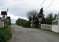
 Pedestrian Level Crossing at Rossett - geograph.org.uk - 3445381.jpg 5,184 × 3,456; 4.15 MB
-
 Poplar Row-Rhes y Poplys, Burton. - geograph.org.uk - 1595750.jpg 640 × 480; 66 KB
-
 Private Drive for Meadow Farm - geograph.org.uk - 1380310.jpg 480 × 640; 152 KB
-
 Pulford Brook - geograph.org.uk - 4273300.jpg 1,800 × 1,200; 1.07 MB
-
 Pulford Brook - geograph.org.uk - 4273306.jpg 1,800 × 1,200; 1,000 KB
-
 Pulford Brook - geograph.org.uk - 4273362.jpg 1,800 × 1,200; 1.06 MB
-
 Pulford Brook and Brookside Farm - geograph.org.uk - 4273358.jpg 1,800 × 1,200; 841 KB
-
 Pumping station on Pulford Brook - geograph.org.uk - 4273307.jpg 1,800 × 1,200; 858 KB
-
 Railway crossing at Rossett - geograph.org.uk - 1469840.jpg 640 × 480; 171 KB
-
 Railway to Chester at Rossett - geograph.org.uk - 1469849.jpg 640 × 480; 210 KB
-
 Railway to Wrexham at Rossett - geograph.org.uk - 1469857.jpg 640 × 480; 194 KB
-

-
 River Alyn and Gun Street - geograph.org.uk - 1468692.jpg 640 × 480; 235 KB
-
 River Alyn and Rossett Bridge - geograph.org.uk - 1468709.jpg 640 × 480; 188 KB
-
 River Alyn between Trevalyn and Holt - geograph.org.uk - 6031146.jpg 4,000 × 3,000; 2.85 MB
-
 River Alyn from Rossett Bridge - geograph.org.uk - 1468684.jpg 640 × 480; 218 KB
-
 River Alyn from Rossett Bridge - geograph.org.uk - 1470003.jpg 480 × 640; 174 KB
-
 River Alyn Weir at Rossett - geograph.org.uk - 3445321.jpg 5,184 × 3,456; 4.63 MB
-
 River Dee - geograph.org.uk - 2396581.jpg 1,356 × 492; 355 KB
-
 River Dee - geograph.org.uk - 2396591.jpg 1,380 × 763; 543 KB
-
 River Wreck - River Dee - geograph.org.uk - 2396587.jpg 845 × 539; 256 KB
-
 RiverDee-Afon Dyfrdwy - geograph.org.uk - 281719.jpg 640 × 480; 166 KB
-
 Road Junction at Parkside - geograph.org.uk - 3495387.jpg 4,000 × 3,000; 2.08 MB
-
 Rosemary Lane, Burton - geograph.org.uk - 3445239.jpg 5,184 × 3,456; 5.4 MB
-
 Rosemary Nurseries, Burton - geograph.org.uk - 3445246.jpg 5,184 × 3,456; 6.22 MB
-
 Rossett Bridge and Christ Church - geograph.org.uk - 1468656.jpg 640 × 480; 124 KB
-

-
 Rossett car park - geograph.org.uk - 1470015.jpg 640 × 480; 133 KB
-
 Rossett Mill - geograph.org.uk - 6031798.jpg 4,000 × 3,000; 2.45 MB
-
 Rossett Presbyterian Church - geograph.org.uk - 5725209.jpg 480 × 640; 58 KB
-

-
 Rossett Road near Plas Devon - geograph.org.uk - 3858722.jpg 640 × 480; 38 KB
-
 Rossett Road-Gamford Lane junction - geograph.org.uk - 3858674.jpg 640 × 480; 62 KB
-
 Rossett village sign - geograph.org.uk - 6031795.jpg 4,000 × 3,000; 2.63 MB
-
 Roundabout on Chester Road (B5445) - geograph.org.uk - 6163564.jpg 800 × 567; 68 KB
-
 Roundabout on the B5445 - geograph.org.uk - 6031791.jpg 4,000 × 3,000; 2.75 MB
-
 Service track from Broad Oak bridge - geograph.org.uk - 2408741.jpg 640 × 480; 74 KB
-
 Sidestream of Pulford Brook - geograph.org.uk - 4273387.jpg 1,800 × 1,200; 1.43 MB
-
 Slip road and bridge for B5102 junction with A483 - geograph.org.uk - 4488522.jpg 1,600 × 1,200; 1.39 MB
-
 Snowdrops at Honkley - geograph.org.uk - 3362520.jpg 5,184 × 3,456; 4.75 MB
-
 St Peter's Primary School, Rossett - geograph.org.uk - 5725169.jpg 640 × 480; 108 KB
-
 Start of footpath, Lavister - geograph.org.uk - 4274037.jpg 1,200 × 1,800; 1.02 MB
-

-
 Station Road, Rossett - geograph.org.uk - 3445400.jpg 5,184 × 3,456; 2.88 MB
-
 Station Road, Rossett - geograph.org.uk - 969364.jpg 640 × 480; 72 KB
-
 Stringer's Lane - geograph.org.uk - 1380284.jpg 480 × 640; 91 KB
-
 Stringers Lane - geograph.org.uk - 3445193.jpg 5,184 × 3,456; 6.55 MB


_-_geograph.org.uk_-_2250372.jpg)


_and_Holt_-_geograph.org.uk_-_3495603.jpg)


_-_geograph.org.uk_-_6163564.jpg)


