Category:Rosyth
Jump to navigation
Jump to search
town in Fife, Scotland, UK  | |||||
| Upload media | |||||
| Audio | |||||
|---|---|---|---|---|---|
| Instance of | |||||
| Location |
| ||||
| Population |
| ||||
 | |||||
Deutsch: Rosyth ( Gälisch: Ros Saoithe) ist eine große Ortschaft am Firth of Forth an Schottlands Ostküste, 1,6 km südlich von Dunfermline, Fife, und ca. 19 km nordwestlich von Edinburgh. Es gehört zum schottischen Verwaltungsbezirk Dunfermline and West Fife. Der Hafen bietet die einzige direkte Fährverbindung von Schottland zum europäischen Festland, der Ankunftshafen ist Zeebrügge.
English: Rosyth (pronounced Ross-sythe) ( Scottish Gaelic: Ros Saidhe or Ros Saoithe) is a town located on the Firth of Forth, three miles (4.8km) south of the centre of Dunfermline. According to the 2007 population estimate, the town has a population of 12,865.
Français : Rosyth (se prononce « Ross-sythe » ; gaélique : Ros Saidhe ou Ros Saoithe) est une ville située sur l'estuaire de la rivière Forth, le Firth of Forth, sur la côte est de l'Écosse. Au sud, à environ 1,6 kilomètre, se situe Dunfermline, et Fife, à environ 19 kilomètres au nord-ouest d'Édimbourg, et Lothian au sud.
日本語: ロサイス( 英語:Rosyth, 発音記号:Ross-sythe, スコットランド・ゲール語:Ros Saidhe / Ros Saoithe)は、スコットランドのファイフにある人口15,000人ほどのタウンである。ロシスとも表記する。フォース湾に面し、南4.8キロメートルの位置にはダンファームリンがある。
Polski: Rosyth ( gael. Ros Saidhe lub Ros Saoithe) – miasto położone w Szkocji w Fife nad zatoką Firth of Forth, ok. 1,6 km na południe od Dunfermline i ok. 19 km na północ od Edynburga. Jako jedyne szkockie miasto posiada bezpośrednie połączenie promowe z kontynentem (z Zeebrugge w Belgii).
Simple English: Rosyth is a town in Fife, Scotland. It is located between Inverkeithing and Dunfermline.
Subcategories
This category has the following 7 subcategories, out of 7 total.
C
- Castlandhill (3 F)
D
G
- Gothenburg Hotel, Rosyth (2 F)
Q
- Queensferry Road, Rosyth (3 F)
R
- Rosyth Castle (12 F)
- Rosyth railway station (7 F)
- Rosyth to Zeebrugge Ferry (3 F)
Media in category "Rosyth"
The following 115 files are in this category, out of 115 total.
-
 'AMT Trader' arrives at Rosyth - geograph.org.uk - 3220436.jpg 3,264 × 2,448; 3.36 MB
-
 'HMS Queen Elizabeth' - geograph.org.uk - 3777127.jpg 1,121 × 839; 372 KB
-
 'HMS Queen Elizabeth' at Rosyth - geograph.org.uk - 5442324.jpg 3,264 × 2,448; 1.84 MB
-
 'HMS Queen Elizabeth' at Rosyth - geograph.org.uk - 5442339.jpg 3,264 × 2,448; 3.31 MB
-
 'HMS Queen Elizabeth' in St Margaret's Hope - geograph.org.uk - 3520843.jpg 3,264 × 2,448; 2.34 MB
-
 'Oxcar' - Leith - geograph.org.uk - 6225939.jpg 2,041 × 2,898; 2.24 MB
-
 'Oxcar' - Leith - geograph.org.uk - 6225944.jpg 2,229 × 2,965; 2.47 MB
-

-
 Admiralty Road Roundabout - geograph.org.uk - 42979.jpg 640 × 480; 87 KB
-
 Aircraft carrier under construction at Rosyth - geograph.org.uk - 5168481.jpg 3,264 × 2,448; 2.05 MB
-
 Allotments - geograph.org.uk - 147142.jpg 640 × 480; 116 KB
-
 Anderson Lane - geograph.org.uk - 1536936.jpg 640 × 480; 125 KB
-
 Avenue of Poplars - geograph.org.uk - 774391.jpg 480 × 640; 140 KB
-
 Brankholm Brae - geograph.org.uk - 355159.jpg 640 × 424; 57 KB
-
 Call Centre - geograph.org.uk - 343745.jpg 640 × 424; 69 KB
-
 Camdean Primary School - geograph.org.uk - 147124.jpg 640 × 480; 75 KB
-
 Castle Road, Rosyth - geograph.org.uk - 855687.jpg 640 × 480; 59 KB
-
 Castlelandhill Road in Rosyth - geograph.org.uk - 1184317.jpg 640 × 480; 56 KB
-
 Cycleway - geograph.org.uk - 349430.jpg 640 × 424; 60 KB
-
 Demolition In Progress - geograph.org.uk - 548528.jpg 640 × 480; 93 KB
-
 Diesel department personnel on HMS Nabob Sept 1944 LAC 3207735.jpeg 600 × 462; 79 KB
-
 Disused factory - geograph.org.uk - 355967.jpg 640 × 424; 46 KB
-
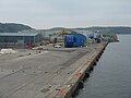
 Dockyard at Rosyth - geograph.org.uk - 5423997.jpg 640 × 427; 324 KB
-
 Dockyard, Rosyth - geograph.org.uk - 5820629.jpg 3,264 × 2,448; 3.82 MB
-
 Doocot - geograph.org.uk - 343677.jpg 640 × 424; 97 KB
-
 Driftwood - geograph.org.uk - 326515.jpg 640 × 424; 65 KB
-
 Empty cable reels at Rosyth - geograph.org.uk - 1228488.jpg 640 × 480; 64 KB
-
 Empty Factory - geograph.org.uk - 355091.jpg 640 × 424; 53 KB
-
 Farmland - geograph.org.uk - 355119.jpg 640 × 424; 51 KB
-
 Farmland - geograph.org.uk - 522017.jpg 640 × 327; 43 KB
-
 Farmland, homes and factory - geograph.org.uk - 65128.jpg 640 × 480; 95 KB
-
 Firth of Forth, Rosyth Docks - geograph.org.uk - 5423990.jpg 640 × 481; 374 KB
-
 Fleet Recreation Ground - geograph.org.uk - 844284.jpg 640 × 480; 42 KB
-
 Flower bed and anchor - geograph.org.uk - 407752.jpg 640 × 424; 82 KB
-
 Forth Ports crane at Rosyth - geograph.org.uk - 6225929.jpg 2,448 × 3,264; 3.2 MB
-
 Forth Ports' tug 'Oxcar' - geograph.org.uk - 6225935.jpg 3,112 × 2,332; 3.05 MB
-
 Foursome heading for Rosyth - geograph.org.uk - 3520849.jpg 3,264 × 2,448; 2.58 MB
-
 Grange Road - geograph.org.uk - 355194.jpg 640 × 424; 65 KB
-
 Her Majesty's Royal Marine Band Service MOD 45155866.jpg 2,551 × 1,918; 1.42 MB
-
 HM Naval Base, Rosyth - geograph.org.uk - 6225927.jpg 3,264 × 2,448; 2.83 MB
-
 HMS Liverpool A 020161.jpg 760 × 572; 79 KB
-
 HMS Prince of Wales - geograph.org.uk - 6225924.jpg 3,264 × 2,448; 1.75 MB
-
 HMS Prince of Wales - geograph.org.uk - 6225926.jpg 3,264 × 2,448; 2.88 MB
-
 Housing - geograph.org.uk - 355861.jpg 640 × 424; 44 KB
-
 Industrial estate - geograph.org.uk - 355911.jpg 640 × 424; 50 KB
-
 Industry in Rosyth - geograph.org.uk - 3153921.jpg 640 × 425; 99 KB
-
 Keep Out - geograph.org.uk - 42963.jpg 640 × 480; 122 KB
-
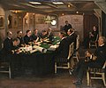
 LaToucheBissetAndRussell.jpg 800 × 605; 35 KB
-
 New houses - geograph.org.uk - 355951.jpg 640 × 424; 121 KB
-
 New road - geograph.org.uk - 409732.jpg 640 × 424; 41 KB
-
 New road 3 - geograph.org.uk - 409944.jpg 640 × 424; 51 KB
-
 North Wall Quay, Rosyth - geograph.org.uk - 5424026.jpg 640 × 481; 408 KB
-
 Oceaneering terminal at Rosyth - geograph.org.uk - 5423891.jpg 640 × 427; 345 KB
-
 Oilseed rape, Blackhall - geograph.org.uk - 1536949.jpg 640 × 480; 112 KB
-
 Oilseed rape, off Grange Road - geograph.org.uk - 1536960.jpg 640 × 480; 106 KB
-
 Oilseed rape, Wester Gellet - geograph.org.uk - 1536971.jpg 640 × 480; 122 KB
-
 Olympus digital camera (4927874024).jpg 3,712 × 2,792; 952 KB
-
 Palace, Rosyth - geograph.org.uk - 1536898.jpg 640 × 480; 89 KB
-
 Park Road, Rosyth - geograph.org.uk - 1536922.jpg 640 × 480; 74 KB
-
 Photo Collage of Rosyth.png 1,333 × 2,000; 3.25 MB
-
 Plaque on memorial cairn - geograph.org.uk - 107748.jpg 640 × 480; 126 KB
-
 Port of Rosyth - geograph.org.uk - 5820587.jpg 3,264 × 2,448; 3.11 MB
-
 Port of Rosyth - geograph.org.uk - 5820588.jpg 3,264 × 2,448; 3.24 MB
-
 Port of Rosyth, cruise ship - geograph.org.uk - 5152166.jpg 3,264 × 2,448; 4.1 MB
-
 Primrose Avenue - geograph.org.uk - 1536944.jpg 640 × 480; 107 KB
-
 Primrose Lane - geograph.org.uk - 59398.jpg 640 × 480; 124 KB
-
 Recreation Park - geograph.org.uk - 147129.jpg 640 × 480; 86 KB
-
-
 Reed beds - geograph.org.uk - 326656.jpg 640 × 424; 49 KB
-

-
 Ro-Ro Cargo Ship at Rosyth Docks - geograph.org.uk - 5426797.jpg 640 × 481; 346 KB
-
 Rock formation at Rosyth - geograph.org.uk - 774358.jpg 640 × 480; 106 KB
-
 Rosyth - geograph.org.uk - 407909.jpg 640 × 424; 165 KB
-
 Rosyth docks from the Firth of Forth - geograph.org.uk - 4668024.jpg 1,024 × 682; 113 KB
-
 Rosyth Docks, North Wall Quay - geograph.org.uk - 5423994.jpg 640 × 481; 339 KB
-
 Rosyth dockyard - geograph.org.uk - 3777125.jpg 3,264 × 2,448; 3.54 MB
-
 Rosyth Dockyard from the air - geograph.org.uk - 5375754.jpg 1,707 × 1,275; 640 KB
-
 Rosyth Ex-Servicemen's Club - geograph.org.uk - 1768731.jpg 480 × 640; 216 KB
-
 Rosyth Fire Station - geograph.org.uk - 147131.jpg 640 × 480; 76 KB
-
 Rosyth from Inverkeithing.jpg 1,862 × 1,396; 265 KB
-
 Rosyth in 2006.jpg 640 × 480; 111 KB
-
 Rosyth Library - geograph.org.uk - 407917.jpg 640 × 424; 56 KB
-
 Rosyth Oil Fuel Depot - geograph.org.uk - 415672.jpg 640 × 403; 45 KB
-
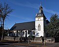 Rosyth Parish Church.jpg 3,000 × 2,366; 5.2 MB
-
 Rosyth Port, Oceaneering Terminal - geograph.org.uk - 5424045.jpg 640 × 480; 345 KB
-
 Rosyth.jpg 1,024 × 768; 416 KB
-
Rosyth.ogg 1.1 s; 23 KB
-
 Rosythaircraftcarrierworks.jpg 3,510 × 2,112; 3.15 MB
-
 St John ^ St Columba, Rosyth - geograph.org.uk - 1995330.jpg 640 × 480; 204 KB
-
 St Margaret's Hope - geograph.org.uk - 5820616.jpg 3,264 × 2,448; 2.85 MB
-
 Sts Peter and Paul Church, Rosyth (30).jpg 640 × 437; 47 KB
-
 The Cockranes Hotel Rosyth - geograph.org.uk - 774429.jpg 640 × 480; 90 KB
-
-
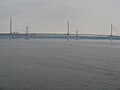
 The Forth Bridges - geograph.org.uk - 327269.jpg 640 × 424; 48 KB
-
 The Forth Bridges from Rosyth - geograph.org.uk - 6225962.jpg 2,908 × 2,177; 1.4 MB
-
 The Forth Ports' tug 'Oxcar' - geograph.org.uk - 6225946.jpg 3,264 × 2,448; 2.48 MB
-
 The Forth Road Bridge - geograph.org.uk - 522001.jpg 640 × 432; 42 KB
-
 The Hilton Road near Rosyth - geograph.org.uk - 1184357.jpg 640 × 480; 52 KB
-
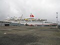
 The Marco Polo - geograph.org.uk - 1478738.jpg 640 × 480; 56 KB
-
 The Port of Rosyth - geograph.org.uk - 6225931.jpg 3,264 × 2,448; 2.1 MB
-
 The Prince of Wales - geograph.org.uk - 5820620.jpg 3,264 × 2,448; 3.17 MB
-
 The road is closed - geograph.org.uk - 1184334.jpg 640 × 480; 44 KB
-
 The Road to Dunfermline - geograph.org.uk - 59537.jpg 640 × 480; 106 KB
-
 The Royal Navy during the Second World War A1485.jpg 603 × 792; 97 KB
-
 The Royal Navy during the Second World War A20167.jpg 648 × 800; 85 KB
-
 The Royal Navy during the Second World War A23377.jpg 800 × 504; 76 KB
-
 The Royal Navy during the Second World War A7127.jpg 800 × 638; 86 KB
-
 The Royal Navy during the Second World War A7136.jpg 1,662 × 2,480; 962 KB
-
 The US battleships 'New York and 'Texas' off Rosyth RMG PW0798.jpg 1,280 × 508; 246 KB
-
 Towing us Away - geograph.org.uk - 5426648.jpg 640 × 481; 314 KB
-
 Tug Approaching - geograph.org.uk - 5426644.jpg 640 × 481; 362 KB
-
-
 View from Windylaw Edge - geograph.org.uk - 349406.jpg 640 × 424; 54 KB
-
 Wilson Way, Rosyth - geograph.org.uk - 774408.jpg 480 × 640; 118 KB
-
 Woodland and benchmark, Rosyth - geograph.org.uk - 855695.jpg 640 × 480; 124 KB


.jpg)


.jpg)

.jpg)


