Category:Rote Mühle (Greetsiel)
Jump to navigation
Jump to search
| Object location | | View all coordinates using: OpenStreetMap |
|---|
Subcategories
This category has only the following subcategory.
I
Media in category "Rote Mühle (Greetsiel)"
The following 25 files are in this category, out of 25 total.
-
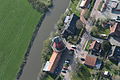
 2013-05-03 Fotoflug Leer Papenburg DSCF7270.jpg 2,500 × 1,673; 2.93 MB
-
 2013-05-03 Fotoflug Leer Papenburg DSCF7273.jpg 2,500 × 1,673; 3.34 MB
-
 2013-05-03 Fotoflug Leer Papenburg DSCF7274.jpg 2,500 × 1,673; 3.22 MB
-
 2013-05-03 Fotoflug Leer Papenburg DSCF7275.jpg 2,500 × 1,673; 3.35 MB
-
 2013-05-03 Fotoflug Nordholz Papenburg HP 3032.JPG 5,760 × 3,840; 7.95 MB
-
 2013-05-03 Fotoflug Nordholz Papenburg HP 3033.JPG 5,760 × 3,840; 7.44 MB
-
 2013-05-03 Fotoflug Nordholz Papenburg HP 3034.JPG 5,760 × 3,840; 8.39 MB
-
 2013-05-03 Fotoflug Nordholz Papenburg HP 3035.JPG 5,760 × 3,840; 8.72 MB
-
 Greetsiel (Ostfriesland) - Germany 22.JPG 3,240 × 4,320; 3.17 MB
-
 Greetsiel (Ostfriesland) - Germany 23.JPG 4,320 × 3,240; 3.14 MB
-
 Greetsiel (Ostfriesland) - Germany 24.JPG 3,240 × 4,320; 2.8 MB
-
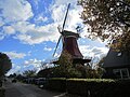
 Greetsiel Zwillingsmuehlen.jpg 1,596 × 1,597; 783 KB
-
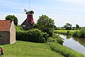 J38 458 Greetsieler rote Mühle.jpg 5,802 × 3,868; 7.42 MB
-
 Molen Greetsielse Tweelingsmolens (1).jpg 2,180 × 3,018; 1.09 MB
-
 Molen Oostelijke Greetsielse Tweelingsmolen (3).jpg 2,448 × 3,264; 1.45 MB
-
 Molen Oostelijke Greetsielse Tweelingsmolen (4).jpg 2,448 × 3,264; 1.26 MB
-
 Molen Oostelijke Greetsielse Tweelingsmolen (5).jpg 2,448 × 3,264; 1.14 MB
-
 Molen Oostelijke Greetsielse Tweelingsmolen, ingang gevelsteen.jpg 3,264 × 2,448; 2.2 MB
-
 Molen Oostelijke Greetsielse Tweelingsmolen, ingang molenwinkel.jpg 2,448 × 3,264; 1.99 MB
-
 Molen Oostelijke Greetsielse Tweelingsmolen, zelfkruiïng windroos (1).jpg 3,264 × 2,448; 924 KB
-
 Molen Oostelijke Greetsielse Tweelingsmolen, zelfkruiïng windroos (2).jpg 2,448 × 3,264; 947 KB
-
 Molen Oostelijke Greetsielse Tweelingsmolen, zelfkruiïng windroos (3).jpg 3,264 × 2,448; 901 KB
-
 Molen Oostelijke Greetsielse Tweelingsmolen, zelfkruiïng windroos (6).jpg 3,264 × 2,448; 895 KB
-
 Molen Oostelijke Greetsielse Tweelingsmolen, zelfkruiïng windroos.jpg 2,448 × 3,264; 1.09 MB
-
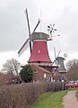
 Zwillingsmuehlen in Greetsiel, Rote Muehle.jpg 2,017 × 3,025; 2.12 MB


_-_Germany_22.JPG)
_-_Germany_23.JPG)
_-_Germany_24.JPG)


.jpg)
.jpg)
.jpg)
.jpg)


.jpg)
.jpg)
.jpg)
.jpg)

